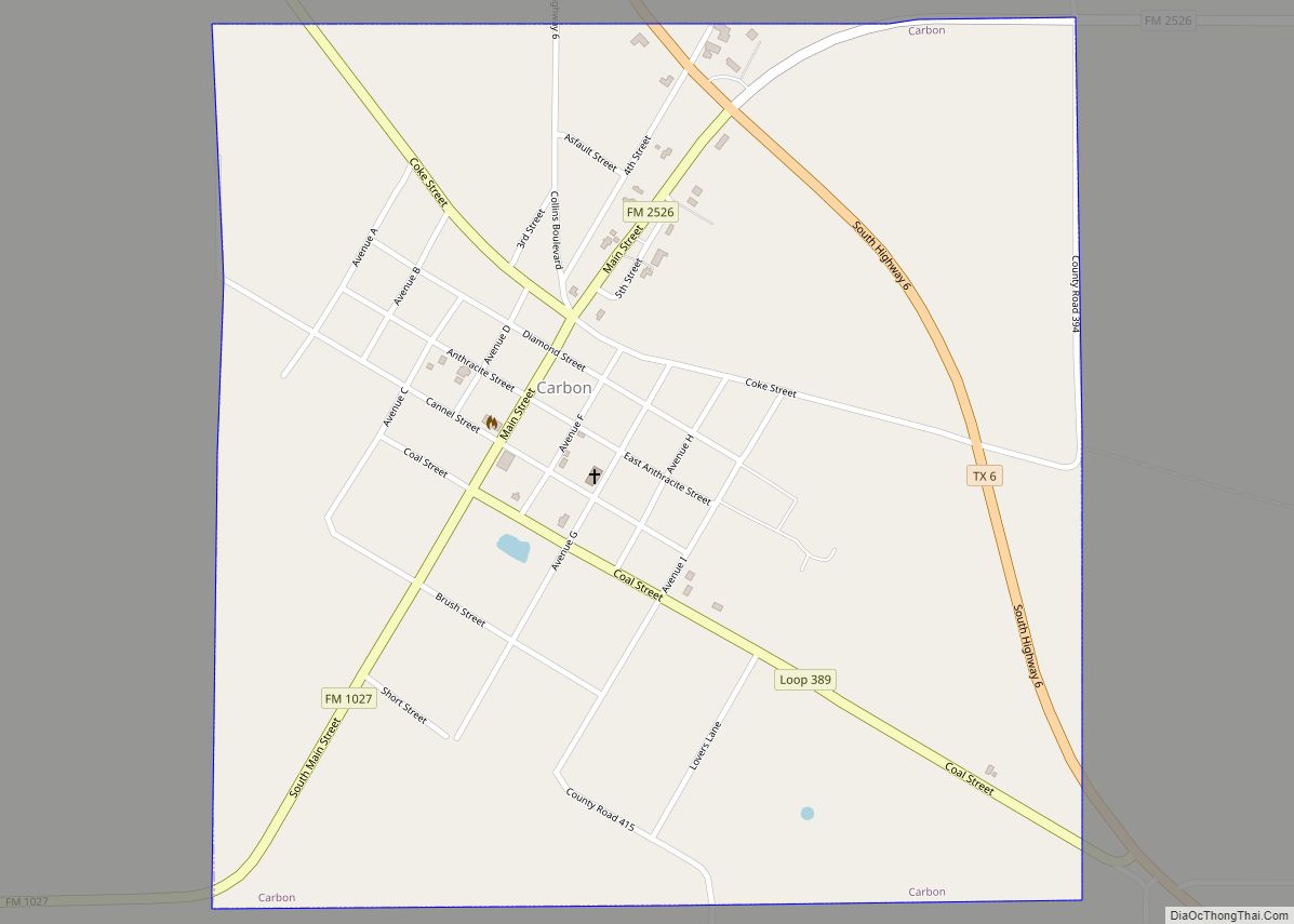
Map of Canyon Lake CDP, Texas
Canyon Lake is a census-designated place (CDP) in Comal County, Texas, United States. The population was 31,124 at the 2020 census. It is part of the San Antonio Metropolitan Statistical Area. The Canyon Lake CDP includes a number of small, unincorporated communities surrounding Canyon Lake, including Sattler, Startzville, Canyon City, Cranes Mill, and Hancock. Communities ... Read more
Map of Canyon Lake CDP, Texas
Map of Carthage city, Texas
Carthage is a city and the county seat of Panola County, Texas, United States. This city is situated in deep East Texas, 20 miles west of the Louisiana state line. Its population was 6,569 at the 2020 census. Carthage city overview: Name: Carthage city LSAD Code: 25 LSAD Description: city (suffix) State: Texas County: Panola ... Read more
Map of Carthage city, Texas
Map of Carrizo Springs city
Carrizo Springs is the largest city in and the county seat of Dimmit County, Texas, United States. The population was 5,368 at the 2010 census. (2018 estimate 5,470). The name of the town is derived from the local springs, which were named by the Spanish for the cane grass that once grew around them. It ... Read more
Map of Carrizo Springs city
Map of Carrizo Hill CDP
Carrizo Hill is a census-designated place (CDP) in Dimmit County, in the U.S. state of Texas, United States. The population was 582 at the 2010 census. Carrizo Hill CDP overview: Name: Carrizo Hill CDP LSAD Code: 57 LSAD Description: CDP (suffix) State: Texas County: Dimmit County Elevation: 630 ft (190 m) Total Area: 0.5 sq mi (1.3 km²) Land Area: ... Read more
Map of Carrizo Hill CDP
Map of Celeste city
Celeste (Light Blue, in Spanish) is a city in Hunt County, in the U.S. state of Texas. The population was 814 at the 2010 census. Celeste city overview: Name: Celeste city LSAD Code: 25 LSAD Description: city (suffix) State: Texas County: Hunt County Elevation: 669 ft (204 m) Total Area: 1.34 sq mi (3.48 km²) Land Area: 1.34 sq mi (3.48 km²) Water ... Read more
Map of Celeste city
Map of Cedar Point CDP, Texas
Cedar Point is a census-designated place (CDP) in Polk County, Texas, United States. This was a new CDP for the 2010 census with a population of 630. Cedar Point CDP overview: Name: Cedar Point CDP LSAD Code: 57 LSAD Description: CDP (suffix) State: Texas County: Polk County Total Area: 1.9 sq mi (4.9 km²) Land Area: 0.9 sq mi (2.3 km²) ... Read more
Map of Cedar Point CDP, Texas
Map of Cedar Park city
Cedar Park is a city and a suburb of Austin in the state of Texas, approximately 16 miles (26 km) to the north-west of the center of Austin. According to the 2020 U.S. census, the city’s population was 77,595. Cedar Park city overview: Name: Cedar Park city LSAD Code: 25 LSAD Description: city (suffix) State: Texas ... Read more
Map of Cedar Park city
Map of Cedar Hill city, Texas
Cedar Hill is a city in Dallas and Ellis counties in the U.S. state of Texas. It is located approximately 16 miles (26 km) southwest of downtown Dallas and is situated along the eastern shore of Joe Pool Lake and Cedar Hill State Park. Per the 2020 United States census, the population was 49,148. Cedar Hill ... Read more
Map of Cedar Hill city, Texas
Map of Catarina CDP
Catarina is a census-designated place (CDP) in Dimmit County, Texas, United States. The population was 118 at the 2010 census. The community has no U.S. Post Office. Catarina CDP overview: Name: Catarina CDP LSAD Code: 57 LSAD Description: CDP (suffix) State: Texas County: Dimmit County Elevation: 551 ft (168 m) Total Area: 3.8 sq mi (9.8 km²) Land Area: 3.8 sq mi ... Read more
Map of Catarina CDP
Map of Castroville city, Texas
Castroville is a city in Medina County, Texas, United States. Its population was 2,680 at the 2010 census. Prior to 1893, Castroville was the first county seat of Medina County. Castroville was founded by Alsatian-Texans, who were mostly Germanic-speaking people who came to Texas during the German emigration period of the mid-1800s. Most Alsatians who ... Read more
Map of Castroville city, Texas
Map of Castle Hills city
Castle Hills is a enclave city located in northern Bexar County, Texas, United States. As of the 2020 census, the city had a total population of 3,978. It is an affluent enclave city surrounded by San Antonio. Castle Hills city overview: Name: Castle Hills city LSAD Code: 25 LSAD Description: city (suffix) State: Texas County: ... Read more
Map of Castle Hills city
Map of Cashion Community city
Cashion Community (commonly called Cashion) is a city in Wichita County, Texas, United States. It was incorporated in 2000 and had a population of 348 in 2010. Cashion Community is part of the Wichita Falls, Texas metropolitan statistical area. Cashion Community city overview: Name: Cashion Community city LSAD Code: 25 LSAD Description: city (suffix) State: ... Read more
Map of Cashion Community city