Castroville is a city in Medina County, Texas, United States. Its population was 2,680 at the 2010 census. Prior to 1893, Castroville was the first county seat of Medina County. Castroville was founded by Alsatian-Texans, who were mostly Germanic-speaking people who came to Texas during the German emigration period of the mid-1800s. Most Alsatians who came to Castroville spoke Alsatian (a dialect of German origin integrating Celtic, Yiddish, and French words). The Alsatian culture and language are still kept alive by the residents of Castroville.
| Name: | Castroville city |
|---|---|
| LSAD Code: | 25 |
| LSAD Description: | city (suffix) |
| State: | Texas |
| County: | Medina County |
| Incorporated: | January 16, 1850 |
| Elevation: | 758 ft (231 m) |
| Total Area: | 2.91 sq mi (7.55 km²) |
| Land Area: | 2.88 sq mi (7.46 km²) |
| Water Area: | 0.03 sq mi (0.09 km²) |
| Total Population: | 2,680 |
| Population Density: | 1,082.61/sq mi (417.97/km²) |
| ZIP code: | 78009, 78023 |
| Area code: | 830 |
| FIPS code: | 4813312 |
| GNISfeature ID: | 1353948 |
| Website: | www.castrovilletx.gov |
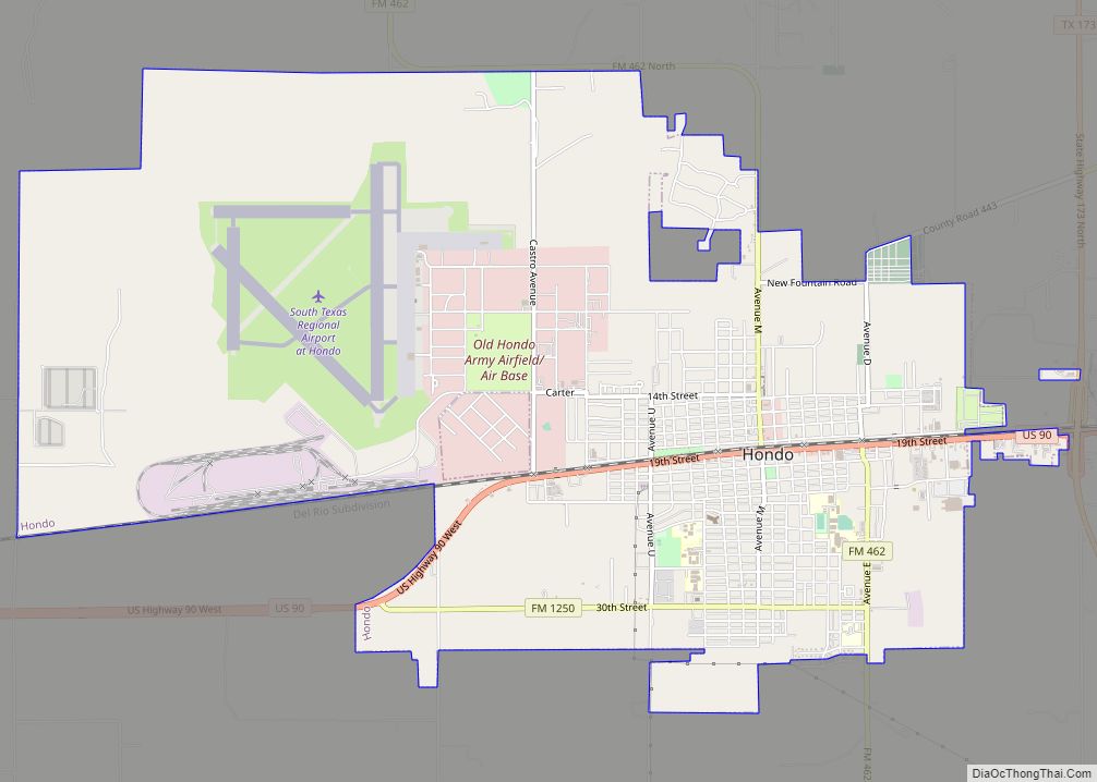
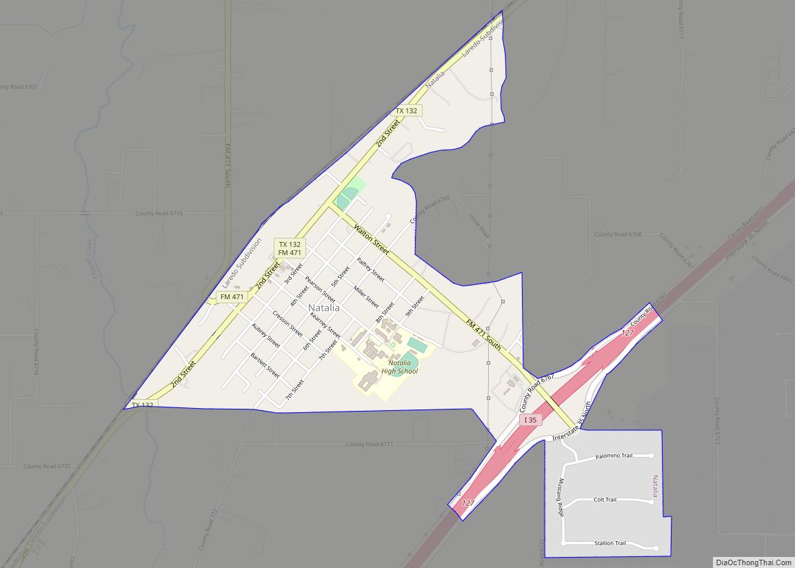
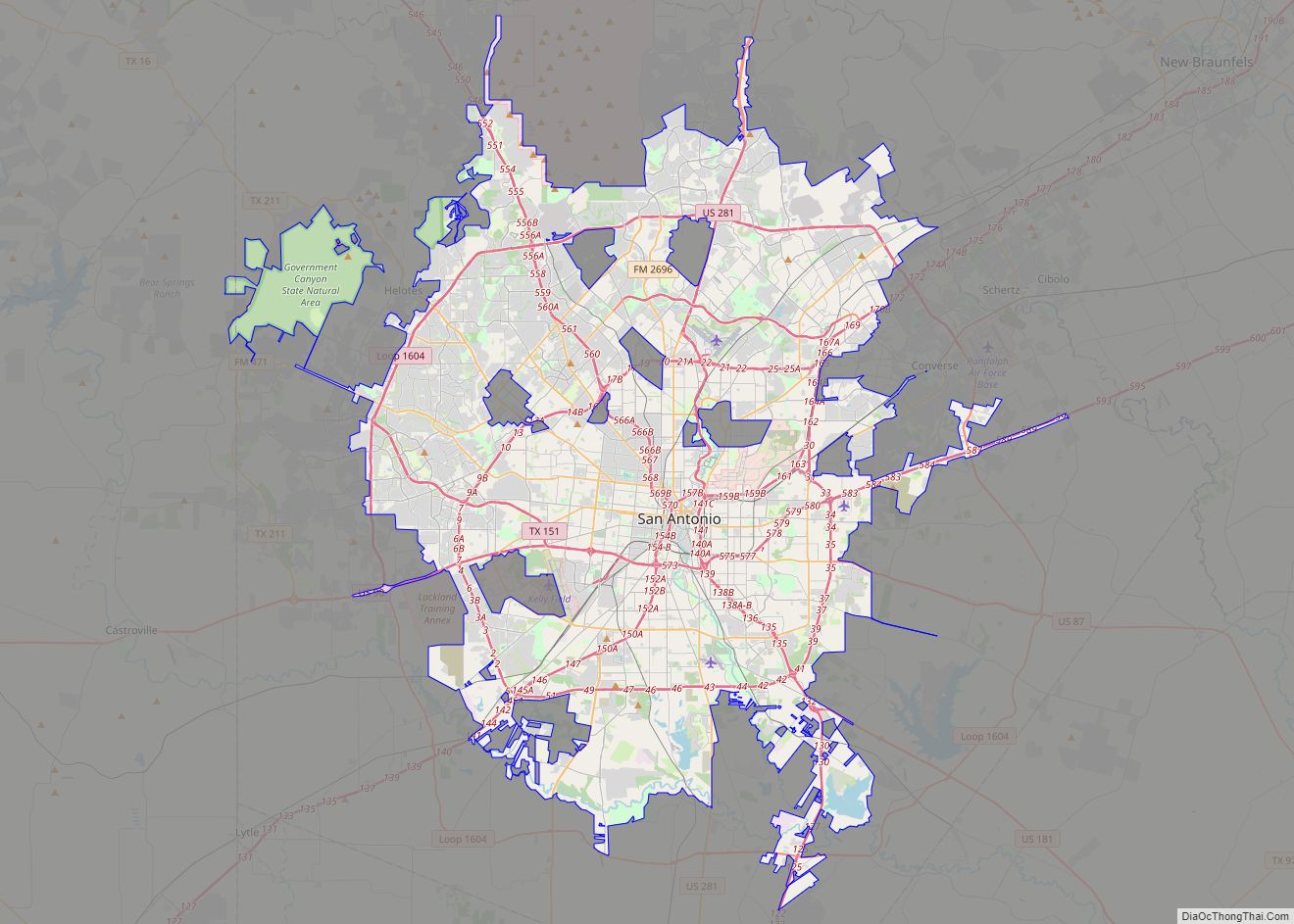
Online Interactive Map
Click on ![]() to view map in "full screen" mode.
to view map in "full screen" mode.
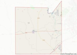
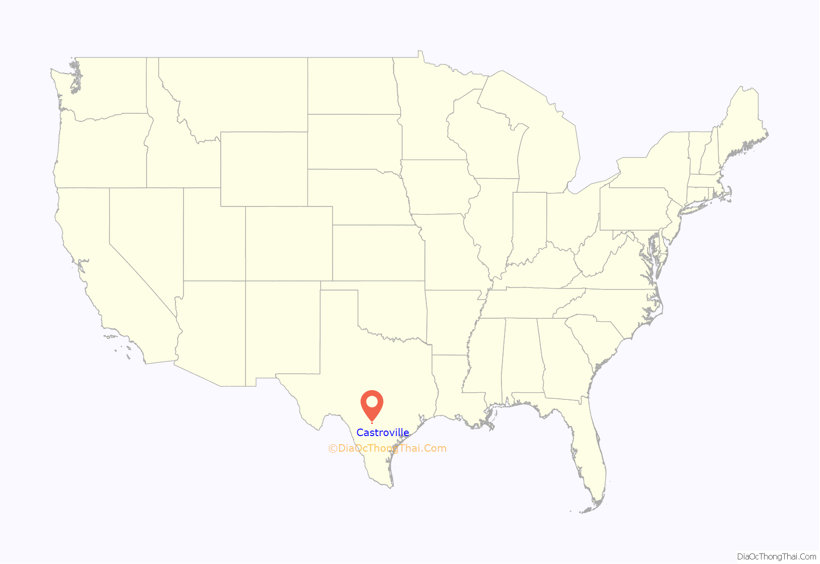
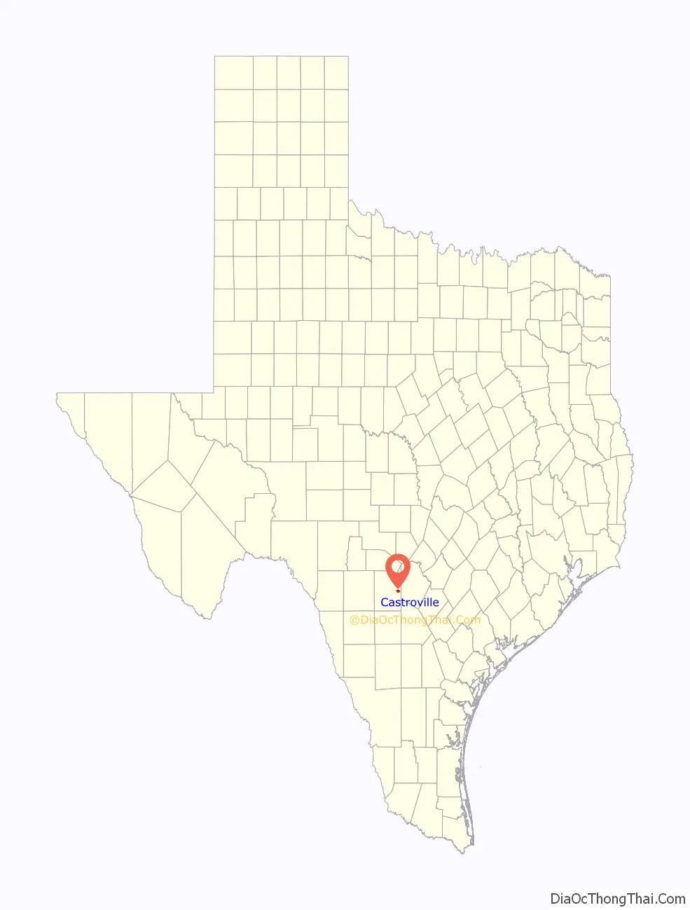
Castroville location map. Where is Castroville city?
History
Castroville was established in 1844 by Henri Castro, an empresario of the Republic of Texas, who brought several dozen European families to the area from Alsace and adjoining Baden to populate his land grant along the Medina River 20 miles (32 km) west of San Antonio. The first colonists disembarked at Galveston on January 9, 1843. They were taken by ship to Lavaca Bay and traveled overland to San Antonio, where they took shelter in abandoned buildings until the Texas Rangers were prepared to escort them to their land and protect them from hostile Indians. On September 2, 1844, the first colonists arrived at Castro’s land grant on the Medina River.
From 1849, Castroville, on the Medina River, was a water stop on the San Antonio-El Paso Road and a stagecoach station on the San Antonio-El Paso Mail Line and San Antonio-San Diego Mail Line.
After a few hard years, the town and surrounding farms flourished, but for generations, the residents remained insular. In Castroville’s first century, a visitor would be more likely to hear Alsatian—a dialect spoken in Europe before Standard German was prevalent—than English spoken in the town’s homes, stores, and taverns. Modern Alsatian travelers noted that the dialect spoken in Castroville was more like that which was spoken in the 1840s. The descendants of the original settlers worked diligently to preserve their language, whose usage in Europe has been diminished by the political actions of France and Germany, especially since World War II.
The Steinbach Haus (originally built between 1618 and 1648 in Wahlbach, Alsace) was dismantled and reconstructed in Castroville in 1998. It was opened to the public in 2002.
Castroville is a sister city of Ensisheim (Alsace) in France.
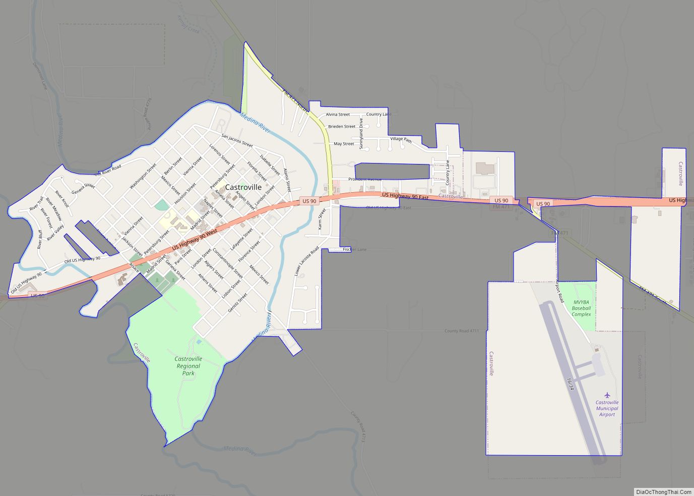
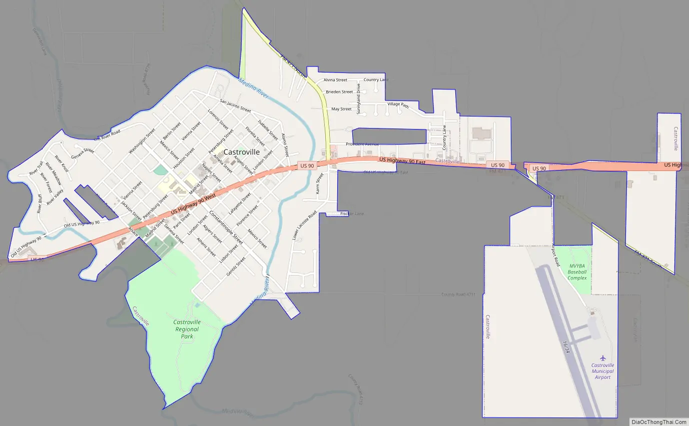
Castroville Road Map
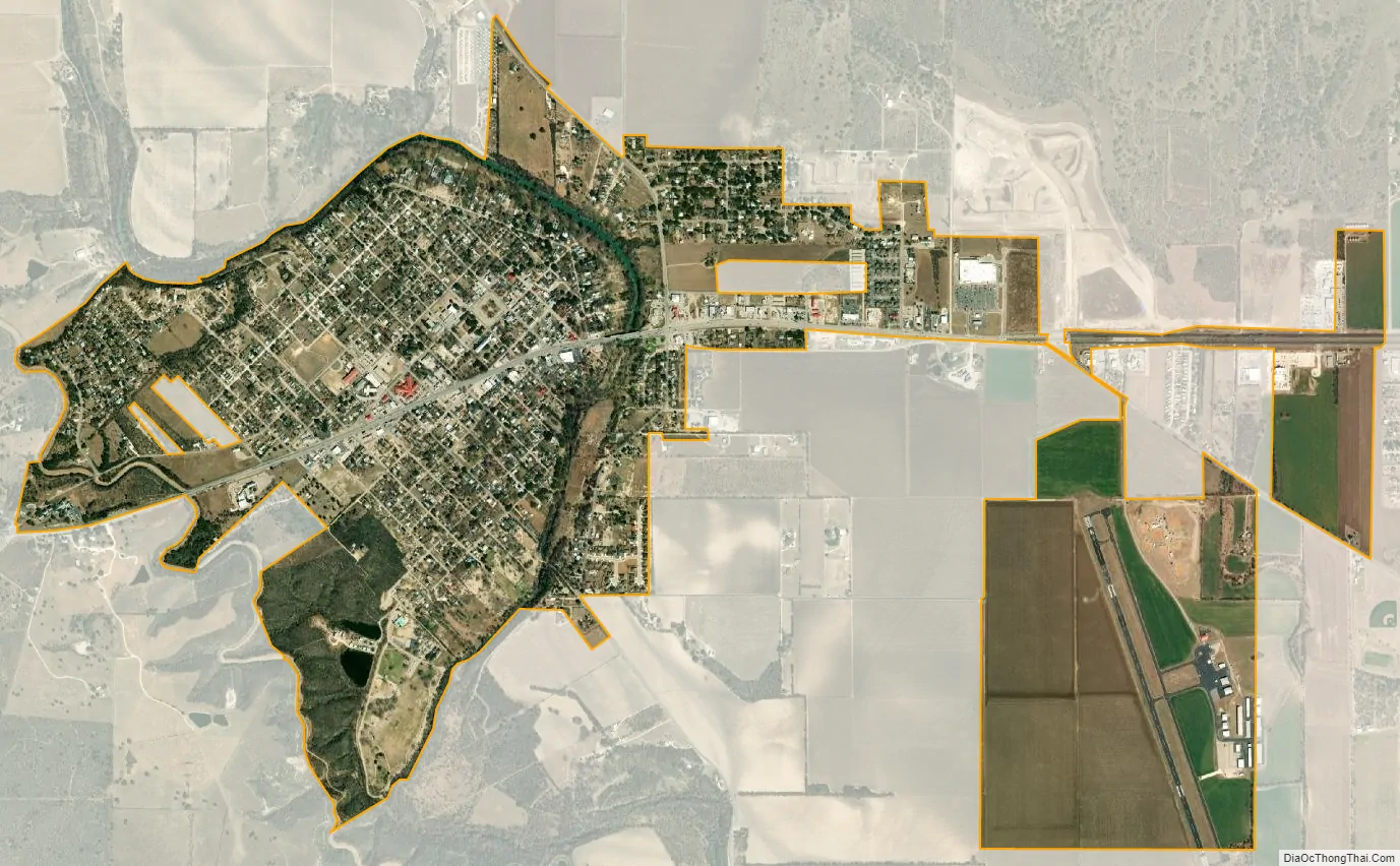
Castroville city Satellite Map
Geography
Castroville is located at 29°21′N 98°53′W / 29.350°N 98.883°W / 29.350; -98.883 (29.3550, −98.8807). This is 20 miles west of downtown San Antonio.
According to the United States Census Bureau, the city has a total area of 2.5 square miles (6.5 km), of which 0.39% is covered with water.
See also
Map of Texas State and its subdivision:- Anderson
- Andrews
- Angelina
- Aransas
- Archer
- Armstrong
- Atascosa
- Austin
- Bailey
- Bandera
- Bastrop
- Baylor
- Bee
- Bell
- Bexar
- Blanco
- Borden
- Bosque
- Bowie
- Brazoria
- Brazos
- Brewster
- Briscoe
- Brooks
- Brown
- Burleson
- Burnet
- Caldwell
- Calhoun
- Callahan
- Cameron
- Camp
- Carson
- Cass
- Castro
- Chambers
- Cherokee
- Childress
- Clay
- Cochran
- Coke
- Coleman
- Collin
- Collingsworth
- Colorado
- Comal
- Comanche
- Concho
- Cooke
- Coryell
- Cottle
- Crane
- Crockett
- Crosby
- Culberson
- Dallam
- Dallas
- Dawson
- Deaf Smith
- Delta
- Denton
- Dewitt
- Dickens
- Dimmit
- Donley
- Duval
- Eastland
- Ector
- Edwards
- El Paso
- Ellis
- Erath
- Falls
- Fannin
- Fayette
- Fisher
- Floyd
- Foard
- Fort Bend
- Franklin
- Freestone
- Frio
- Gaines
- Galveston
- Garza
- Gillespie
- Glasscock
- Goliad
- Gonzales
- Gray
- Grayson
- Gregg
- Grimes
- Guadalupe
- Hale
- Hall
- Hamilton
- Hansford
- Hardeman
- Hardin
- Harris
- Harrison
- Hartley
- Haskell
- Hays
- Hemphill
- Henderson
- Hidalgo
- Hill
- Hockley
- Hood
- Hopkins
- Houston
- Howard
- Hudspeth
- Hunt
- Hutchinson
- Irion
- Jack
- Jackson
- Jasper
- Jeff Davis
- Jefferson
- Jim Hogg
- Jim Wells
- Johnson
- Jones
- Karnes
- Kaufman
- Kendall
- Kenedy
- Kent
- Kerr
- Kimble
- King
- Kinney
- Kleberg
- Knox
- La Salle
- Lamar
- Lamb
- Lampasas
- Lavaca
- Lee
- Leon
- Liberty
- Limestone
- Lipscomb
- Live Oak
- Llano
- Loving
- Lubbock
- Lynn
- Madison
- Marion
- Martin
- Mason
- Matagorda
- Maverick
- McCulloch
- McLennan
- McMullen
- Medina
- Menard
- Midland
- Milam
- Mills
- Mitchell
- Montague
- Montgomery
- Moore
- Morris
- Motley
- Nacogdoches
- Navarro
- Newton
- Nolan
- Nueces
- Ochiltree
- Oldham
- Orange
- Palo Pinto
- Panola
- Parker
- Parmer
- Pecos
- Polk
- Potter
- Presidio
- Rains
- Randall
- Reagan
- Real
- Red River
- Reeves
- Refugio
- Roberts
- Robertson
- Rockwall
- Runnels
- Rusk
- Sabine
- San Augustine
- San Jacinto
- San Patricio
- San Saba
- Schleicher
- Scurry
- Shackelford
- Shelby
- Sherman
- Smith
- Somervell
- Starr
- Stephens
- Sterling
- Stonewall
- Sutton
- Swisher
- Tarrant
- Taylor
- Terrell
- Terry
- Throckmorton
- Titus
- Tom Green
- Travis
- Trinity
- Tyler
- Upshur
- Upton
- Uvalde
- Val Verde
- Van Zandt
- Victoria
- Walker
- Waller
- Ward
- Washington
- Webb
- Wharton
- Wheeler
- Wichita
- Wilbarger
- Willacy
- Williamson
- Wilson
- Winkler
- Wise
- Wood
- Yoakum
- Young
- Zapata
- Zavala
- Alabama
- Alaska
- Arizona
- Arkansas
- California
- Colorado
- Connecticut
- Delaware
- District of Columbia
- Florida
- Georgia
- Hawaii
- Idaho
- Illinois
- Indiana
- Iowa
- Kansas
- Kentucky
- Louisiana
- Maine
- Maryland
- Massachusetts
- Michigan
- Minnesota
- Mississippi
- Missouri
- Montana
- Nebraska
- Nevada
- New Hampshire
- New Jersey
- New Mexico
- New York
- North Carolina
- North Dakota
- Ohio
- Oklahoma
- Oregon
- Pennsylvania
- Rhode Island
- South Carolina
- South Dakota
- Tennessee
- Texas
- Utah
- Vermont
- Virginia
- Washington
- West Virginia
- Wisconsin
- Wyoming