Map of Groveton city, Texas
Groveton is a city in Trinity County, Texas, United States. The population was 918 at the 2020 census. It is the county seat of Trinity County. Groveton city overview: Name: Groveton city LSAD Code: 25 LSAD Description: city (suffix) State: Texas County: Trinity County Elevation: 328 ft (100 m) Total Area: 2.62 sq mi (6.77 km²) Land Area: 2.58 sq mi (6.69 km²) ... Read more
Map of Groveton city, Texas
Map of Groves city
Groves is a city in Jefferson County, Texas, United States. The population was 17,335 at the 2020 census. It is part of the Beaumont–Port Arthur Metropolitan Statistical Area. Groves city overview: Name: Groves city LSAD Code: 25 LSAD Description: city (suffix) State: Texas County: Jefferson County Elevation: 13 ft (4 m) Total Area: 5.19 sq mi (13.44 km²) Land Area: ... Read more
Map of Groves city
Map of Groom town
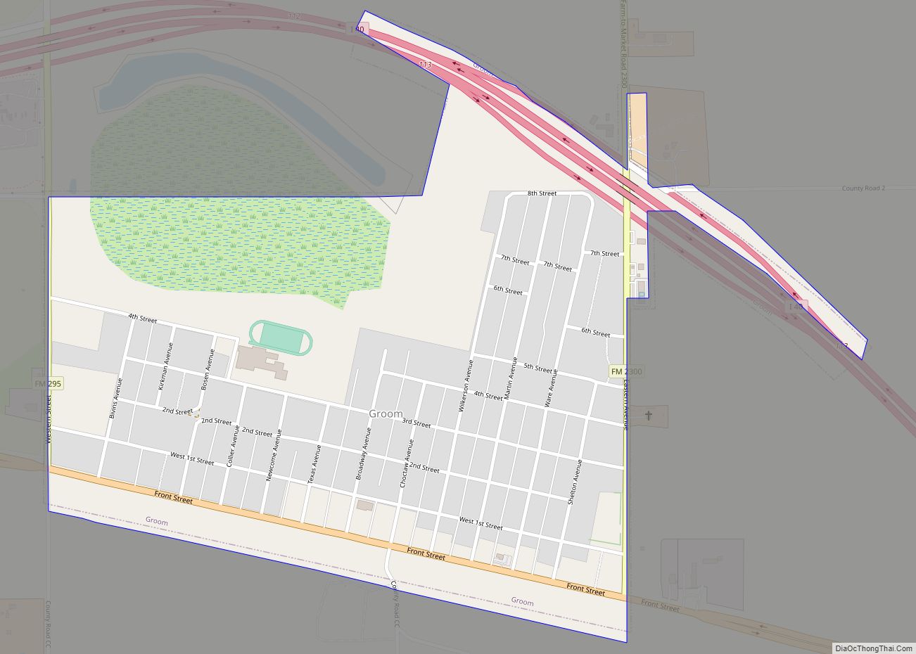
Groom is a town in Carson County, Texas, United States. The population was 574 at the 2010 census. It is part of the Amarillo, Texas Metropolitan Statistical Area. It is on Interstate Highway 40 (Historic Route 66) 42 miles (68 km) east of Amarillo and 215 miles (346 km) west of Oklahoma City. Groom town overview: Name: ... Read more
Map of Groom town
Map of Groesbeck city, Texas
Groesbeck is a city in and the county seat of Limestone County, Texas, United States. Its population was 3,631 at the 2020 census. The community is named after a railroad employee. Groesbeck city overview: Name: Groesbeck city LSAD Code: 25 LSAD Description: city (suffix) State: Texas County: Limestone County Elevation: 479 ft (146 m) Total Area: 4.37 sq mi ... Read more
Map of Groesbeck city, Texas
Map of Grey Forest city
Grey Forest is a city in northwest Bexar County, Texas, United States. The population was 483 at the 2010 census. It is part of the San Antonio Metropolitan Statistical Area. Grey Forest city overview: Name: Grey Forest city LSAD Code: 25 LSAD Description: city (suffix) State: Texas County: Bexar County Elevation: 1,142 ft (348 m) Total Area: ... Read more
Map of Grey Forest city
Map of Gregory city, Texas
Gregory is a city in San Patricio County, Texas, United States. The population was 1,907 at the 2010 census. Gregory city overview: Name: Gregory city LSAD Code: 25 LSAD Description: city (suffix) State: Texas County: San Patricio County Elevation: 30 ft (9 m) Total Area: 1.35 sq mi (3.50 km²) Land Area: 1.35 sq mi (3.50 km²) Water Area: 0.00 sq mi (0.00 km²) Total Population: ... Read more
Map of Gregory city, Texas
Map of Hackberry town, Texas
Hackberry is a town in Denton County, Texas, United States. The population was 2,973 in 2020. Hackberry town overview: Name: Hackberry town LSAD Code: 43 LSAD Description: town (suffix) State: Texas County: Denton County Elevation: 551 ft (168 m) Total Area: 0.68 sq mi (1.77 km²) Land Area: 0.68 sq mi (1.76 km²) Water Area: 0.00 sq mi (0.01 km²) Total Population: 2,973 Population Density: 1,586.16/sq mi ... Read more
Map of Hackberry town, Texas
Map of H. Cuellar Estates CDP
H. Cuellar Estates is a census-designated place (CDP) in Starr County, Texas, United States. It is a new CDP formed from part of the Falcon Heights CDP prior to the 2010 census. In the 2020 census, it had a population of 11, down from 20 in the 2010 census. H. Cuellar Estates CDP overview: Name: ... Read more
Map of H. Cuellar Estates CDP
Map of Gutierrez CDP
Gutierrez is a census-designated place (CDP) in Starr County, Texas, United States. This was a new CDP for the 2010 census with a population of 79. Gutierrez CDP overview: Name: Gutierrez CDP LSAD Code: 57 LSAD Description: CDP (suffix) State: Texas County: Starr County Total Area: 0.1 sq mi (0.3 km²) Land Area: 0.1 sq mi (0.3 km²) Water Area: 0.0 sq mi ... Read more
Map of Gutierrez CDP
Map of Guthrie CDP, Texas
Guthrie is an unincorporated community and census-designated place (CDP) in, and the county seat of, King County in the U.S. state of Texas. It is in the northern part of the state, 93 miles (150 km) east of Lubbock. It serves as the principal headquarters of the Four Sixes Ranch. As of the 2010 census, its ... Read more
Map of Guthrie CDP, Texas
Map of Gustine town, Texas
Gustine is a town located in Comanche County in Central Texas. The population was 476 at the 2010 census. The town, formerly known as Cora, was the county seat in the 1850s. Jim Reese, a Republican politician who served as the mayor of Odessa, Texas, from 1968 to 1974, was born in Gustine in 1929 ... Read more
Map of Gustine town, Texas
Map of Gunter city
Gunter is a city in the southwestern corner of Grayson County, Texas, United States. The population was 2,060 at the 2020 census, up from 1,498 at the 2010 census. It is part of the Sherman–Denison metropolitan area. Gunter city overview: Name: Gunter city LSAD Code: 25 LSAD Description: city (suffix) State: Texas County: Grayson County ... Read more
Map of Gunter city