Guthrie is an unincorporated community and census-designated place (CDP) in, and the county seat of, King County in the U.S. state of Texas. It is in the northern part of the state, 93 miles (150 km) east of Lubbock. It serves as the principal headquarters of the Four Sixes Ranch. As of the 2010 census, its population was 160.
| Name: | Guthrie CDP |
|---|---|
| LSAD Code: | 57 |
| LSAD Description: | CDP (suffix) |
| State: | Texas |
| County: | King County |
| Elevation: | 1,739 ft (530 m) |
| Total Area: | 1.78 sq mi (4.61 km²) |
| Land Area: | 1.78 sq mi (4.61 km²) |
| Water Area: | 0.0 sq mi (0.0 km²) |
| Total Population: | 160 |
| Population Density: | 90/sq mi (34.7/km²) |
| ZIP code: | 79236 |
| Area code: | 806 |
| FIPS code: | 4831640 |
| GNISfeature ID: | 1358533 |
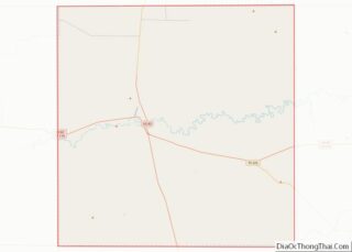
Online Interactive Map
Click on ![]() to view map in "full screen" mode.
to view map in "full screen" mode.
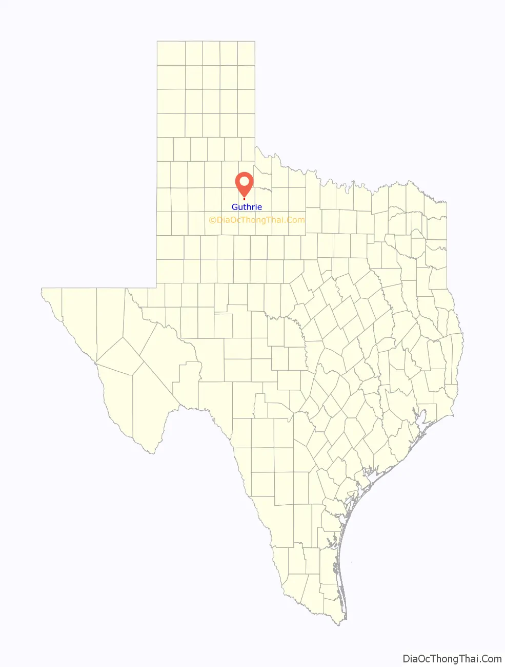
Guthrie location map. Where is Guthrie CDP?

History
Guthrie’s recorded history begins in 1883, when the Louisville Land and Cattle Company in Louisville, Kentucky, purchased several hundred acres in what later became King County. Named after Louisville Land and Cattle stockholder W.H. Guthrie, the community’s townsite was platted in 1891 by Andrew Chester Tackitt (son of Rev. Pleasant Tackitt, who had built Guthrie’s first residence). When King County was organized that same year, Louisville Land and Cattle proposed the platting of a company townsite, to be named “Ashville”, to serve as the county’s seat. Tackitt strongly opposed this proposition and led a charge to bring the seat to Guthrie, instead. Tackitt’s hotly contested campaign ultimately proved successful, and he not only succeeded in making Guthrie the county seat, but was also elected to serve as King County’s first county judge. Late in 1891, the Guthrie post office opened to the public.
The next year, Tackitt and a man by the name of Charlie Bradford brought in lumber from the neighboring community of Seymour and constructed Guthrie’s first school, a small, one-room building. A larger school followed in 1895, though the lone teacher continued to depend upon schools in Seymour and Benjamin for curriculum. Proprietor John Gibson began to keep a stock of school books at his Guthrie general store in 1897, decreasing the school’s dependence upon other districts.
In 1904, Guthrie claimed 101 residents, and though hurt by the effects of the Great Depression and the Dust Bowl, remained stable through to the mid-20th century, with the 1950 Census also reporting 101 residents. In 1959, schools in nearby Dumont were consolidated with Guthrie’s schools, and by 1963, its population had more than doubled to 210.
The mid- to late 1960s brought an end to Guthrie’s growth; the population had fallen to 125 by 1970. It increased to 140 in 1980 and 160 in 1990, a figure it maintained through to the 2010 census. Being a company town, very few homes in Guthrie are privately owned; most residents live in housing provided by the 6666 (Four Sixes) or Pitchfork ranches, or the school district.
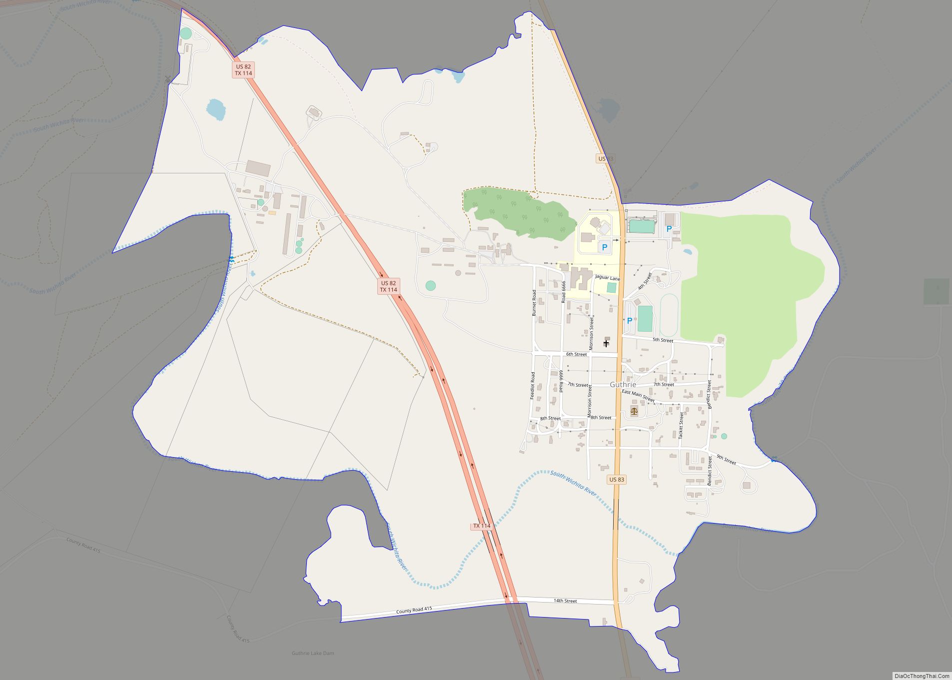
Guthrie Road Map
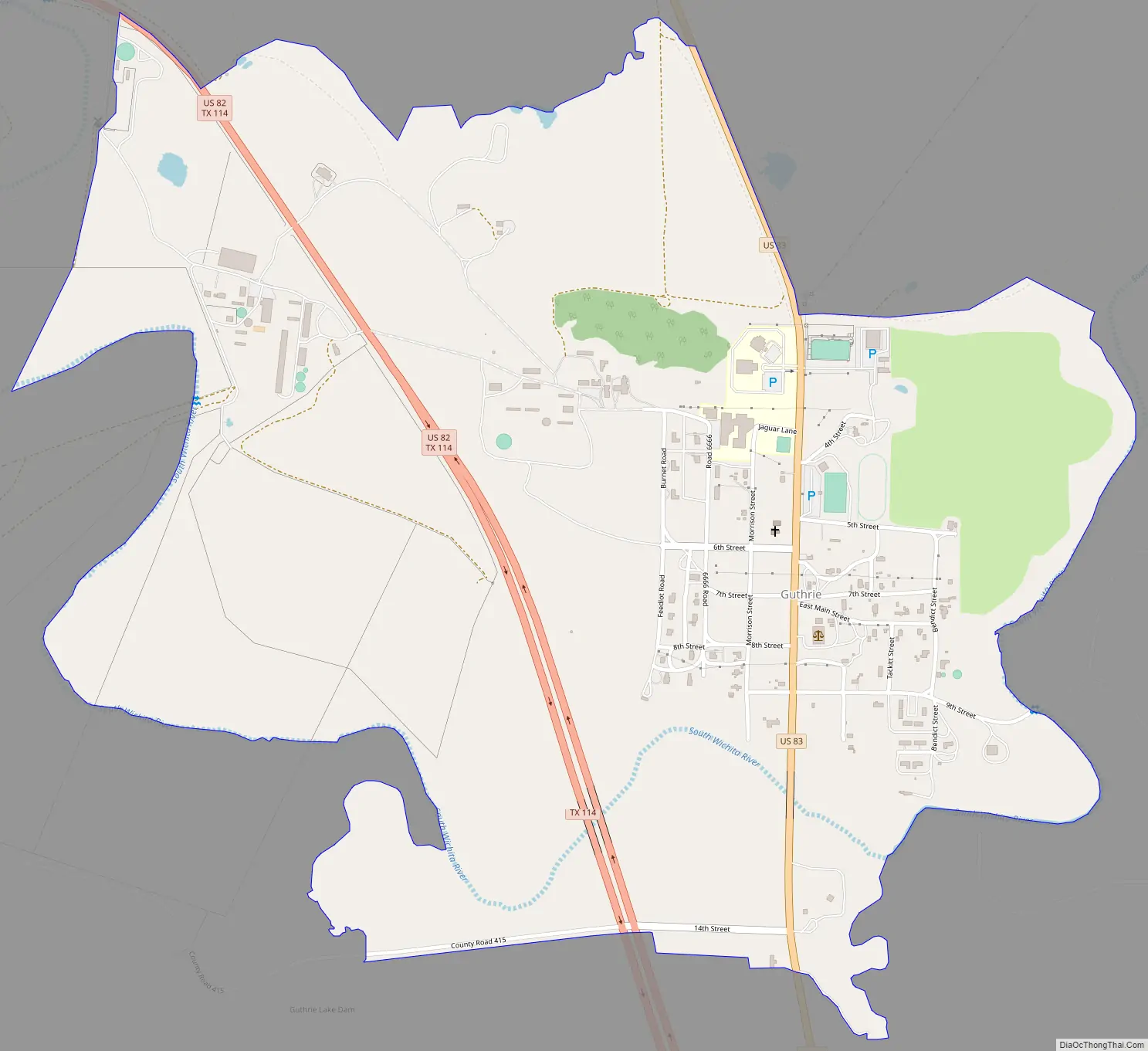
Guthrie city Satellite Map

Geography
Guthrie is located in west-central King County, on the north side of the South Wichita River. U.S. Route 82 passes through the western side of the community, and U.S. Route 83 passes through the center of Guthrie.
According to the U.S. Census Bureau, the Guthrie CDP has an area of 11,000 acres (4,600 ha), of which 7.1 acres (2.87 ha), or 0.06%, is covered by water.
Climate
According to the Köppen climate classification, Guthrie has a humid subtropical climate, denoted as Cfa on climate maps, though it closely borders a cool semi-arid climate (BSk).
Guthrie has a USDA hardiness zone of 7b, with minimum temperatures ranging from 5 to 10 °F or −15.0 to −12.2 °C.
See also
Map of Texas State and its subdivision:- Anderson
- Andrews
- Angelina
- Aransas
- Archer
- Armstrong
- Atascosa
- Austin
- Bailey
- Bandera
- Bastrop
- Baylor
- Bee
- Bell
- Bexar
- Blanco
- Borden
- Bosque
- Bowie
- Brazoria
- Brazos
- Brewster
- Briscoe
- Brooks
- Brown
- Burleson
- Burnet
- Caldwell
- Calhoun
- Callahan
- Cameron
- Camp
- Carson
- Cass
- Castro
- Chambers
- Cherokee
- Childress
- Clay
- Cochran
- Coke
- Coleman
- Collin
- Collingsworth
- Colorado
- Comal
- Comanche
- Concho
- Cooke
- Coryell
- Cottle
- Crane
- Crockett
- Crosby
- Culberson
- Dallam
- Dallas
- Dawson
- Deaf Smith
- Delta
- Denton
- Dewitt
- Dickens
- Dimmit
- Donley
- Duval
- Eastland
- Ector
- Edwards
- El Paso
- Ellis
- Erath
- Falls
- Fannin
- Fayette
- Fisher
- Floyd
- Foard
- Fort Bend
- Franklin
- Freestone
- Frio
- Gaines
- Galveston
- Garza
- Gillespie
- Glasscock
- Goliad
- Gonzales
- Gray
- Grayson
- Gregg
- Grimes
- Guadalupe
- Hale
- Hall
- Hamilton
- Hansford
- Hardeman
- Hardin
- Harris
- Harrison
- Hartley
- Haskell
- Hays
- Hemphill
- Henderson
- Hidalgo
- Hill
- Hockley
- Hood
- Hopkins
- Houston
- Howard
- Hudspeth
- Hunt
- Hutchinson
- Irion
- Jack
- Jackson
- Jasper
- Jeff Davis
- Jefferson
- Jim Hogg
- Jim Wells
- Johnson
- Jones
- Karnes
- Kaufman
- Kendall
- Kenedy
- Kent
- Kerr
- Kimble
- King
- Kinney
- Kleberg
- Knox
- La Salle
- Lamar
- Lamb
- Lampasas
- Lavaca
- Lee
- Leon
- Liberty
- Limestone
- Lipscomb
- Live Oak
- Llano
- Loving
- Lubbock
- Lynn
- Madison
- Marion
- Martin
- Mason
- Matagorda
- Maverick
- McCulloch
- McLennan
- McMullen
- Medina
- Menard
- Midland
- Milam
- Mills
- Mitchell
- Montague
- Montgomery
- Moore
- Morris
- Motley
- Nacogdoches
- Navarro
- Newton
- Nolan
- Nueces
- Ochiltree
- Oldham
- Orange
- Palo Pinto
- Panola
- Parker
- Parmer
- Pecos
- Polk
- Potter
- Presidio
- Rains
- Randall
- Reagan
- Real
- Red River
- Reeves
- Refugio
- Roberts
- Robertson
- Rockwall
- Runnels
- Rusk
- Sabine
- San Augustine
- San Jacinto
- San Patricio
- San Saba
- Schleicher
- Scurry
- Shackelford
- Shelby
- Sherman
- Smith
- Somervell
- Starr
- Stephens
- Sterling
- Stonewall
- Sutton
- Swisher
- Tarrant
- Taylor
- Terrell
- Terry
- Throckmorton
- Titus
- Tom Green
- Travis
- Trinity
- Tyler
- Upshur
- Upton
- Uvalde
- Val Verde
- Van Zandt
- Victoria
- Walker
- Waller
- Ward
- Washington
- Webb
- Wharton
- Wheeler
- Wichita
- Wilbarger
- Willacy
- Williamson
- Wilson
- Winkler
- Wise
- Wood
- Yoakum
- Young
- Zapata
- Zavala
- Alabama
- Alaska
- Arizona
- Arkansas
- California
- Colorado
- Connecticut
- Delaware
- District of Columbia
- Florida
- Georgia
- Hawaii
- Idaho
- Illinois
- Indiana
- Iowa
- Kansas
- Kentucky
- Louisiana
- Maine
- Maryland
- Massachusetts
- Michigan
- Minnesota
- Mississippi
- Missouri
- Montana
- Nebraska
- Nevada
- New Hampshire
- New Jersey
- New Mexico
- New York
- North Carolina
- North Dakota
- Ohio
- Oklahoma
- Oregon
- Pennsylvania
- Rhode Island
- South Carolina
- South Dakota
- Tennessee
- Texas
- Utah
- Vermont
- Virginia
- Washington
- West Virginia
- Wisconsin
- Wyoming