Greenville (locally /ˈɡriːnvəl/ GREEN-vəl) is a city in Hunt County, Texas, United States, about 50 miles (80 km) northeast of Dallas. It is the county seat and largest city of Hunt County. As of the 2010 census, the city population was 25,557, and in 2019, its estimated population was 28,827. The town’s slogan from 1921 to the 1960s was: “The blackest land, the whitest people.”
Greenville was named for Thomas J. Green, a significant contributor to the founding of the Texas Republic.
| Name: | Greenville city |
|---|---|
| LSAD Code: | 25 |
| LSAD Description: | city (suffix) |
| State: | Texas |
| County: | Hunt County |
| Incorporated: | April 13, 1852 |
| Elevation: | 541 ft (165 m) |
| Total Area: | 33.11 sq mi (85.75 km²) |
| Land Area: | 32.29 sq mi (83.62 km²) |
| Water Area: | 0.82 sq mi (2.12 km²) |
| Total Population: | 28,164 |
| Population Density: | 850/sq mi (330/km²) |
| ZIP code: | 75401–75404 |
| Area code: | 903, 430 |
| FIPS code: | 4830920 |
| GNISfeature ID: | 1377755 |
| Website: | www.ci.greenville.tx.us |
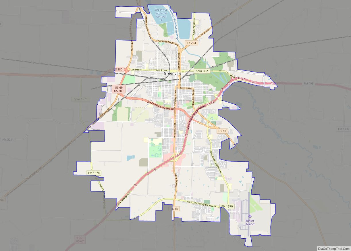
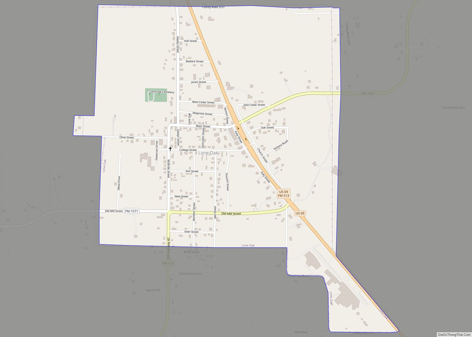
Online Interactive Map
Click on ![]() to view map in "full screen" mode.
to view map in "full screen" mode.
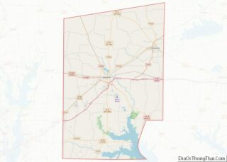
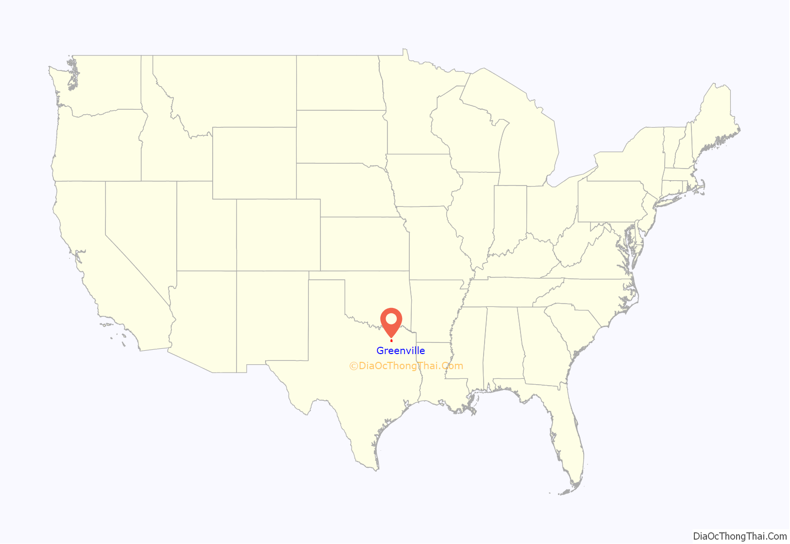
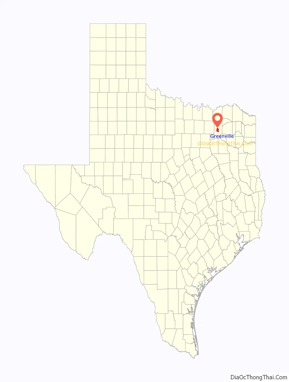
Greenville location map. Where is Greenville city?
History
Greenville was founded in 1846. The city was named after Thomas J. Green, a significant contributor to the establishment of the Texas Republic. He later became a member of the Congress of the Texas Republic.
As the Civil War loomed, Greenville was divided over the issue of secession, as were several area towns and counties. Greenville attorney and State Senator Martin D. Hart was a prominent Unionist. He formed a company of men who fought for the Union in Arkansas, even as other Greenville residents fought for the Confederacy. The divided nature of Greenville and Hunt County is noted by a historical marker in “The SPOT” Park at 2800 Lee Street in downtown Greenville. In the post-Civil War era, Greenville’s economy became partly dependent on cotton, as the local economy entered a period of transition.
With a population of 12,384 in the 1920 census, the city was the 20th-largest city in Texas at the time.
In World War II, the Mexican Escuadrón 201 was stationed in Greenville while training at nearby Majors Field.
Greenville was notorious for a large sign, installed on July 7, 1921, over Lee Street, the main street in the downtown district, between the train station and the bus station in the 1920s to 1960s. The sign read: “Welcome to Greenville, The Blackest Land, The Whitest People.” According to history teacher Paul E. Sturdevant of Greenville, the original intent behind “the whitest people” was to define “the citizens of Greenville as friendly, trustworthy, and helpful was sincere, and it was meant to include all citizens, regardless of race.” In pre-civil rights America, the phrase “That’s mighty White of you” meant that you were honest, not like suspect Blacks. The sign thus acquired racial overtones, and the original sign was taken down and placed into storage on April 13, 1965, possibly at the urging of Texas Governor John Connally, who had made a visit to the town weeks before. In 1968, Greenville’s Sybil Maddux had the sign reinstalled, with the wording modified to read “The Greatest People”; the original sign is in the collection of the Audie Murphy American Cotton Museum.
In 1957, Greenville annexed the small town of Peniel, which had been founded in 1899 as a Pentecostal Church of the Nazarene community centered around Texas Holiness University. The annexation was approved by the citizens of Peniel, which at the time had a population around 157.
On May 12, 2011, a white buffalo was born near Greenville during a thunderstorm on the ranch of Arby Littlesoldier, who identified himself as a great-great grandson of Sitting Bull. A public naming ceremony and dedication was held on June 29, 2011, during which the male calf was officially given the name “Lightning Medicine Cloud”. However, on August 21, 2012, Lightning Medicine Cloud died. The sheriff’s department declared it had died from a bacterial infection, but the owners disagree, claiming that the buffalo was allegedly skinned by an unknown party.
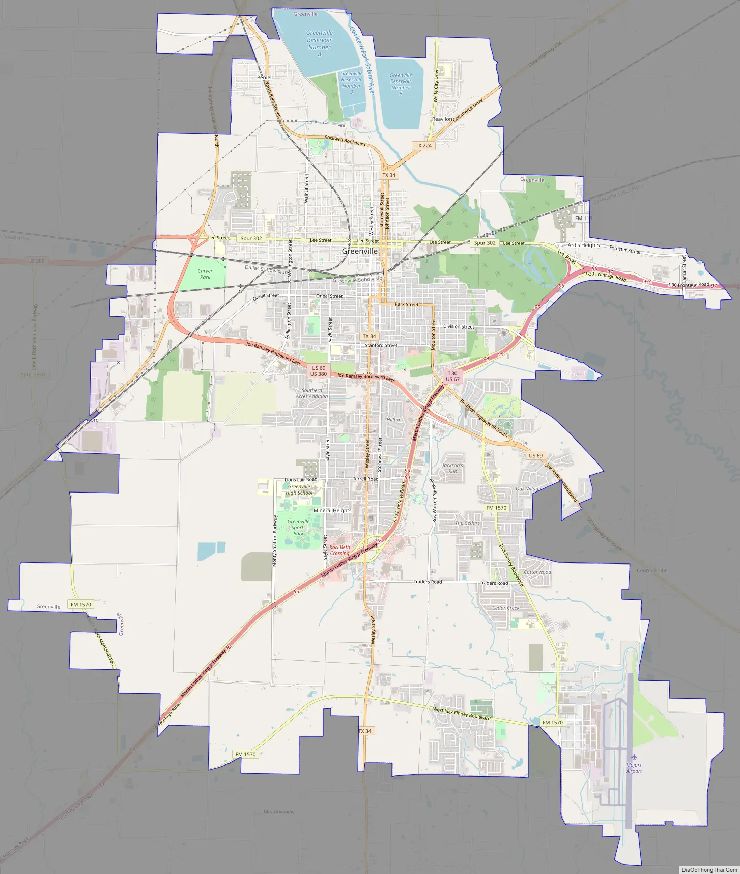
Greenville Road Map
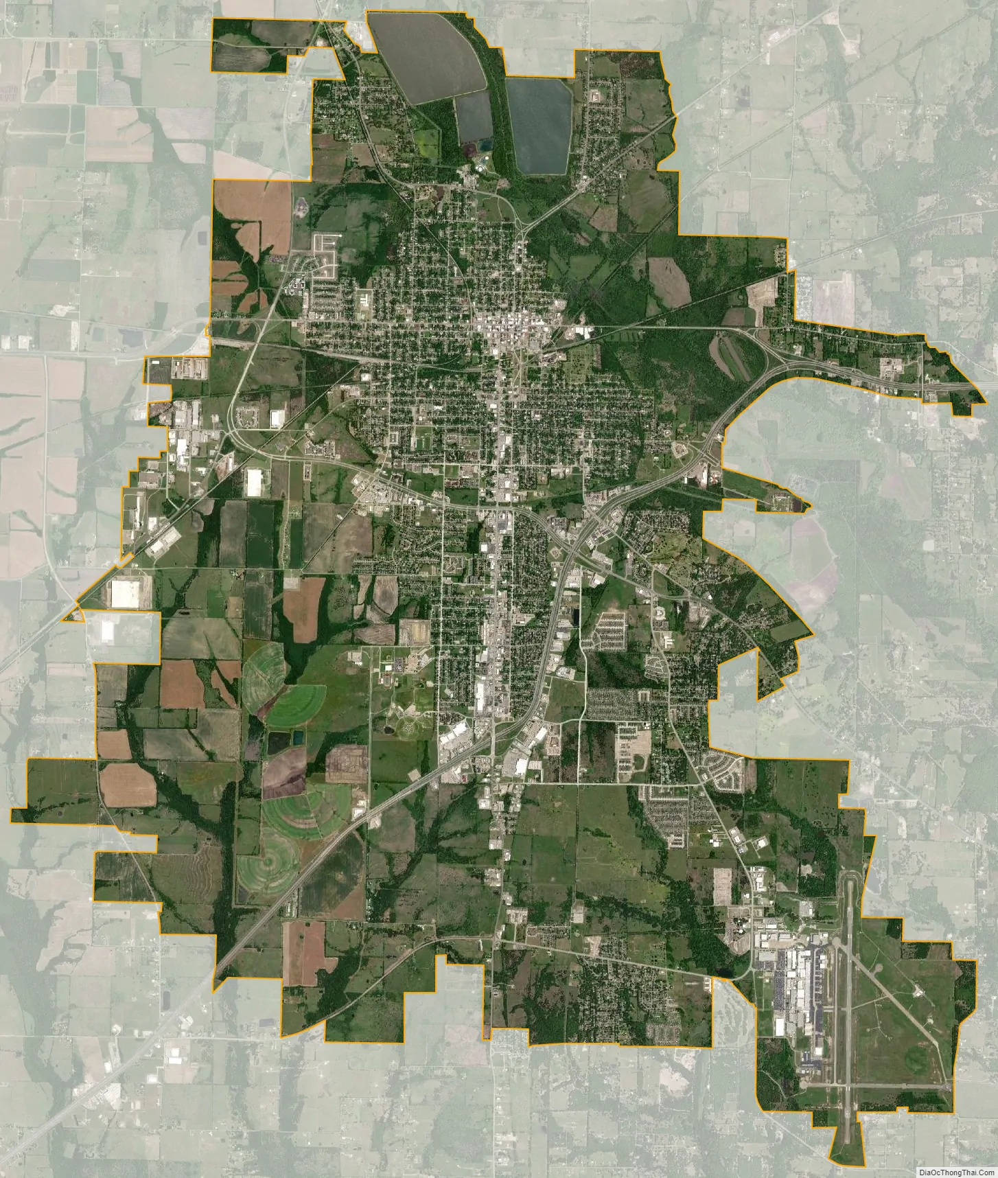
Greenville city Satellite Map
Geography
Greenville is located in North Texas at 33°7′34″N 96°6′35″W / 33.12611°N 96.10972°W / 33.12611; -96.10972 (33.126004, −96.109703), in central Hunt County, in the heart of the Texas blackland prairies, 50 miles (80 km) northeast of Dallas and about 45 miles (72 km) south of the Texas/Oklahoma border, on the eastern edge of the Dallas/Fort Worth Metroplex.
According to the U.S. Census Bureau, Greenville has a total area of 33.4 square miles (86.6 km), of which 32.6 square miles (84.5 km) are land and 0.1 square miles (0.2 km), or 2.46%, is covered by water. The Cowleech Fork of the Sabine River flows through the northeast part of the city.
Climate
Greenville has a humid subtropical climate. Due to its location on the North Texas prairies, its weather is typically humid with mild precipitation.
See also
Map of Texas State and its subdivision:- Anderson
- Andrews
- Angelina
- Aransas
- Archer
- Armstrong
- Atascosa
- Austin
- Bailey
- Bandera
- Bastrop
- Baylor
- Bee
- Bell
- Bexar
- Blanco
- Borden
- Bosque
- Bowie
- Brazoria
- Brazos
- Brewster
- Briscoe
- Brooks
- Brown
- Burleson
- Burnet
- Caldwell
- Calhoun
- Callahan
- Cameron
- Camp
- Carson
- Cass
- Castro
- Chambers
- Cherokee
- Childress
- Clay
- Cochran
- Coke
- Coleman
- Collin
- Collingsworth
- Colorado
- Comal
- Comanche
- Concho
- Cooke
- Coryell
- Cottle
- Crane
- Crockett
- Crosby
- Culberson
- Dallam
- Dallas
- Dawson
- Deaf Smith
- Delta
- Denton
- Dewitt
- Dickens
- Dimmit
- Donley
- Duval
- Eastland
- Ector
- Edwards
- El Paso
- Ellis
- Erath
- Falls
- Fannin
- Fayette
- Fisher
- Floyd
- Foard
- Fort Bend
- Franklin
- Freestone
- Frio
- Gaines
- Galveston
- Garza
- Gillespie
- Glasscock
- Goliad
- Gonzales
- Gray
- Grayson
- Gregg
- Grimes
- Guadalupe
- Hale
- Hall
- Hamilton
- Hansford
- Hardeman
- Hardin
- Harris
- Harrison
- Hartley
- Haskell
- Hays
- Hemphill
- Henderson
- Hidalgo
- Hill
- Hockley
- Hood
- Hopkins
- Houston
- Howard
- Hudspeth
- Hunt
- Hutchinson
- Irion
- Jack
- Jackson
- Jasper
- Jeff Davis
- Jefferson
- Jim Hogg
- Jim Wells
- Johnson
- Jones
- Karnes
- Kaufman
- Kendall
- Kenedy
- Kent
- Kerr
- Kimble
- King
- Kinney
- Kleberg
- Knox
- La Salle
- Lamar
- Lamb
- Lampasas
- Lavaca
- Lee
- Leon
- Liberty
- Limestone
- Lipscomb
- Live Oak
- Llano
- Loving
- Lubbock
- Lynn
- Madison
- Marion
- Martin
- Mason
- Matagorda
- Maverick
- McCulloch
- McLennan
- McMullen
- Medina
- Menard
- Midland
- Milam
- Mills
- Mitchell
- Montague
- Montgomery
- Moore
- Morris
- Motley
- Nacogdoches
- Navarro
- Newton
- Nolan
- Nueces
- Ochiltree
- Oldham
- Orange
- Palo Pinto
- Panola
- Parker
- Parmer
- Pecos
- Polk
- Potter
- Presidio
- Rains
- Randall
- Reagan
- Real
- Red River
- Reeves
- Refugio
- Roberts
- Robertson
- Rockwall
- Runnels
- Rusk
- Sabine
- San Augustine
- San Jacinto
- San Patricio
- San Saba
- Schleicher
- Scurry
- Shackelford
- Shelby
- Sherman
- Smith
- Somervell
- Starr
- Stephens
- Sterling
- Stonewall
- Sutton
- Swisher
- Tarrant
- Taylor
- Terrell
- Terry
- Throckmorton
- Titus
- Tom Green
- Travis
- Trinity
- Tyler
- Upshur
- Upton
- Uvalde
- Val Verde
- Van Zandt
- Victoria
- Walker
- Waller
- Ward
- Washington
- Webb
- Wharton
- Wheeler
- Wichita
- Wilbarger
- Willacy
- Williamson
- Wilson
- Winkler
- Wise
- Wood
- Yoakum
- Young
- Zapata
- Zavala
- Alabama
- Alaska
- Arizona
- Arkansas
- California
- Colorado
- Connecticut
- Delaware
- District of Columbia
- Florida
- Georgia
- Hawaii
- Idaho
- Illinois
- Indiana
- Iowa
- Kansas
- Kentucky
- Louisiana
- Maine
- Maryland
- Massachusetts
- Michigan
- Minnesota
- Mississippi
- Missouri
- Montana
- Nebraska
- Nevada
- New Hampshire
- New Jersey
- New Mexico
- New York
- North Carolina
- North Dakota
- Ohio
- Oklahoma
- Oregon
- Pennsylvania
- Rhode Island
- South Carolina
- South Dakota
- Tennessee
- Texas
- Utah
- Vermont
- Virginia
- Washington
- West Virginia
- Wisconsin
- Wyoming