Map of Madisonville city, Texas

Map of Madisonville city, Texas

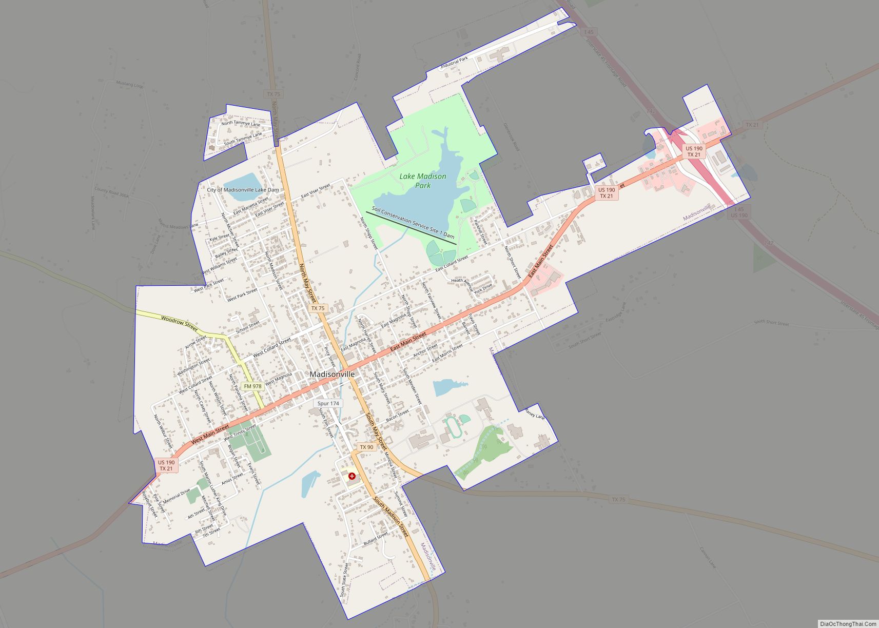
Madisonville is a city in Madison County, Texas, United States. The population was 4,420 at the 2020 census. It is the county seat of Madison County. Both the City of Madisonville and the County of Madison were named for U.S. President James Madison, the fourth chief executive. Madisonville city overview: Name: Madisonville city LSAD Code: … Read more

Map of Macdona CDP

Map of Macdona CDP

Macdona is an unincorporated community and census-designated place in Bexar County, Texas, United States. As of the 2010 census it had a population of 559. Macdona lies along the Union Pacific rail line near Loop 1604 in southwest Bexar County. It is part of the San Antonio Metropolitan Statistical Area. Macdona CDP overview: Name: Macdona … Read more

Map of Mabank town

Map of Mabank town

Mabank (/ˈmeɪbæŋk/ MAY-bank) is a town in Henderson, Van Zandt and Kaufman counties in the U.S. state of Texas. Its population was 4,050 at the 2020 census. Mabank town overview: Name: Mabank town LSAD Code: 43 LSAD Description: town (suffix) State: Texas County: Henderson County, Kaufman County Elevation: 394 ft (120 m) Total Area: 7.63 sq mi (19.77 km²) Land … Read more

Map of Lytle city

Map of Lytle city

Lytle is a city in Atascosa, Bexar, and Medina counties in the U.S. state of Texas. The population was 2,492 at the 2010 census. It is part of the San Antonio Metropolitan Statistical Area. Lytle city overview: Name: Lytle city LSAD Code: 25 LSAD Description: city (suffix) State: Texas County: Atascosa County, Bexar County, Medina … Read more

Map of Lyford city

Map of Lyford city

Lyford is a city in Willacy County, Texas. The population was 2,611 at the 2010 census. It may be included as part of the Brownsville–Harlingen–Raymondville and the Matamoros–Brownsville metropolitan areas. Lyford city overview: Name: Lyford city LSAD Code: 25 LSAD Description: city (suffix) State: Texas County: Willacy County Elevation: 33 ft (10 m) Total Area: 1.81 sq mi (4.68 km²) … Read more

Map of Lumberton city, Texas

Map of Lumberton city, Texas

Lumberton is a city in Hardin County, Texas, United States. The population was 13,554 at the 2010 census, up from 11,943 at the 2000 census. Lumberton is the home of Village Creek State Park. The city is part of the Beaumont–Port Arthur metropolitan area. Lumberton city overview: Name: Lumberton city LSAD Code: 25 LSAD Description: … Read more

Map of Luling city, Texas

Map of Luling city, Texas

Luling /ˈluːlɪŋ/ is a city in Caldwell and Guadalupe counties, Texas, United States, along the San Marcos River. The population as of the 2020 census was 5,599. Luling city overview: Name: Luling city LSAD Code: 25 LSAD Description: city (suffix) State: Texas County: Caldwell County, Guadalupe County Elevation: 410 ft (125 m) Total Area: 5.55 sq mi (14.38 km²) Land … Read more

Map of Lufkin city

Map of Lufkin city

Lufkin is the largest city in Angelina County, Texas and the county seat. The city is situated in Deep East Texas and is 60 mi (97 km) west of the Texas- Louisiana state line. Its estimated population is 35,021 as of July 1, 2019. Lufkin was founded in 1884 and named for Abraham P. Lufkin. It originally … Read more

Map of Lueders city

Map of Lueders city

Lueders is a city in Jones and Shackelford counties in the U.S. state of Texas. The population was 346 at the 2010 census. The portion of Lueders located in Jones County is part of the Abilene, Texas metropolitan area. Lueders city overview: Name: Lueders city LSAD Code: 25 LSAD Description: city (suffix) State: Texas County: … Read more

Map of Lucas city, Texas

Map of Lucas city, Texas

Lucas is a city in Collin County, Texas, United States. As of the 2010 census the population was 5,166, up from 2,890 at the 2000 census; in 2020, its population was 7,612. Lucas city overview: Name: Lucas city LSAD Code: 25 LSAD Description: city (suffix) State: Texas County: Collin County Elevation: 568 ft (173 m) Total Area: … Read more

Map of Marathon CDP, Texas

Map of Marathon CDP, Texas

Marathon (/ˈmærəθən/) is a census-designated place (CDP) in Brewster County, Texas, United States. The population was 470 in 2007, after growing from 455 in 2000, but had decreased to 430 by 2010. As of 2012 Marathon services tourists traveling to Big Bend National Park. Marathon CDP overview: Name: Marathon CDP LSAD Code: 57 LSAD Description: … Read more

Map of Manvel city, Texas

Map of Manvel city, Texas

Manvel is a city in Brazoria County, Texas, United States. As of the 2020 census the population was 9,992, up from 5,179 at the 2010 census. Manvel city overview: Name: Manvel city LSAD Code: 25 LSAD Description: city (suffix) State: Texas County: Brazoria County Elevation: 52 ft (16 m) Total Area: 27.50 sq mi (71.22 km²) Land Area: 27.45 sq mi (71.09 km²) … Read more