Lytle is a city in Atascosa, Bexar, and Medina counties in the U.S. state of Texas. The population was 2,492 at the 2010 census. It is part of the San Antonio Metropolitan Statistical Area.
| Name: | Lytle city |
|---|---|
| LSAD Code: | 25 |
| LSAD Description: | city (suffix) |
| State: | Texas |
| County: | Atascosa County, Bexar County, Medina County |
| Elevation: | 722 ft (220 m) |
| Total Area: | 4.81 sq mi (12.45 km²) |
| Land Area: | 4.76 sq mi (12.33 km²) |
| Water Area: | 0.05 sq mi (0.12 km²) |
| Total Population: | 2,492 |
| Population Density: | 644.25/sq mi (248.73/km²) |
| ZIP code: | 78052 |
| Area code: | 830 |
| FIPS code: | 4845288 |
| GNISfeature ID: | 1362011 |
| Website: | www.lytletx.org |
Online Interactive Map
Click on ![]() to view map in "full screen" mode.
to view map in "full screen" mode.
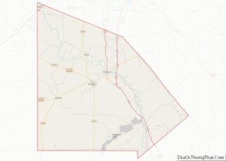
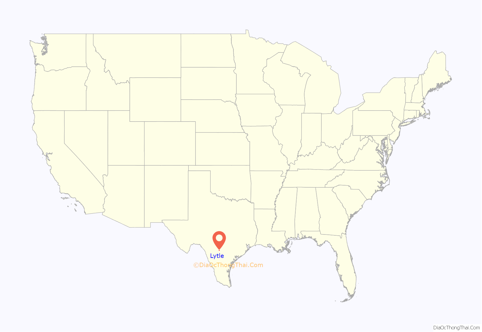
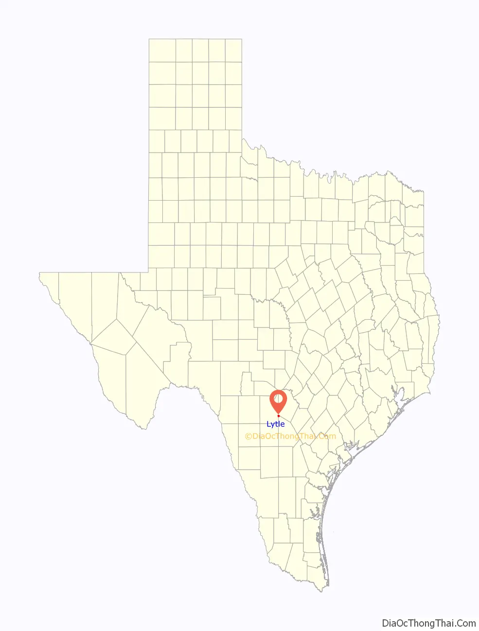
Lytle location map. Where is Lytle city?
History
Lytle grew out of 321 acres located around the head of Atascosa Creek which were patented to Henry Volkner in 1856. Volkner was the assignee of Mahan Matter, and the patent was signed by Elisha M. Pease, Governor of Texas. In 1870, Volkner sold the 321 acres for $175 to Fitch S. Adams. Lytle’s first school was built on Adams’ property with a verbal agreement that as long as the school building was there, the land on which it stood would belong to the school.
In 1881, officials from the International–Great Northern Railroad made an agreement with B. G. Andrews in which he was to give land for a new station (“Andrews Station”). There was some misunderstanding in making the deed, and the dispute ended with Mr. Andrews refusing to submit the property deed. Traildriver and cattleman Captain John Thomas Lytle (1844–1907) then secured land some three miles southwest of Andrews Station, and one morning in 1882 railroad employees loaded Andrews Station on two flat cars and moved it to the present site near the Lytle-McDaniel Ranch, which became known as Lytle or Lytle Station. When a post office was granted in 1883, the town also consisted of a general store, a bar, and a casketmaker named W. J. Garnand, who also became the first postmaster. An undated newspaper clipping entitled “Pioneer of Lytle” reads, “…W. J. Garnand was the first man to locate in the town of Lytle. That was in 1883. He was the first postmaster there and has been a leading citizen all the time.”
In 1884, Lytle had a population of fifty and the town included a union church, a district school, a hotel, and a physician. By 1892 the population doubled and grown to include four general stores, two livestock breeders, and a Methodist church. Lytle’s early settlers were primarily engaged in farming and in raising cattle. Over time, Lytle became a major shipping point for cattle, and for years the old stock pens and loading chute were familiar landmarks until they were removed in the late 1960’s and early 1970’s. Cotton and corn were also two important crops, and cotton gins were located in both Lytle and in now-abandoned Benton City. In the late 1890s, coal mining also contributed to the local economy. By 1896, the population had risen to 150. By 1914 the town had grown to include telephone service, another general store, two lumberyards, and a weekly newspaper called The Herald, and the population had grown to 600. Lytle School had 127 students. During the Great Depression, the school was enlarged as part of a WPA project.
After World War II, the Chamber of Commerce raised enough money together with property owner participation to pave the streets. Later, a pitch by W. C. Loessberg and a group of volunteers led to the town being incorporated on October 27, 1951. On May 28, 1955, a bond election was passed to drill the Edwards well for city water service, and the Lytle Volunteer Fire Department was also founded that year. Another bond election passed to give the city a gas system in 1960, and a sewer system in 1961. More streets were paved in 1971, and a garbage removal and ambulance service were added in 1974. Since that time, the city has continued to grow.
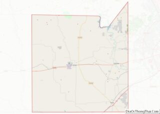
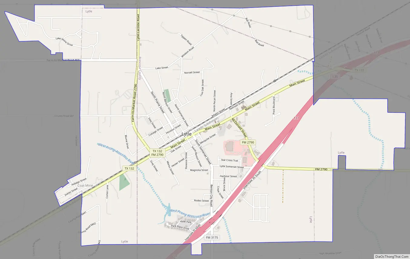
Lytle Road Map
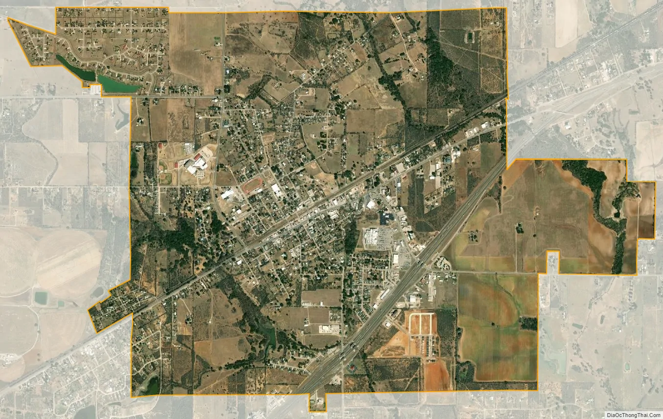
Lytle city Satellite Map
Geography
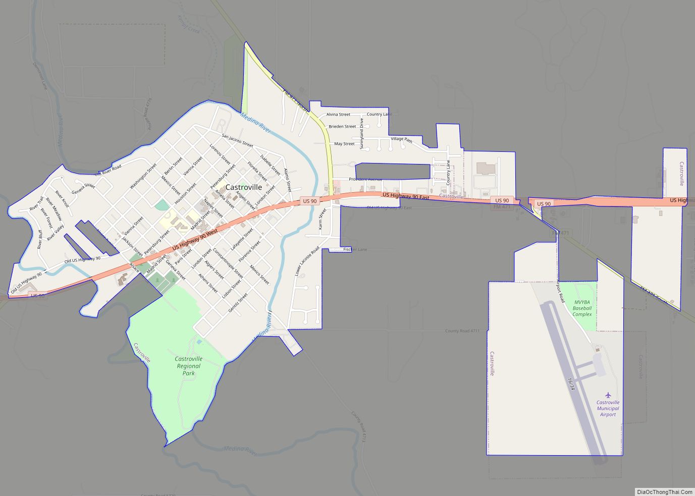
Lytle is located in the northern corner of Atascosa County. Most of the city lies in Atascosa County; only small portions extend into Bexar and Medina counties.
Interstate 35 passes through the southeast part of the city, with access from Exit 131. Lytle’s Main Street is Texas State Highway 132, following the route of the former U.S. Route 81 southwest to Natalia and Devine, before rejoining I-35. Downtown San Antonio is 25 miles (40 km) northeast via I-35, and Laredo is 133 miles (214 km) to the south.
According to the United States Census Bureau, the city has a total area of 4.5 square miles (12 km), of which, 4.45 square miles (11.5 km) of it is land and 0.04 square miles (0.10 km) is water.
See also
Map of Texas State and its subdivision:- Anderson
- Andrews
- Angelina
- Aransas
- Archer
- Armstrong
- Atascosa
- Austin
- Bailey
- Bandera
- Bastrop
- Baylor
- Bee
- Bell
- Bexar
- Blanco
- Borden
- Bosque
- Bowie
- Brazoria
- Brazos
- Brewster
- Briscoe
- Brooks
- Brown
- Burleson
- Burnet
- Caldwell
- Calhoun
- Callahan
- Cameron
- Camp
- Carson
- Cass
- Castro
- Chambers
- Cherokee
- Childress
- Clay
- Cochran
- Coke
- Coleman
- Collin
- Collingsworth
- Colorado
- Comal
- Comanche
- Concho
- Cooke
- Coryell
- Cottle
- Crane
- Crockett
- Crosby
- Culberson
- Dallam
- Dallas
- Dawson
- Deaf Smith
- Delta
- Denton
- Dewitt
- Dickens
- Dimmit
- Donley
- Duval
- Eastland
- Ector
- Edwards
- El Paso
- Ellis
- Erath
- Falls
- Fannin
- Fayette
- Fisher
- Floyd
- Foard
- Fort Bend
- Franklin
- Freestone
- Frio
- Gaines
- Galveston
- Garza
- Gillespie
- Glasscock
- Goliad
- Gonzales
- Gray
- Grayson
- Gregg
- Grimes
- Guadalupe
- Hale
- Hall
- Hamilton
- Hansford
- Hardeman
- Hardin
- Harris
- Harrison
- Hartley
- Haskell
- Hays
- Hemphill
- Henderson
- Hidalgo
- Hill
- Hockley
- Hood
- Hopkins
- Houston
- Howard
- Hudspeth
- Hunt
- Hutchinson
- Irion
- Jack
- Jackson
- Jasper
- Jeff Davis
- Jefferson
- Jim Hogg
- Jim Wells
- Johnson
- Jones
- Karnes
- Kaufman
- Kendall
- Kenedy
- Kent
- Kerr
- Kimble
- King
- Kinney
- Kleberg
- Knox
- La Salle
- Lamar
- Lamb
- Lampasas
- Lavaca
- Lee
- Leon
- Liberty
- Limestone
- Lipscomb
- Live Oak
- Llano
- Loving
- Lubbock
- Lynn
- Madison
- Marion
- Martin
- Mason
- Matagorda
- Maverick
- McCulloch
- McLennan
- McMullen
- Medina
- Menard
- Midland
- Milam
- Mills
- Mitchell
- Montague
- Montgomery
- Moore
- Morris
- Motley
- Nacogdoches
- Navarro
- Newton
- Nolan
- Nueces
- Ochiltree
- Oldham
- Orange
- Palo Pinto
- Panola
- Parker
- Parmer
- Pecos
- Polk
- Potter
- Presidio
- Rains
- Randall
- Reagan
- Real
- Red River
- Reeves
- Refugio
- Roberts
- Robertson
- Rockwall
- Runnels
- Rusk
- Sabine
- San Augustine
- San Jacinto
- San Patricio
- San Saba
- Schleicher
- Scurry
- Shackelford
- Shelby
- Sherman
- Smith
- Somervell
- Starr
- Stephens
- Sterling
- Stonewall
- Sutton
- Swisher
- Tarrant
- Taylor
- Terrell
- Terry
- Throckmorton
- Titus
- Tom Green
- Travis
- Trinity
- Tyler
- Upshur
- Upton
- Uvalde
- Val Verde
- Van Zandt
- Victoria
- Walker
- Waller
- Ward
- Washington
- Webb
- Wharton
- Wheeler
- Wichita
- Wilbarger
- Willacy
- Williamson
- Wilson
- Winkler
- Wise
- Wood
- Yoakum
- Young
- Zapata
- Zavala
- Alabama
- Alaska
- Arizona
- Arkansas
- California
- Colorado
- Connecticut
- Delaware
- District of Columbia
- Florida
- Georgia
- Hawaii
- Idaho
- Illinois
- Indiana
- Iowa
- Kansas
- Kentucky
- Louisiana
- Maine
- Maryland
- Massachusetts
- Michigan
- Minnesota
- Mississippi
- Missouri
- Montana
- Nebraska
- Nevada
- New Hampshire
- New Jersey
- New Mexico
- New York
- North Carolina
- North Dakota
- Ohio
- Oklahoma
- Oregon
- Pennsylvania
- Rhode Island
- South Carolina
- South Dakota
- Tennessee
- Texas
- Utah
- Vermont
- Virginia
- Washington
- West Virginia
- Wisconsin
- Wyoming