Luling /ˈluːlɪŋ/ is a city in Caldwell and Guadalupe counties, Texas, United States, along the San Marcos River. The population as of the 2020 census was 5,599.
| Name: | Luling city |
|---|---|
| LSAD Code: | 25 |
| LSAD Description: | city (suffix) |
| State: | Texas |
| County: | Caldwell County, Guadalupe County |
| Elevation: | 410 ft (125 m) |
| Total Area: | 5.55 sq mi (14.38 km²) |
| Land Area: | 5.51 sq mi (14.27 km²) |
| Water Area: | 0.04 sq mi (0.11 km²) |
| Total Population: | 5,599 |
| Population Density: | 1,065.15/sq mi (411.22/km²) |
| ZIP code: | 78648 |
| Area code: | 830 |
| FIPS code: | 4845096 |
| GNISfeature ID: | 1340735 |
| Website: | www.cityofluling.net |
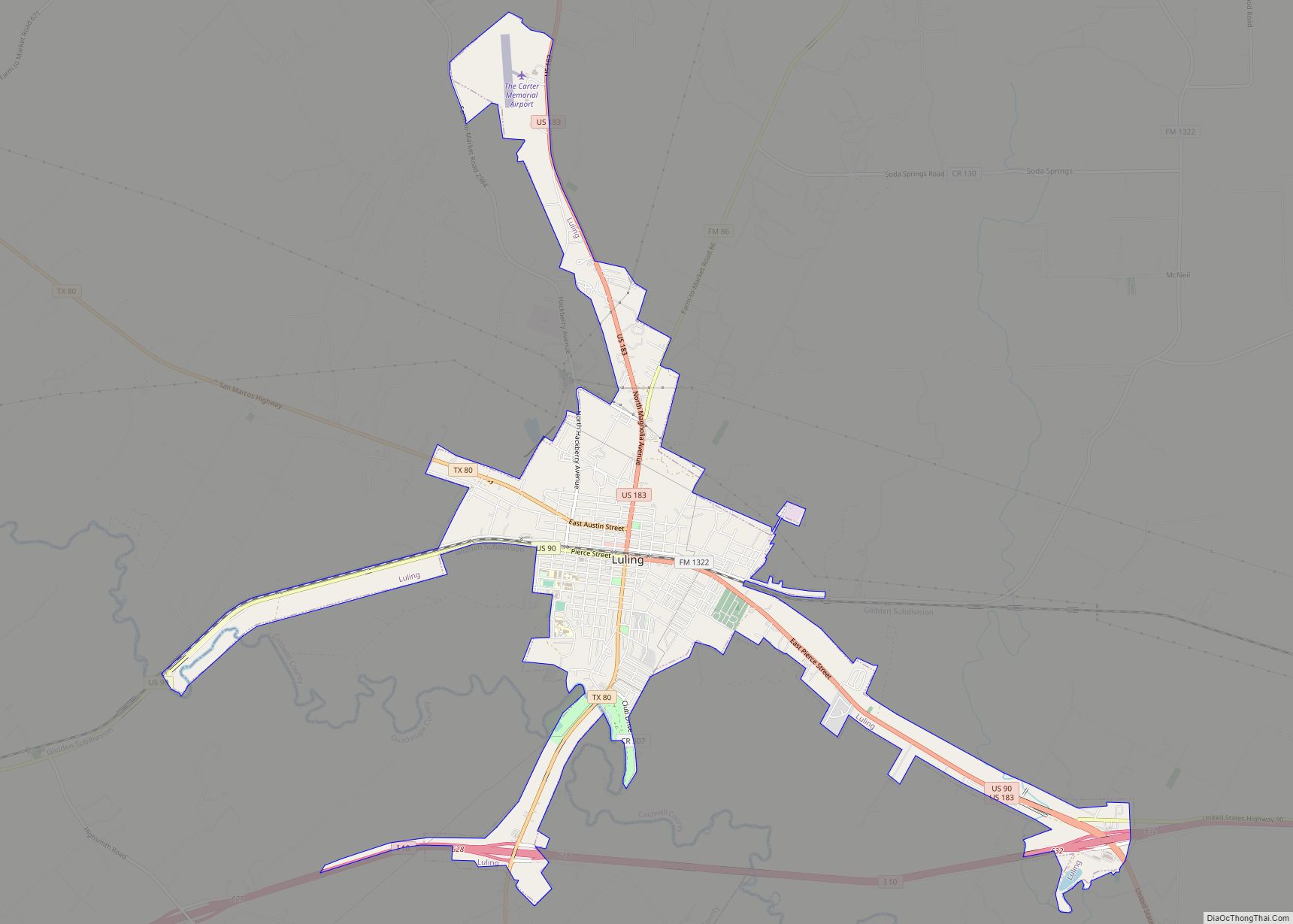
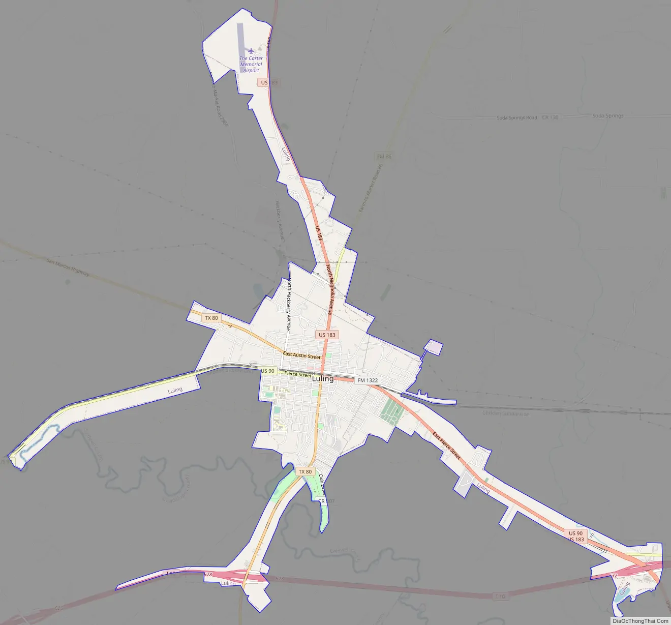
Online Interactive Map
Click on ![]() to view map in "full screen" mode.
to view map in "full screen" mode.
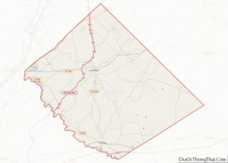
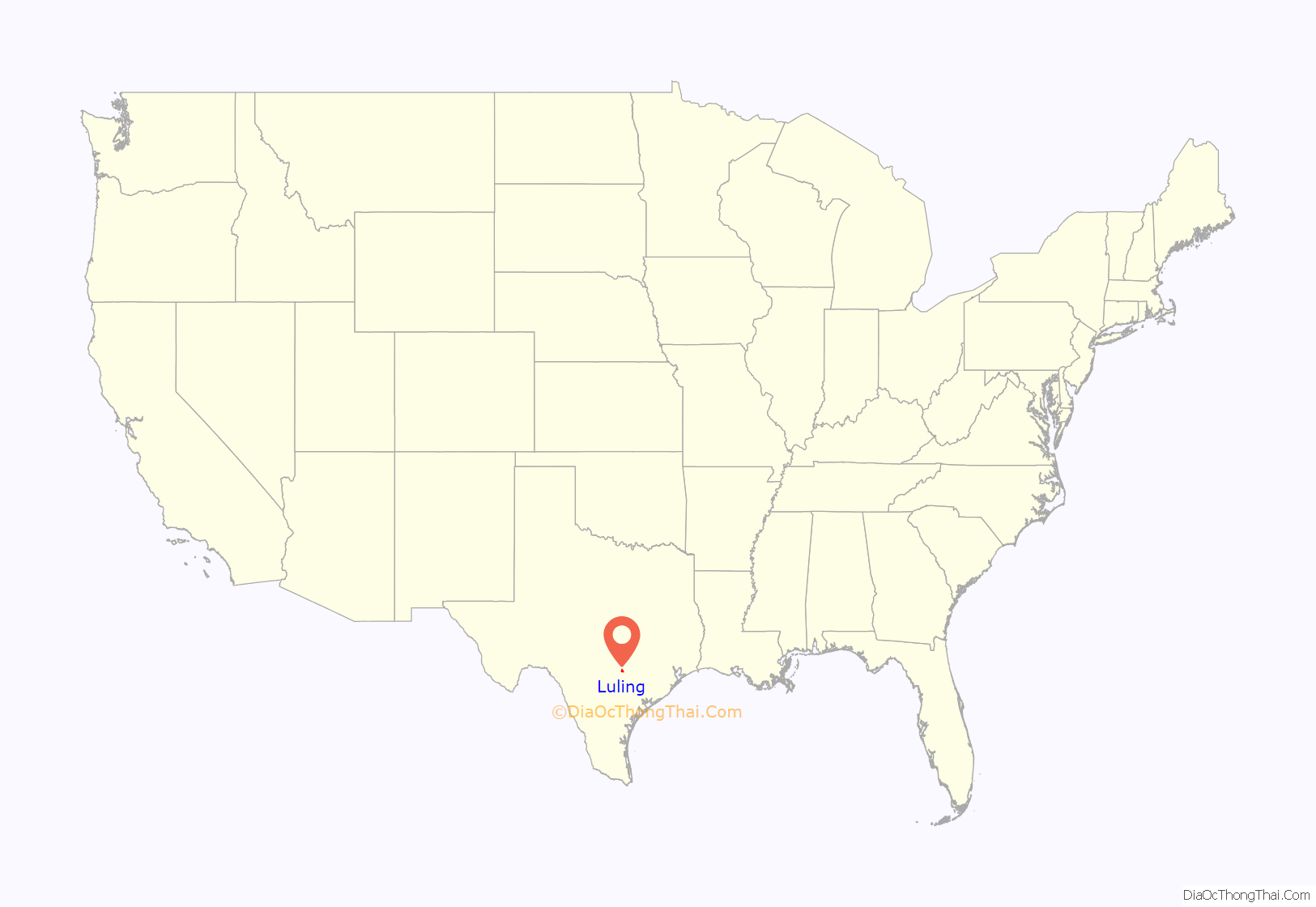
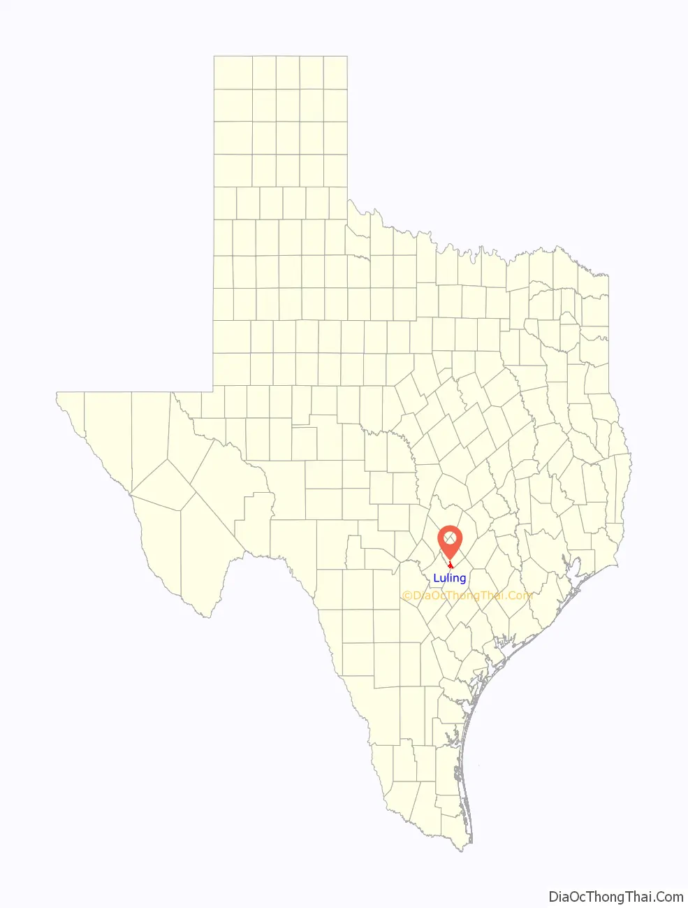
Luling location map. Where is Luling city?
History
The town was named after a New York banker, Charles Luling. He was a personal friend of Thomas Wentworth Pierce and provided the financing for the railroad as well the purchase of the land that became Luling. Prior to the founding of the town, a small farming community named Atlanta was established nearby, with residents associating themselves with the newly founded Luling, causing Atlanta to fade.
Luling was founded in 1874 as a railroad town and became a rowdy center for the cattle drivers on the Chisholm Trail. Contempt of the law by the cowboys helped Luling become known as the “toughest town in Texas”. After the great cattle drives ended in the late 1880s, Luling quieted down to a town of about 500 and cotton ruled the local economy. Perhaps due to arrival of immigrants, including a sizeable Jewish population, in the late-19th century, Luling began a long, slow, period of growth, and by 1925 the population reached 1,500.
One of the most significant events in Luling’s history was the discovery of oil by Edgar B. Davis. Davis mortgaged everything he owned to finance drilling operations around Luling. On August 9, 1922, the Rafael Rios No. 1 well struck oil at 2,161 feet (659 m), producing 150 barrels per day (24 m/d). To repay his loans, Davis contracted 2 million barrels (320,000 m) each to Atlantic Oil and Magnolia Oil at $.50 a barrel, plus another 2 million barrels (320,000 m) to Magnolia at $.75 per barrel.
Davis’ discovery opened up an oilfield 12 miles (19 km) long and 2 miles (3 km) wide. The economy quickly moved from the railroad and agriculture to oil. The population of the town rapidly increased to over 5,000. By 1924, the Luling Oil Field was producing over 15 million barrels (2,400,000 m) of oil per year, and oil formed much of Luling’s economy for the next 60 years.
As oil grew in importance in the 1930s and 1940s, the railroads that helped form the town declined and largely pulled out of Luling.
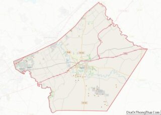
Luling Road Map
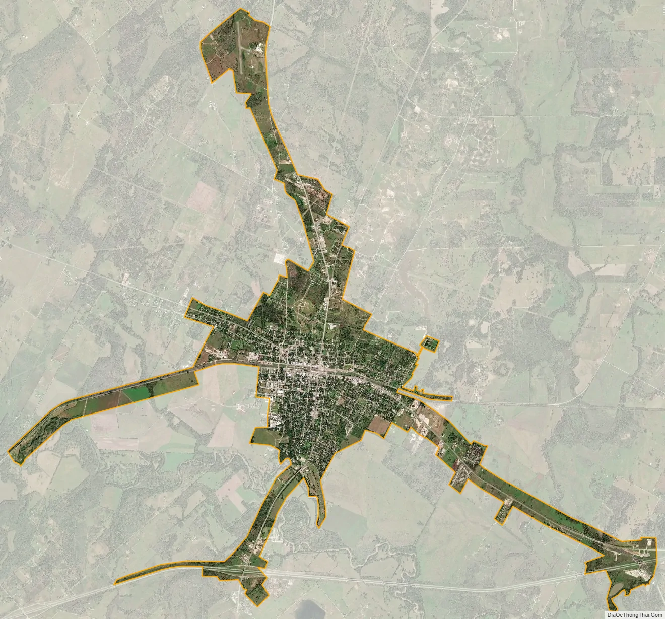
Luling city Satellite Map
Geography
Luling is located in southern Caldwell County, 47 miles (76 km) south of Austin. The city limits extend south along Texas State Highway 80 across the San Marcos River into Guadalupe County, reaching as far as Interstate 10 Exit 628. Via I-10, San Antonio is 57 miles (92 km) to the west and Houston is 141 miles (227 km) to the east.
According to the United States Census Bureau, Luling has a total area of 5.50 square miles (14.2 km). 5.46 square miles (14.1 km) of it is land, and 0.04 square miles (0.10 km), or 0.67%, is water.
Climate
The climate in this area is characterized by hot, humid summers and generally mild to cool winters. According to the Köppen Climate Classification system, Luling has a humid subtropical climate, abbreviated “Cfa” on climate maps.
See also
Map of Texas State and its subdivision:- Anderson
- Andrews
- Angelina
- Aransas
- Archer
- Armstrong
- Atascosa
- Austin
- Bailey
- Bandera
- Bastrop
- Baylor
- Bee
- Bell
- Bexar
- Blanco
- Borden
- Bosque
- Bowie
- Brazoria
- Brazos
- Brewster
- Briscoe
- Brooks
- Brown
- Burleson
- Burnet
- Caldwell
- Calhoun
- Callahan
- Cameron
- Camp
- Carson
- Cass
- Castro
- Chambers
- Cherokee
- Childress
- Clay
- Cochran
- Coke
- Coleman
- Collin
- Collingsworth
- Colorado
- Comal
- Comanche
- Concho
- Cooke
- Coryell
- Cottle
- Crane
- Crockett
- Crosby
- Culberson
- Dallam
- Dallas
- Dawson
- Deaf Smith
- Delta
- Denton
- Dewitt
- Dickens
- Dimmit
- Donley
- Duval
- Eastland
- Ector
- Edwards
- El Paso
- Ellis
- Erath
- Falls
- Fannin
- Fayette
- Fisher
- Floyd
- Foard
- Fort Bend
- Franklin
- Freestone
- Frio
- Gaines
- Galveston
- Garza
- Gillespie
- Glasscock
- Goliad
- Gonzales
- Gray
- Grayson
- Gregg
- Grimes
- Guadalupe
- Hale
- Hall
- Hamilton
- Hansford
- Hardeman
- Hardin
- Harris
- Harrison
- Hartley
- Haskell
- Hays
- Hemphill
- Henderson
- Hidalgo
- Hill
- Hockley
- Hood
- Hopkins
- Houston
- Howard
- Hudspeth
- Hunt
- Hutchinson
- Irion
- Jack
- Jackson
- Jasper
- Jeff Davis
- Jefferson
- Jim Hogg
- Jim Wells
- Johnson
- Jones
- Karnes
- Kaufman
- Kendall
- Kenedy
- Kent
- Kerr
- Kimble
- King
- Kinney
- Kleberg
- Knox
- La Salle
- Lamar
- Lamb
- Lampasas
- Lavaca
- Lee
- Leon
- Liberty
- Limestone
- Lipscomb
- Live Oak
- Llano
- Loving
- Lubbock
- Lynn
- Madison
- Marion
- Martin
- Mason
- Matagorda
- Maverick
- McCulloch
- McLennan
- McMullen
- Medina
- Menard
- Midland
- Milam
- Mills
- Mitchell
- Montague
- Montgomery
- Moore
- Morris
- Motley
- Nacogdoches
- Navarro
- Newton
- Nolan
- Nueces
- Ochiltree
- Oldham
- Orange
- Palo Pinto
- Panola
- Parker
- Parmer
- Pecos
- Polk
- Potter
- Presidio
- Rains
- Randall
- Reagan
- Real
- Red River
- Reeves
- Refugio
- Roberts
- Robertson
- Rockwall
- Runnels
- Rusk
- Sabine
- San Augustine
- San Jacinto
- San Patricio
- San Saba
- Schleicher
- Scurry
- Shackelford
- Shelby
- Sherman
- Smith
- Somervell
- Starr
- Stephens
- Sterling
- Stonewall
- Sutton
- Swisher
- Tarrant
- Taylor
- Terrell
- Terry
- Throckmorton
- Titus
- Tom Green
- Travis
- Trinity
- Tyler
- Upshur
- Upton
- Uvalde
- Val Verde
- Van Zandt
- Victoria
- Walker
- Waller
- Ward
- Washington
- Webb
- Wharton
- Wheeler
- Wichita
- Wilbarger
- Willacy
- Williamson
- Wilson
- Winkler
- Wise
- Wood
- Yoakum
- Young
- Zapata
- Zavala
- Alabama
- Alaska
- Arizona
- Arkansas
- California
- Colorado
- Connecticut
- Delaware
- District of Columbia
- Florida
- Georgia
- Hawaii
- Idaho
- Illinois
- Indiana
- Iowa
- Kansas
- Kentucky
- Louisiana
- Maine
- Maryland
- Massachusetts
- Michigan
- Minnesota
- Mississippi
- Missouri
- Montana
- Nebraska
- Nevada
- New Hampshire
- New Jersey
- New Mexico
- New York
- North Carolina
- North Dakota
- Ohio
- Oklahoma
- Oregon
- Pennsylvania
- Rhode Island
- South Carolina
- South Dakota
- Tennessee
- Texas
- Utah
- Vermont
- Virginia
- Washington
- West Virginia
- Wisconsin
- Wyoming