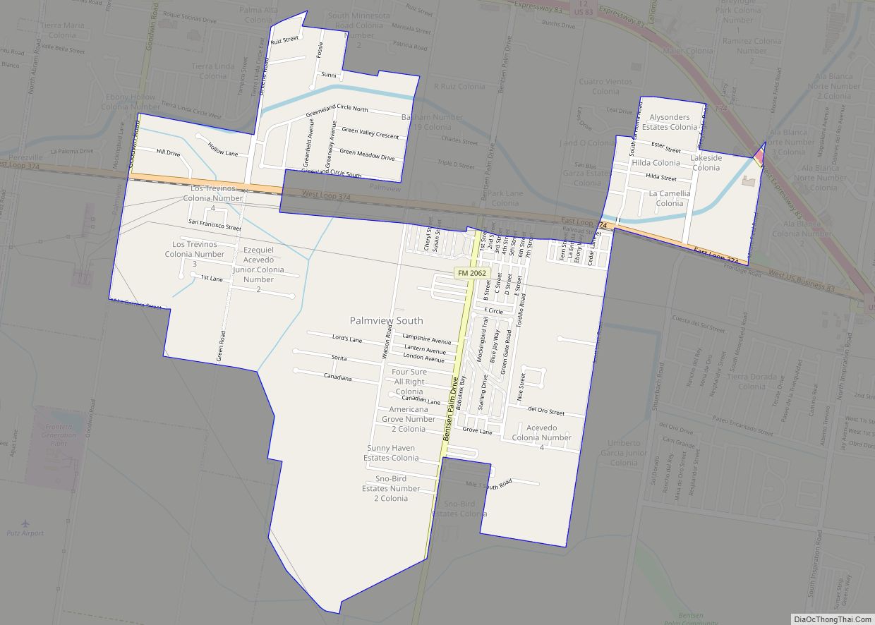
Map of Palisades village

Map of Palisades village

Palisades is a village in Randall County, Texas, United States. The population was 325 at the 2010 census. It is part of the Amarillo, Texas Metropolitan Statistical Area. Palisades village overview: Name: Palisades village LSAD Code: 47 LSAD Description: village (suffix) State: Texas County: Randall County Elevation: 3,353 ft (1,022 m) Total Area: 0.58 sq mi (1.50 km²) Land Area: … Read more

Map of Palestine city, Texas

Map of Palestine city, Texas

Palestine (/ˈpælɪstiːn/ PAL-ih-steen) is a city in and the seat of Anderson County in the U.S. state of Texas. It was named for Palestine, Illinois, by preacher Daniel Parker, who had migrated from that town. It is also contested that Micham Main named Palestine after his hometown of Palestine, Illinois when he and his family … Read more

Map of Palacios city

Map of Palacios city

Palacios (/pəˈlæʃəs/ (listen) pə-LASH-əs) is a city in Matagorda County, Texas, United States. The population was 4,395 at the 2020 census. Palacios city overview: Name: Palacios city LSAD Code: 25 LSAD Description: city (suffix) State: Texas County: Matagorda County Elevation: 13 ft (4 m) Total Area: 5.21 sq mi (13.48 km²) Land Area: 4.94 sq mi (12.79 km²) Water Area: 0.27 sq mi (0.69 km²) Total … Read more

Map of Paisano Park CDP

Map of Paisano Park CDP

Paisano Park is a census-designated place (CDP) in San Patricio County, Texas, United States. The population was 130 at the 2010 census. Prior to the 2010 census Paisano Park was part of the Edgewater-Paisano CDP. Paisano Park CDP overview: Name: Paisano Park CDP LSAD Code: 57 LSAD Description: CDP (suffix) State: Texas County: San Patricio … Read more

Map of Palo Pinto CDP

Map of Palo Pinto CDP

Palo Pinto is a census-designated place (CDP) and unincorporated community and county seat in Palo Pinto County, Texas, United States. This was a new CDP for the 2010 census with a population of 333. Palo Pinto CDP overview: Name: Palo Pinto CDP LSAD Code: 57 LSAD Description: CDP (suffix) State: Texas County: Palo Pinto County … Read more

Map of Parker city, Texas

Map of Parker city, Texas

Parker is a city in Collin County, Texas, United States. The population was 5,462 in 2020. Parker city overview: Name: Parker city LSAD Code: 25 LSAD Description: city (suffix) State: Texas County: Collin County Elevation: 604 ft (184 m) Total Area: 8.55 sq mi (22.13 km²) Land Area: 8.52 sq mi (22.06 km²) Water Area: 0.03 sq mi (0.07 km²) Total Population: 3,811 Population Density: 607.70/sq mi … Read more

Map of Paris city, Texas

Map of Paris city, Texas

Paris is a city and county seat of Lamar County, Texas, United States. Located in Northeast Texas at the western edge of the Piney Woods, the population of the city was 24,171 in 2020. Paris city overview: Name: Paris city LSAD Code: 25 LSAD Description: city (suffix) State: Texas County: Lamar County Elevation: 600 ft (183 m) … Read more

Map of Paradise city, Texas

Map of Paradise city, Texas

Paradise is a city in Wise County, Texas, United States. The population was 475 in 2020. According to tradition, the area was a cowboy’s “paradise”, hence the name. In 1985, Blue Bell Ice Cream filmed a television commercial in Paradise, TX. The commercial starred some residents of the town. Paradise city overview: Name: Paradise city … Read more

Map of Pantego town, Texas

Map of Pantego town, Texas

Pantego is a town in Tarrant County, Texas, United States. Its population was 2,394 at the 2010 census. It is entirely surrounded by the cities of Arlington and Dalworthington Gardens. It is in the middle of the Dallas–Fort Worth metroplex, a metropolitan area spanning several counties. Pantego town overview: Name: Pantego town LSAD Code: 43 … Read more

Map of Panorama Village city

Map of Panorama Village city

Panorama Village is a city in Montgomery County, Texas, United States. Residents have Conroe, Texas addresses and Willis, Texas phone numbers. The small city is home to a 27-hole municipal golf course and country club. The population was 2,515 at the 2020 census. Panorama Village city overview: Name: Panorama Village city LSAD Code: 25 LSAD … Read more

Map of Panhandle town

Map of Panhandle town

Panhandle is the county seat of Carson County, Texas, United States. The population of the town was 2,452 at the 2010 census. Panhandle is part of the Amarillo metropolitan statistical area. Panhandle town overview: Name: Panhandle town LSAD Code: 43 LSAD Description: town (suffix) State: Texas County: Carson County Elevation: 3,458 ft (1,054 m) Total Area: 2.12 sq mi … Read more

Map of Pampa city

Map of Pampa city

Pampa (from the Quechua: pampa, meaning “plain”) is a city in Gray County, Texas, United States. Its population was 16,867 as of the 2020 census. Pampa is the county seat of Gray County and is the principal city of the Pampa micropolitan statistical area, which includes both Gray and Roberts Counties. Pampa is named after … Read more