Pampa (from the Quechua: pampa, meaning “plain”) is a city in Gray County, Texas, United States. Its population was 16,867 as of the 2020 census. Pampa is the county seat of Gray County and is the principal city of the Pampa micropolitan statistical area, which includes both Gray and Roberts Counties. Pampa is named after the Pampas Lowlands in Argentina, Uruguay, and southern Brazil.
Pampa hosts the Top o’ Texas Rodeo each year in July, which brings competitors from Texas and the surrounding states to Gray County. The White Deer Land Company Museum, which showcases ranching exhibits, is located in downtown Pampa.
| Name: | Pampa city |
|---|---|
| LSAD Code: | 25 |
| LSAD Description: | city (suffix) |
| State: | Texas |
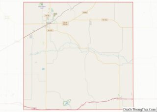
| County: | Gray County |
| Elevation: | 3,238 ft (987 m) |
| Total Area: | 9.02 sq mi (23.36 km²) |
| Land Area: | 9.02 sq mi (23.36 km²) |
| Water Area: | 0.00 sq mi (0.00 km²) |
| Total Population: | 16,867 |
| Population Density: | 1,869.96/sq mi (722.05/km²) |
| ZIP code: | 79065-79066 |
| Area code: | 806 |
| FIPS code: | 4854912 |
| Website: | www.cityofpampa.org |
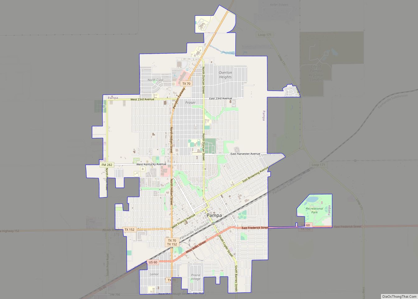
Online Interactive Map
Click on ![]() to view map in "full screen" mode.
to view map in "full screen" mode.
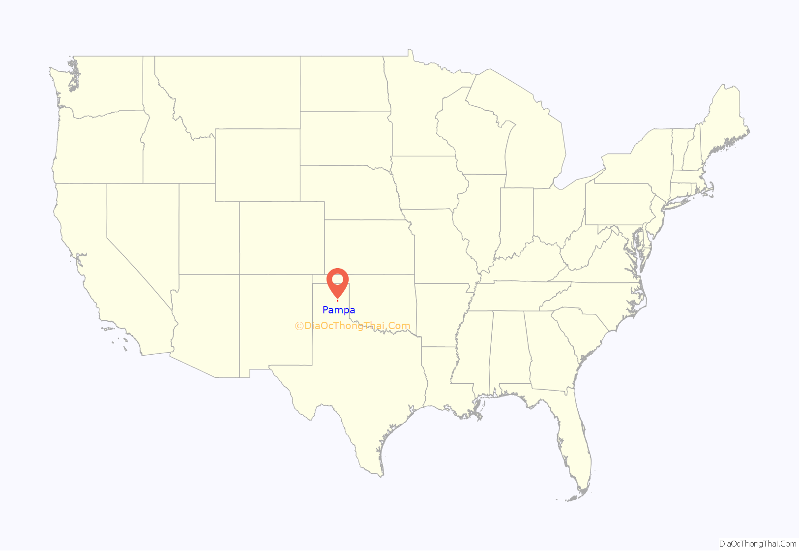
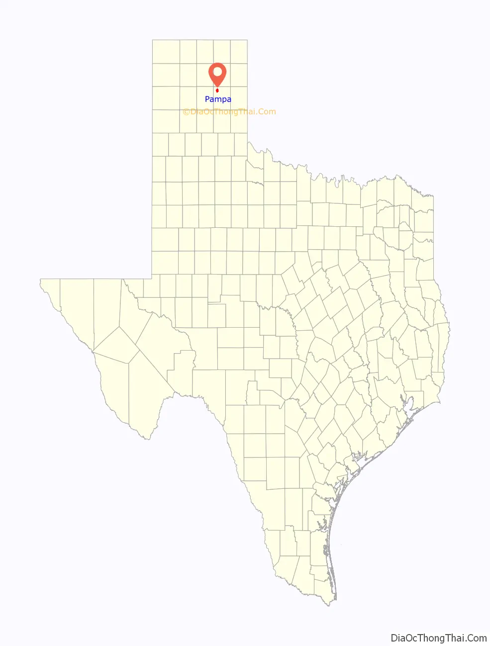
Pampa location map. Where is Pampa city?
History
In 1888, the Santa Fe Railroad was constructed through the area where Pampa would be established. A rail station and telegraph office were built, and the townsite was laid out by George Tyng, manager of the White Deer Lands ranch. The town was first called “Glasgow”, then “Sutton”, and then the name was changed to “Pampa” after the pampas grasslands of South America at Mr. Tyng’s suggestion. Timothy Dwight Hobart, a native of Vermont, sold plots of land for the town only to people who agreed to settle there and develop the land, and Pampa soon became a center for agriculture. Gas and oil were discovered in the Texas Panhandle in 1916. Pampa prospered greatly in the resulting oil boom, and the Gray County seat of government was moved in 1928 from Lefors to Pampa.
The Army Air Forces Training Command operated the Pampa Army Air Field that was in operation from 1942 to 1945. The former base is located near the intersection of SH 152 and FM 1474, about 10 miles east of the town.
1995 tornado
On June 8, 1995, a violent tornado hit the industrial section on the west side of Pampa, destroying or damaging about 250 businesses and homes. It resulted in $30 million in damage and was the costliest and the most destructive tornado on record for this town. It had a 3-mile-long path and was 200 yards wide. At its peak, it was rated an F4 on the Fujita scale.
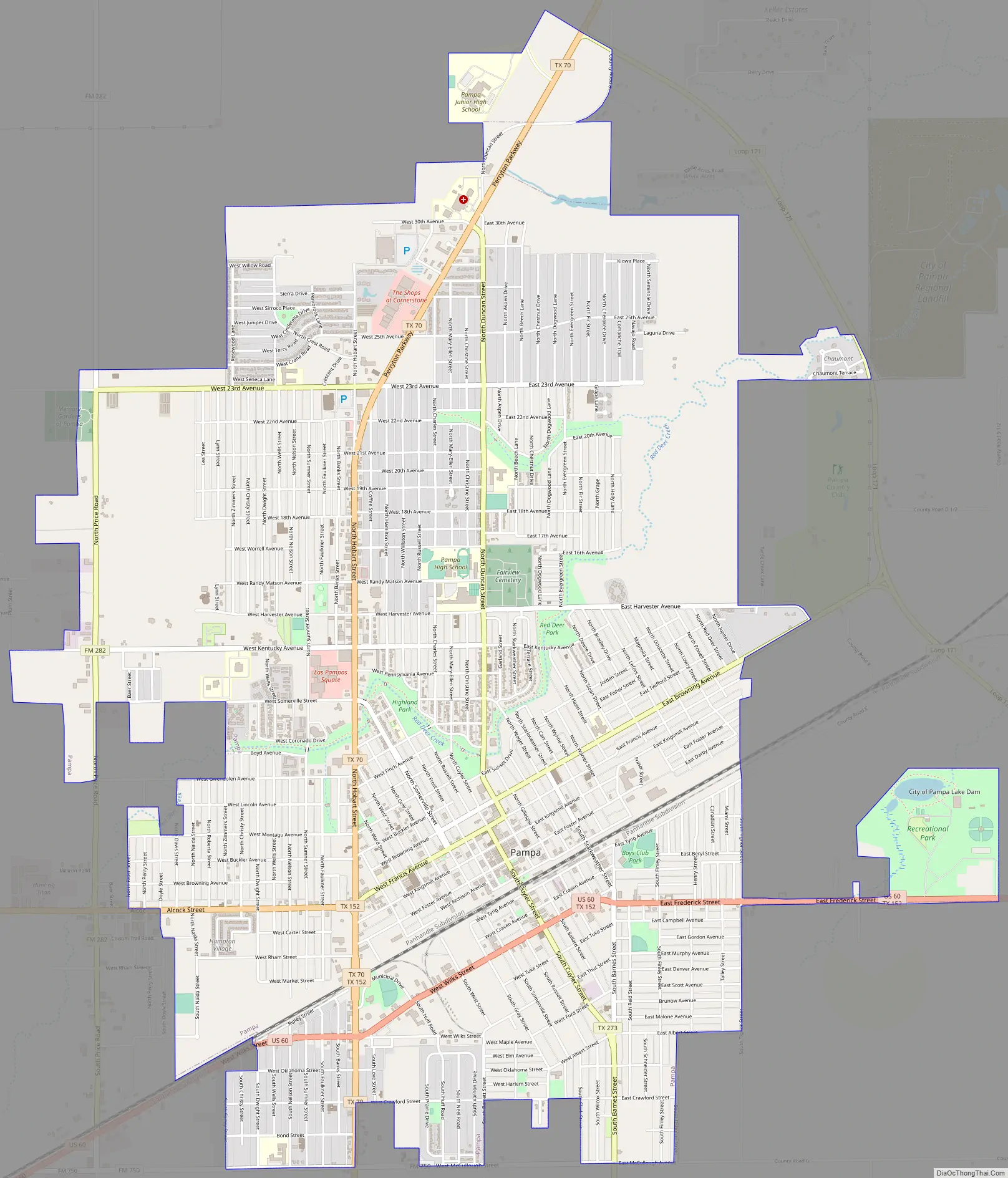
Pampa Road Map
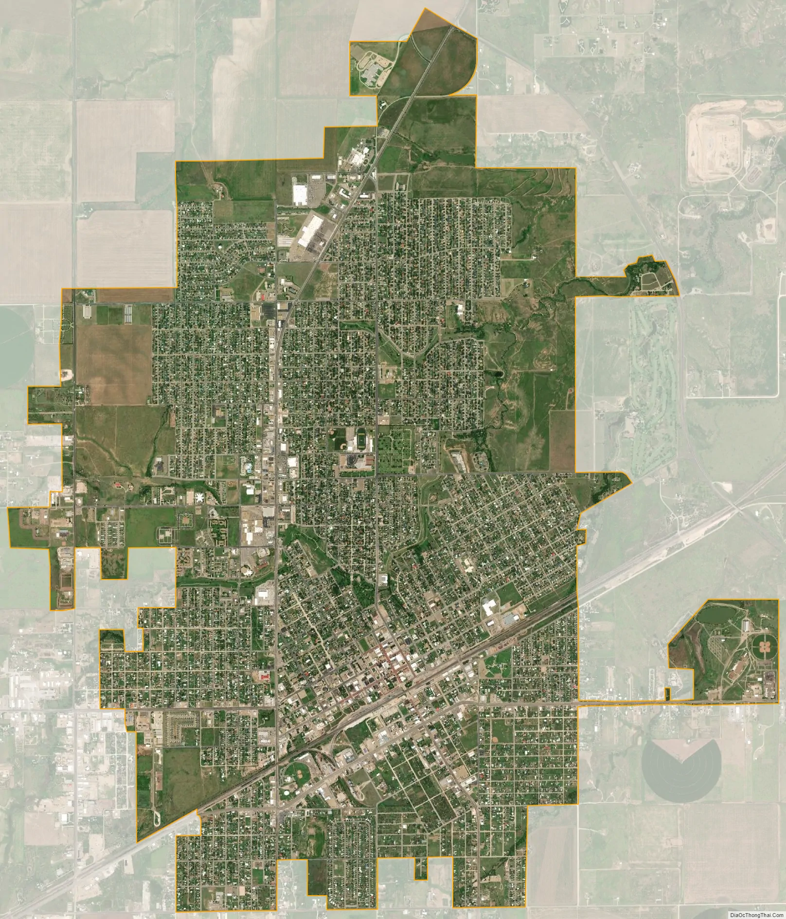
Pampa city Satellite Map
Geography
Pampa is located in northwestern Gray County. According to the United States Census Bureau, the city has a total land area of 9.0 square miles (23.2 km), all land.
U.S. Route 60 passes through Pampa, leading northeast 46 miles (74 km) to Canadian and southwest 54 miles (87 km) to Amarillo. Texas State Highway 70 crosses US 60 in the southwest part of Pampa and leads north 62 miles (100 km) to Perryton and south 24 miles (39 km) to Interstate 40.
See also
Map of Texas State and its subdivision:- Anderson
- Andrews
- Angelina
- Aransas
- Archer
- Armstrong
- Atascosa
- Austin
- Bailey
- Bandera
- Bastrop
- Baylor
- Bee
- Bell
- Bexar
- Blanco
- Borden
- Bosque
- Bowie
- Brazoria
- Brazos
- Brewster
- Briscoe
- Brooks
- Brown
- Burleson
- Burnet
- Caldwell
- Calhoun
- Callahan
- Cameron
- Camp
- Carson
- Cass
- Castro
- Chambers
- Cherokee
- Childress
- Clay
- Cochran
- Coke
- Coleman
- Collin
- Collingsworth
- Colorado
- Comal
- Comanche
- Concho
- Cooke
- Coryell
- Cottle
- Crane
- Crockett
- Crosby
- Culberson
- Dallam
- Dallas
- Dawson
- Deaf Smith
- Delta
- Denton
- Dewitt
- Dickens
- Dimmit
- Donley
- Duval
- Eastland
- Ector
- Edwards
- El Paso
- Ellis
- Erath
- Falls
- Fannin
- Fayette
- Fisher
- Floyd
- Foard
- Fort Bend
- Franklin
- Freestone
- Frio
- Gaines
- Galveston
- Garza
- Gillespie
- Glasscock
- Goliad
- Gonzales
- Gray
- Grayson
- Gregg
- Grimes
- Guadalupe
- Hale
- Hall
- Hamilton
- Hansford
- Hardeman
- Hardin
- Harris
- Harrison
- Hartley
- Haskell
- Hays
- Hemphill
- Henderson
- Hidalgo
- Hill
- Hockley
- Hood
- Hopkins
- Houston
- Howard
- Hudspeth
- Hunt
- Hutchinson
- Irion
- Jack
- Jackson
- Jasper
- Jeff Davis
- Jefferson
- Jim Hogg
- Jim Wells
- Johnson
- Jones
- Karnes
- Kaufman
- Kendall
- Kenedy
- Kent
- Kerr
- Kimble
- King
- Kinney
- Kleberg
- Knox
- La Salle
- Lamar
- Lamb
- Lampasas
- Lavaca
- Lee
- Leon
- Liberty
- Limestone
- Lipscomb
- Live Oak
- Llano
- Loving
- Lubbock
- Lynn
- Madison
- Marion
- Martin
- Mason
- Matagorda
- Maverick
- McCulloch
- McLennan
- McMullen
- Medina
- Menard
- Midland
- Milam
- Mills
- Mitchell
- Montague
- Montgomery
- Moore
- Morris
- Motley
- Nacogdoches
- Navarro
- Newton
- Nolan
- Nueces
- Ochiltree
- Oldham
- Orange
- Palo Pinto
- Panola
- Parker
- Parmer
- Pecos
- Polk
- Potter
- Presidio
- Rains
- Randall
- Reagan
- Real
- Red River
- Reeves
- Refugio
- Roberts
- Robertson
- Rockwall
- Runnels
- Rusk
- Sabine
- San Augustine
- San Jacinto
- San Patricio
- San Saba
- Schleicher
- Scurry
- Shackelford
- Shelby
- Sherman
- Smith
- Somervell
- Starr
- Stephens
- Sterling
- Stonewall
- Sutton
- Swisher
- Tarrant
- Taylor
- Terrell
- Terry
- Throckmorton
- Titus
- Tom Green
- Travis
- Trinity
- Tyler
- Upshur
- Upton
- Uvalde
- Val Verde
- Van Zandt
- Victoria
- Walker
- Waller
- Ward
- Washington
- Webb
- Wharton
- Wheeler
- Wichita
- Wilbarger
- Willacy
- Williamson
- Wilson
- Winkler
- Wise
- Wood
- Yoakum
- Young
- Zapata
- Zavala
- Alabama
- Alaska
- Arizona
- Arkansas
- California
- Colorado
- Connecticut
- Delaware
- District of Columbia
- Florida
- Georgia
- Hawaii
- Idaho
- Illinois
- Indiana
- Iowa
- Kansas
- Kentucky
- Louisiana
- Maine
- Maryland
- Massachusetts
- Michigan
- Minnesota
- Mississippi
- Missouri
- Montana
- Nebraska
- Nevada
- New Hampshire
- New Jersey
- New Mexico
- New York
- North Carolina
- North Dakota
- Ohio
- Oklahoma
- Oregon
- Pennsylvania
- Rhode Island
- South Carolina
- South Dakota
- Tennessee
- Texas
- Utah
- Vermont
- Virginia
- Washington
- West Virginia
- Wisconsin
- Wyoming