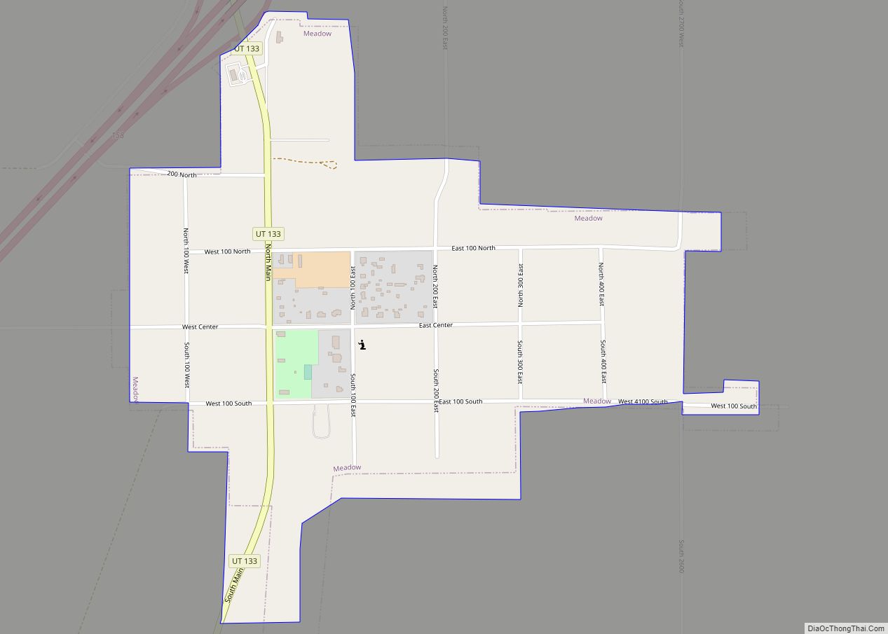
Map of Huntington city, Utah

Map of Huntington city, Utah

Huntington is a city in northwestern Emery County, Utah, United States. The population was 2,129 at the 2010 census. It is the largest town in Emery County. Huntington city overview: Name: Huntington city LSAD Code: 25 LSAD Description: city (suffix) State: Utah County: Emery County Founded: 1875 Elevation: 5,787 ft (1,764 m) Total Area: 2.26 sq mi (5.85 km²) Land … Read more

Map of Hoytsville CDP

Map of Hoytsville CDP

Hoytsville is a census-designated place in western Summit County, Utah, United States. Hoytsville is named for early settler Samuel P. Hoyt. It is bordered by Coalville to the north, and by Wanship on the south. The population was 607 at the 2010 census. Interstate 80 passes through the area, as well as the Weber River. … Read more

Map of Howell town, Utah

Map of Howell town, Utah

Howell is a town located in the Blue Creek Valley in northeast Box Elder County, Utah, United States. The population was 245 at the 2010 census. Howell town overview: Name: Howell town LSAD Code: 43 LSAD Description: town (suffix) State: Utah County: Box Elder County Incorporated: 1941 Elevation: 4,561 ft (1,390 m) Total Area: 35.47 sq mi (91.87 km²) Land … Read more

Map of Hooper city, Utah

Map of Hooper city, Utah

Hooper is a city in Weber County, Utah, United States, first called Muskrat Springs and later Hooperville for Captain William Henry Hooper, an early Utah delegate to Congress. The population was 9,087 at the 2020 census, up from the 2010 figure of 6,932. Prior to the city’s incorporation on November 30, 2000, Hooper was an … Read more

Map of Honeyville city

Map of Honeyville city

Honeyville is a city near the eastern edge of Box Elder County, Utah, United States. The population was 1,441 at the 2010 census. Honeyville city overview: Name: Honeyville city LSAD Code: 25 LSAD Description: city (suffix) State: Utah County: Box Elder County Incorporated: July 8, 1911 Elevation: 4,298 ft (1,310 m) Total Area: 11.74 sq mi (30.42 km²) Land Area: … Read more

Map of Holladay city

Map of Holladay city

Holladay is a city in central Salt Lake County, Utah, United States. It is part of the Salt Lake City, Utah Metropolitan Statistical Area and abuts the Wasatch National Forest. The population was 31,965 at the 2020 census, a significant increase from 14,561 in 2000 when the first area incorporated from Salt Lake County. The … Read more

Map of Joseph town, Utah

Map of Joseph town, Utah

Joseph is a town in Sevier County, Utah, United States. The population was 269 at the 2000 census. The town was named for Joseph Angell Young, an apostle of the Church of Jesus Christ of Latter-day Saints. Joseph was settled in 1871. Joseph town overview: Name: Joseph town LSAD Code: 43 LSAD Description: town (suffix) … Read more

Map of Jensen CDP

Map of Jensen CDP

Jensen is a census-designated place in eastern Uintah County, Utah, United States. The population was 412 at the 2010 census. It lies along the Green River and U.S. Route 40, southeast of the city of Vernal, the county seat of Uintah County, and about 17 miles west of the Colorado border. Although Jensen is unincorporated, … Read more

Map of Ivins city

Map of Ivins city

Ivins (/ˈaɪvɪnz/ EYE-vinz) is a city in southwestern Washington County, Utah, United States. It is a part of the St. George Metropolitan Area as a suburb or “bedroom” community. The population was 8,978 at the 2020 census, up from 6,753 at the 2010 census. Although Ivins was listed as a town in the 2000 census, … Read more

Map of Interlaken town, Utah

Map of Interlaken town, Utah

Interlaken is a town in northwestern Wasatch County, Utah, United States. The current mayor is Greg Harrigan Interlaken town overview: Name: Interlaken town LSAD Code: 43 LSAD Description: town (suffix) State: Utah County: Wasatch County Incorporated: May 20, 2015 Elevation: 5,919 ft (1,805 m) Total Area: 0.22 sq mi (0.58 km²) Land Area: 0.22 sq mi (0.58 km²) Water Area: 0.00 sq mi (0.00 km²) Total … Read more

Map of Independence town, Utah

Map of Independence town, Utah

Independence is a town in Wasatch County, Utah, United States. Lying just east of U.S. Route 40 southeast of Heber City, Independence was incorporated in 2008 under a controversial, short-lived state law. The population was 164 at the 2010 census. Independence town overview: Name: Independence town LSAD Code: 43 LSAD Description: town (suffix) State: Utah … Read more

Map of Kanosh town

Map of Kanosh town

Kanosh (/kəˈnɒʃ/ kə-NOSH) is a town in Millard County, Utah, United States. The population was 474 at the 2010 census. Kanosh town overview: Name: Kanosh town LSAD Code: 43 LSAD Description: town (suffix) State: Utah County: Millard County Incorporated: 1901 Elevation: 5,020 ft (1,530 m) Total Area: 0.77 sq mi (2.00 km²) Land Area: 0.77 sq mi (2.00 km²) Water Area: 0.00 sq mi (0.00 km²) … Read more