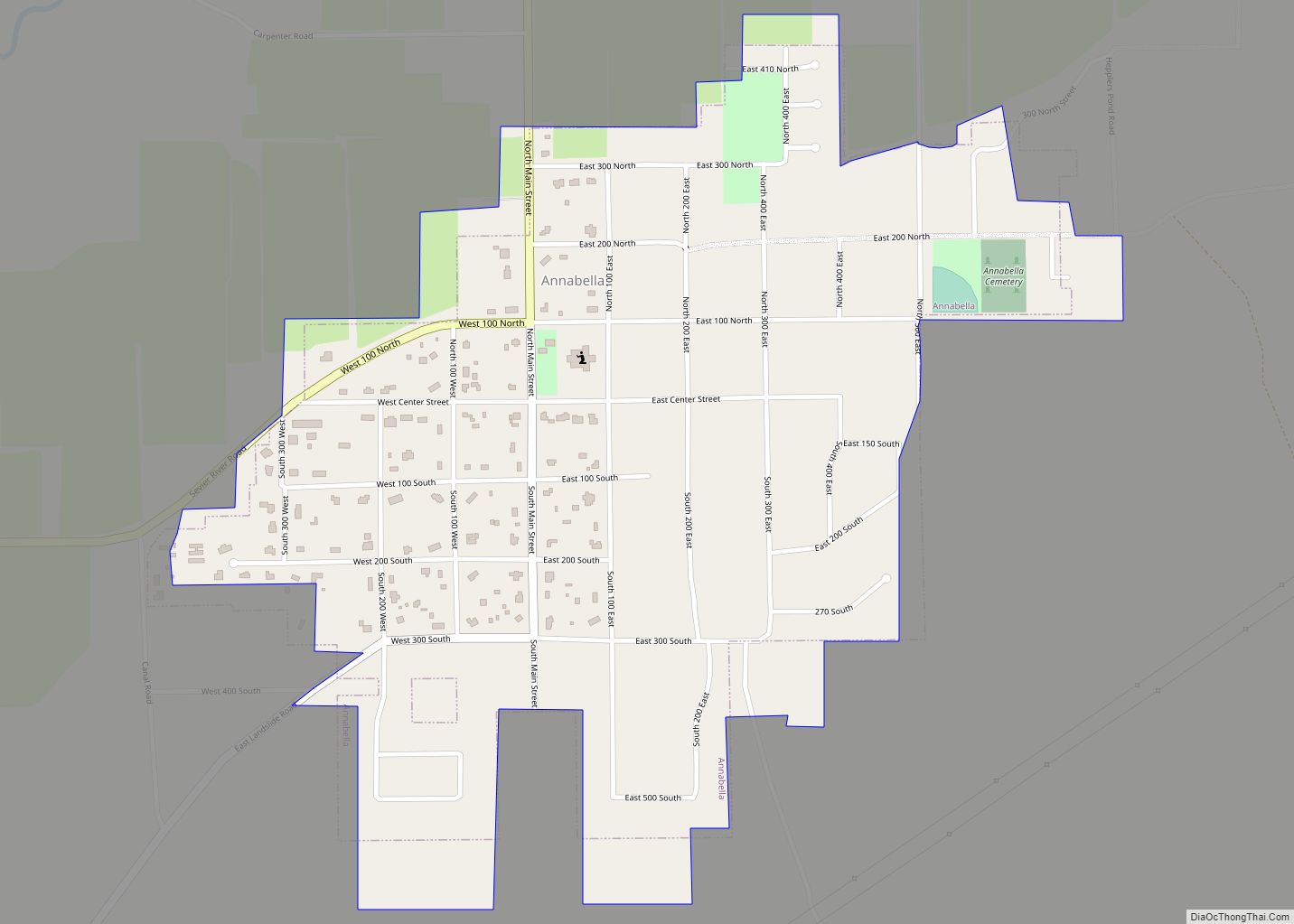
Map of Aneth CDP
Aneth (Navajo: Tʼáá Bííchʼį́įdii) is a census-designated place (CDP) in San Juan County, Utah, United States. The population was 598 at the 2000 census. The origin of the name Aneth is obscure. Aneth CDP overview: Name: Aneth CDP LSAD Code: 57 LSAD Description: CDP (suffix) State: Utah County: San Juan County Elevation: 4,511 ft (1,375 m) Total ... Read more
Map of Aneth CDP
Map of Alton town, Utah
Alton is a town in northwest Kane County, Utah, United States. The population was 119 at the 2010 census, a decrease from the 2000 figure of 134. Alton town overview: Name: Alton town LSAD Code: 43 LSAD Description: town (suffix) State: Utah County: Kane County Founded: 1907 Incorporated: 1935 Elevation: 7,041 ft (2,146 m) Total Area: 2.33 sq mi ... Read more
Map of Alton town, Utah
Map of Beaver city, Utah
Beaver is a city in, and county seat of, Beaver County in southwestern Utah, United States. The population was 3,592 at the 2020 census, up from the 2010 figure of 3,112. Beaver city overview: Name: Beaver city LSAD Code: 25 LSAD Description: city (suffix) State: Utah County: Beaver County Incorporated: January 10, 1867 Elevation: 5,902 ft ... Read more
Map of Beaver city, Utah
Map of Bluff town
Bluff is a town in San Juan County, Utah, United States. The population was 320 at the 2000 census. Bluff incorporated in 2018. Ann Leppanen is currently the mayor. Bluff town overview: Name: Bluff town LSAD Code: 43 LSAD Description: town (suffix) State: Utah County: San Juan County Founded: April 6, 1880 Incorporated: August 31, ... Read more
Map of Bluff town
Map of Bluebell CDP
Bluebell is a census-designated place in eastern Duchesne County, Utah, United States, on the Uintah and Ouray Indian Reservation. The population as of the 2010 census was 293. It lies along local roads east of State Route 87, northeast of the city of Duchesne, the county seat of Duchesne County. Its elevation is 6,201 feet ... Read more
Map of Bluebell CDP
Map of Blanding city
Blanding (/ˈblændɪŋ/ (listen)) is a city in San Juan County, Utah, United States. The population was 3,375 at the 2010 census, making it the most populated city in San Juan County. It was settled in the late 19th century by Mormon settlers, predominantly from the famed Hole-In-The-Rock expedition. Economic contributors include mineral processing, mining, agriculture, ... Read more
Map of Blanding city
Map of Big Water town
Big Water is a town in Kane County, Utah, United States. The population was 475 at the 2010 census, up from 417 at the 2000 census. It is located 17 miles (27 km) northwest of Page, Arizona, on US-89 near Lake Powell and the Glen Canyon Dam. It was originally called Glen Canyon City and housed ... Read more
Map of Big Water town
Map of Beryl Junction CDP
Beryl Junction (/ˈbɜːrəl/ BUR-əl) is a census-designated place (CDP) in Iron County, Utah, United States. The population was 197 at the 2010 census. Beryl Junction Airport, a small, private airport, is located here. Beryl Junction CDP overview: Name: Beryl Junction CDP LSAD Code: 57 LSAD Description: CDP (suffix) State: Utah County: Iron County Founded: 1909 ... Read more
Map of Beryl Junction CDP
Map of Cache CDP, Utah
Cache Junction (pronounced /kæʃ/ KASH) is a census-designated place (CDP) in Cache County, Utah, United States. The population was 38 at the 2010 census. It is included in the Logan, Utah–Idaho (partial) Metropolitan Statistical Area. Cache CDP overview: Name: Cache CDP LSAD Code: 57 LSAD Description: CDP (suffix) State: Utah County: Cache County Total Area: ... Read more
Map of Cache CDP, Utah
Map of Bryce Canyon City town
Bryce Canyon City, sometimes shown as Bryce on maps, is a town in Garfield County, Utah, United States, adjacent to Bryce Canyon National Park. The town, formerly known as Ruby’s Inn, was officially incorporated on July 23, 2007 under a short-lived state law. The population was 198 at the 2010 census. Bryce Canyon City town ... Read more
Map of Bryce Canyon City town
Map of Brigham City
Brigham City is a city in Box Elder County, Utah, United States. The population was 19,650 at the 2020 census, up from the 2010 figure of 17,899. It is the county seat of Box Elder County. It lies on the western slope of the Wellsville Mountains, a branch of the Wasatch Range at the western ... Read more
Map of Brigham City
Map of Brian Head town
Brian Head is a town in Iron County, Utah, United States. The population was 83 at the 2010 census, a significant decrease from the 2000 figure of 118. Brian Head is also the location of the Brian Head Ski Resort. Brian Head town overview: Name: Brian Head town LSAD Code: 43 LSAD Description: town (suffix) ... Read more
Map of Brian Head town