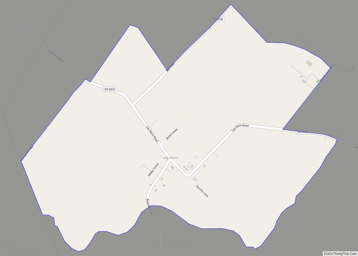
Lancaster is an unincorporated community and census-designated place (CDP) in Lancaster County, Virginia, United States. It is the county seat, and is also known as Lancaster Courthouse or by an alternative spelling, Lancaster Court House. The community was first drawn as a CDP prior to the 2020 census. Lancaster lies along Virginia State Route 3, ... Read more
Virginia Cities and Places
Loch Lomond is a census-designated place (CDP) in Prince William County, Virginia, United States. The population was 3,701 at the 2010 census. It is named after a loch in northern Scotland, Loch Lomond. Loch Lomond CDP overview: Name: Loch Lomond CDP LSAD Code: 57 LSAD Description: CDP (suffix) State: Virginia County: Prince William County Elevation: ... Read more
Linton Hall is a census-designated place (CDP) in Prince William County, Virginia, United States, which includes unincorporated Bristow. The population was 35,725 at the 2010 census, an increase of over 300% from the 2000 census. According to the United States Census Bureau, residents of Linton Hall had an average commute of 46.3 minutes each way ... Read more
Lincolnia is a census-designated place (CDP) in Fairfax County, Virginia, United States. The population was 22,828 at the 2010 census, an increase of over 44% from 2000. Lincolnia CDP overview: Name: Lincolnia CDP LSAD Code: 57 LSAD Description: CDP (suffix) State: Virginia County: Fairfax County Elevation: 246 ft (75 m) Total Area: 4.75 sq mi (12.30 km²) Land Area: 4.72 sq mi ... Read more
Low Moor is a census-designated place (CDP) in Alleghany County, Virginia. The population was 258 at the 2010 census. Low Moor CDP overview: Name: Low Moor CDP LSAD Code: 57 LSAD Description: CDP (suffix) State: Virginia County: Alleghany County Elevation: 1,122 ft (342 m) Total Area: 0.8 sq mi (2.2 km²) Land Area: 0.8 sq mi (2.1 km²) Water Area: 0.0 sq mi (0.0 km²) Total ... Read more
Lovingston CDP overview: Name: Lovingston CDP LSAD Code: 57 LSAD Description: CDP (suffix) State: Virginia County: Nelson County FIPS code: 5147224 Online Interactive Map Lovingston online map. Source: Basemap layers from Google Map, Open Street Map (OSM), Arcgisonline, Wmflabs. Boundary Data from Database of Global Administrative Areas. Lovingston location map. Where is Lovingston CDP? Lovingston ... Read more
Lovettsville is a town in Loudoun County, located near the very northern tip of the Commonwealth of Virginia, United States. Settled primarily by German immigrants, the town was originally established in 1836. The population was 1,613 at the 2010 census and an estimated 2,198 in 2019. Lovettsville town overview: Name: Lovettsville town LSAD Code: 43 ... Read more
Louisa (originally named Louisa Court House) is a town in Louisa County, Virginia, United States. The population was 1,555 at the 2010 census. It is the county seat of Louisa County. Louisa town overview: Name: Louisa town LSAD Code: 43 LSAD Description: town (suffix) State: Virginia County: Louisa County Founded: 1873 Elevation: 466 ft (142 m) Total ... Read more
Loudoun Valley Estates is a census-designated place (CDP) in Loudoun County, Virginia, United States. The population as of the 2010 United States Census was 3,656. It is a Toll Brothers community located near the planned Ashburn Metro station complex and Moorefield Station town center in the southern part of Ashburn, Virginia. Loudoun Valley Estates is ... Read more
Lorton is a census-designated place (CDP) in Fairfax County, Virginia, United States. The population was 20,072 as of the 2020 census. Lorton CDP overview: Name: Lorton CDP LSAD Code: 57 LSAD Description: CDP (suffix) State: Virginia County: Fairfax County Elevation: 144 ft (44 m) Total Area: 5.4 sq mi (13.9 km²) Land Area: 5.3 sq mi (13.7 km²) Water Area: 0.08 sq mi (0.2 km²) Total ... Read more
Long Branch is a census-designated place in Fairfax County, Virginia, bordering the city of Fairfax. The population as of the 2010 census was 7,593. Long Branch CDP overview: Name: Long Branch CDP LSAD Code: 57 LSAD Description: CDP (suffix) State: Virginia County: Fairfax County Elevation: 360 ft (110 m) Total Area: 2.48 sq mi (6.42 km²) Land Area: 2.46 sq mi (6.38 km²) ... Read more
Mantua is a census-designated place (CDP) in Fairfax County, Virginia, United States. Mantua is a bedroom community serving as a suburb to the Washington, D.C. metropolitan area. Most of the homes in Mantua were built between the 1950s and the 1980s. The population was 7,503 at the 2020 census. Mantua CDP overview: Name: Mantua CDP ... Read more