Lorton is a census-designated place (CDP) in Fairfax County, Virginia, United States. The population was 20,072 as of the 2020 census.
| Name: | Lorton CDP |
|---|---|
| LSAD Code: | 57 |
| LSAD Description: | CDP (suffix) |
| State: | Virginia |
| County: | Fairfax County |
| Elevation: | 144 ft (44 m) |
| Total Area: | 5.4 sq mi (13.9 km²) |
| Land Area: | 5.3 sq mi (13.7 km²) |
| Water Area: | 0.08 sq mi (0.2 km²) |
| Total Population: | 20,072 |
| Population Density: | 3,508/sq mi (1,354.6/km²) |
| ZIP code: | 22079, 22199 |
| Area code: | 703, 571 |
| FIPS code: | 5147064 |
| GNISfeature ID: | 1495046 |
Online Interactive Map
Click on ![]() to view map in "full screen" mode.
to view map in "full screen" mode.
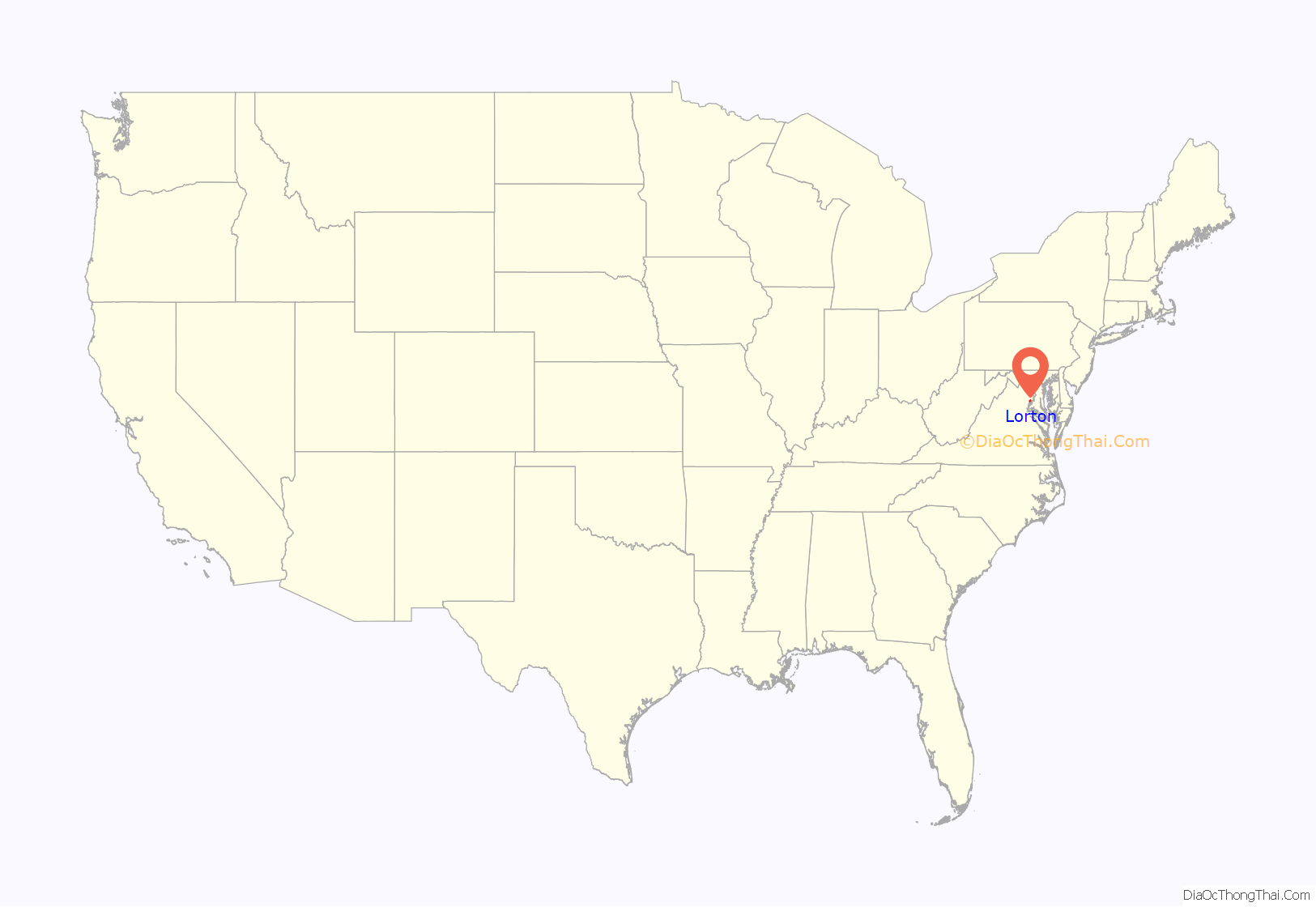
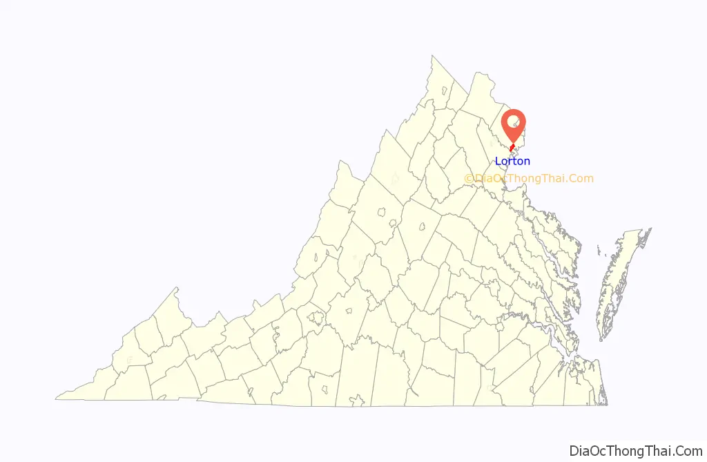
Lorton location map. Where is Lorton CDP?
History
Lorton is named for a village in the Lake District National Park, Cumbria, in England. Joseph Plaskett of the Cumbrian village settled in southern Fairfax County, running a general store and opening the Lorton Valley Post Office on November 11, 1875.
Before the identity of Lorton, the commercial center was Colchester, and the spiritual and historical center of the community around which the leading citizens of the time revolved was Pohick Church, where George Washington and George Mason were at times members of the vestry.
From the early 20th century until November 2001, Lorton was the site of a District of Columbia correctional facility called the Lorton Reformatory which, among other things, detained approximately 168 women from the women’s suffrage movement from the Washington, D.C. area from June to December 1917. For the 2010 census, the area around the former Lorton Reformatory was assigned to the Laurel Hill census-designated place, reducing the area and population of the Lorton CDP.
A Nike missile site was built at Lorton in 1955, and remained until 1973.
Lorton is one of the two stations that serve Amtrak’s Auto Train which carries passengers and their vehicles non-stop to Sanford, Florida, in the Orlando area. The Lorton and Occoquan Railroad once operated between the Lorton Reformatory and Occoquan, with connection to the Richmond, Fredericksburg and Potomac Railroad.
Historic landmarks in the surrounding area include Gunston Hall, George Mason’s home; Belvoir, which was William Fairfax’s home; the Market; and now the Fort Belvoir Army Corps of Engineers base and Cranford Church. Woodlawn Plantation and Mount Vernon, the latter being George Washington’s home on the Potomac River, lie farther to the east.
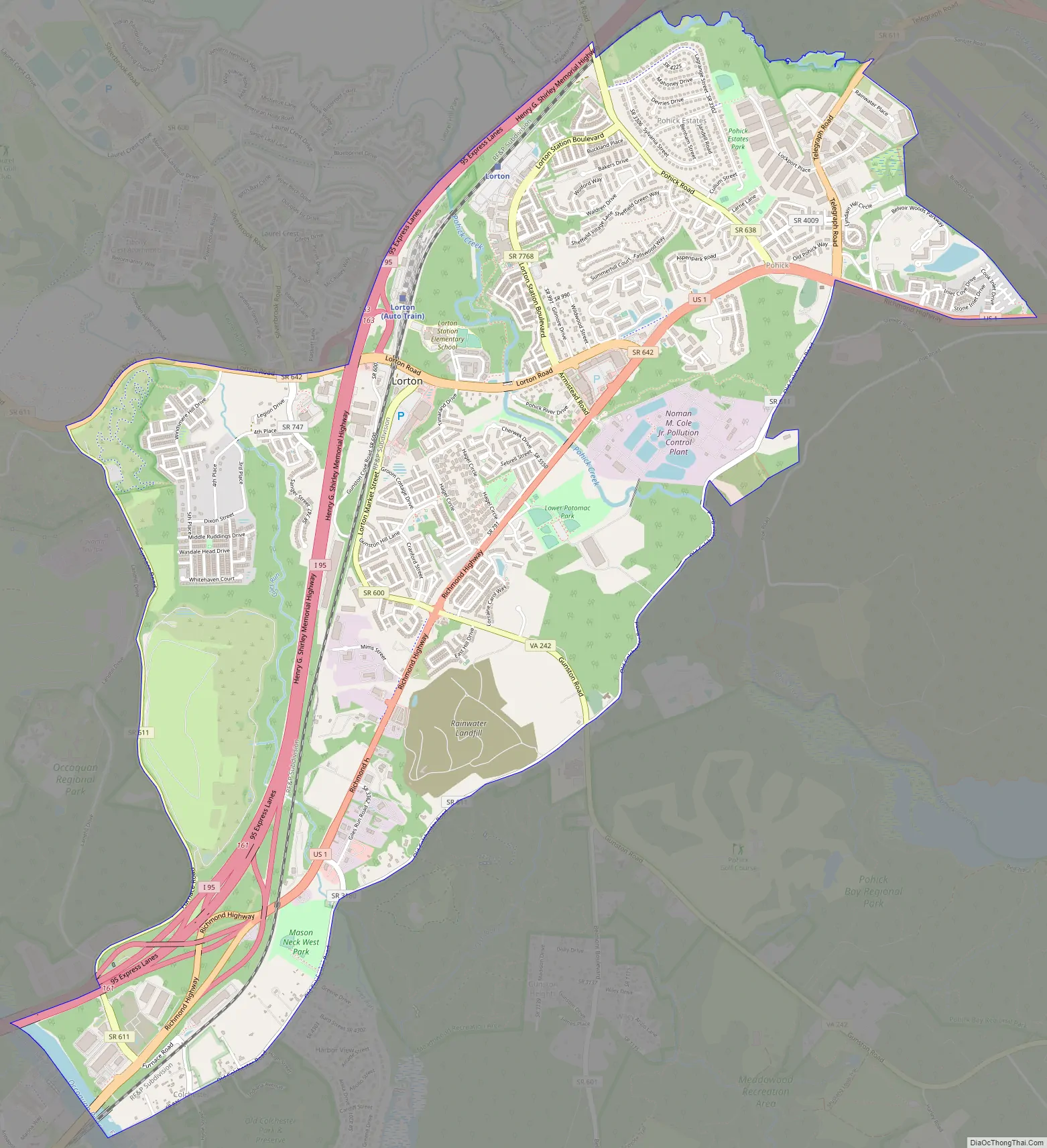
Lorton Road Map
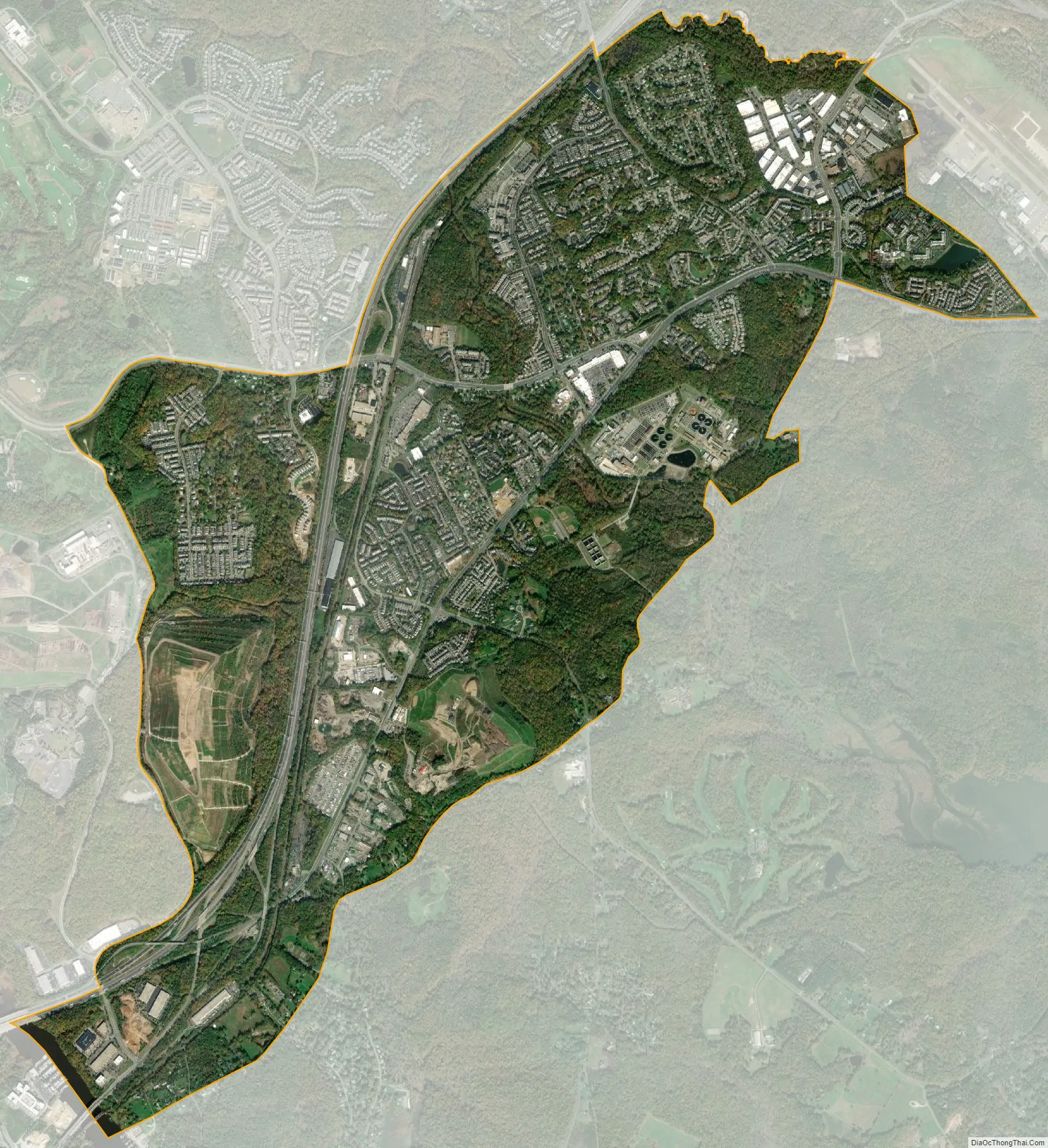
Lorton city Satellite Map
Geography
Lorton is located in southern Fairfax County at 38°42′18″N 77°14′1″W / 38.70500°N 77.23361°W / 38.70500; -77.23361 (38.704915, −77.233573). It is bordered to the west by Laurel Hill, to the north by Newington, to the east by Fort Belvoir, to the southeast by Mason Neck, and to the southwest by Woodbridge in Prince William County.
According to the United States Census Bureau, the Lorton CDP has a total area of 5.4 square miles (13.9 km), of which 5.3 square miles (13.7 km) is land and 0.1 square miles (0.2 km), or 1.39%, is water. The elevation ranges from sea level at the Prince William County line (the Occoquan River) to slightly over 200 feet (61 m) along Furnace Road at the CDP’s western edge.
U.S. Route 1 (Richmond Highway) and Interstate 95 pass through Lorton, leading northeast 15 miles (24 km) to Alexandria and 19 miles (31 km) to Washington, D.C., and south 34 miles (55 km) to Fredericksburg. The Amtrak Auto Train to and from Florida has Lorton as its northern terminal.
See also
Map of Virginia State and its subdivision:- Accomack
- Albemarle
- Alexandria
- Alleghany
- Amelia
- Amherst
- Appomattox
- Arlington
- Augusta
- Bath
- Bedford
- Bedford City
- Bland
- Botetourt
- Bristol
- Brunswick
- Buchanan
- Buckingham
- Buena Vista
- Campbell
- Caroline
- Carroll
- Charles City
- Charlotte
- Charlottesville
- Chesapeake
- Chesterfield
- Clarke
- Clifton Forge City
- Colonial Heights
- Covington
- Craig
- Culpeper
- Cumberland
- Danville
- Dickenson
- Dinwiddie
- Emporia
- Essex
- Fairfax
- Fairfax City
- Falls Church
- Fauquier
- Floyd
- Fluvanna
- Franklin
- Frederick
- Fredericksburg
- Galax
- Giles
- Gloucester
- Goochland
- Grayson
- Greene
- Greensville
- Halifax
- Hampton
- Hanover
- Harrisonburg
- Henrico
- Henry
- Highland
- Hopewell
- Isle of Wight
- James City
- King and Queen
- King George
- King William
- Lancaster
- Lee
- Lexington
- Loudoun
- Louisa
- Lunenburg
- Lynchburg
- Madison
- Manassas
- Manassas Park
- Martinsville
- Mathews
- Mecklenburg
- Middlesex
- Montgomery
- Nelson
- New Kent
- Newport News
- Norfolk
- Northampton
- Northumberland
- Norton
- Nottoway
- Orange
- Page
- Patrick
- Petersburg
- Pittsylvania
- Poquoson
- Portsmouth
- Powhatan
- Prince Edward
- Prince George
- Prince William
- Pulaski
- Radford
- Rappahannock
- Richmond
- Roanoke
- Roanoke City
- Rockbridge
- Rockingham
- Russell
- Salem
- Scott
- Shenandoah
- Smyth
- Southampton
- Spotsylvania
- Stafford
- Staunton
- Suffolk
- Surry
- Sussex
- Tazewell
- Virginia Beach
- Warren
- Washington
- Waynesboro
- Westmoreland
- Williamsburg
- Winchester
- Wise
- Wythe
- York
- Alabama
- Alaska
- Arizona
- Arkansas
- California
- Colorado
- Connecticut
- Delaware
- District of Columbia
- Florida
- Georgia
- Hawaii
- Idaho
- Illinois
- Indiana
- Iowa
- Kansas
- Kentucky
- Louisiana
- Maine
- Maryland
- Massachusetts
- Michigan
- Minnesota
- Mississippi
- Missouri
- Montana
- Nebraska
- Nevada
- New Hampshire
- New Jersey
- New Mexico
- New York
- North Carolina
- North Dakota
- Ohio
- Oklahoma
- Oregon
- Pennsylvania
- Rhode Island
- South Carolina
- South Dakota
- Tennessee
- Texas
- Utah
- Vermont
- Virginia
- Washington
- West Virginia
- Wisconsin
- Wyoming


