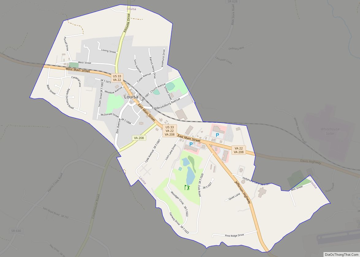
Louisa (originally named Louisa Court House) is a town in Louisa County, Virginia, United States. The population was 1,555 at the 2010 census. It is the county seat of Louisa County.
| Name: | Louisa town |
|---|---|
| LSAD Code: | 43 |
| LSAD Description: | town (suffix) |
| State: | Virginia |
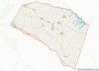
| County: | Louisa County |
| Founded: | 1873 |
| Elevation: | 466 ft (142 m) |
| Total Area: | 1.84 sq mi (4.77 km²) |
| Land Area: | 1.83 sq mi (4.73 km²) |
| Water Area: | 0.01 sq mi (0.04 km²) |
| Total Population: | 1,555 |
| Population Density: | 948.55/sq mi (366.28/km²) |
| ZIP code: | 23093 |
| Area code: | 540 |
| FIPS code: | 5147144 |
| GNISfeature ID: | 1498507 |
| Website: | http://louisatown.org/ |
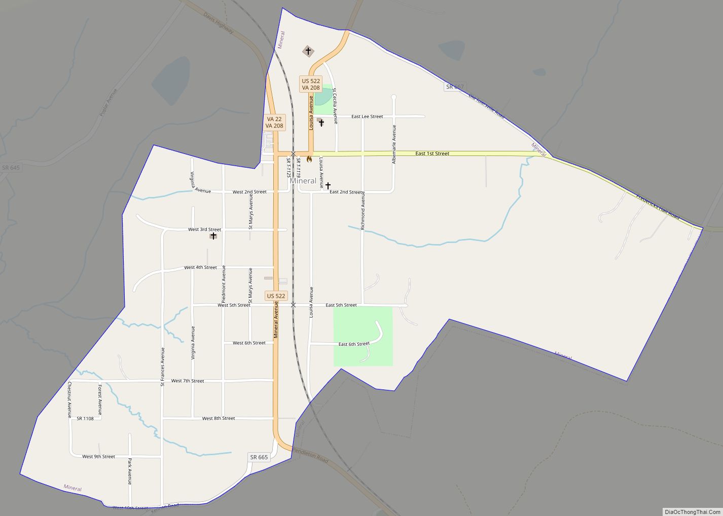
Online Interactive Map
Click on ![]() to view map in "full screen" mode.
to view map in "full screen" mode.
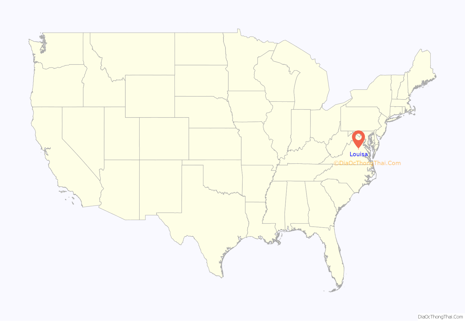
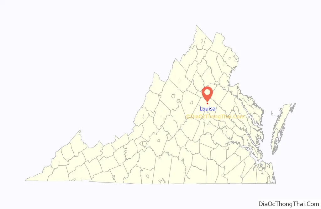
Louisa location map. Where is Louisa town?
History
Louisa Court House was named because of the county courthouse constructed in 1742, near the intersection of Courthouse Road (now SR 208) and Main Street/Louisa Road (now SR-22/US-33). The village of Louisa Court House had been the county seat for over a century when it became a strategic location during the American Civil War for Virginia’s supply and communication lines.
Chartered in 1836 as the Louisa Railroad by the Virginia General Assembly, the Virginia Central Railroad mainline passed through the village. On 10 June 1864, thousands of men and horses of Gen. Fitzhugh Lee’s cavalry division camped around the courthouse prior to the Battle of Trevilian Station. The VCR merged into the Chesapeake and Ohio Railroad in 1868 (reorganized as the Chesapeake and Ohio Railway in 1878). The C&O operated the mainline through Louisa over one hundred years, until the Chessie System merged into CSX in the 1980s.
The incorporated Town of Louisa was created by Act of the General Assembly in 1873. Many businesses found advantage in locating near the mainline, especially heavy industries that could transport using the railroad. As the road infrastructure improved and especially since the 1956 development of the interstate highway system’s I-64, local businesses transport mainly via semi-truck using US 33.
East of the Town of Louisa on Jeff Davis Highway is the Cooke Industrial Rail Park, a 1400 acre contiguous tract of land with over 1 mile of rail frontage, served by CSX and Buckingham Branch Railroad.
Louisa Road Map
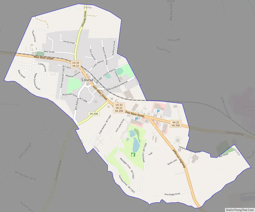
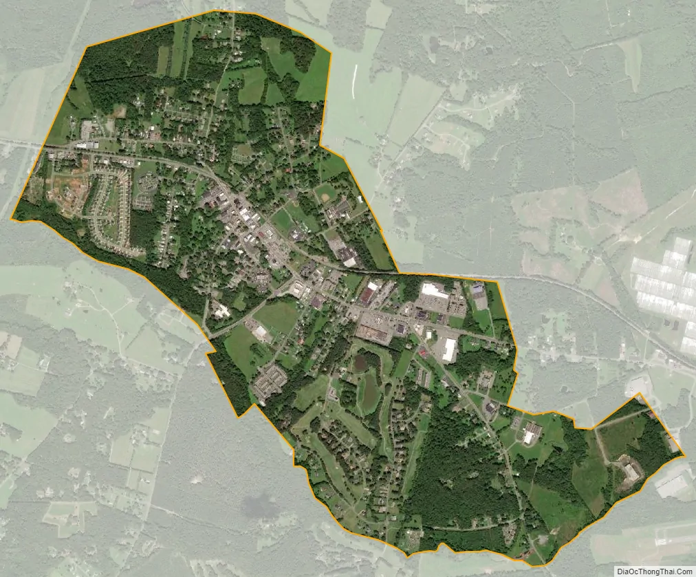
Louisa city Satellite Map
Geography
Louisa is located at 38°1′27″N 78°0′6″W / 38.02417°N 78.00167°W / 38.02417; -78.00167 (38.024057, −78.001584).
According to the United States Census Bureau, the city has a total area of 1.8 square miles (4.7 km), of which 1.8 square miles (4.7 km) is land and 0.55% is water.
Climate
See also
Map of Virginia State and its subdivision:- Accomack
- Albemarle
- Alexandria
- Alleghany
- Amelia
- Amherst
- Appomattox
- Arlington
- Augusta
- Bath
- Bedford
- Bedford City
- Bland
- Botetourt
- Bristol
- Brunswick
- Buchanan
- Buckingham
- Buena Vista
- Campbell
- Caroline
- Carroll
- Charles City
- Charlotte
- Charlottesville
- Chesapeake
- Chesterfield
- Clarke
- Clifton Forge City
- Colonial Heights
- Covington
- Craig
- Culpeper
- Cumberland
- Danville
- Dickenson
- Dinwiddie
- Emporia
- Essex
- Fairfax
- Fairfax City
- Falls Church
- Fauquier
- Floyd
- Fluvanna
- Franklin
- Frederick
- Fredericksburg
- Galax
- Giles
- Gloucester
- Goochland
- Grayson
- Greene
- Greensville
- Halifax
- Hampton
- Hanover
- Harrisonburg
- Henrico
- Henry
- Highland
- Hopewell
- Isle of Wight
- James City
- King and Queen
- King George
- King William
- Lancaster
- Lee
- Lexington
- Loudoun
- Louisa
- Lunenburg
- Lynchburg
- Madison
- Manassas
- Manassas Park
- Martinsville
- Mathews
- Mecklenburg
- Middlesex
- Montgomery
- Nelson
- New Kent
- Newport News
- Norfolk
- Northampton
- Northumberland
- Norton
- Nottoway
- Orange
- Page
- Patrick
- Petersburg
- Pittsylvania
- Poquoson
- Portsmouth
- Powhatan
- Prince Edward
- Prince George
- Prince William
- Pulaski
- Radford
- Rappahannock
- Richmond
- Roanoke
- Roanoke City
- Rockbridge
- Rockingham
- Russell
- Salem
- Scott
- Shenandoah
- Smyth
- Southampton
- Spotsylvania
- Stafford
- Staunton
- Suffolk
- Surry
- Sussex
- Tazewell
- Virginia Beach
- Warren
- Washington
- Waynesboro
- Westmoreland
- Williamsburg
- Winchester
- Wise
- Wythe
- York
- Alabama
- Alaska
- Arizona
- Arkansas
- California
- Colorado
- Connecticut
- Delaware
- District of Columbia
- Florida
- Georgia
- Hawaii
- Idaho
- Illinois
- Indiana
- Iowa
- Kansas
- Kentucky
- Louisiana
- Maine
- Maryland
- Massachusetts
- Michigan
- Minnesota
- Mississippi
- Missouri
- Montana
- Nebraska
- Nevada
- New Hampshire
- New Jersey
- New Mexico
- New York
- North Carolina
- North Dakota
- Ohio
- Oklahoma
- Oregon
- Pennsylvania
- Rhode Island
- South Carolina
- South Dakota
- Tennessee
- Texas
- Utah
- Vermont
- Virginia
- Washington
- West Virginia
- Wisconsin
- Wyoming