Map of South Boston town
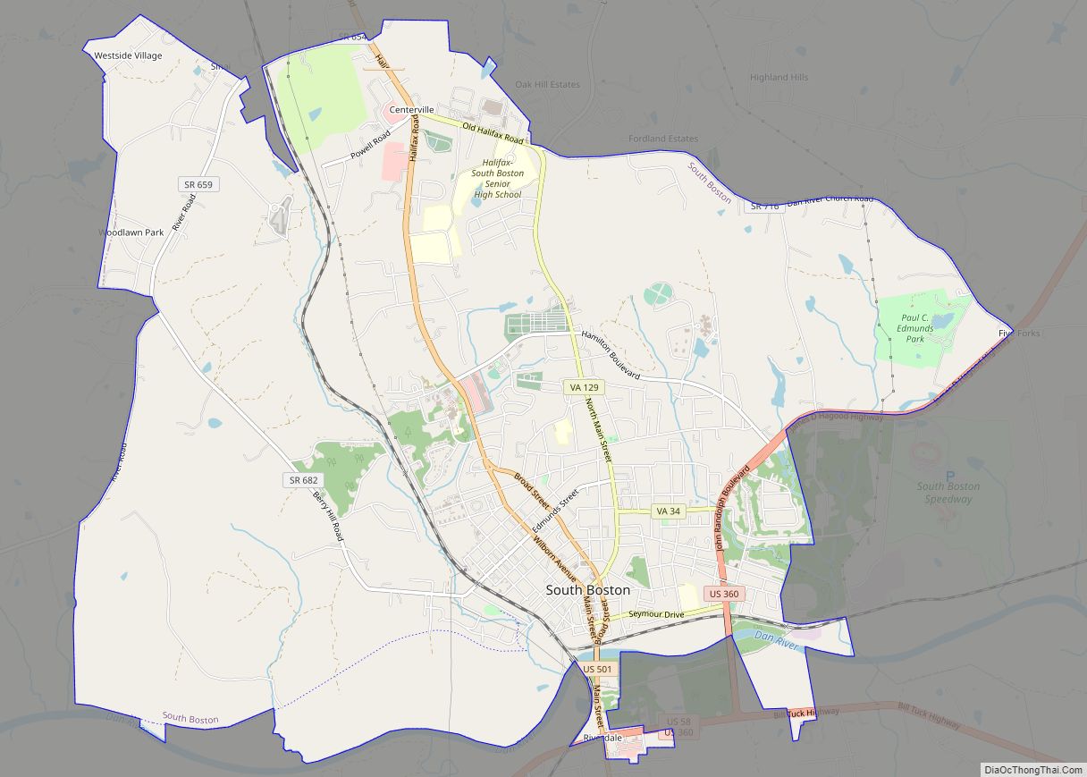
South Boston, formerly Boyd’s Ferry, is a town in Halifax County, Virginia, United States. The population was 8,142 at the 2010 census, down from 8,491 at the 2000 census. It is the most populous town in Halifax County. South Boston town overview: Name: South Boston town LSAD Code: 43 LSAD Description: town (suffix) State: Virginia ... Read more
Map of South Boston town
Map of Snowville CDP, Virginia
Snowville is a census-designated place (CDP) located in southeastern Pulaski County in the Commonwealth of Virginia. The population, as of the 2010 Census, was 149. It is part of the Blacksburg–Christiansburg Metropolitan Statistical Area. Snowville CDP overview: Name: Snowville CDP LSAD Code: 57 LSAD Description: CDP (suffix) State: Virginia County: Pulaski County Elevation: 1,940 ft (591 m) ... Read more
Map of Snowville CDP, Virginia
Map of Smithfield town, Virginia
Smithfield is a town in Isle of Wight County, in the South Hampton Roads subregion of the Hampton Roads region of Virginia in the United States. The population was 8,089 at the 2010 census. The town is most famous for the curing and production of the Smithfield ham. The Virginia General Assembly passed a statute ... Read more
Map of Smithfield town, Virginia
Map of Skyland Estates CDP
Skyland Estates is a census-designated place in Warren County, Virginia, just north of Linden. The population as of the 2010 Census was 830. Skyland Estates CDP overview: Name: Skyland Estates CDP LSAD Code: 57 LSAD Description: CDP (suffix) State: Virginia County: Warren County Total Area: 830 ZIP code: 22642 FIPS code: 5172935 GNISfeature ID: 2629748 ... Read more
Map of Skyland Estates CDP
Map of Shipman CDP, Virginia
Shipman CDP overview: Name: Shipman CDP LSAD Code: 57 LSAD Description: CDP (suffix) State: Virginia County: Nelson County FIPS code: 5172080 Online Interactive Map Shipman online map. Source: Basemap layers from Google Map, Open Street Map (OSM), Arcgisonline, Wmflabs. Boundary Data from Database of Global Administrative Areas. Shipman location map. Where is Shipman CDP? Shipman ... Read more
Map of Shipman CDP, Virginia
Map of Sherando CDP
Sherando CDP overview: Name: Sherando CDP LSAD Code: 57 LSAD Description: CDP (suffix) State: Virginia County: Augusta County FIPS code: 5171904 Online Interactive Map Sherando online map. Source: Basemap layers from Google Map, Open Street Map (OSM), Arcgisonline, Wmflabs. Boundary Data from Database of Global Administrative Areas. Sherando location map. Where is Sherando CDP? Sherando ... Read more
Map of Sherando CDP
Map of Shenandoah town, Virginia
Shenandoah /ˌʃɛnənˈdoʊə/ is a town in Page County, Virginia, United States. The population was 2,373 at the 2010 census. Shenandoah town overview: Name: Shenandoah town LSAD Code: 43 LSAD Description: town (suffix) State: Virginia County: Page County Elevation: 988 ft (301 m) Total Area: 2.26 sq mi (5.86 km²) Land Area: 2.17 sq mi (5.61 km²) Water Area: 0.10 sq mi (0.25 km²) Total Population: 2,373 ... Read more
Map of Shenandoah town, Virginia
Map of Shenandoah Shores CDP
Shenandoah Shores is a census-designated place in Warren County, Virginia, just north of Front Royal. The population as of the 2010 Census was 934. Shenandoah Shores CDP overview: Name: Shenandoah Shores CDP LSAD Code: 57 LSAD Description: CDP (suffix) State: Virginia County: Warren County Total Area: 934 ZIP code: 22630 FIPS code: 5171826 GNISfeature ID: ... Read more
Map of Shenandoah Shores CDP
Map of Southampton Meadows CDP
Southampton Meadows is a mobile home community and census-designated place in southeastern Southampton County, Virginia. The population as of the 2010 Census was 592. Southampton Meadows CDP overview: Name: Southampton Meadows CDP LSAD Code: 57 LSAD Description: CDP (suffix) State: Virginia County: Southampton County Total Area: 592 ZIP code: 23851 FIPS code: 5173624 GNISfeature ID: ... Read more
Map of Southampton Meadows CDP
Map of South Run CDP
South Run is a census-designated place in Fairfax County, Virginia, United States. The population as of the 2010 census was 6,389. South Run CDP overview: Name: South Run CDP LSAD Code: 57 LSAD Description: CDP (suffix) State: Virginia County: Fairfax County Elevation: 300 ft (90 m) Total Area: 2.60 sq mi (6.73 km²) Land Area: 2.53 sq mi (6.56 km²) Water Area: 0.07 sq mi ... Read more
Map of South Run CDP
Map of South Riding CDP
South Riding is a census-designated place and planned community in Loudoun County, Virginia, United States. The South Riding homeowner association was founded in January 1995 to provide services to the community. Neighboring U.S. Route 50 and State Route 28 provide access to the Dulles/Reston/Tysons Corner technology corridor and other major employment centers in Northern Virginia ... Read more
Map of South Riding CDP
Map of St. Charles town, Virginia
St. Charles is a town in Lee County, Virginia, United States. The population was 128 at the 2010 census, down from 159 at the 2000 census. St. Charles town overview: Name: St. Charles town LSAD Code: 43 LSAD Description: town (suffix) State: Virginia County: Lee County Elevation: 1,522 ft (464 m) Total Area: 0.18 sq mi (0.46 km²) Land Area: ... Read more
Map of St. Charles town, Virginia