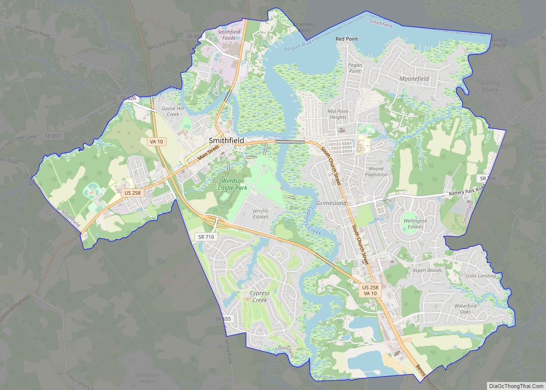
Smithfield is a town in Isle of Wight County, in the South Hampton Roads subregion of the Hampton Roads region of Virginia in the United States. The population was 8,089 at the 2010 census.
The town is most famous for the curing and production of the Smithfield ham. The Virginia General Assembly passed a statute defining “Smithfield ham” by law in 1926, with one of the requirements that it be processed within the town limits. Smithfield Foods, a Chinese Fortune 500 company that owns Smithfield Packing Company and others, is the world’s largest pork processor and hog producer. The company, based in Smithfield, raises 12 million hogs and processes 20 million pounds of them annually.
| Name: | Smithfield town |
|---|---|
| LSAD Code: | 43 |
| LSAD Description: | town (suffix) |
| State: | Virginia |
| County: | Isle of Wight County |
| Elevation: | 30 ft (9 m) |
| Total Area: | 10.65 sq mi (27.58 km²) |
| Land Area: | 9.72 sq mi (25.19 km²) |
| Water Area: | 0.92 sq mi (2.39 km²) |
| Total Population: | 8,089 |
| Population Density: | 871.47/sq mi (336.47/km²) |
| ZIP code: | 23430-23431 |
| Area code: | 757, 948 (planned) |
| FIPS code: | 5173200 |
| GNISfeature ID: | 1474779 |
| Website: | www.smithfieldva.gov |
Online Interactive Map
Click on ![]() to view map in "full screen" mode.
to view map in "full screen" mode.
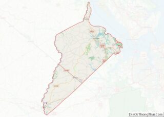
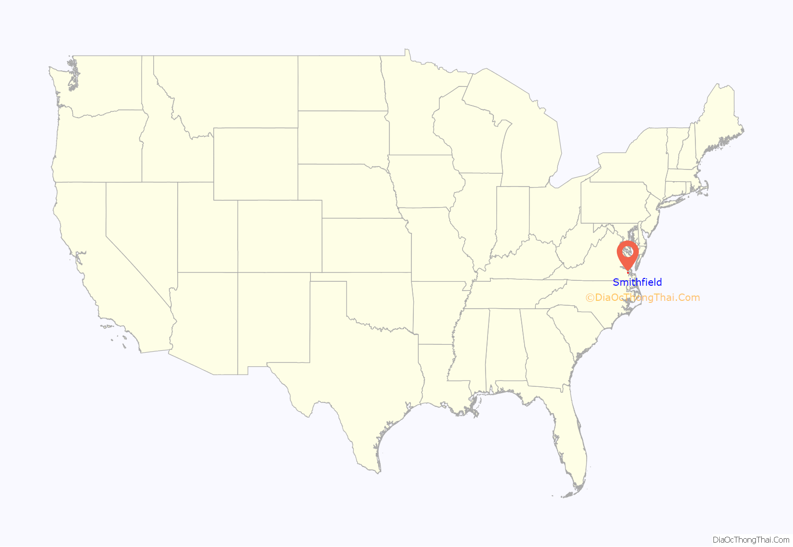
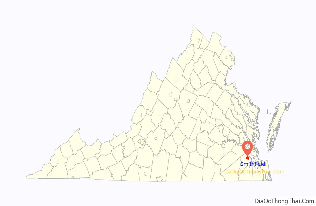
Smithfield location map. Where is Smithfield town?
History
Smithfield, first colonized in 1634, is located on the Pagan River, south of Jamestown and on the south side of the James River. The Native Americans knew this area as Warascoyak, also spelled Warrosquoyacke, meaning “point of land.”
The Virginia colony officially formed Warrosquyoake Shire (with numerous variant spellings, including Warrascoyack, Warrascocke and “Warwick Squeak”) in 1634, but it had already been known as “Warascoyack County” before this. It was renamed as Isle of Wight County in 1637.
In 1730, the Tobacco Inspection Act of 1730 established “Warricksqueak Bay, in Isle of Wight County” as the site of an official tobacco inspection house.
The town was established as a seaport in 1752 by Arthur Smith IV. The original survey and plat of the Town of Smithfield was made by Jordan Thomas, County Surveyor, for “Captain Arthur Smith” in 1750.
As a river town, its life and growth were dependent on the river. “Wharf Hill” was the waterfront location of the beginning of the industries of Smithfield. They eventually included peanuts and the raising of pork as commodities, leading to the city claiming the titles of “Peanut Capital of the World” and “Ham Capital of the World.”
George Purdie, a County Justice and Postmaster of Smithfield during his lifetime, in 1763 purchased Lots 4 and 5 of the original plat of the Town of Smithfield. Purdie’s neighbor, Captain Mallory Todd, developed the business of curing and shipping the hams that has made Smithfield world-famous. The peanut industry continued until the fire of 1921, which destroyed the peanut warehouses. The peanut trade moved to the nearby railroad hub of Suffolk, Virginia.
Military actions of both the Revolutionary and Civil War took place in and around the town, as it was considered strategic due to its proximity to the James River. Revolutionary Patriots used Wharf Hill as a safe harbor for receiving arms and supplies, and a vantage point for directing Federal cannon fire on Main Street. Its dock has welcomed the fictional drama of the real “Show Boat” (James Adams Floating Theatre).
The Mansion on Main was the showplace home of a Victorian-era “Virginian of Virginians”, Richard Samuel “R.S.” Thomas (1837–1915). It was restored by Sala Clark in the late 1990s. His 1889 “urban” Queen Ann-style mansion changed the face of Smithfield (which had been dominated by colonial and cottage styles). Thomas helped to preserve the 1632 St. Luke’s Church, which in the late 20th century was recognized as a National Historic Landmark. Thomas literally “wrote the book” on St. Luke’s Church, The Old Brick Church Near Smithfield, Virginia, specifically to champion recognition of its 1632 date of construction and legacy. He presented his work to the Virginia Historical Society on December 22, 1891.
He wrote: “It is my object to prove that this Church was built in 1632, and I shall prove it, 1. By the existence at that early date, of such strong, religious sentiment, as demanded a house of worship to the living God; 2. By tradition; 3. By lately existing records; and – 4. By the bricks and mortar of the Church itself.”
Today, Smithfield has a population of 8,100. It is approximately 10.1 square miles (26 km) in size. The ham production operation was purchased by a Chinese firm in 2014.
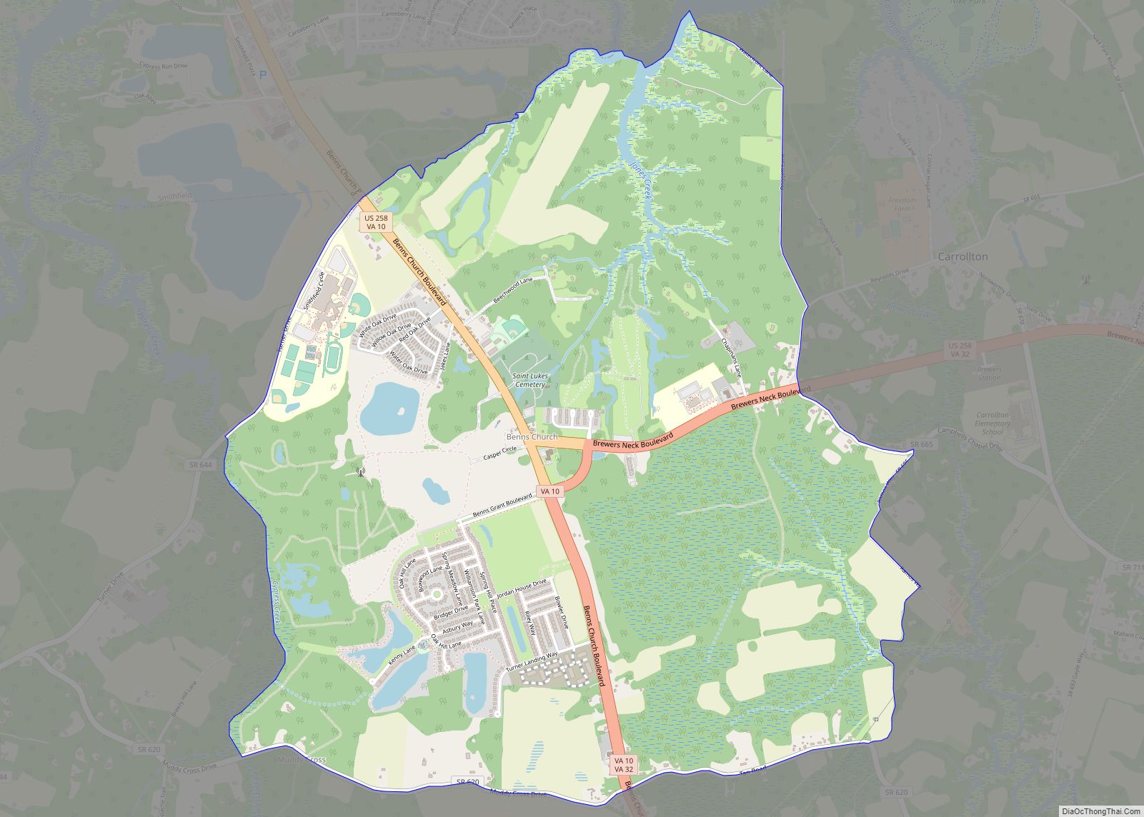
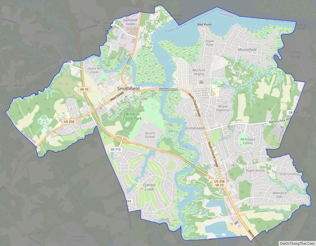
Smithfield Road Map
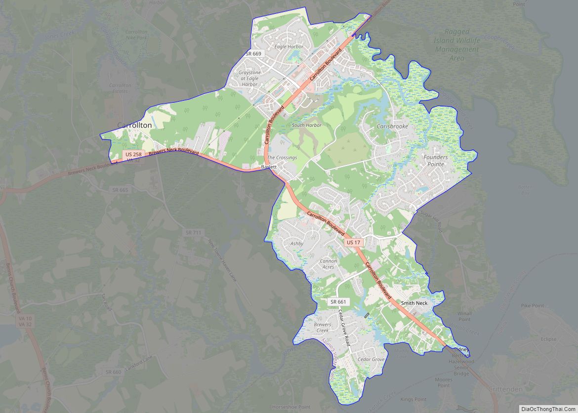
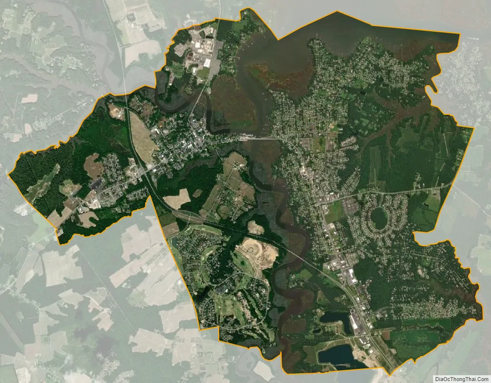
Smithfield city Satellite Map
Geography
Smithfield is located at 36°58′44″N 76°37′7″W / 36.97889°N 76.61861°W / 36.97889; -76.61861 (36.978767, -76.618578).
According to the United States Census Bureau, the town has a total area of 10.4 square miles (27.1 km), of which 9.5 square miles (24.7 km) is land and 0.9 square miles (2.4 km) (8.80%) is water.
See also
Map of Virginia State and its subdivision:- Accomack
- Albemarle
- Alexandria
- Alleghany
- Amelia
- Amherst
- Appomattox
- Arlington
- Augusta
- Bath
- Bedford
- Bedford City
- Bland
- Botetourt
- Bristol
- Brunswick
- Buchanan
- Buckingham
- Buena Vista
- Campbell
- Caroline
- Carroll
- Charles City
- Charlotte
- Charlottesville
- Chesapeake
- Chesterfield
- Clarke
- Clifton Forge City
- Colonial Heights
- Covington
- Craig
- Culpeper
- Cumberland
- Danville
- Dickenson
- Dinwiddie
- Emporia
- Essex
- Fairfax
- Fairfax City
- Falls Church
- Fauquier
- Floyd
- Fluvanna
- Franklin
- Frederick
- Fredericksburg
- Galax
- Giles
- Gloucester
- Goochland
- Grayson
- Greene
- Greensville
- Halifax
- Hampton
- Hanover
- Harrisonburg
- Henrico
- Henry
- Highland
- Hopewell
- Isle of Wight
- James City
- King and Queen
- King George
- King William
- Lancaster
- Lee
- Lexington
- Loudoun
- Louisa
- Lunenburg
- Lynchburg
- Madison
- Manassas
- Manassas Park
- Martinsville
- Mathews
- Mecklenburg
- Middlesex
- Montgomery
- Nelson
- New Kent
- Newport News
- Norfolk
- Northampton
- Northumberland
- Norton
- Nottoway
- Orange
- Page
- Patrick
- Petersburg
- Pittsylvania
- Poquoson
- Portsmouth
- Powhatan
- Prince Edward
- Prince George
- Prince William
- Pulaski
- Radford
- Rappahannock
- Richmond
- Roanoke
- Roanoke City
- Rockbridge
- Rockingham
- Russell
- Salem
- Scott
- Shenandoah
- Smyth
- Southampton
- Spotsylvania
- Stafford
- Staunton
- Suffolk
- Surry
- Sussex
- Tazewell
- Virginia Beach
- Warren
- Washington
- Waynesboro
- Westmoreland
- Williamsburg
- Winchester
- Wise
- Wythe
- York
- Alabama
- Alaska
- Arizona
- Arkansas
- California
- Colorado
- Connecticut
- Delaware
- District of Columbia
- Florida
- Georgia
- Hawaii
- Idaho
- Illinois
- Indiana
- Iowa
- Kansas
- Kentucky
- Louisiana
- Maine
- Maryland
- Massachusetts
- Michigan
- Minnesota
- Mississippi
- Missouri
- Montana
- Nebraska
- Nevada
- New Hampshire
- New Jersey
- New Mexico
- New York
- North Carolina
- North Dakota
- Ohio
- Oklahoma
- Oregon
- Pennsylvania
- Rhode Island
- South Carolina
- South Dakota
- Tennessee
- Texas
- Utah
- Vermont
- Virginia
- Washington
- West Virginia
- Wisconsin
- Wyoming