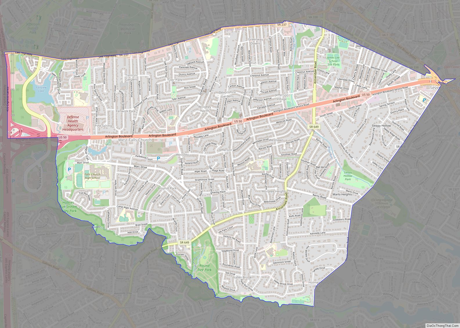
Wattsville is a census-designated place (CDP) in Accomack County, Virginia, United States. It was first listed as a CDP in 2010. As of the 2020 census, it had a population of 1,341. Wattsville CDP overview: Name: Wattsville CDP LSAD Code: 57 LSAD Description: CDP (suffix) State: Virginia County: Accomack County Elevation: 3 ft (0.9 m) Total Area: ... Read more
Virginia Cities and Places
The town of Washington, Virginia, is a historic village located in the eastern foothills of the Blue Ridge Mountains near Shenandoah National Park. The entire town is listed on the National Register of Historic Places as a historic district, Washington Historic District. It is the county seat of Rappahannock County, Virginia. The town was established ... Read more
Warsaw is an incorporated town in and the county seat of Richmond County, Virginia, United States. The population was 1,637 at the 2020 census and is estimated to be 2,281 as of 2022. Warsaw town overview: Name: Warsaw town LSAD Code: 43 LSAD Description: town (suffix) State: Virginia County: Richmond County Elevation: 131 ft (40 m) Total ... Read more
Warrenton is a town in Fauquier County, Virginia, of which it is the seat of government. The population was 10,057 as of the 2020 census, an increase from 9,611 at the 2010 census and 6,670 at the 2000 census. The estimated population in July 2021 was 10,109. It is at the junction of U.S. Route ... Read more
Woodlake is a census-designated place in Chesterfield County, Virginia. The population as of the 2010 Census was 7,319. The suburban community is located on the west shore of Swift Creek Reservoir. Woodlake CDP overview: Name: Woodlake CDP LSAD Code: 57 LSAD Description: CDP (suffix) State: Virginia County: Chesterfield County Total Area: 7,319 ZIP code: 23112 ... Read more
Woodburn is a census-designated place in Fairfax County, Virginia, United States. The population as of the 2010 census was 8,480. Woodburn CDP overview: Name: Woodburn CDP LSAD Code: 57 LSAD Description: CDP (suffix) State: Virginia County: Fairfax County Elevation: 290 ft (90 m) Total Area: 2.80 sq mi (7.25 km²) Land Area: 2.78 sq mi (7.19 km²) Water Area: 0.02 sq mi (0.05 km²) Total Population: ... Read more
Woodbridge is a census-designated place (CDP) in Prince William County, Virginia, United States, located 20 miles (32 km) south of Washington, D.C. Bounded by the Occoquan and Potomac rivers, Woodbridge had 44,668 residents at the 2020 census. Woodbridge offers a variety of amenities for residents and visitors, including Potomac Mills shopping mall and Stonebridge at Potomac ... Read more
Wolf Trap is a census-designated place (CDP) in Fairfax County, Virginia, United States. The population was 16,131 at the 2010 census. Wolf Trap National Park for the Performing Arts is located in the CDP. Wolf Trap CDP overview: Name: Wolf Trap CDP LSAD Code: 57 LSAD Description: CDP (suffix) State: Virginia County: Fairfax County Elevation: ... Read more
Wise is a town in Wise County, Virginia, United States. The population was 3,286 at the 2010 census. It is the county seat of Wise County. It was originally incorporated as the town of Gladeville in 1874. The town’s name was changed to Wise in 1924, after Henry A. Wise, the last Virginia governor before ... Read more
Wintergreen CDP overview: Name: Wintergreen CDP LSAD Code: 57 LSAD Description: CDP (suffix) State: Virginia County: Augusta County, Nelson County FIPS code: 5187008 Online Interactive Map Wintergreen online map. Source: Basemap layers from Google Map, Open Street Map (OSM), Arcgisonline, Wmflabs. Boundary Data from Database of Global Administrative Areas. Wintergreen location map. Where is Wintergreen ... Read more
Windsor is an incorporated town in Isle of Wight County in the Hampton Roads region of southeastern Virginia in the United States. It is located near the crossroads of U.S. Route 460 and U.S. Route 258. The population was 2,626 at the 2010 census, up from 916 at the 2000 census. Windsor town overview: Name: ... Read more
Whitesville is a census-designated place (CDP) in Accomack County, Virginia, United States. It was first listed as a CDP in 2010. As of the 2020 census, it had a population of 241. Whitesville CDP overview: Name: Whitesville CDP LSAD Code: 57 LSAD Description: CDP (suffix) State: Virginia County: Accomack County Elevation: 30 ft (9 m) Total Area: ... Read more