Waverly is an incorporated town in Sussex County, Virginia, United States. Per the 2020 census, the population was 1,955.
| Name: | Waverly town |
|---|---|
| LSAD Code: | 43 |
| LSAD Description: | town (suffix) |
| State: | Virginia |
| County: | Sussex County |
| Elevation: | 112 ft (34 m) |
| Total Area: | 3.08 sq mi (7.99 km²) |
| Land Area: | 3.08 sq mi (7.99 km²) |
| Water Area: | 0.00 sq mi (0.00 km²) |
| Total Population: | 1,955 |
| Population Density: | 630/sq mi (240/km²) |
| ZIP code: | 23890-23891 |
| Area code: | 804 |
| FIPS code: | 5183600 |
| GNISfeature ID: | 1500286 |
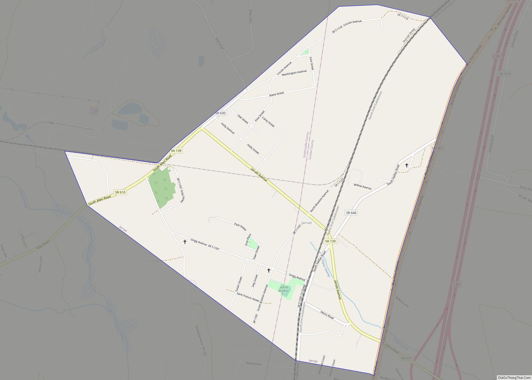
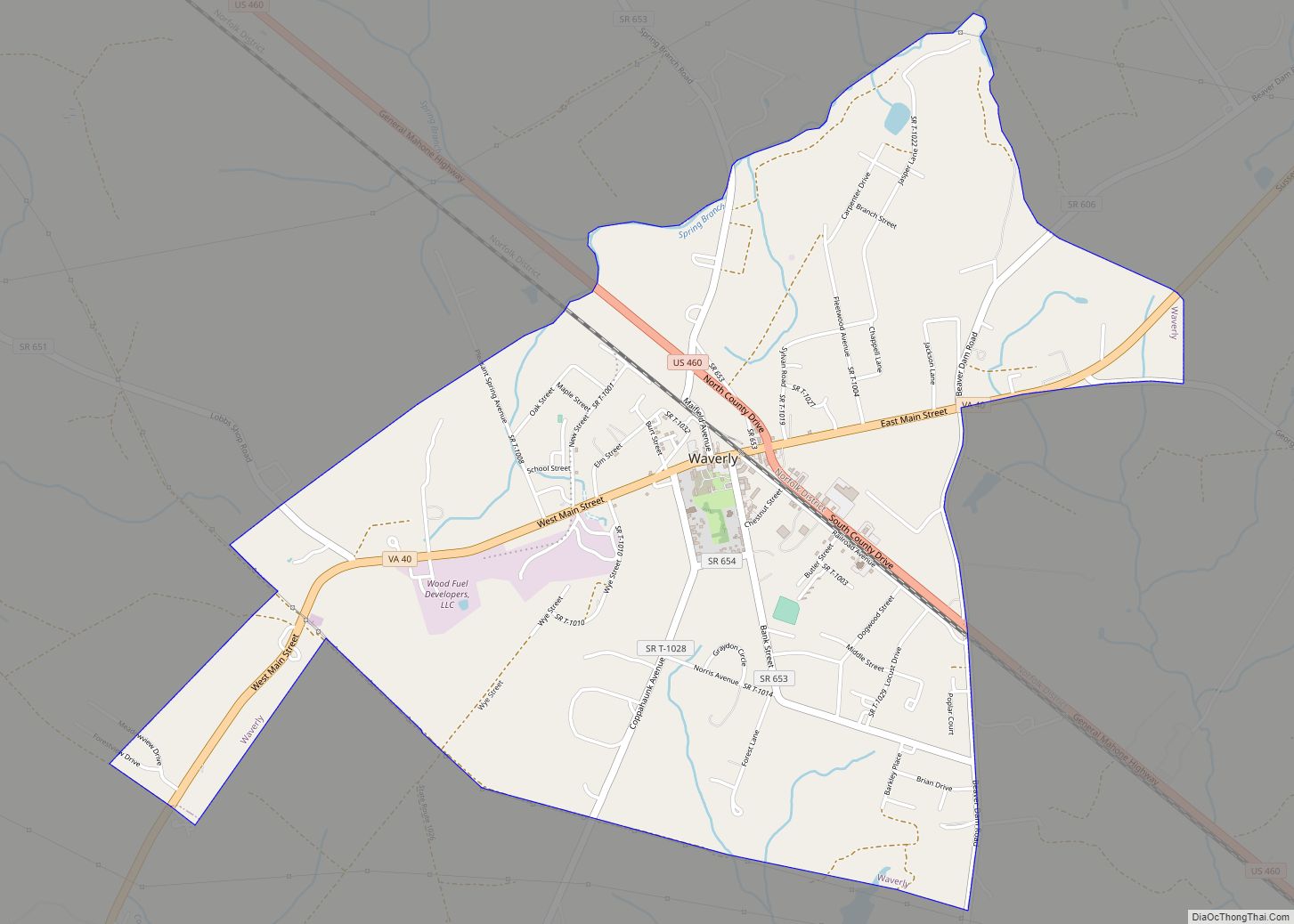
Online Interactive Map
Click on ![]() to view map in "full screen" mode.
to view map in "full screen" mode.
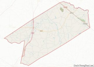
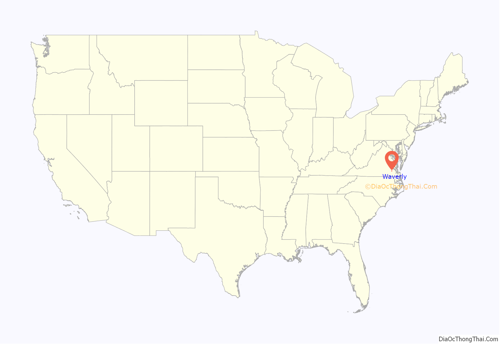
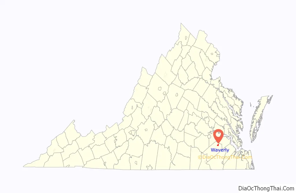
Waverly location map. Where is Waverly town?
History
Popular legend has it that William Mahone (1826–1895), builder of the Norfolk and Petersburg Railroad (now Norfolk Southern), and his cultured wife, Otelia Butler Mahone (1837–1911), traveled along the newly completed Norfolk and Petersburg Railroad naming stations. Otelia was reading Ivanhoe, a book written by Sir Walter Scott. From his historical Scottish novels, Otelia chose the place names of Waverly, as well as Windsor and Wakefield. She tapped the Scottish Clan “McIvor” for the name of Ivor, a small town in neighboring Southampton County. When they could not agree, it is said that they invented a new name in honor of their dispute, which is how the tiny community of Disputanta a few miles west of Waverly was named. The N&P railroad was completed in 1858.
William Mahone became a Major General in the Confederate Army during the American Civil War, and later, a Senator in the United States Congress. A large portion of U.S. Route 460 between Petersburg and Suffolk is named in his honor.
Waverly is the second largest of the towns Gen. Mahone founded. Waverly has supplied the most state senators and delegate members to the Virginia General Assembly of any Virginia town under 3,000 people. They are Junius Edgar West, Delegate (1910–1912) and Senator (1912–1918); Thomas H. Howerton, Delegate (1912–1914); William O. Rogers, Senator (1924–1934); Garland “Peck” Gray, Senator (1942–1945 and 1948–1971); and Elmon T. Gray, Senator (1971–1992).
The Miles B. Carpenter House, Hunting Quarter, and Waverly Downtown Historic District are listed on the National Register of Historic Places.
On February 24, 2016, an EF1 tornado touched down in Waverly, killing three, as verified by the Virginia Department of Game and Inland Fisheries. The storm also caused significant damage to the town, destroying mobile homes, and damaging homes, businesses, trees, and power poles and lines. This was all part of a massive storm system that moved rapidly across the region.
One of the last lynchings in Virginia happened in Waverly in 1925, when a black man was arrested for allegedly attacking a married white woman and stealing a pistol belonging to her husband. An armed mob of approximately 500 descended on the jail, seized the man, and then strung him up a tree, shot him, and burned him. The following day, Governor E. Lee Trinkle arrived in Waverly and admonished citizens. Negative publicity surrounding the event and the lynching of another black man in Wytheville, Virginia in 1926, led to anti-lynching legislation.
Waverly Road Map
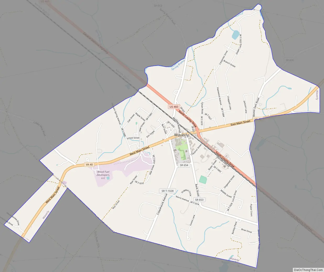
Waverly city Satellite Map

Geography
According to the United States Census Bureau, the town has a total area of 3.1 square miles (8.0 km), all of it land.
See also
Map of Virginia State and its subdivision:- Accomack
- Albemarle
- Alexandria
- Alleghany
- Amelia
- Amherst
- Appomattox
- Arlington
- Augusta
- Bath
- Bedford
- Bedford City
- Bland
- Botetourt
- Bristol
- Brunswick
- Buchanan
- Buckingham
- Buena Vista
- Campbell
- Caroline
- Carroll
- Charles City
- Charlotte
- Charlottesville
- Chesapeake
- Chesterfield
- Clarke
- Clifton Forge City
- Colonial Heights
- Covington
- Craig
- Culpeper
- Cumberland
- Danville
- Dickenson
- Dinwiddie
- Emporia
- Essex
- Fairfax
- Fairfax City
- Falls Church
- Fauquier
- Floyd
- Fluvanna
- Franklin
- Frederick
- Fredericksburg
- Galax
- Giles
- Gloucester
- Goochland
- Grayson
- Greene
- Greensville
- Halifax
- Hampton
- Hanover
- Harrisonburg
- Henrico
- Henry
- Highland
- Hopewell
- Isle of Wight
- James City
- King and Queen
- King George
- King William
- Lancaster
- Lee
- Lexington
- Loudoun
- Louisa
- Lunenburg
- Lynchburg
- Madison
- Manassas
- Manassas Park
- Martinsville
- Mathews
- Mecklenburg
- Middlesex
- Montgomery
- Nelson
- New Kent
- Newport News
- Norfolk
- Northampton
- Northumberland
- Norton
- Nottoway
- Orange
- Page
- Patrick
- Petersburg
- Pittsylvania
- Poquoson
- Portsmouth
- Powhatan
- Prince Edward
- Prince George
- Prince William
- Pulaski
- Radford
- Rappahannock
- Richmond
- Roanoke
- Roanoke City
- Rockbridge
- Rockingham
- Russell
- Salem
- Scott
- Shenandoah
- Smyth
- Southampton
- Spotsylvania
- Stafford
- Staunton
- Suffolk
- Surry
- Sussex
- Tazewell
- Virginia Beach
- Warren
- Washington
- Waynesboro
- Westmoreland
- Williamsburg
- Winchester
- Wise
- Wythe
- York
- Alabama
- Alaska
- Arizona
- Arkansas
- California
- Colorado
- Connecticut
- Delaware
- District of Columbia
- Florida
- Georgia
- Hawaii
- Idaho
- Illinois
- Indiana
- Iowa
- Kansas
- Kentucky
- Louisiana
- Maine
- Maryland
- Massachusetts
- Michigan
- Minnesota
- Mississippi
- Missouri
- Montana
- Nebraska
- Nevada
- New Hampshire
- New Jersey
- New Mexico
- New York
- North Carolina
- North Dakota
- Ohio
- Oklahoma
- Oregon
- Pennsylvania
- Rhode Island
- South Carolina
- South Dakota
- Tennessee
- Texas
- Utah
- Vermont
- Virginia
- Washington
- West Virginia
- Wisconsin
- Wyoming