Map of Montrose town, West Virginia
Montrose is a town in Randolph County, West Virginia, United States. The population was 141 at the 2020 census. The town was so named on account of wild rose bushes near the original town site. Montrose town overview: Name: Montrose town LSAD Code: 43 LSAD Description: town (suffix) State: West Virginia County: Randolph County Elevation: ... Read more
Map of Montrose town, West Virginia
Map of Montgomery city, West Virginia
Montgomery is a city in West Virginia, along the Kanawha River. Most of the city is in Fayette County, with the remainder in Kanawha County. The population was 1,280 at the 2020 census. From 1876 to 1890, the town was called Coal Valley Post Office. The name then changed to Montgomery’s Landing, then to Coal ... Read more
Map of Montgomery city, West Virginia
Map of Montcalm CDP
Montcalm is a census-designated place (CDP) in Mercer County, West Virginia, United States. The population was 726 at the 2010 census. It is part of the Bluefield, WV-VA micropolitan area which has a population of 107,342. Residents of Montcalm are called Montcalmers. Montcalm CDP overview: Name: Montcalm CDP LSAD Code: 57 LSAD Description: CDP (suffix) ... Read more
Map of Montcalm CDP
Map of Monaville CDP
Monaville is an unincorporated community and census-designated place (CDP) in Logan County, West Virginia, United States. As of the 2010 census, its population was 309. Monaville CDP overview: Name: Monaville CDP LSAD Code: 57 LSAD Description: CDP (suffix) State: West Virginia County: Logan County Elevation: 712 ft (217 m) Total Area: 0.464 sq mi (1.20 km²) Land Area: 0.457 sq mi (1.18 km²) ... Read more
Map of Monaville CDP
Map of Mitchell Heights town
Mitchell Heights is a town in Logan County, West Virginia, United States. The population was 315 at the 2020 census. The town was named for an early farm on which it was established. Mitchell Heights town overview: Name: Mitchell Heights town LSAD Code: 43 LSAD Description: town (suffix) State: West Virginia County: Logan County Elevation: ... Read more
Map of Mitchell Heights town
Map of Neibert CDP
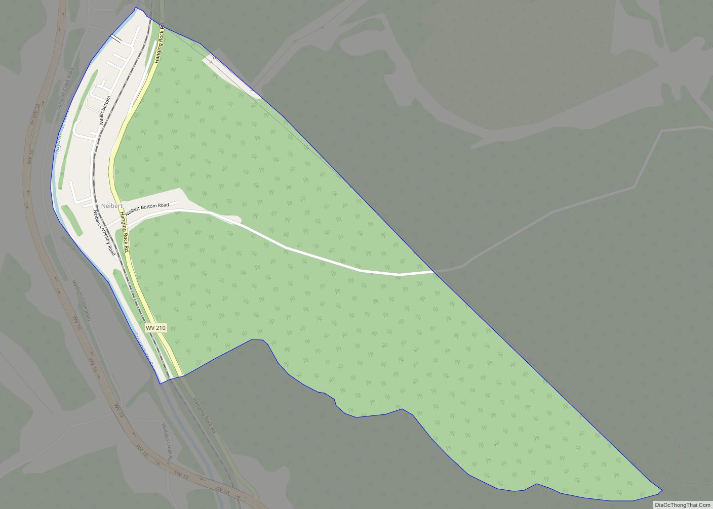
Neibert is an unincorporated community and census-designated place (CDP) in Logan County, West Virginia, United States. Its population was 183 as of the 2010 census. Neibert CDP overview: Name: Neibert CDP LSAD Code: 57 LSAD Description: CDP (suffix) State: West Virginia County: Logan County Elevation: 718 ft (219 m) Total Area: 0.630 sq mi (1.63 km²) Land Area: 0.612 sq mi (1.59 km²) ... Read more
Map of Neibert CDP
Map of Middleway CDP
Middleway is a census-designated place (CDP) in Jefferson County, West Virginia, United States, in the lower Shenandoah Valley. As of the 2010 census, its population was 441. Middleway CDP overview: Name: Middleway CDP LSAD Code: 57 LSAD Description: CDP (suffix) State: West Virginia County: Jefferson County Total Area: 1.123 sq mi (2.91 km²) Land Area: 1.123 sq mi (2.91 km²) Water ... Read more
Map of Middleway CDP
Map of Middlebourne town
Middlebourne is a town in Tyler County, West Virginia, United States. The population was 715 at the 2020 census. It serves as the county seat of Tyler County. Middlebourne town overview: Name: Middlebourne town LSAD Code: 43 LSAD Description: town (suffix) State: West Virginia County: Tyler County Elevation: 735 ft (224 m) Total Area: 0.38 sq mi (0.98 km²) Land ... Read more
Map of Middlebourne town
Map of Mount Hope city, West Virginia
Mount Hope is a city in Fayette County, West Virginia, United States. The population was 1,414 at the 2010 census. Mount Hope city overview: Name: Mount Hope city LSAD Code: 25 LSAD Description: city (suffix) State: West Virginia County: Fayette County Elevation: 1,722 ft (525 m) Total Area: 1.56 sq mi (4.03 km²) Land Area: 1.56 sq mi (4.03 km²) Water Area: 0.00 sq mi ... Read more
Map of Mount Hope city, West Virginia
Map of Meadow Bridge town
Meadow Bridge is a town in Fayette County, West Virginia, United States. The population was 379 at the 2010 census. The first settler of the area was John Gwin, closely followed by Dan Griffin. The community took its name from a nearby bridge over Meadow Creek. Meadow Bridge town overview: Name: Meadow Bridge town LSAD ... Read more
Map of Meadow Bridge town
Map of Mount Gay-Shamrock CDP
Mount Gay-Shamrock is a census-designated place (CDP) in Logan County, West Virginia, United States. Mount Gay-Shamrock has a 2020 population of 1,360. Mount Gay-Shamrock is currently declining at a rate of -2.51% annually. The population was 1,779 at the 2010 census. The CDP includes the unincorporated communities of Mount Gay, Shamrock, Black Bottom, Whites Addition, ... Read more
Map of Mount Gay-Shamrock CDP
Map of McMechen city
McMechen is a city in Marshall County, West Virginia, United States, situated along the Ohio River. It is part of the Wheeling, West Virginia Metropolitan Statistical Area. The population was 1,714 at the 2020 census. McMechen city overview: Name: McMechen city LSAD Code: 25 LSAD Description: city (suffix) State: West Virginia County: Marshall County Elevation: ... Read more
Map of McMechen city