Map of Oakvale town
Oakvale is a town in Mercer County, West Virginia, United States, along the East River. The population was 137 at the 2020 census. It is part of the Bluefield, WV-VA micropolitan area which has a population of 107,578. Oakvale town overview: Name: Oakvale town LSAD Code: 43 LSAD Description: town (suffix) State: West Virginia County: ... Read more
Map of Oakvale town
Map of Oak Hill city, West Virginia
Oak Hill is a city in Fayette County, West Virginia, United States. The population was 8,179 at the 2020 census. It is part of the Beckley metropolitan area. The city is also home to the historic Oak Hill Railroad Depot which still stands today as an artisan shop. Country singer Hank Williams died in Oak ... Read more
Map of Oak Hill city, West Virginia
Map of Nutter Fort town
Nutter Fort is a town in Harrison County, West Virginia, United States, incorporated in 1923. The town is a southeastern suburb of Clarksburg. Since 1996, Nutter Fort has held the West Virginia Blackberry Festival during the first weekend of August. The population was 1,497 at the 2020 census. The town is also home to the ... Read more
Map of Nutter Fort town
Map of Northfork town
Northfork is a town in McDowell County, West Virginia, United States, located on U.S. Route 52 between Welch and Bluefield. The population was 231 at the 2020 census. Northfork was incorporated in 1901, so named because of its location on the north fork of the Elkhorn Creek at its junction with the south fork. It ... Read more
Map of Northfork town
Map of North Hills town, West Virginia
North Hills is a town in Wood County, West Virginia, United States. It is a suburb of Parkersburg. The population was 837 at the 2020 census. North Hills was incorporated on February 15, 1979. North Hills town overview: Name: North Hills town LSAD Code: 43 LSAD Description: town (suffix) State: West Virginia County: Wood County ... Read more
Map of North Hills town, West Virginia
Map of Nitro city
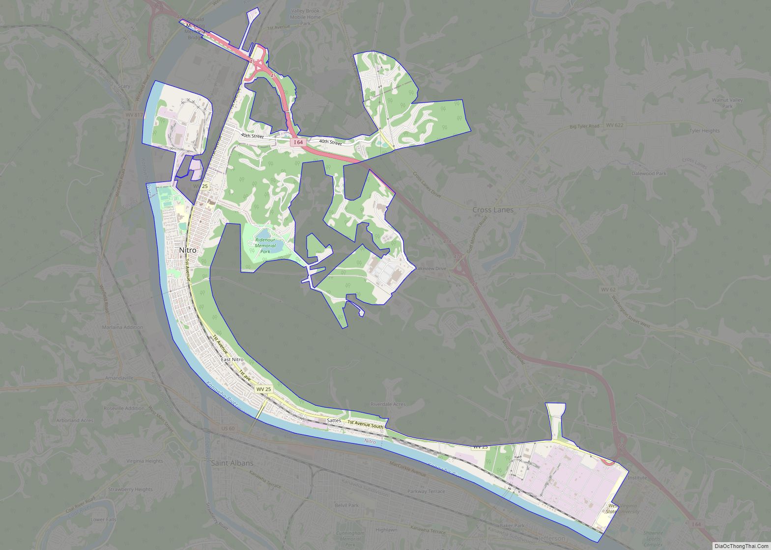
Nitro is a city in Kanawha and Putnam counties in the U.S. state of West Virginia. It takes its name from a World War I era nitrocellulose plant. The population was 6,618 according to the 2020 census. It is part of the Charleston metropolitan area. Nitro city overview: Name: Nitro city LSAD Code: 25 LSAD ... Read more
Map of Nitro city
Map of Newell CDP, West Virginia
Newell is an unincorporated community and census-designated place in northern Hancock County, West Virginia, United States, situated along the Ohio River. The population was 1,203 at the 2020 census. It is a part of the Weirton–Steubenville metropolitan area. Newell is home to the Fiesta Tableware Company and the Mountaineer Casino, Racetrack and Resort. Newell CDP ... Read more
Map of Newell CDP, West Virginia
Map of New Richmond CDP, West Virginia
New Richmond is a census-designated place (CDP) in Wyoming County, West Virginia, United States. As of the 2010 census, its population was 238. The community is the site of Wyoming East High School. New Richmond CDP overview: Name: New Richmond CDP LSAD Code: 57 LSAD Description: CDP (suffix) State: West Virginia County: Wyoming County Total ... Read more
Map of New Richmond CDP, West Virginia
Map of Parsons city, West Virginia
Parsons is the largest city in and county seat of Tucker County, West Virginia, United States. The population was 1,322 at the 2020 census. Parsons is located at the confluence of the Shavers Fork and the Black Fork, forming the head of the Cheat River. Parsons city overview: Name: Parsons city LSAD Code: 25 LSAD ... Read more
Map of Parsons city, West Virginia
Map of Parcoal CDP
Parcoal CDP overview: Name: Parcoal CDP LSAD Code: 57 LSAD Description: CDP (suffix) State: West Virginia FIPS code: 5462044 Online Interactive Map Parcoal online map. Source: Basemap layers from Google Map, Open Street Map (OSM), Arcgisonline, Wmflabs. Boundary Data from Database of Global Administrative Areas. Parcoal location map. Where is Parcoal CDP? Parcoal Road Map ... Read more
Map of Parcoal CDP
Map of New Haven town, West Virginia
New Haven is a town in Mason County, West Virginia, United States, along the Ohio River. The population was 1,485 at the 2020 census. It is part of the Point Pleasant, WV–OH Micropolitan Statistical Area. The town was named after New Haven, Connecticut, the native home of the local mine proprietors. New Haven town overview: ... Read more
Map of New Haven town, West Virginia
Map of Pageton CDP
Pageton is a census-designated place (CDP) in McDowell County, West Virginia, United States. As of the 2010 census, its population was 187. Pageton is located on the Tug Fork Branch of the Norfolk and Western Railway, along the Pocahontas seam of rich bituminous coal. Pageton is located on State Route 161 between Thorpe and Anawalt. ... Read more
Map of Pageton CDP