Map of Hedgesville town
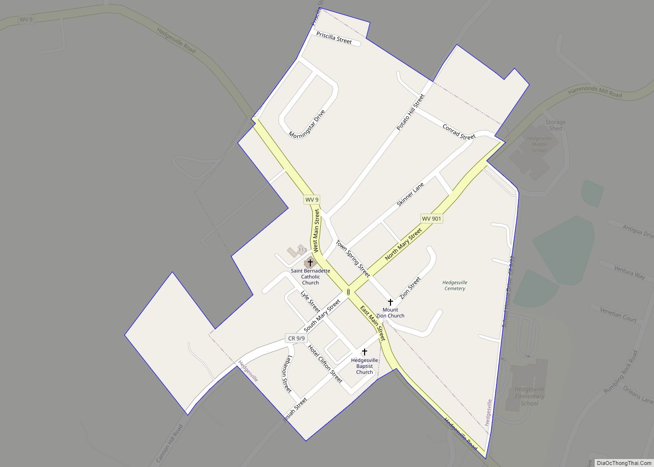
Hedgesville is a town in Berkeley County, West Virginia, United States, in the state’s Eastern Panhandle region. The population was 318 at the 2010 census. The town sits on WV 9, and is roughly 13 miles east of Berkeley Springs. In addition to its legal definition, Hedgesville has come to be the common name for ... Read more
Map of Hedgesville town
Map of Harts CDP
Harts is a census-designated place (CDP) at the mouth of Big Harts Creek in Lincoln County, West Virginia, United States, situated along the Guyandotte River. As of the 2010 census, its population was 656. Harts is a part of the Huntington-Ashland, WV-KY-OH, Metropolitan Statistical Area (MSA). The Harts CDP includes the unincorporated communities of Harts, ... Read more
Map of Harts CDP
Map of Harrisville town, West Virginia
Harrisville is a town in Ritchie County, West Virginia, United States. It is the county seat of Ritchie County. Harrisville is located at the junction of State Routes 31 and 16, five miles south of U.S. 50. Within the community are an elementary school, the county board of education, many businesses, three banks, a library, ... Read more
Map of Harrisville town, West Virginia
Map of Harpers Ferry town, West Virginia
Harpers Ferry is a historic town in Jefferson County, West Virginia, United States, in the lower Shenandoah Valley. The population was 285 at the 2020 census. Situated at the confluence of the Potomac and Shenandoah rivers, where the U.S. states of Maryland, Virginia, and West Virginia meet, it is the easternmost town in West Virginia. ... Read more
Map of Harpers Ferry town, West Virginia
Map of Hinton city, West Virginia
Hinton is a city in Summers County, West Virginia, United States. The population was 2,266 at the 2020 census. It is the county seat of Summers County. Hinton was established in 1873 and chartered in 1897. Hinton was named after John “Jack” Hinton, the original owner of the town site. Much of Hinton’s downtown was ... Read more
Map of Hinton city, West Virginia
Map of Hilltop CDP, West Virginia
Hilltop is a census-designated place (CDP) in Fayette County, West Virginia, United States. Hilltop is located on state routes 16 and 61, 2 miles (3.2 km) south of Oak Hill. Hilltop has a post office with ZIP code 25855. As of the 2010 census, its population was 624. Hilltop CDP overview: Name: Hilltop CDP LSAD Code: ... Read more
Map of Hilltop CDP, West Virginia
Map of Jane Lew town
Jane Lew is a town in Lewis County, West Virginia, United States. The population was 409 at the time of the 2020 census. Jane Lew town overview: Name: Jane Lew town LSAD Code: 43 LSAD Description: town (suffix) State: West Virginia County: Lewis County Elevation: 1,017 ft (310 m) Total Area: 0.25 sq mi (0.64 km²) Land Area: 0.24 sq mi (0.62 km²) ... Read more
Map of Jane Lew town
Map of Hico CDP, West Virginia
Hico is a census-designated place (CDP) in Fayette County, West Virginia, United States. Hico is located at the junction of U.S. routes 19 and 60, 7 miles (11 km) northeast of Fayetteville. Hico has a post office with ZIP code 25854. As of the 2010 census, its population was 272. Some say the community was named ... Read more
Map of Hico CDP, West Virginia
Map of Itmann CDP
Itmann is a census-designated place (CDP) and former mining town located in Wyoming County, West Virginia, United States, between Pineville and Mullens off West Virginia Route 16. As of the 2010 census, its population was 293; it had 138 homes, 119 of which were occupied. Itmann CDP overview: Name: Itmann CDP LSAD Code: 57 LSAD ... Read more
Map of Itmann CDP
Map of Inwood CDP, West Virginia
Inwood is a census-designated place (CDP) in Berkeley County, West Virginia, United States, located south of Martinsburg in the lower Shenandoah Valley. The population was 2,954 at the 2010 census. It is located on U.S. Route 11. Inwood CDP overview: Name: Inwood CDP LSAD Code: 57 LSAD Description: CDP (suffix) State: West Virginia County: Berkeley ... Read more
Map of Inwood CDP, West Virginia
Map of Hendricks town, West Virginia
Hendricks is a town in Tucker County, West Virginia, United States. The population was 226 at the 2020 census. The Blackwater River and the Dry Fork join at Hendricks to form the Black Fork, a principal tributary of the Cheat River. Hendricks town overview: Name: Hendricks town LSAD Code: 43 LSAD Description: town (suffix) State: ... Read more
Map of Hendricks town, West Virginia
Map of Iaeger town
Iaeger (pronounced YAY-ger) is a town in McDowell County, West Virginia, United States. The population was 257 at the 2020 census. Iaeger town overview: Name: Iaeger town LSAD Code: 43 LSAD Description: town (suffix) State: West Virginia County: McDowell County Elevation: 984 ft (300 m) Total Area: 0.84 sq mi (2.16 km²) Land Area: 0.79 sq mi (2.05 km²) Water Area: 0.04 sq mi (0.11 km²) ... Read more
Map of Iaeger town