Hinton is a city in Summers County, West Virginia, United States. The population was 2,266 at the 2020 census. It is the county seat of Summers County. Hinton was established in 1873 and chartered in 1897. Hinton was named after John “Jack” Hinton, the original owner of the town site. Much of Hinton’s downtown was placed on the National Register of Historic Places in 1984.
Part of Paramount’s 1994 film Lassie was shot in Hinton.
| Name: | Hinton city |
|---|---|
| LSAD Code: | 25 |
| LSAD Description: | city (suffix) |
| State: | West Virginia |
| County: | Summers County |
| Elevation: | 1,463 ft (446 m) |
| Total Area: | 3.03 sq mi (7.85 km²) |
| Land Area: | 2.23 sq mi (5.78 km²) |
| Water Area: | 0.80 sq mi (2.07 km²) |
| Total Population: | 2,266 |
| Population Density: | 1,055.53/sq mi (407.60/km²) |
| ZIP code: | 25951 |
| Area code: | 304 |
| FIPS code: | 5437636 |
| GNISfeature ID: | 1551458 |
| Website: | hintonwva.com |
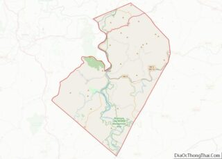
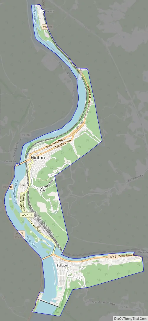
Online Interactive Map
Click on ![]() to view map in "full screen" mode.
to view map in "full screen" mode.
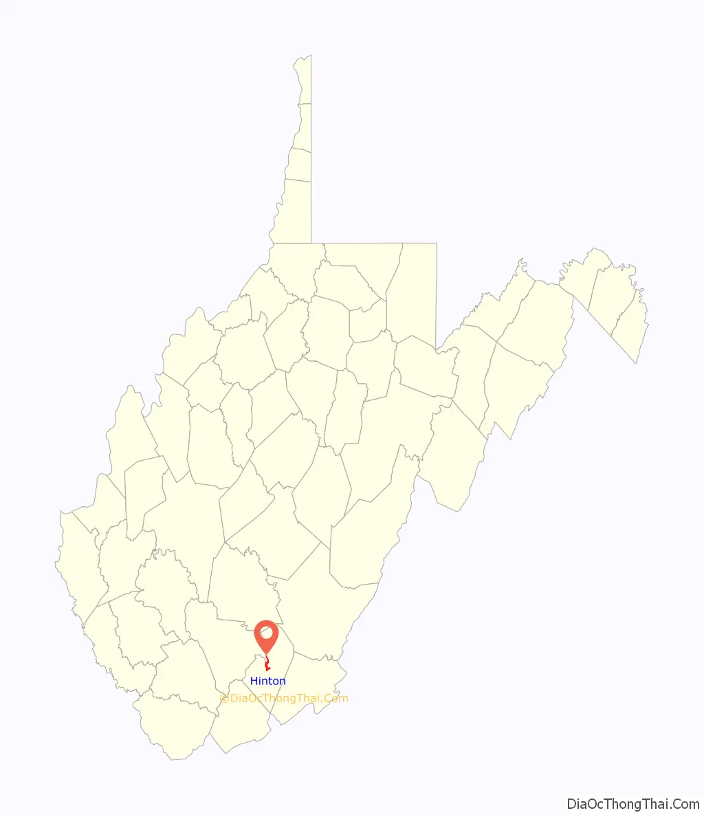
Hinton location map. Where is Hinton city?

Hinton Road Map
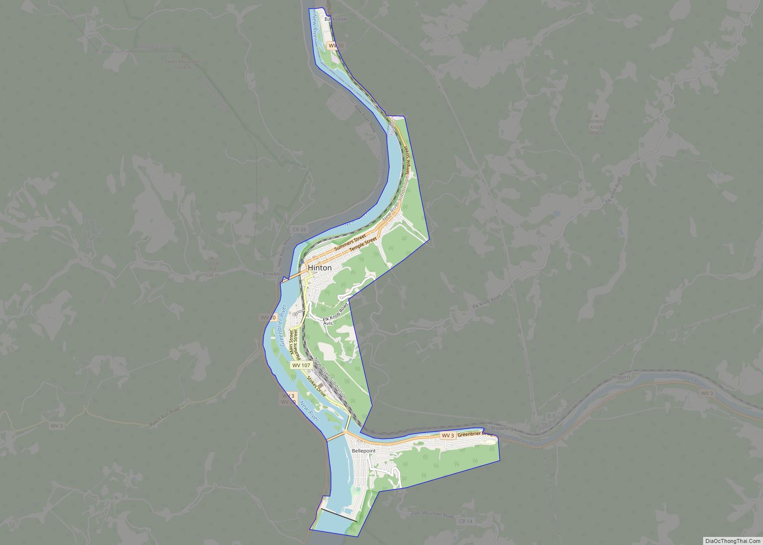
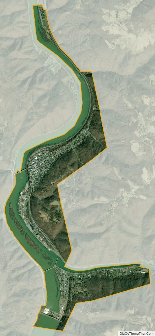
Hinton city Satellite Map
Geography
Hinton is situated along the New River just north of its confluence with the Greenbrier River. Bluestone Lake is located near Hinton. The city is about 28 miles from Beckley and 90 miles from Charleston. According to the United States Census Bureau, the city has a total area of 3.03 square miles (7.85 km), of which 2.22 square miles (5.75 km) is land and 0.81 square miles (2.10 km) is water.
Climate
The climate in this area has mild differences between highs and lows, and there is adequate rainfall year-round. According to the Köppen Climate Classification system, Hinton has a marine west coast climate, abbreviated “Cfb” on climate maps.
See also
Map of West Virginia State and its subdivision:- Barbour
- Berkeley
- Boone
- Braxton
- Brooke
- Cabell
- Calhoun
- Clay
- Doddridge
- Fayette
- Gilmer
- Grant
- Greenbrier
- Hampshire
- Hancock
- Hardy
- Harrison
- Jackson
- Jefferson
- Kanawha
- Lewis
- Lincoln
- Logan
- Marion
- Marshall
- Mason
- McDowell
- Mercer
- Mineral
- Mingo
- Monongalia
- Monroe
- Morgan
- Nicholas
- Ohio
- Pendleton
- Pleasants
- Pocahontas
- Preston
- Putnam
- Raleigh
- Randolph
- Ritchie
- Roane
- Summers
- Taylor
- Tucker
- Tyler
- Upshur
- Wayne
- Webster
- Wetzel
- Wirt
- Wood
- Wyoming
- Alabama
- Alaska
- Arizona
- Arkansas
- California
- Colorado
- Connecticut
- Delaware
- District of Columbia
- Florida
- Georgia
- Hawaii
- Idaho
- Illinois
- Indiana
- Iowa
- Kansas
- Kentucky
- Louisiana
- Maine
- Maryland
- Massachusetts
- Michigan
- Minnesota
- Mississippi
- Missouri
- Montana
- Nebraska
- Nevada
- New Hampshire
- New Jersey
- New Mexico
- New York
- North Carolina
- North Dakota
- Ohio
- Oklahoma
- Oregon
- Pennsylvania
- Rhode Island
- South Carolina
- South Dakota
- Tennessee
- Texas
- Utah
- Vermont
- Virginia
- Washington
- West Virginia
- Wisconsin
- Wyoming