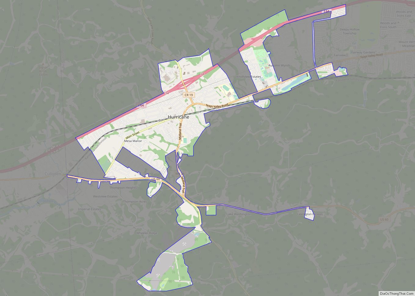
Map of Corinne CDP, West Virginia

Map of Corinne CDP, West Virginia

Corinne is a census-designated place (CDP) in Wyoming County, West Virginia, United States. As of the 2010 census, Corinne’s population was 362. It has a post office, established in 1916, with a zip code of 25826. Corinne CDP overview: Name: Corinne CDP LSAD Code: 57 LSAD Description: CDP (suffix) State: West Virginia County: Wyoming County … Read more

Map of Chapmanville town

Map of Chapmanville town

Chapmanville is a town in Logan County, West Virginia, United States. The population was 1,025 at the 2020 census. Chapmanville is named for Ned Chapman, an early settler who operated a store and post office. It was incorporated in 1947. Chapmanville town overview: Name: Chapmanville town LSAD Code: 43 LSAD Description: town (suffix) State: West … Read more

Map of Comfort CDP, West Virginia

Map of Comfort CDP, West Virginia

Comfort is a census-designated place (CDP) in Boone County, West Virginia, United States. Comfort is located on West Virginia Route 3, 12 miles (19 km) northeast of Madison. Comfort has a post office with ZIP code 25049. As of the 2010 census, its population is 306. Comfort is the home of Sherman Elementary School. Comfort CDP … Read more

Map of Coal Fork CDP

Map of Coal Fork CDP

Coal Fork is an unincorporated census-designated place (CDP) in Kanawha County, West Virginia, United States. It is part of a larger unincorporated community known as Campbells Creek, approximately 10 minutes east of Charleston. The population was 1,233 at the 2010 census. Coal Fork CDP overview: Name: Coal Fork CDP LSAD Code: 57 LSAD Description: CDP … Read more

Map of Davis town, West Virginia

Map of Davis town, West Virginia

Davis is a town in Tucker County, West Virginia, United States, situated along the Blackwater River. The population was 595 at the 2020 census. Davis town overview: Name: Davis town LSAD Code: 43 LSAD Description: town (suffix) State: West Virginia County: Tucker County Elevation: 3,100 ft (945 m) Total Area: 1.83 sq mi (4.74 km²) Land Area: 1.83 sq mi (4.74 km²) Water … Read more

Map of Danville town, West Virginia

Map of Danville town, West Virginia

Danville is a town in Boone County, West Virginia, United States. The population was 660 at the 2020 census. Danville was incorporated in 1911 and named for Dan Rock, the town’s first postmaster. Danville was formerly known as Newport and Red House. Danville town overview: Name: Danville town LSAD Code: 43 LSAD Description: town (suffix) … Read more

Map of Daniels CDP

Map of Daniels CDP

Daniels is a census-designated place (CDP) in Raleigh County, West Virginia, United States. The population was 1,881 at the 2010 census. Daniels CDP overview: Name: Daniels CDP LSAD Code: 57 LSAD Description: CDP (suffix) State: West Virginia County: Raleigh County Elevation: 2,375 ft (724 m) Total Area: 4.6 sq mi (12.0 km²) Land Area: 4.6 sq mi (12.0 km²) Water Area: 0.0 sq mi (0.0 km²) … Read more

Map of Dailey CDP

Map of Dailey CDP

Dailey is a census-designated place (CDP) in Randolph County, West Virginia, United States. Dailey is located on U.S. routes 219 and 250, 3 miles (4.8 km) south-southwest of Beverly. Dailey has a post office with ZIP code 26259. As of the 2010 census, its population was 114. Located near Dailey is the Tygart Valley Homesteads Historic … Read more

Map of Culloden CDP, West Virginia

Map of Culloden CDP, West Virginia

Culloden is a census-designated place in Cabell and Putnam counties in the U.S. state of West Virginia. As of the 2020 census, the population was 3,016. It is part of the Huntington–Ashland metropolitan area. The community’s name was selected on account of its perceived uniqueness. Culloden CDP overview: Name: Culloden CDP LSAD Code: 57 LSAD … Read more

Map of Cucumber CDP

Map of Cucumber CDP

Cucumber is a census-designated place (CDP) in McDowell County, West Virginia, United States. Its population was 74 at the 2020 census. The community is centered on mining. Named either for nearby Cucumber Creek or for the cucumber trees in the area, it is the only community in the United States with this name. Its post … Read more

Map of Eccles CDP

Map of Eccles CDP

Eccles is a census-designated place (CDP) in Raleigh County, West Virginia, United States. Eccles is located on West Virginia Route 3, 4 miles (6.4 km) west of Beckley. Eccles has a post office with ZIP code 25836. As of the 2010 census, its population is 362. The community was originally named after the book Ecclesiastes, where … Read more

Map of Crumpler CDP

Map of Crumpler CDP

Crumpler is a census-designated place (CDP) located in McDowell County, West Virginia, United States. As of the 2010 census, its population was 204. Crumpler CDP overview: Name: Crumpler CDP LSAD Code: 57 LSAD Description: CDP (suffix) State: West Virginia County: McDowell County Total Area: 1.500 sq mi (3.88 km²) Land Area: 1.500 sq mi (3.88 km²) Water Area: 0 sq mi (0 km²) Total … Read more