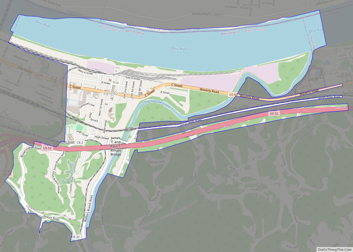
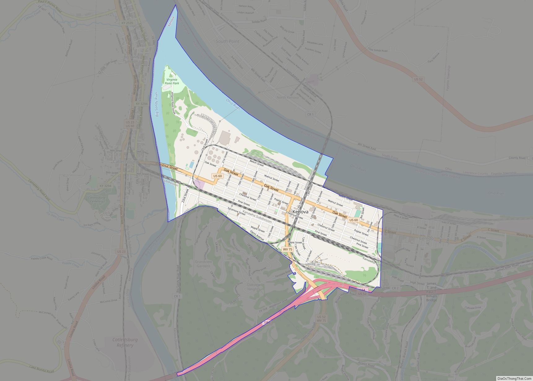
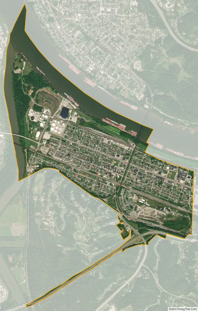
Kenova is a city in Wayne County, West Virginia, United States, situated at the confluence of the Ohio and Big Sandy rivers. The city’s name is a portmanteau of Kentucky, Ohio, and Virginia (Va), owing to its location where the three states met before the creation of West Virginia. The population was 3,030 at the 2020 census. It is part of the Huntington–Ashland metropolitan area.
Founded in 1859 but not incorporated until 1894, the town’s early history and development was centered on the railroad industry. It is home to a major Norfolk Southern Ohio River Bridge. CSX Transportation’s former Chesapeake and Ohio Kanawha Subdivision travels through the town as well. The city is also near the site of the Southern Airways Flight 932 aviation disaster. In 1970, a plane carrying the Marshall University football team crashed on a hillside on approach to the Tri-State Airport, killing all on board. A movie about the tragedy, We Are Marshall, was released in 2006.
| Name: | Kenova city |
|---|---|
| LSAD Code: | 25 |
| LSAD Description: | city (suffix) |
| State: | West Virginia |
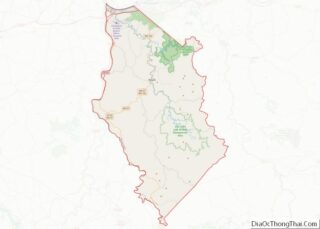
| County: | Wayne County |
| Elevation: | 558 ft (170 m) |
| Total Area: | 1.66 sq mi (4.30 km²) |
| Land Area: | 1.32 sq mi (3.42 km²) |
| Water Area: | 0.34 sq mi (0.88 km²) |
| Total Population: | 3,030 |
| Population Density: | 2,244.88/sq mi (866.71/km²) |
| ZIP code: | 25530 |
| Area code: | 304 |
| FIPS code: | 5443180 |
| GNISfeature ID: | 1541155 |
| Website: | https://kenovawv.com/ |
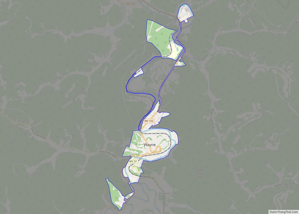
Online Interactive Map
Click on ![]() to view map in "full screen" mode.
to view map in "full screen" mode.
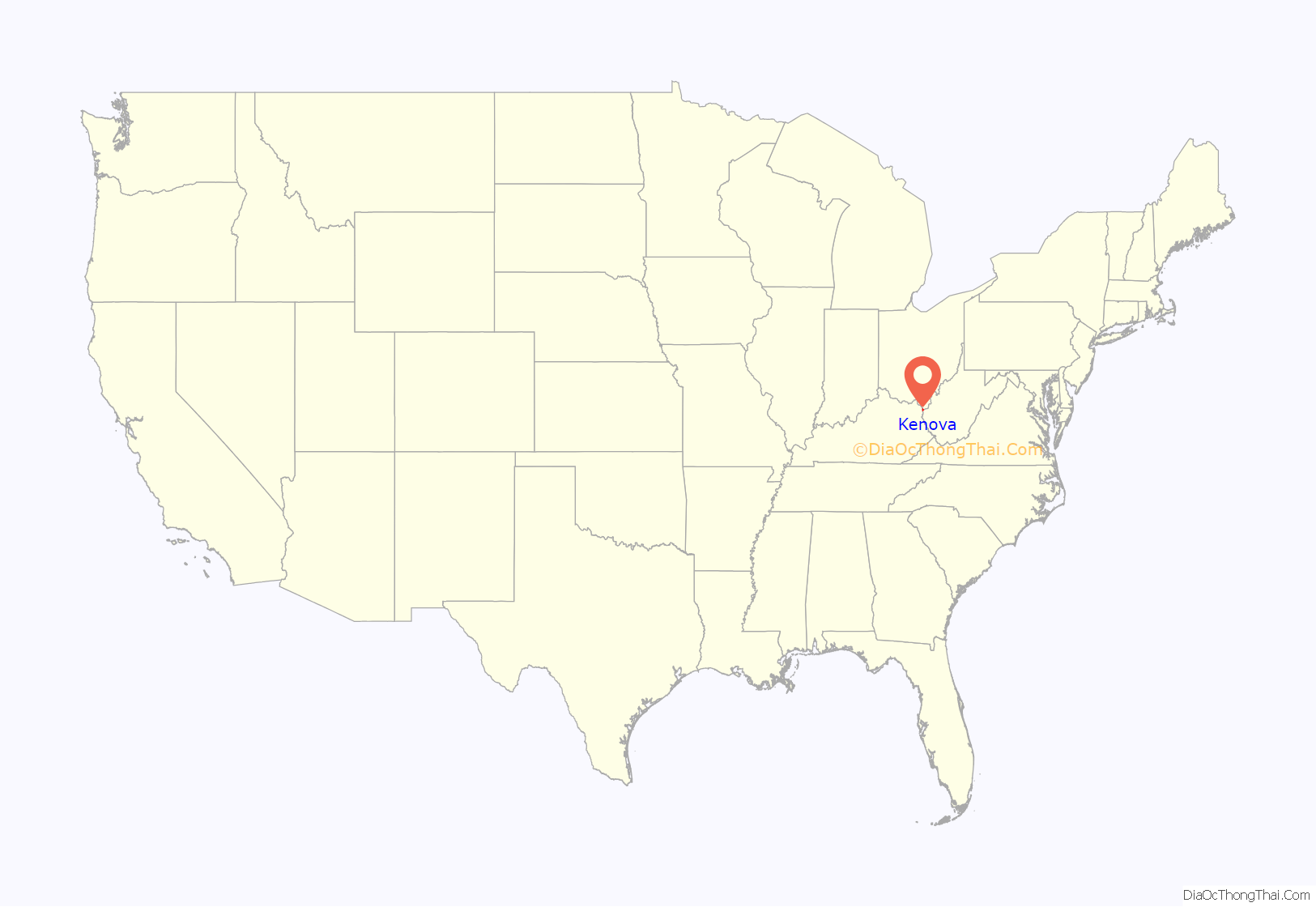
Kenova location map. Where is Kenova city?

Kenova Road Map

Kenova city Satellite Map
Geography
According to the United States Census Bureau, the city has a total area of 1.60 square miles (4.14 km), of which 1.26 square miles (3.26 km) is land and 0.34 square miles (0.88 km) is water.
See also
Map of West Virginia State and its subdivision:- Barbour
- Berkeley
- Boone
- Braxton
- Brooke
- Cabell
- Calhoun
- Clay
- Doddridge
- Fayette
- Gilmer
- Grant
- Greenbrier
- Hampshire
- Hancock
- Hardy
- Harrison
- Jackson
- Jefferson
- Kanawha
- Lewis
- Lincoln
- Logan
- Marion
- Marshall
- Mason
- McDowell
- Mercer
- Mineral
- Mingo
- Monongalia
- Monroe
- Morgan
- Nicholas
- Ohio
- Pendleton
- Pleasants
- Pocahontas
- Preston
- Putnam
- Raleigh
- Randolph
- Ritchie
- Roane
- Summers
- Taylor
- Tucker
- Tyler
- Upshur
- Wayne
- Webster
- Wetzel
- Wirt
- Wood
- Wyoming
- Alabama
- Alaska
- Arizona
- Arkansas
- California
- Colorado
- Connecticut
- Delaware
- District of Columbia
- Florida
- Georgia
- Hawaii
- Idaho
- Illinois
- Indiana
- Iowa
- Kansas
- Kentucky
- Louisiana
- Maine
- Maryland
- Massachusetts
- Michigan
- Minnesota
- Mississippi
- Missouri
- Montana
- Nebraska
- Nevada
- New Hampshire
- New Jersey
- New Mexico
- New York
- North Carolina
- North Dakota
- Ohio
- Oklahoma
- Oregon
- Pennsylvania
- Rhode Island
- South Carolina
- South Dakota
- Tennessee
- Texas
- Utah
- Vermont
- Virginia
- Washington
- West Virginia
- Wisconsin
- Wyoming