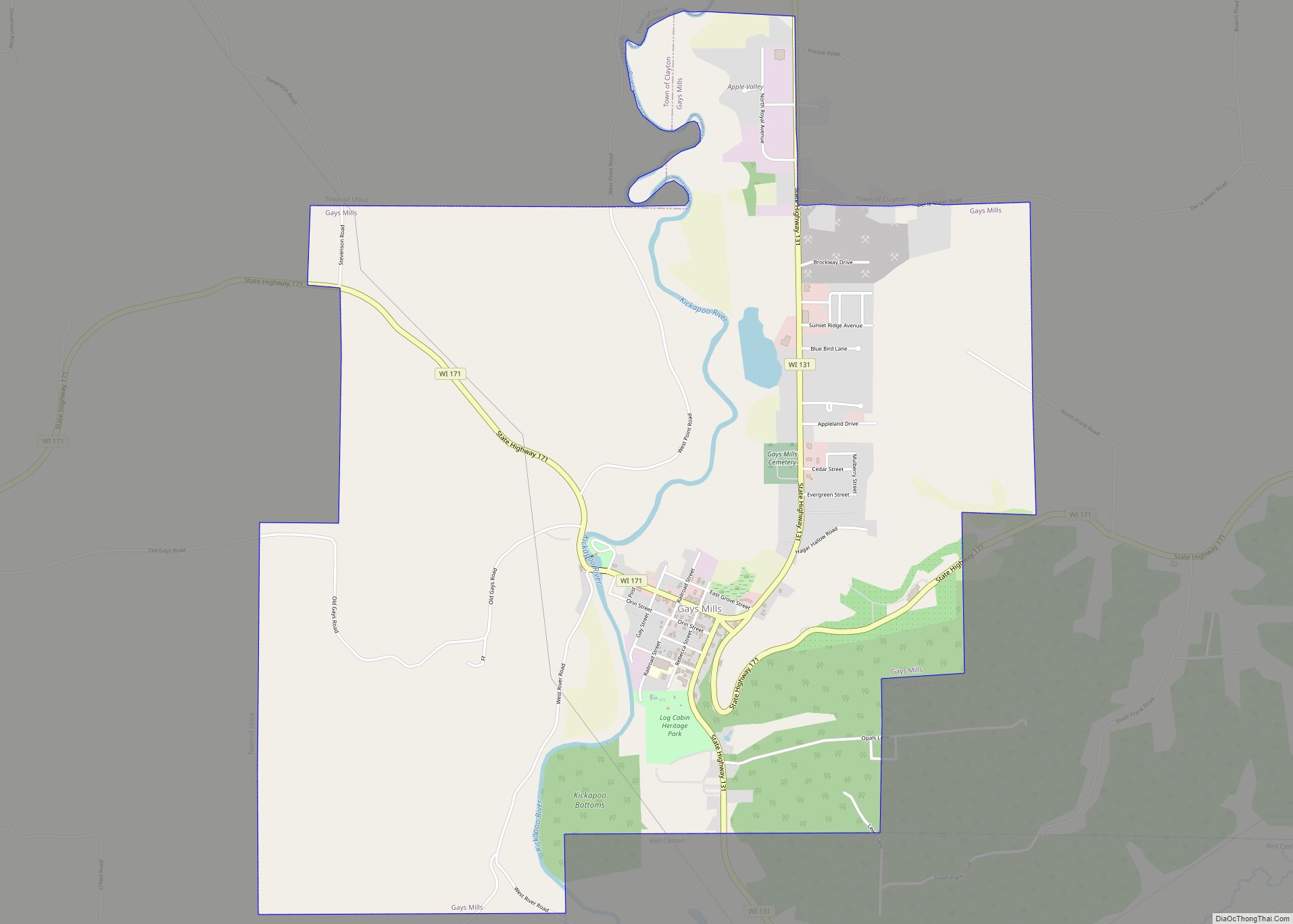
Map of Bruce village, Wisconsin

Map of Bruce village, Wisconsin

Bruce is a village in Rusk County, Wisconsin, United States. The population was 779 at the 2010 census. The village was founded in 1884 by the Sault Ste. Marie Land and Improvement Company. The land company was incorporated and led by the principal officers of the Minneapolis, Sault Ste. Marie and Atlantic Railway, which operated … Read more

Map of Campbellsport village

Map of Campbellsport village

Campbellsport is a village in Fond du Lac County, Wisconsin, United States. The population was 2,016 at the 2010 census. Campbellsport village overview: Name: Campbellsport village LSAD Code: 47 LSAD Description: village (suffix) State: Wisconsin County: Fond du Lac County Elevation: 1,027 ft (313 m) Total Area: 1.36 sq mi (3.51 km²) Land Area: 1.33 sq mi (3.46 km²) Water Area: 0.02 sq mi (0.06 km²) … Read more

Map of Camp Douglas village

Map of Camp Douglas village

Camp Douglas is a village in Juneau County, Wisconsin, United States. The population was 601 at the 2010 census. Camp Douglas is home to Volk Field Air National Guard Base. Camp Douglas village overview: Name: Camp Douglas village LSAD Code: 47 LSAD Description: village (suffix) State: Wisconsin County: Juneau County Elevation: 942 ft (287 m) Total Area: … Read more

Map of Cameron village, Wisconsin

Map of Cameron village, Wisconsin

Cameron is a village in Barron County in the U.S. state of Wisconsin. The population was 1,783 at the 2010 census. Cameron village overview: Name: Cameron village LSAD Code: 47 LSAD Description: village (suffix) State: Wisconsin County: Barron County Total Area: 2.66 sq mi (6.90 km²) Land Area: 2.62 sq mi (6.79 km²) Water Area: 0.04 sq mi (0.11 km²) Total Population: 1,783 Population … Read more

Map of Cambridge village, Wisconsin

Map of Cambridge village, Wisconsin

Cambridge is a village in Dane (mostly) and Jefferson counties in the U.S. state of Wisconsin. The population was 1,638 at the 2020 census. Of this, 1,539 were in Dane County, and 99 were in Jefferson County. The Dane County portion of Cambridge is part of the Madison Metropolitan Statistical Area, while the Jefferson County … Read more

Map of Cambria village, Wisconsin

Map of Cambria village, Wisconsin

Cambria is a village in Columbia County, Wisconsin, United States. The population was 767 at the 2010 census. It is part of the Madison Metropolitan Statistical Area. Cambria village overview: Name: Cambria village LSAD Code: 47 LSAD Description: village (suffix) State: Wisconsin County: Columbia County Elevation: 915 ft (279 m) Total Area: 1.03 sq mi (2.67 km²) Land Area: 0.98 sq mi … Read more

Map of Caledonia village, Wisconsin

Map of Caledonia village, Wisconsin

Caledonia is a village in Racine County, Wisconsin, United States. The population was 25,361 at the 2020 census. The residential community of Franksville is located within the village. Franksville is a former census-designated place. The residential neighborhood of Husher is also located within the village. Caledonia village overview: Name: Caledonia village LSAD Code: 47 LSAD … Read more

Map of Cedar Grove village, Wisconsin

Map of Cedar Grove village, Wisconsin

Cedar Grove is a village in Sheboygan County, Wisconsin, United States, within the Town of Holland. The population was 2,113 at the 2010 census. It is included in the Sheboygan, Wisconsin Metropolitan Statistical Area. Cedar Grove village overview: Name: Cedar Grove village LSAD Code: 47 LSAD Description: village (suffix) State: Wisconsin County: Sheboygan County Elevation: … Read more

Map of Cadott village

Map of Cadott village

Cadott is a village in Chippewa County in the U.S. state of Wisconsin. The population was 1,437 at the 2010 census. Cadott village overview: Name: Cadott village LSAD Code: 47 LSAD Description: village (suffix) State: Wisconsin County: Chippewa County Elevation: 984 ft (300 m) Total Area: 3.48 sq mi (9.01 km²) Land Area: 3.40 sq mi (8.81 km²) Water Area: 0.07 sq mi (0.19 km²) Total … Read more

Map of Cecil village, Wisconsin

Map of Cecil village, Wisconsin

Cecil is a village in Shawano County, Wisconsin, United States. The population was 570 at the 2010 census. Cecil village overview: Name: Cecil village LSAD Code: 47 LSAD Description: village (suffix) State: Wisconsin County: Shawano County Elevation: 807 ft (246 m) Total Area: 1.80 sq mi (4.66 km²) Land Area: 1.79 sq mi (4.64 km²) Water Area: 0.01 sq mi (0.03 km²) Total Population: 570 Population … Read more

Map of Cable CDP

Map of Cable CDP

Cable is an unincorporated, census-designated place located in the town of Cable, Bayfield County, Wisconsin, United States. The community is located 16 miles (26 km) northeast of the city of Hayward on U.S. Highway 63. Cable has a post office with ZIP code 54821. As of the 2010 census, its population was 206. Cable CDP overview: … Read more

Map of Cazenovia village, Wisconsin

Map of Cazenovia village, Wisconsin

Cazenovia is a village in Richland and Sauk Counties in the U.S. state of Wisconsin. The population was 318 at the 2010 census. Of this, 314 were in Richland County, and only 4 were in Sauk County. Cazenovia village overview: Name: Cazenovia village LSAD Code: 47 LSAD Description: village (suffix) State: Wisconsin County: Richland County, … Read more