Map of Lake Camelot CDP, Wisconsin
Lake Camelot is a census-designated place in the town of Rome, Adams County, Wisconsin, United States. Its population was 826 as of the 2010 census. Lake Camelot CDP overview: Name: Lake Camelot CDP LSAD Code: 57 LSAD Description: CDP (suffix) State: Wisconsin County: Adams County Elevation: 1,020 ft (310 m) Total Area: 4.391 sq mi (11.37 km²) Land Area: 3.774 sq mi ... Read more
Map of Lake Camelot CDP, Wisconsin
Map of Lake Arrowhead CDP, Wisconsin
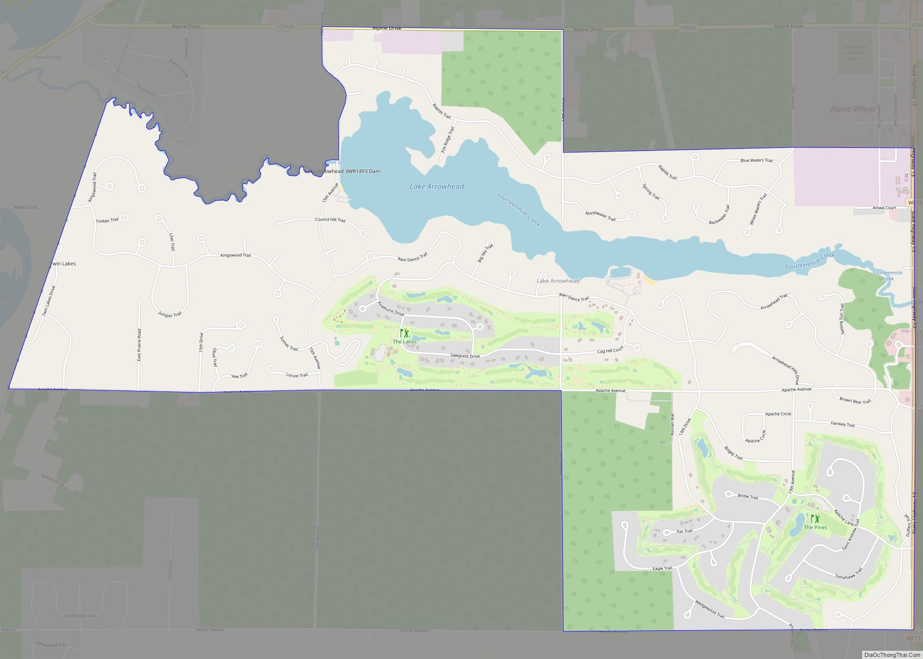
Lake Arrowhead is a census-designated place in the town of Rome, Adams County, Wisconsin, United States. Its population was 838 as of the 2010 census. Lake Arrowhead CDP overview: Name: Lake Arrowhead CDP LSAD Code: 57 LSAD Description: CDP (suffix) State: Wisconsin County: Adams County Elevation: 988 ft (301 m) Total Area: 5.502 sq mi (14.25 km²) Land Area: 5.032 sq mi ... Read more
Map of Lake Arrowhead CDP, Wisconsin
Map of Lake Wissota CDP
Lake Wissota is a census-designated place (CDP) in the town of Lafayette in Chippewa County in the U.S. state of Wisconsin. The population was 2,738 at the 2010 census. The CDP, known locally as Lake Wissota Village, is located along the southern shores of Lake Wissota. Lake Wissota CDP overview: Name: Lake Wissota CDP LSAD ... Read more
Map of Lake Wissota CDP
Map of Lake Wisconsin CDP
Lake Wisconsin is a census-designated place (CDP) in Columbia and Sauk counties, in the towns of Lodi and Merrimac, in Wisconsin, United States. The population was 4,189 at the 2010 census. The Columbia County portion of the Lake Wisconsin is part of the Madison Metropolitan Statistical Area, while the Sauk County portion is part of ... Read more
Map of Lake Wisconsin CDP
Map of Lake Tomahawk CDP, Wisconsin
Lake Tomahawk is an unincorporated census-designated place located in the town of Lake Tomahawk, Oneida County, Wisconsin, United States. Lake Tomahawk is located on Wisconsin Highway 47 15 miles (24 km) northwest of Rhinelander. Lake Tomahawk has a post office with ZIP code 54539. As of the 2010 census, its population was 228. Lake Tomahawk CDP ... Read more
Map of Lake Tomahawk CDP, Wisconsin
Map of Lake Sherwood CDP, Wisconsin
Lake Sherwood is a census-designated place in the town of Rome, Adams County, Wisconsin, United States. Its population was 372 as of the 2010 census. Lake Sherwood CDP overview: Name: Lake Sherwood CDP LSAD Code: 57 LSAD Description: CDP (suffix) State: Wisconsin County: Adams County Elevation: 1,014 ft (309 m) Total Area: 1.404 sq mi (3.64 km²) Land Area: 1.054 sq mi ... Read more
Map of Lake Sherwood CDP, Wisconsin
Map of Lewis CDP, Wisconsin
Lewis is an unincorporated census-designated place in the town of Clam Falls, Polk County, Wisconsin, United States. Lewis is located on Wisconsin Highway 35 4.5 miles (7.2 km) northeast of Frederic. As of the 2010 census, its population is 164. Lewis CDP overview: Name: Lewis CDP LSAD Code: 57 LSAD Description: CDP (suffix) State: Wisconsin County: ... Read more
Map of Lewis CDP, Wisconsin
Map of Leopolis CDP
Leopolis is an unincorporated census-designated place in Shawano County, Wisconsin, United States. The community is located on County Highway D, between the towns of Herman, and Pella, Wisconsin. As of the 2010 census, its population is 87. Leopolis CDP overview: Name: Leopolis CDP LSAD Code: 57 LSAD Description: CDP (suffix) State: Wisconsin County: Shawano County ... Read more
Map of Leopolis CDP
Map of Lena village, Wisconsin
Lena is a town in Oconto County, Wisconsin, United States. The population was 769 at the 2000 census. The Village of Lena is adjacent to the town. Lena village overview: Name: Lena village LSAD Code: 47 LSAD Description: village (suffix) State: Wisconsin County: Oconto County FIPS code: 5543325 Online Interactive Map Lena online map. Source: ... Read more
Map of Lena village, Wisconsin
Map of Long Lake CDP, Wisconsin
Long Lake is an unincorporated census-designated place in the town of Long Lake, Florence County, Wisconsin, United States. Long Lake is located on the eastern shore of Long Lake along Wisconsin Highway 139, 21 miles (34 km) west-southwest of Florence. As of the 2020 census, its population was 59. The community became a census-designated place in ... Read more
Map of Long Lake CDP, Wisconsin
Map of Legend Lake CDP
Legend Lake is a census-designated place (CDP) in Menominee County, Wisconsin, Wisconsin, United States, on the Menominee Indian Reservation. The population was 1,670 at the 2020 census. Legend Lake CDP overview: Name: Legend Lake CDP LSAD Code: 57 LSAD Description: CDP (suffix) State: Wisconsin County: Menominee County Elevation: 458 ft (140 m) Total Area: 20.5 sq mi (53.1 km²) Land ... Read more
Map of Legend Lake CDP
Map of Lone Rock village, Wisconsin
Lone Rock is a village in Richland County, Wisconsin, United States. The population was 888 at the 2010 census. The village is named after a sandstone outcrop. Lone Rock village overview: Name: Lone Rock village LSAD Code: 47 LSAD Description: village (suffix) State: Wisconsin County: Richland County Elevation: 709 ft (216 m) Total Area: 1.00 sq mi (2.58 km²) Land ... Read more
Map of Lone Rock village, Wisconsin