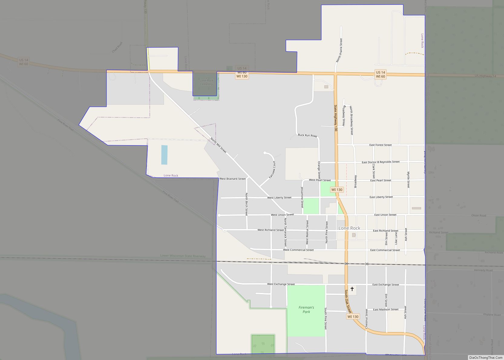
Lone Rock is a village in Richland County, Wisconsin, United States. The population was 888 at the 2010 census. The village is named after a sandstone outcrop.
| Name: | Lone Rock village |
|---|---|
| LSAD Code: | 47 |
| LSAD Description: | village (suffix) |
| State: | Wisconsin |
| County: | Richland County |
| Elevation: | 709 ft (216 m) |
| Total Area: | 1.00 sq mi (2.58 km²) |
| Land Area: | 1.00 sq mi (2.58 km²) |
| Water Area: | 0.00 sq mi (0.00 km²) |
| Total Population: | 888 |
| Population Density: | 838.35/sq mi (323.69/km²) |
| Area code: | 608 |
| FIPS code: | 5545575 |
| GNISfeature ID: | 1568511 |
| Website: | www.lonerockwisconsin.com |
Online Interactive Map
Click on ![]() to view map in "full screen" mode.
to view map in "full screen" mode.
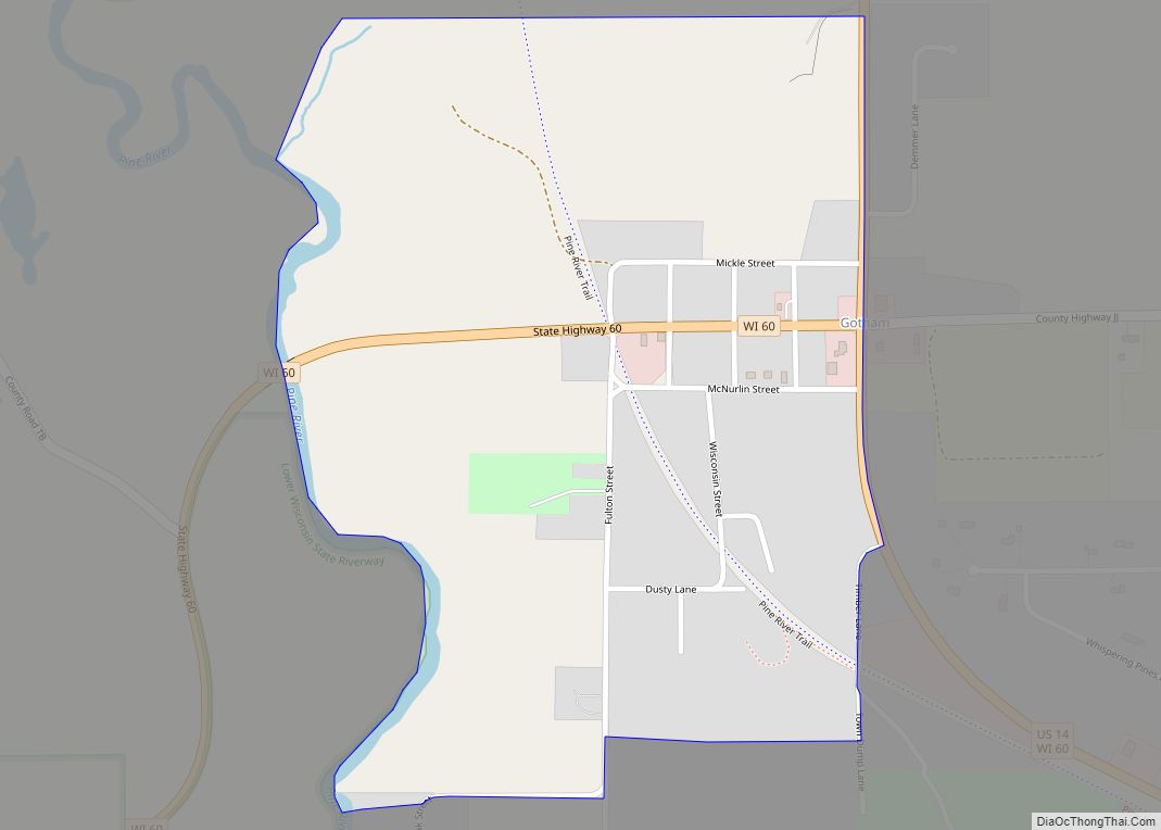
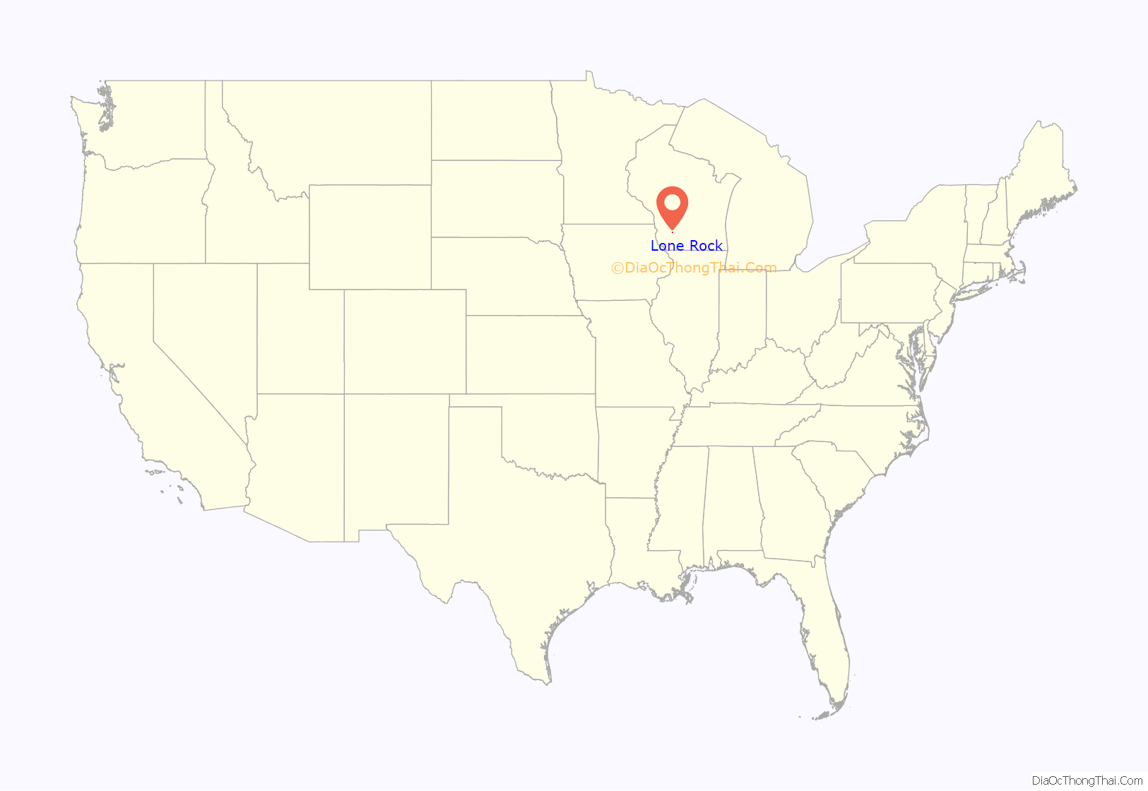
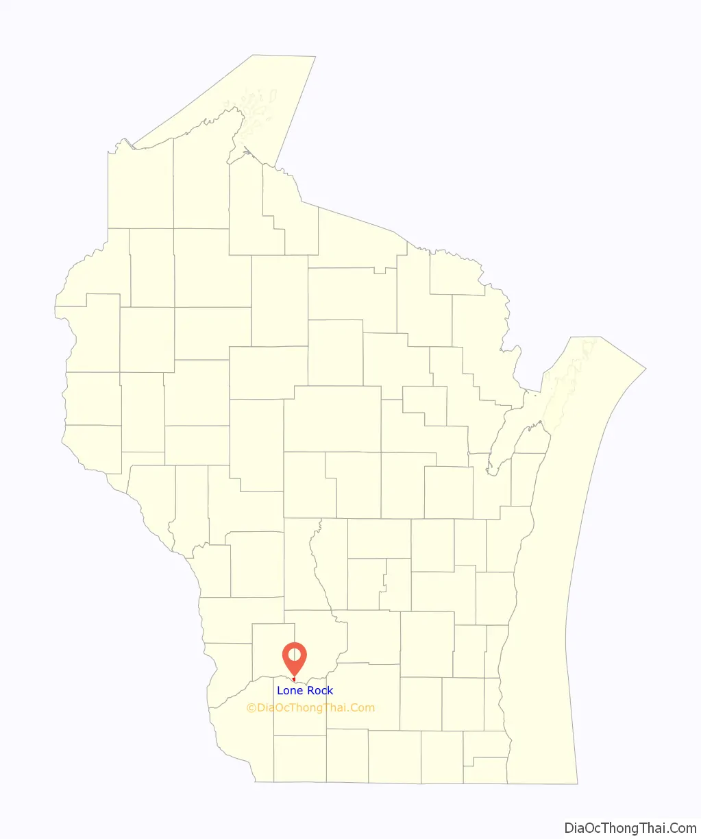
Lone Rock location map. Where is Lone Rock village?
History
According to a sign near the site, “The Lone Rock – At one time a massive piece of sandstone stood a short distance from the north bank of the Wisconsin River. The rock became a landmark for early river raftsmen and was known as ‘Lone Rock’ from which the town took its name. The rock was cut and used for basements and foundations in the village. What is left of the rock is located west of Highway 130 across from Brace Park.”
The community was founded in 1856 and incorporated as a village in 1866. Among its best-known residents is Bertha E. Reynolds, or “Dr. Bertha,” the physician who served the community in the early twentieth century. A park and street in Lone Rock honor Reynolds.
Lone Rock Road Map
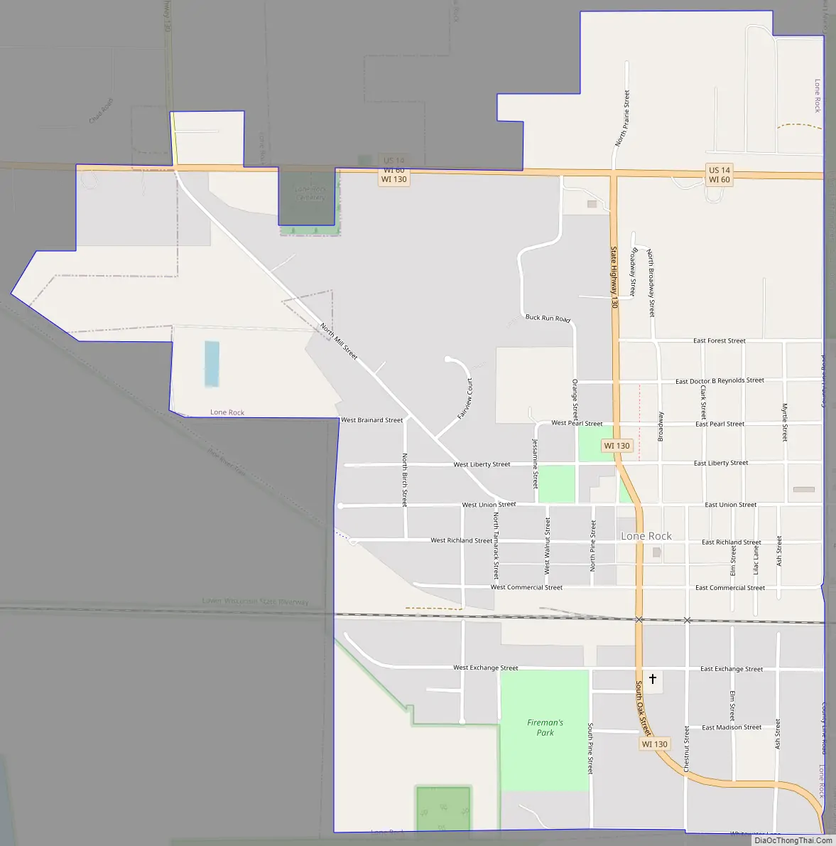
Lone Rock city Satellite Map

Geography
Lone Rock is located at 43°11′3″N 90°11′54″W / 43.18417°N 90.19833°W / 43.18417; -90.19833 (43.184165, -90.198384).
According to the United States Census Bureau, the village has a total area of 1.11 square miles (2.87 km), all of it land.
The community is on the north side of the Wisconsin River on US Route 14 at the junction of State Highway 130.
See also
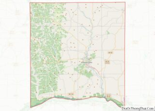
Map of Wisconsin State and its subdivision:- Adams
- Ashland
- Barron
- Bayfield
- Brown
- Buffalo
- Burnett
- Calumet
- Chippewa
- Clark
- Columbia
- Crawford
- Dane
- Dodge
- Door
- Douglas
- Dunn
- Eau Claire
- Florence
- Fond du Lac
- Forest
- Grant
- Green
- Green Lake
- Iowa
- Iron
- Jackson
- Jefferson
- Juneau
- Kenosha
- Kewaunee
- La Crosse
- Lafayette
- Lake Michigan
- Lake Superior
- Langlade
- Lincoln
- Manitowoc
- Marathon
- Marinette
- Marquette
- Menominee
- Milwaukee
- Monroe
- Oconto
- Oneida
- Outagamie
- Ozaukee
- Pepin
- Pierce
- Polk
- Portage
- Price
- Racine
- Richland
- Rock
- Rusk
- Saint Croix
- Sauk
- Sawyer
- Shawano
- Sheboygan
- Taylor
- Trempealeau
- Vernon
- Vilas
- Walworth
- Washburn
- Washington
- Waukesha
- Waupaca
- Waushara
- Winnebago
- Wood
- Alabama
- Alaska
- Arizona
- Arkansas
- California
- Colorado
- Connecticut
- Delaware
- District of Columbia
- Florida
- Georgia
- Hawaii
- Idaho
- Illinois
- Indiana
- Iowa
- Kansas
- Kentucky
- Louisiana
- Maine
- Maryland
- Massachusetts
- Michigan
- Minnesota
- Mississippi
- Missouri
- Montana
- Nebraska
- Nevada
- New Hampshire
- New Jersey
- New Mexico
- New York
- North Carolina
- North Dakota
- Ohio
- Oklahoma
- Oregon
- Pennsylvania
- Rhode Island
- South Carolina
- South Dakota
- Tennessee
- Texas
- Utah
- Vermont
- Virginia
- Washington
- West Virginia
- Wisconsin
- Wyoming