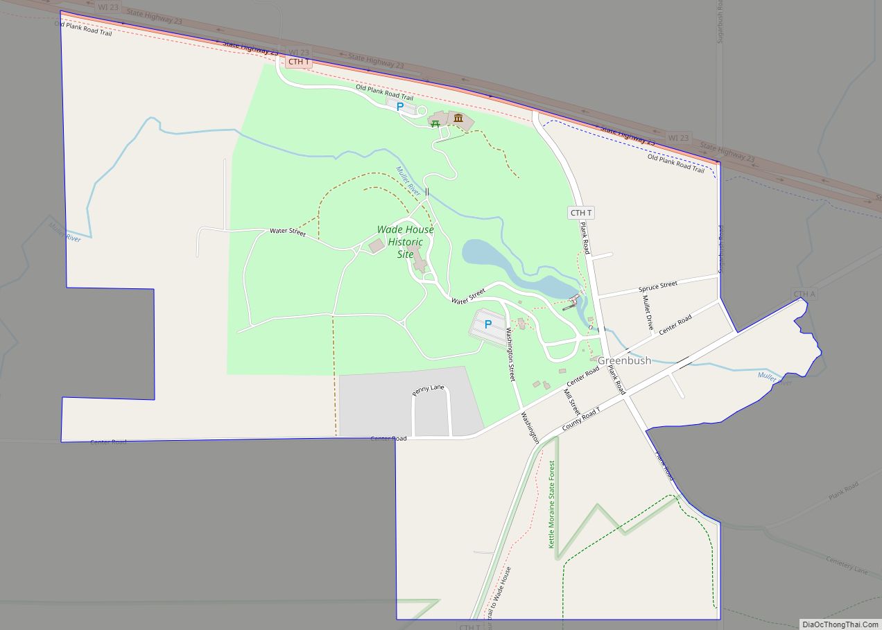
Map of Three Lakes CDP, Wisconsin

Map of Three Lakes CDP, Wisconsin

Three Lakes is an unincorporated census-designated place located in the town of Three Lakes, Oneida County, Wisconsin, United States. Three Lakes is located at the junction of U.S. Route 45 and Wisconsin Highway 32 9 miles (14 km) south-southeast of Eagle River. Three Lakes has a post office with ZIP code 54562. As of the 2010 … Read more

Map of Thorp city, Wisconsin

Map of Thorp city, Wisconsin

Thorp is a city in Clark County in the U.S. state of Wisconsin. The population was 1,621 at the 2010 census. The city is located partially within the Town of Thorp and partially within the Town of Withee. Thorp city overview: Name: Thorp city LSAD Code: 25 LSAD Description: city (suffix) State: Wisconsin County: Clark … Read more

Map of Thornton CDP, Wisconsin

Map of Thornton CDP, Wisconsin

Thornton is a census-designated place in the town of Richmond, Shawano County, Wisconsin, United States. Its population was 65 as of the 2010 census. Thornton CDP overview: Name: Thornton CDP LSAD Code: 57 LSAD Description: CDP (suffix) State: Wisconsin County: Shawano County Elevation: 853 ft (260 m) Total Area: 0.259 sq mi (0.67 km²) Land Area: 0.259 sq mi (0.67 km²) Water Area: … Read more

Map of Thiensville village

Map of Thiensville village

Thiensville is a village in Ozaukee County, Wisconsin, United States. Located on the west bank of a bend in the Milwaukee River, the community is bordered on all sides by the City of Mequon and is a suburb in the Milwaukee metropolitan area. The population was 3,235 at the 2010 census. Thiensville was the site … Read more

Map of Theresa village, Wisconsin

Map of Theresa village, Wisconsin

Theresa is a town in Dodge County, Wisconsin, United States. As of the census in 2000, the town population was 1,080. The Village of Theresa is located within the town. The unincorporated community of Theresa Station is located in the town. The unincorporated community of Hochheim is also located partially in the town. Theresa village … Read more

Map of Tennyson village, Wisconsin

Map of Tennyson village, Wisconsin

Tennyson is a village in Grant County, Wisconsin, United States, originally called Dutch Hollow. The population was 355 at the 2010 census. Tennyson village overview: Name: Tennyson village LSAD Code: 47 LSAD Description: village (suffix) State: Wisconsin County: Grant County Elevation: 932 ft (284 m) Total Area: 0.43 sq mi (1.12 km²) Land Area: 0.43 sq mi (1.12 km²) Water Area: 0.00 sq mi (0.00 km²) … Read more

Map of Taylor village, Wisconsin

Map of Taylor village, Wisconsin

Taylor is a village in Jackson County, Wisconsin, United States, along the Trempealeau River. The population was 484 at the 2020 census. Taylor village overview: Name: Taylor village LSAD Code: 47 LSAD Description: village (suffix) State: Wisconsin County: Jackson County Elevation: 892 ft (272 m) Total Area: 0.73 sq mi (1.89 km²) Land Area: 0.73 sq mi (1.89 km²) Water Area: 0.00 sq mi (0.00 km²) … Read more

Map of Taycheedah CDP

Map of Taycheedah CDP

Taycheedah, Wisconsin is an unincorporated census-designated place in the Town of Taycheedah in Fond du Lac County, Wisconsin. The community is located adjacent to the city of Fond du Lac and Lake Winnebago. As of the 2010 census, its population is 704. Taycheedah calls itself the “Sheepshead Fishing Center of the World”. U.S. Route 151 … Read more

Map of Tainter Lake CDP

Map of Tainter Lake CDP

Tainter Lake is a census-designated place (CDP) in part of the Town of Tainter, Dunn County, Wisconsin, and part of the Town of Red Cedar, Dunn County, Wisconsin, United States. The population was 2,550 at the 2020 census. Tainter Lake CDP is located along the shores of Tainter Lake, a reservoir on the Red Cedar … Read more

Map of Sussex village, Wisconsin

Map of Sussex village, Wisconsin

Sussex is a village in Waukesha County, Wisconsin, United States, about 19 miles (31 km) northwest of Milwaukee and 9 miles (14 km) north of Waukesha. The village is 7.24 square miles (19 km) at an elevation of 930 feet. The population was 11,487 at the 2020 census. It is part of the Milwaukee metropolitan area. Sussex village … Read more

Map of Suring village

Map of Suring village

Suring is a village in Oconto County, Wisconsin, United States, along the 45th parallel. The population was 544 at the 2010 census. It is part of the Green Bay Metropolitan Statistical Area. Suring village overview: Name: Suring village LSAD Code: 47 LSAD Description: village (suffix) State: Wisconsin County: Oconto County Elevation: 801 ft (244 m) Total Area: … Read more

Map of Tomahawk city

Map of Tomahawk city

Tomahawk is a city in Lincoln County, Wisconsin, United States. The population was 3,441 at the 2020 census. The city is located to the northeast of the Town of Tomahawk and is not contiguous with it. Tomahawk city overview: Name: Tomahawk city LSAD Code: 25 LSAD Description: city (suffix) State: Wisconsin County: Lincoln County Total … Read more