Rock Springs is a city in Sweetwater County, Wyoming, United States. The population was 23,036 at the 2010 census, making it the fifth most populated city in the state of Wyoming, and the most populous city in Sweetwater County. Rock Springs is the principal city of the Rock Springs micropolitan statistical area, which has a population of 37,975. Rock Springs is known as the Home of 56 Nationalities because of the influx of immigrants from all over the world who came to work in the coal mines that supplied the fuel to power the steam engines of the Union Pacific Railroad. The city’s rich cultural heritage is celebrated each summer on International Day, a festival where the foods, costumes, and traditions of residents’ ancestors are recreated and enjoyed at Bunning Park in downtown Rock Springs.
Rock Springs is the site of Western Wyoming Community College and Wyoming’s Big Show, a yearly event with a carnival and concerts which is held at the Sweetwater County Events Complex.
Rock Springs is located in an energy-rich region with many oil and natural gas wells.
| Name: | Rock Springs city |
|---|---|
| LSAD Code: | 25 |
| LSAD Description: | city (suffix) |
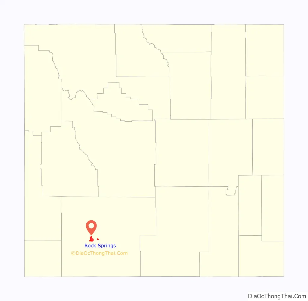
| State: | Wyoming |
| County: | Sweetwater County |
| Elevation: | 6,388 ft (1,947 m) |
| Total Area: | 19.75 sq mi (51.16 km²) |
| Land Area: | 19.75 sq mi (51.16 km²) |
| Water Area: | 0.00 sq mi (0.00 km²) |
| Total Population: | 23,036 |
| Population Density: | 1,146.81/sq mi (442.78/km²) |
| Area code: | 307 |
| FIPS code: | 5667235 |
| GNISfeature ID: | 1593588 |
| Website: | www.rswy.net |
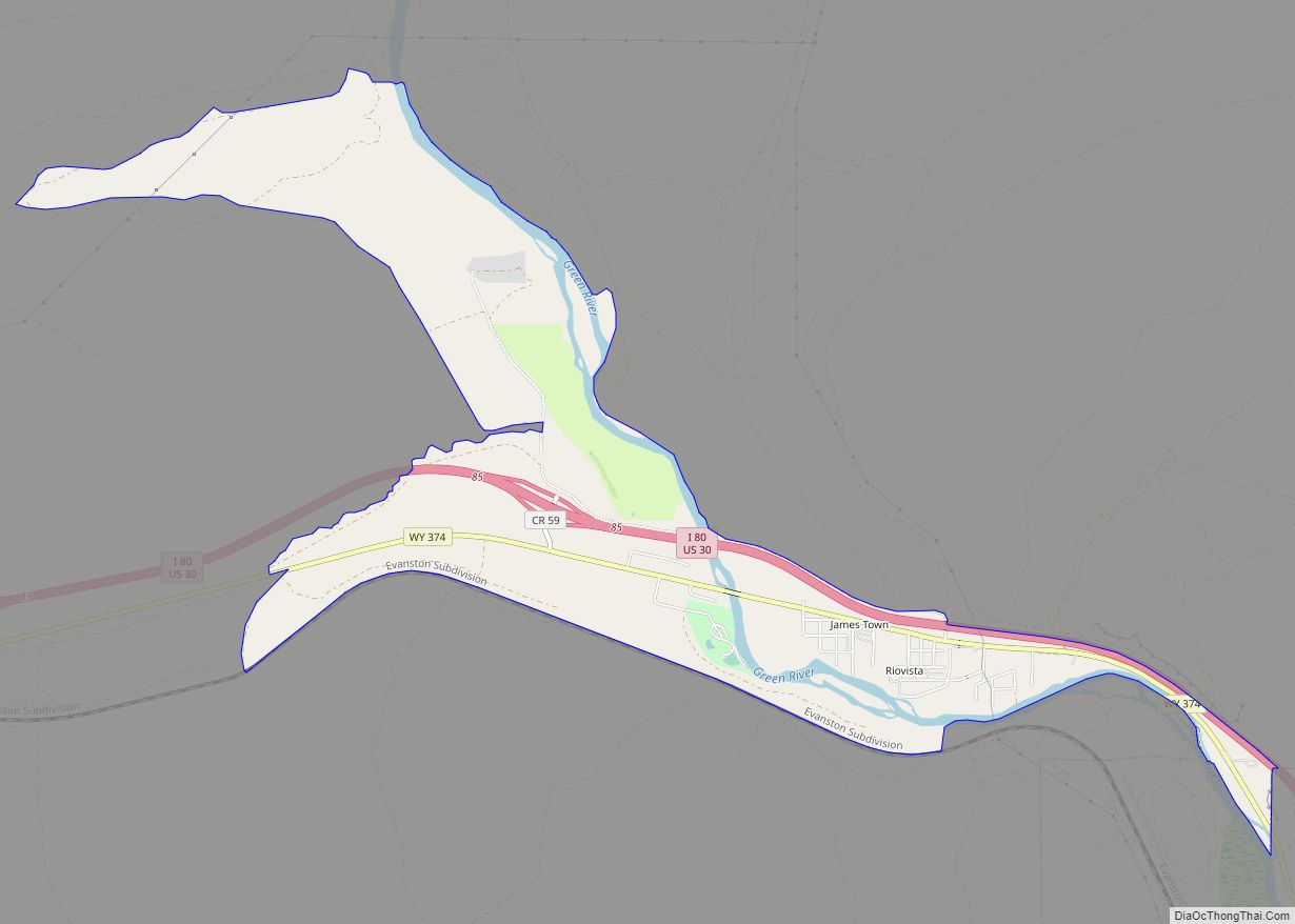
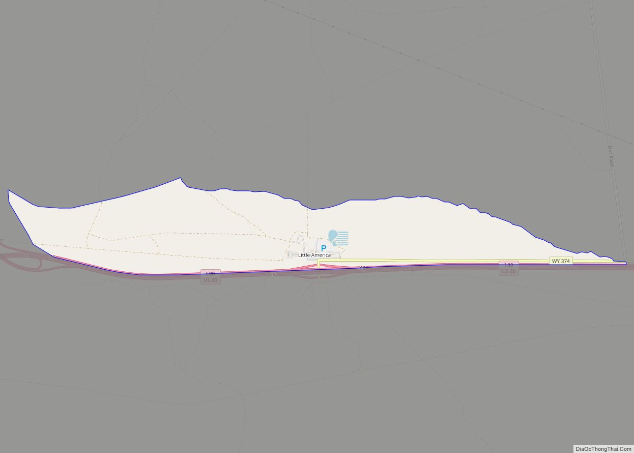
Online Interactive Map
Click on ![]() to view map in "full screen" mode.
to view map in "full screen" mode.
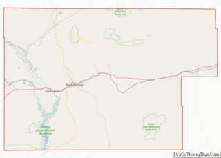
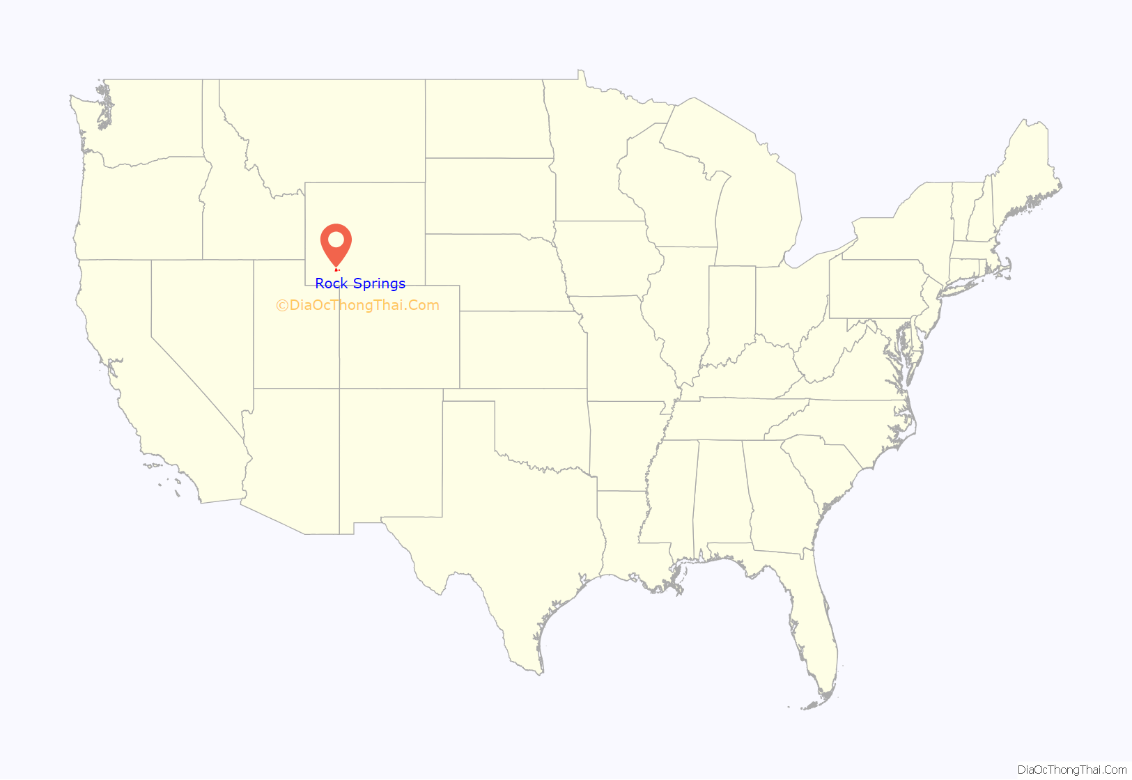
Rock Springs location map. Where is Rock Springs city?
History
Rock Springs derives its name from a rock spring which flowed in the Number 6 district in the northern part of town. An erroneous story had indicated that the spring was found by a lost Pony Express rider, but the spring station was known to Jim Bridger before 1860; the Overland Stage station was located nearby. The spring disappeared when the coal mine operations interrupted the underground flow. Later an ‘S’ was added to the name making it “Rock Springs”.
Through the years, water supplies have been a problem to Rock Springs. In the early days, Ed Cleg hauled domestic water from the sulfur spring north of Rock Springs and charged $.25 a barrel. With the mining operations, the water flow was interrupted and water was hauled from Green River and Point of Rocks. Beginning in 1887, a water main was started from the Green River and completed in 1888 to bring a continuous supply of water to Rock Springs.
Rock Springs has a multi-ethnic heritage; locals called it the 57 Variety Town. The first immigrants were brought in by the railroad and coal mining companies. The Welsh and British people were initially most populous. Later, Irish, Blacks and refugees from the Southern part of the United States also came. The Scandinavian people were represented with a heavy Mormon recruitment.
One of the worst incidents of anti-immigrant violence in American history, known as the Rock Springs Massacre, occurred on September 2, 1885, whereby White miners slaughtered their Chinese counterparts due to anti-Chinese sentiment. There are still remains of the old coal mining towns outside of Rock Springs.
On June 10, 1892, Rock Springs National Bank opened on 515 S Main St, across from the Union Pacific depot. The original sandstone building was designed by Mayor H.H. Edgar who chose an Italianate style. In 1907, when John Hay Sr. assumed control of the business, the location moved to C Street. RSNB owned the original building until 1921 when it was sold to Anton Mengoni. Hay Sr. navigated the bank through the Great Depression and World War II, before retiring in 1947. John Hay Jr., his son, then took control of the bank, having to control wild growth during Wyoming’s massive energy boom in the 1970s. Another of Hay Sr.’s sons was Archibald (Archie) Hay. Archibald was killed in France by a German plane in 1918. In his memory, Post 24 of the American Legion, chartered in 1919, was named Archie Hay Post.
Rock Springs was featured on 60 Minutes in 1977 due to corruption within the Police Department and City Government. A grand jury was called into session. The Sheriff of Sweetwater County, James Stark, testified and no wrongdoing was ever found. A follow up was filmed 20 years later for the show City Confidential. The episode was named “Rock Springs: Deadly Draw in the Wild West”.
More about the history of Rock Springs can be found at the https://www.rswy.net/department/index.php?structureid=15.
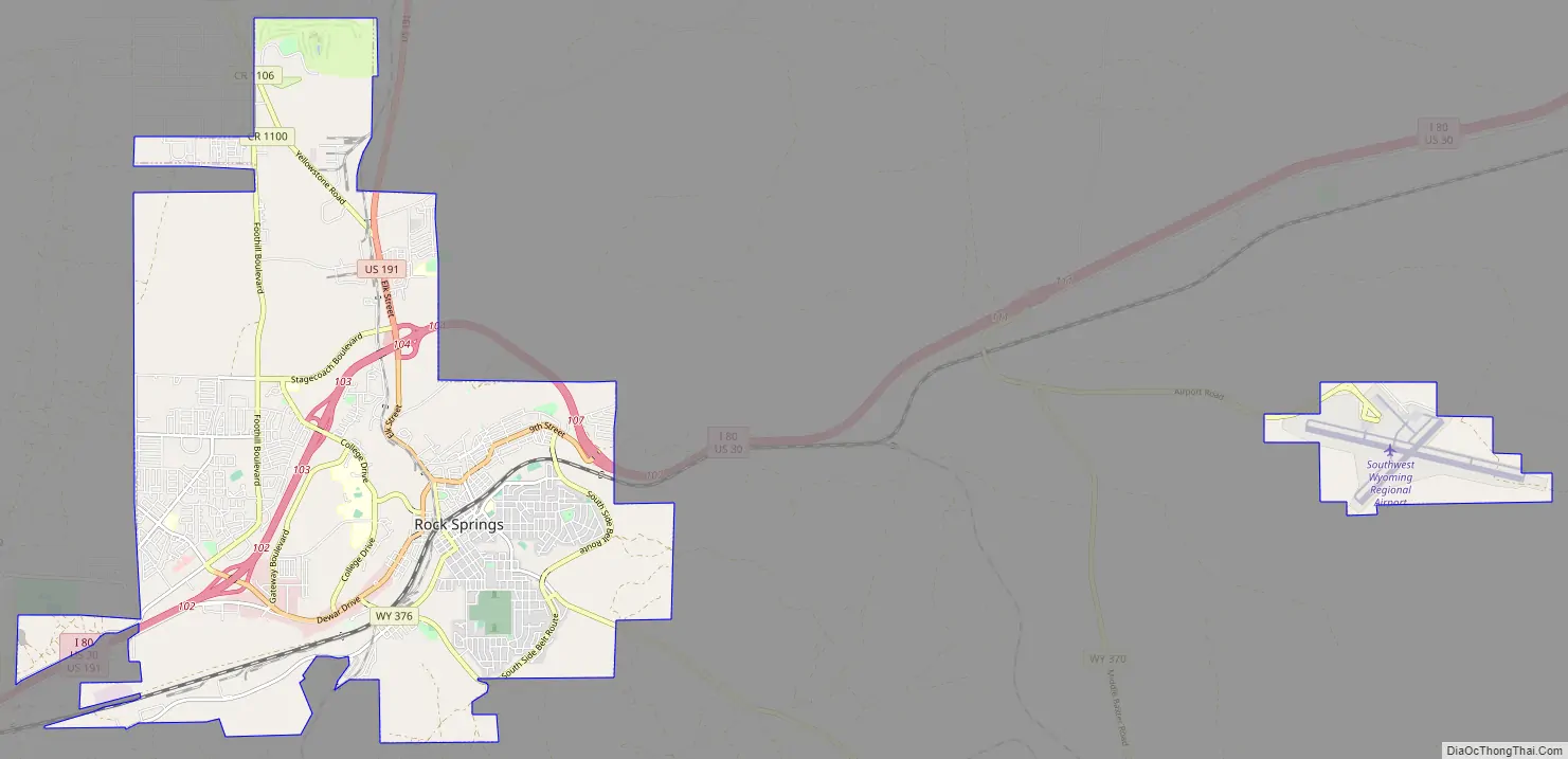
Rock Springs Road Map
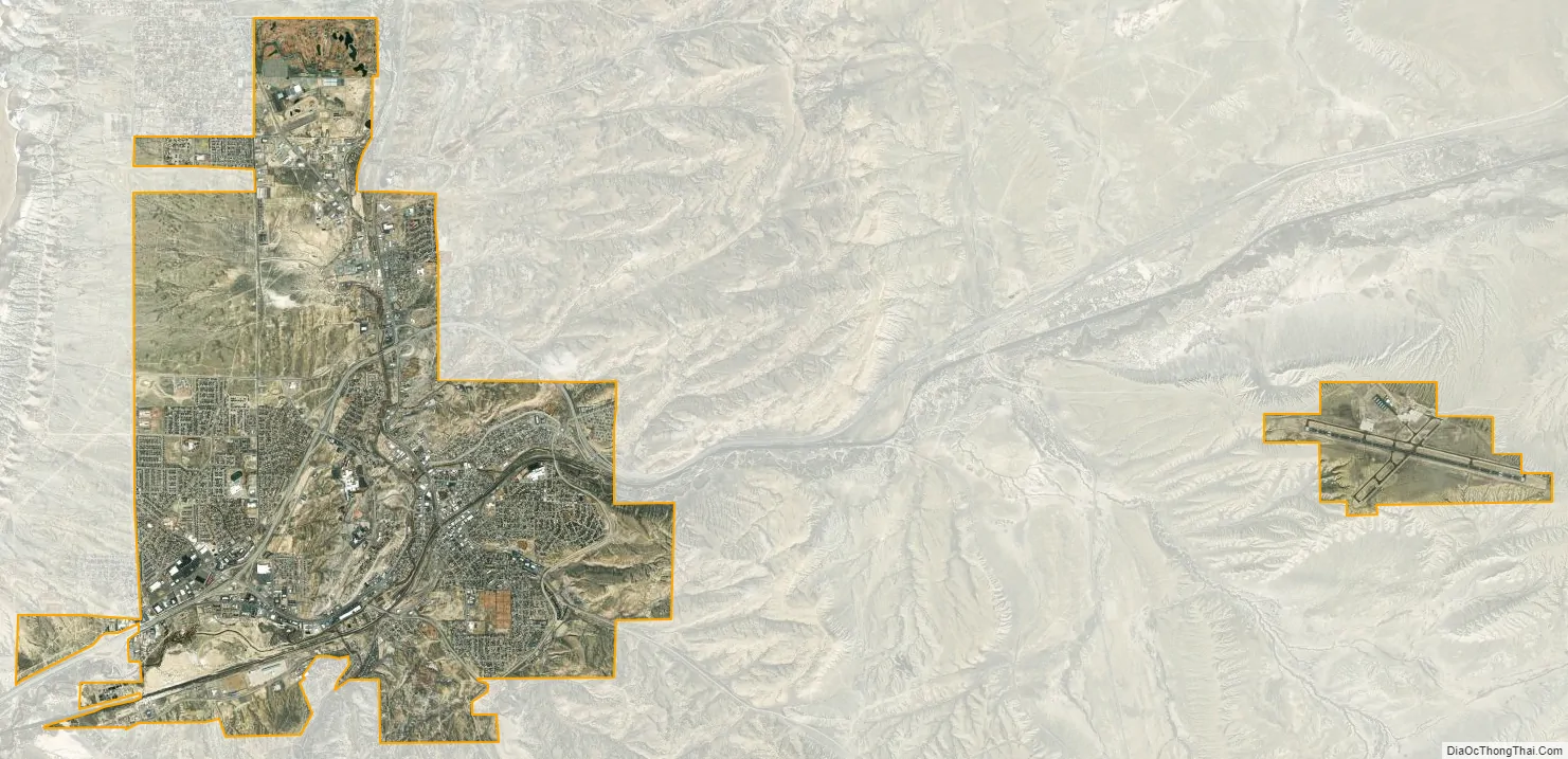
Rock Springs city Satellite Map
Geography
Rock Springs is located at 41°35′6.38″N 109°13′17.01″W / 41.5851056°N 109.2213917°W / 41.5851056; -109.2213917 (41.585106, –109.221392). According to the United States Census Bureau, the city has a total area of 19.34 square miles (50.09 km), all land.
The city is approximately 6759 feet (2060 m) above sea level.
See also
Map of Wyoming State and its subdivision: Map of other states:- Alabama
- Alaska
- Arizona
- Arkansas
- California
- Colorado
- Connecticut
- Delaware
- District of Columbia
- Florida
- Georgia
- Hawaii
- Idaho
- Illinois
- Indiana
- Iowa
- Kansas
- Kentucky
- Louisiana
- Maine
- Maryland
- Massachusetts
- Michigan
- Minnesota
- Mississippi
- Missouri
- Montana
- Nebraska
- Nevada
- New Hampshire
- New Jersey
- New Mexico
- New York
- North Carolina
- North Dakota
- Ohio
- Oklahoma
- Oregon
- Pennsylvania
- Rhode Island
- South Carolina
- South Dakota
- Tennessee
- Texas
- Utah
- Vermont
- Virginia
- Washington
- West Virginia
- Wisconsin
- Wyoming