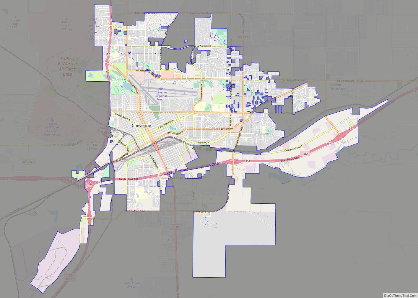
Cheyenne (/ʃaɪˈæn/ shy-AN or /ʃaɪˈɛn/ shy-EN) is the capital and most populous city of the U.S. state of Wyoming, as well as the county seat of Laramie County, with 65,132 residents, per the 2020 US Census. It is the principal city of the Cheyenne metropolitan statistical area which encompasses all of Laramie County and had 100,512 residents as of the 2020 census. Local residents named the town for the Cheyenne Native American people in 1867 when it was founded in the Dakota Territory.
Cheyenne is the northern terminus of the extensive Southern Rocky Mountain Front, which extends southward to Albuquerque, New Mexico, and includes the fast-growing Front Range Urban Corridor. Cheyenne is situated on Crow Creek and Dry Creek.
| Name: | Cheyenne city |
|---|---|
| LSAD Code: | 25 |
| LSAD Description: | city (suffix) |
| State: | Wyoming |
| County: | Laramie County |
| Founded: | 1867 |
| Elevation: | 6,086 ft (1,855 m) |
| Land Area: | 32.26 sq mi (83.55 km²) |
| Water Area: | 0.11 sq mi (0.29 km²) 0.45% |
| Population Density: | 1,991.23/sq mi (768.82/km²) |
| ZIP code: | 82001–82003, 82006–82010 |
| Area code: | 307 |
| FIPS code: | 5613900 |
| GNISfeature ID: | 1609077 |
| Website: | www.cheyennecity.org |
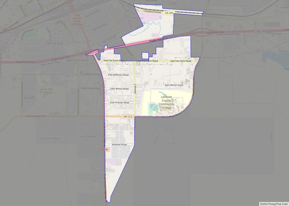
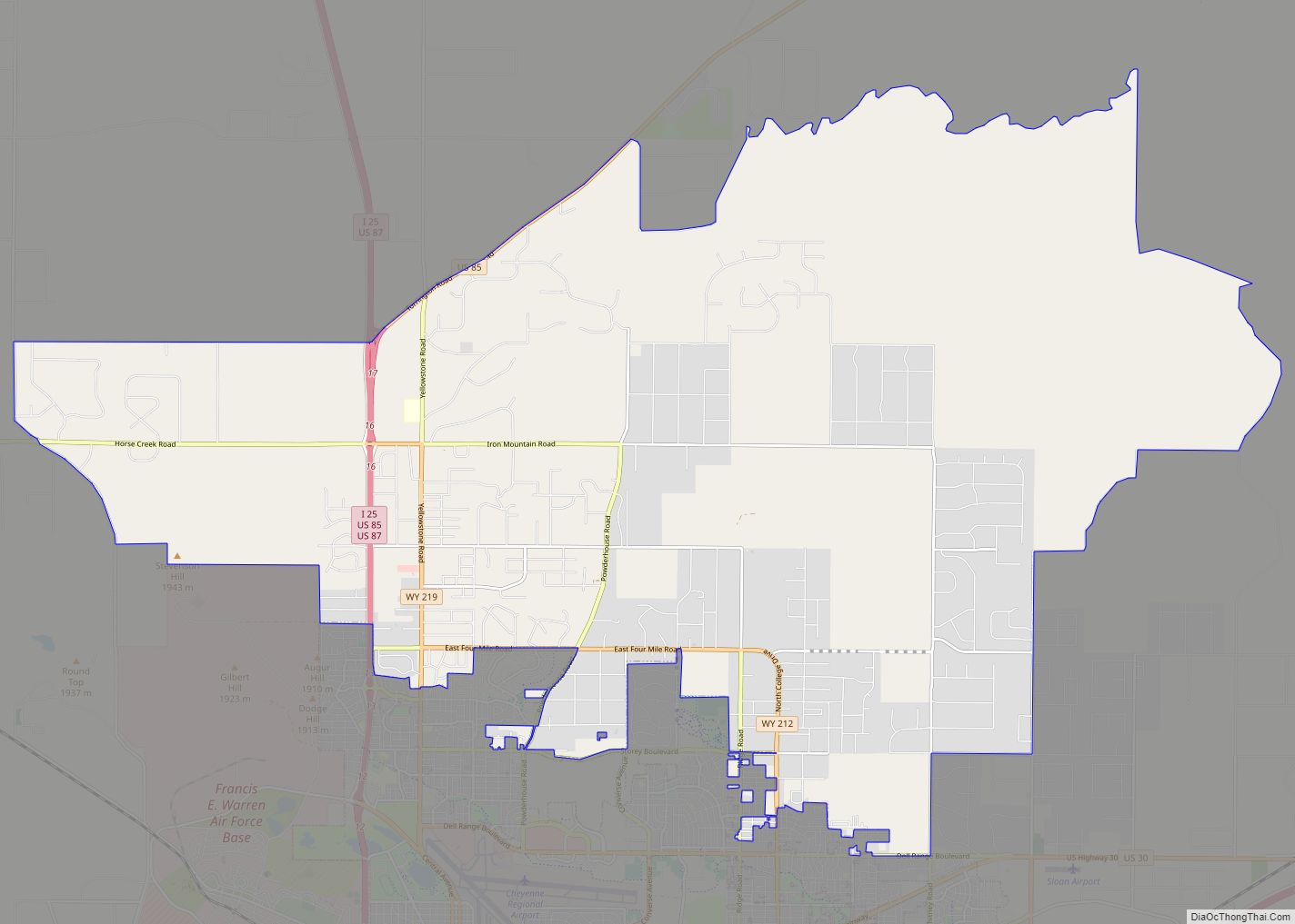
Online Interactive Map
Click on ![]() to view map in "full screen" mode.
to view map in "full screen" mode.
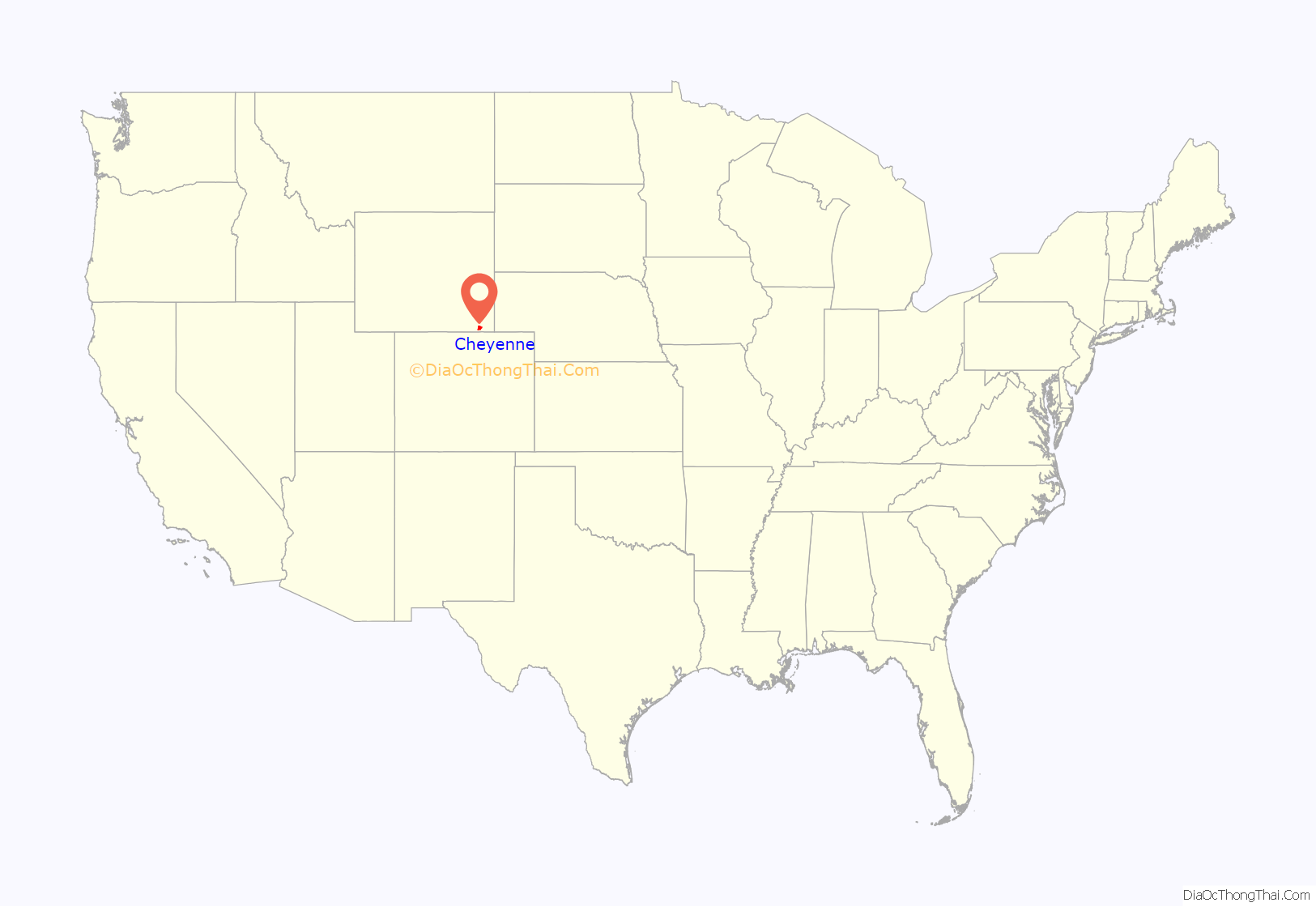
Cheyenne location map. Where is Cheyenne city?
History
At a celebration on July 4, 1867, Grenville M. Dodge of the Union Pacific Railroad announced the selection of a townsite for its mountain region headquarters adjacent to the bridge the railroad planned to build across Crow Creek in the Territory of Dakota. At the same celebration, Major General Christopher C. Augur announced the selection of a site three miles (5 km) west of Crow Creek Crossing for a U.S. Army fort to protect the railroad.
The Union Pacific Railroad platted its Crow Creek Crossing townsite on July 5, 1867. Residents named the town Cheyenne for the Cheyenne Native American people. On August 8, 1867, the Town of Cheyenne, Dakota Territory was incorporated, and on August 10, 1867, H. M. Hook was elected as Cheyenne’s first mayor. The tracks of the Union Pacific Railroad reached Cheyenne on November 13, 1867, and the first train arrived the following day. Cheyenne grew so quickly it gained the nickname of “Magic City of the Plains”.
On September 8, 1867, the United States Army established Fort D.A. Russell in honor of Brigadier General David Allen Russell. Initially a cavalry encampment, construction of the fort began the following month. The fort was renamed Fort Francis E. Warren in 1930 in honor of the first Governor of the State of Wyoming, Francis E. Warren. The fort was transferred to the new United States Air Force and was renamed Francis E. Warren Air Force Base in October 1949.
On July 25, 1868, the United States organized the Territory of Wyoming. Territorial Governor John Allen Campbell arrived in Cheyenne on May 7, 1869, and named Cheyenne the temporary territorial capital. Cheyenne has remained the only capital of Wyoming. On December 10, 1869, the first session of the Wyoming Territorial Legislature met in Cheyenne. That day, the legislature passed and Territorial Governor Campbell signed an act to re-incorporate the Town of Cheyenne, Wyoming Territory, and an act granting white women the right to vote, the first U.S. state or territory to grant suffrage to some women.
On July 10, 1890, the Territory of Wyoming was admitted to the Union as the State of Wyoming. The Wyoming State Capitol was constructed between 1886 and 1890, with further improvements being completed in 1917.
The Cheyenne Regional Airport was opened in 1920, initially serving as a stop for airmail. It soon developed into a civil-military airport, serving DC-3s and various military craft. During World War II, hundreds of B-17s, B-24s, and PBYs were outfitted and upgraded at the airfield. Today, it serves a number of military functions, and as a high-altitude testbed for civilian craft.
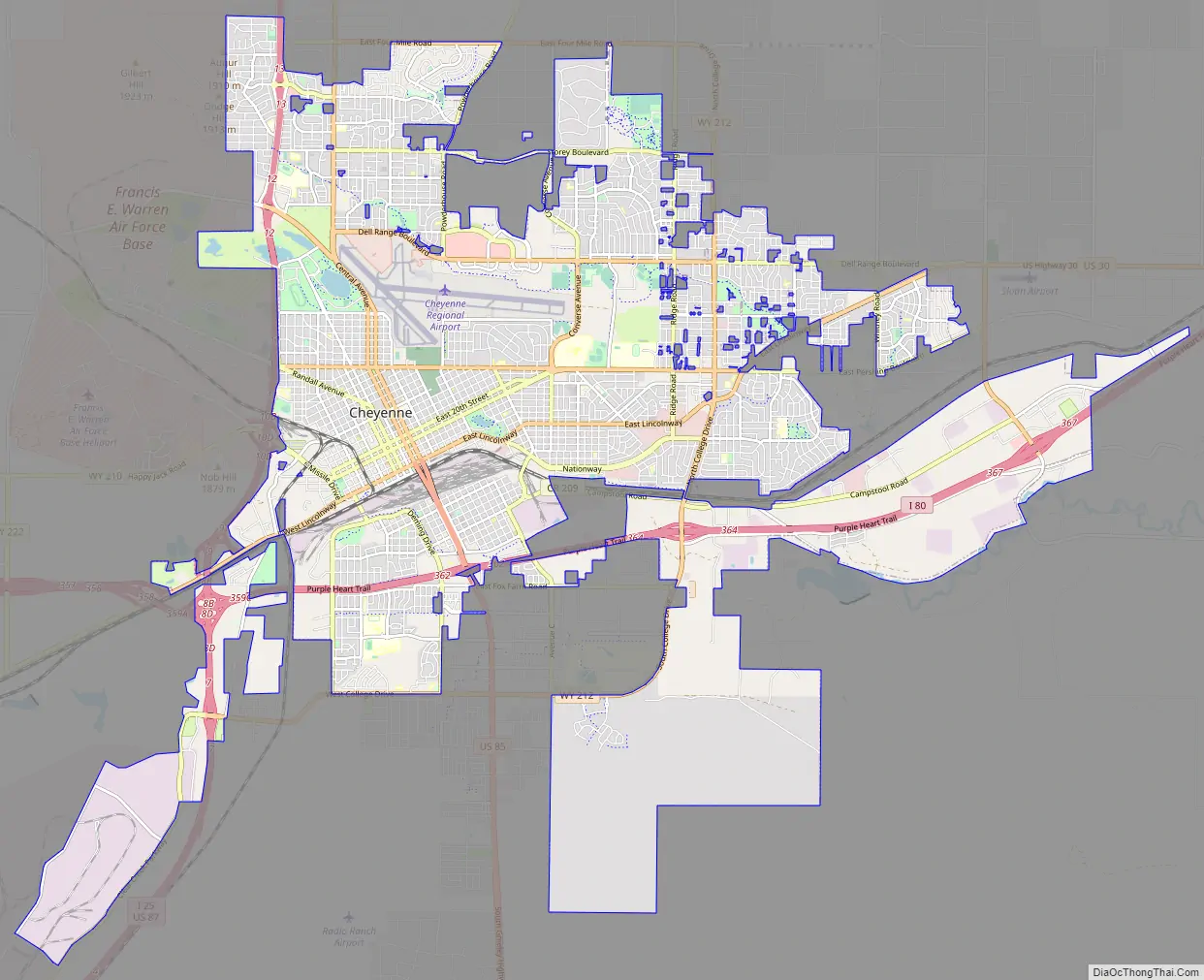
Cheyenne Road Map
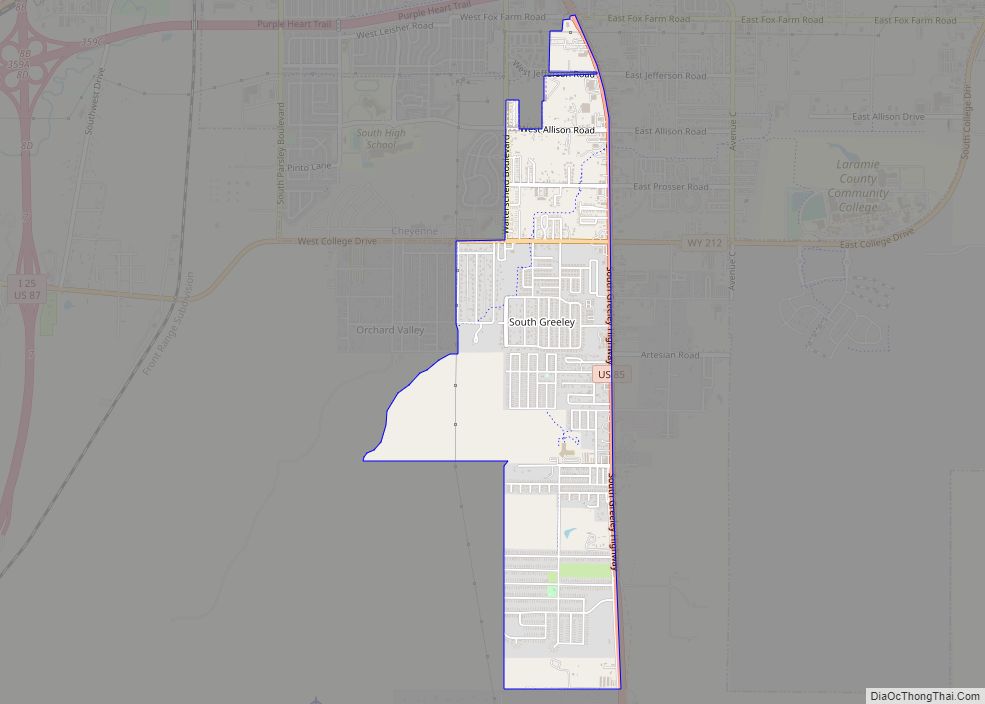
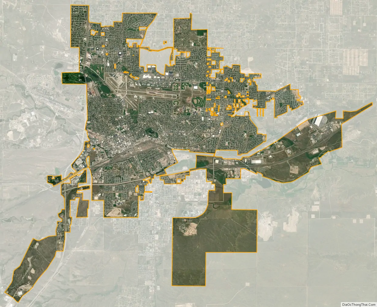
Cheyenne city Satellite Map
Geography
Lying near the southeast corner of the state, Cheyenne is one of the least centrally located state capitals in the nation (together with cities such as Carson City, Nevada; Juneau, Alaska; Tallahassee, Florida; and Topeka, Kansas).
According to the United States Census Bureau, the city has a total area of 24.63 square miles (63.79 km), of which 24.52 square miles (63.51 km) is land and 0.11 square miles (0.28 km) is water.
Climate
Cheyenne, like much of Wyoming, has a cold semi-arid climate (Köppen BSk) and is part of USDA Hardiness zone 5b, with the suburbs falling in zone 5a. Winters are cold and moderately long, but relatively dry with highs often above freezing, having a normal mean temperature of 27.7 °F (−2.4 °C), highs that fail to breach freezing for 35 days per year, and lows that dip to the 0 °F (−18 °C) mark on 9.2 mornings. However, the cold is often interrupted, with chinook winds blowing downslope from the Rockies that can bring warm conditions, bringing the high above 50 °F (10 °C) on twenty days from December to February.
While December is the coldest month, snowfall is greatest in March and April, seasonally averaging 60 inches (1,500 mm), historically ranging from 13.1 inches (330 mm) between July 1965 and June 1966 up to 121.5 inches (3,090 mm) between July 1979 and June 1980, yet thick snow cover rarely stays. Summers are warm, with a high diurnal temperature range; July averages 69.4 °F (20.8 °C), and highs reach 90 °F (32 °C) on average for twelve afternoons annually. Spring and autumn are quick transitions, with the average window for freezing temperatures being September 29 thru May 14, allowing a growing season of 106 days. Official record temperatures range from −38 °F (−39 °C) on January 9, 1875, up to 100 °F (38 °C) on June 23, 1954, the last of four occurrences; the record cold daily maximum is −21 °F (−29 °C) on January 11, 1963, while, conversely, the record warm daily minimum is 68 °F (20 °C) on July 31, 1960. The annual precipitation of 15.9 inches (400 mm) tends to be concentrated from May to August and is low during fall and winter; it has historically ranged from 5.04 inches (128.0 mm) in 1876 to 23.69 inches (602 mm) in 1942.
The city averages below 60% daily relative humidity in each month and receives an average 2,980 hours (~67% of the possible total) of sunshine annually. On July 16, 1979, an F3 tornado struck Cheyenne, causing one death and 40 injuries. It was the most destructive tornado in Wyoming history.
See also
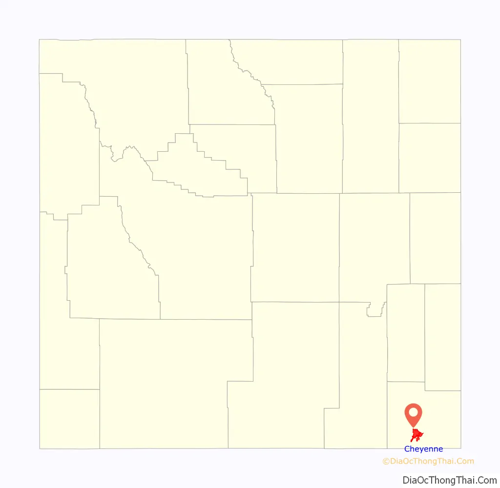
Map of Wyoming State and its subdivision: Map of other states:- Alabama
- Alaska
- Arizona
- Arkansas
- California
- Colorado
- Connecticut
- Delaware
- District of Columbia
- Florida
- Georgia
- Hawaii
- Idaho
- Illinois
- Indiana
- Iowa
- Kansas
- Kentucky
- Louisiana
- Maine
- Maryland
- Massachusetts
- Michigan
- Minnesota
- Mississippi
- Missouri
- Montana
- Nebraska
- Nevada
- New Hampshire
- New Jersey
- New Mexico
- New York
- North Carolina
- North Dakota
- Ohio
- Oklahoma
- Oregon
- Pennsylvania
- Rhode Island
- South Carolina
- South Dakota
- Tennessee
- Texas
- Utah
- Vermont
- Virginia
- Washington
- West Virginia
- Wisconsin
- Wyoming