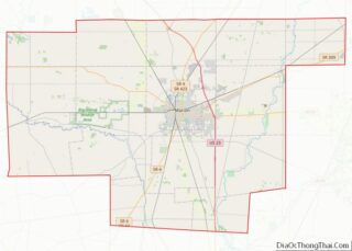
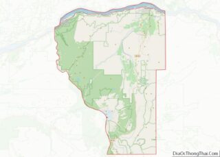
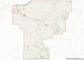
Rockingham County is a county in the U.S. state of New Hampshire. At the 2020 census, the population was 314,176, making it New Hampshire’s second-most populous county. The county seat is Brentwood. Rockingham County is part of the Boston–Cambridge–Newton, MA-NH Metropolitan Statistical Area and the greater Boston-Worcester-Providence, MA-RI-NH–CT Combined Statistical Area. Per the 2020 census, ... Read more
Map of US Counties
Morris County overview: Name: Morris County FIPS code: 34-027 State: New Jersey Founded: March 15, 1739 Named for: Colonial governor Lewis Morris Seat: Morristown Largest town: Parsippany-Troy Hills Township (population)Rockaway Township (area) Total Area: 481.62 sq mi (1,247.4 km²) Land Area: 460.18 sq mi (1,191.9 km²) Total Population: 509,285 Population Density: 1,104.8/sq mi (426.6/km²) Website: www.co.morris.nj.us Morris County location map. Where is ... Read more
Eddy County is a county located in the U.S. state of New Mexico. As of the 2010 census, the population was 53,829. Its county seat and largest city is Carlsbad. The county was created in 1891 and later organized in 1892. It is north of the Texas state line. Eddy County comprises the Carlsbad-Artesia, NM ... Read more
San Miguel County (Spanish: Condado de San Miguel) is a county in the U.S. state of New Mexico. As of the 2010 census, the population was 29,393. Its county seat is Las Vegas. San Miguel County comprises the Las Vegas Micropolitan Statistical Area, which is also included in the Albuquerque–Santa Fe–Las Vegas combined statistical area. ... Read more
Chemung County is a county in the southern tier of the U.S. state of New York. The population was 84,148 as of the 2020 census. Its county seat is Elmira. Its name is derived from a Delaware Indian village whose name meant “big horn”. Chemung County comprises the Elmira, NY Metropolitan Statistical Area, which is ... Read more
Brooklyn (/ˈbrʊklɪn/) is a borough of New York City, coextensive with Kings County, in the U.S. state of New York. Kings County is the most populous county in the State of New York, and the second-most densely populated county in the United States, behind New York County (Manhattan). Brooklyn is also New York City’s most ... Read more
Otsego County is a county in the U.S. state of New York. As of the 2020 census, the population was 58,524. The county seat is Cooperstown. The county’s population center is Oneonta. The name Otsego is from a Mohawk or Oneida word meaning “place of the rock.” Otsego County overview: Name: Otsego County FIPS code: ... Read more
Tompkins County is a county located in the U.S. state of New York. As of the 2020 census, the population was 105,740. The county seat is Ithaca. The name is in honor of Daniel D. Tompkins, who served as Governor of New York and Vice President of the United States. Tompkins County comprises the Ithaca ... Read more
Bladen County (/ˈbleɪdən/) is a county located in the U.S. state of North Carolina. As of the 2020 census, the population was 29,606. Its county seat is Elizabethtown. The county was created in 1734 as Bladen Precinct and gained county status in 1739. Bladen County overview: Name: Bladen County FIPS code: 37-017 State: North Carolina ... Read more
Craven County is located in the U.S. state of North Carolina. As of the 2020 census, the population was 100,720. Its county seat is New Bern. The county was created in 1705 as Archdale Precinct from the now-extinct Bath County. It was renamed Craven Precinct in 1712 and gained county status in 1739. It is ... Read more
Guilford County is a county located in the U.S. state of North Carolina. As of the 2020 census, the population is 541,299, making it the third-most populous county in North Carolina. The county seat, and largest municipality, is Greensboro. Since 1938, an additional county court has been located in High Point. The county was formed ... Read more
Madison County overview: Name: Madison County FIPS code: 37-115 State: North Carolina Founded: 1851 Named for: James Madison Seat: Marshall Largest town: Mars Hill Total Area: 451 sq mi (1,170 km²) Land Area: 450 sq mi (1,200 km²) Total Population: 21,193 Population Density: 47.8/sq mi (18.5/km²) Time zone: UTC−5 (Eastern) Summer Time Zone (DST): UTC−4 (EDT) Website: www.madisoncountync.gov Madison County location map. ... Read more