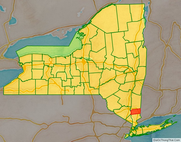
| Name: | Putnam County |
|---|---|
| FIPS code: | 36-079 |
| State: | New York |
| Founded: | 1812 |
| Named for: | Israel Putnam |
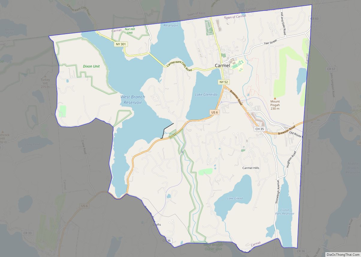
| Seat: | Carmel |
| Total Area: | 246 sq mi (640 km²) |
| Land Area: | 230 sq mi (600 km²) |
| Total Population: | 97,668 |
| Population Density: | 424.2/sq mi (163.8/km²) |
| Time zone: | UTC−5 (Eastern) |
| Summer Time Zone (DST): | UTC−4 (EDT) |
| Website: | www.putnamcountyny.com |
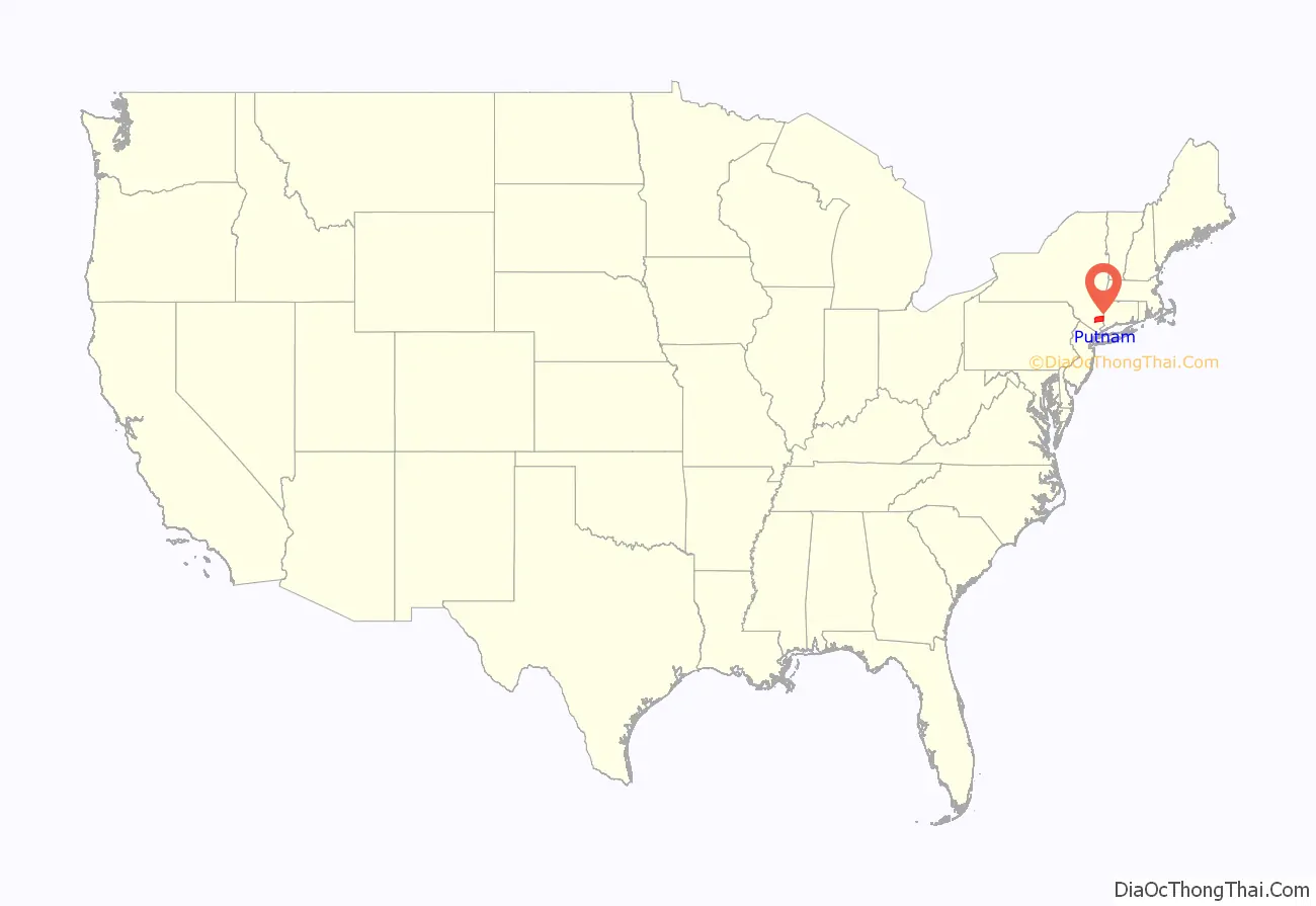
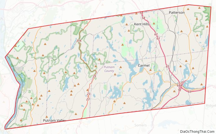
Putnam County location map. Where is Putnam County?
History
In 1609, the Wappinger Native American people inhabited the east bank of the Hudson River. They farmed, hunted, and fished throughout their range, often encountering Dutch fur traders. They obtained metal tools and goods such as alcohol and firearms in exchange for furs.
The colonial Province of New York and the Connecticut Colony negotiated an agreement on November 28, 1683, establishing their border as 20 miles (32 km) east of the Hudson River, and north to Massachusetts. Dutchess county was organized as one of New York’s twelve counties. It included all of today’s Putnam County and two towns in the present Columbia county. Until 1713, Dutchess was administered by Ulster county.
In 1691, a group of Dutch traders purchased a tract of land from the Wappingers that spanned from the Hudson River to the Connecticut border. Six years later they sold it to wealthy Dutch-American merchant Adolphus Philipse, who obtained a Royal sanction for a “Highland Patent” (later to be known as the Philipse Patent) that encompassed most of today’s Putnam County. Unknown at that time was a northwest veer in the river’s path at the Hudson Highlands. This generated a dispute over a roughly 2-mile-wide section of border between northern Westchester County, then-Dutchess County, and the Connecticut Colony, which came to be known as “The Oblong”.
In 1737, the New York Colonial Assembly designated the Philipse Patent as the South Precinct of Dutchess County. The Philipses began leasing farms to migrants from Massachusetts, Connecticut, Long Island, and lower Westchester. After Adolph Philipse’s death, the Patent was divided in 1754 into nine lots granted to three heirs: Mary Philipse, Philip Philipse, and Susannah Philipse Robinson. During the French and Indian War, many of the Wappinger went to Stockbridge, Massachusetts.
Compared to other parts of the Hudson Valley, Putnam County had slow settlement. It was privately owned and settlement was limited to tenant farmers willing to pay the Philipse family for leases. Secondly, it was mostly hilly and rocky, making it unappealing to men looking for tillable cropland. Its use was generally limited to dairy farming and wood cutting. The first non-tenant settlers in the county were along its eastern edge. The ambiguous border with Connecticut attracted farmers from New England. They assumed that Philipse did not own the disputed area.
Among early settlers were the Hayt family, which built a farm called The Elm in 1720. Jacob Haviland settled in the Oblong in 1731 in what became known as Haviland Hollow. The first village in the county was Fredericksburg, now the hamlet of Patterson.
During the American Revolution, the Philipses stayed loyal to the Crown. As a consequence, their lands were confiscated by the New York government. It sold the Philipse Patent along with the rest of their holdings. The dispute over The Oblong was resolved in the aftermath of the war, with the heavily settled tract being incorporated as the first of two versions of the Town of Southeast. Also resolved were two “Gores”, the Beekman Gore and the Rombout Gore, which being geographically similar to the Livingston and Beekman patents they abutted, were ceded by the Philipses to Dutchess County in 1758 and 1771 respectively.
Due to the increasing population of the Southern Precinct of Dutchess County and the great distance of these communities from the county seat in Poughkeepsie, Putnam was split from Dutchess in 1812 and organized as an independent county. It encompassed all of the Philipse Patent and the Oblong abutting it, less a triangular area in the farthest northwest reach of the Patent. There, a lowland near Fishkill Creek isolated from the rest of Putnam County and its adjacent upland drainage leading into the Hudson Highlands to the south, were ceded to Dutchess.
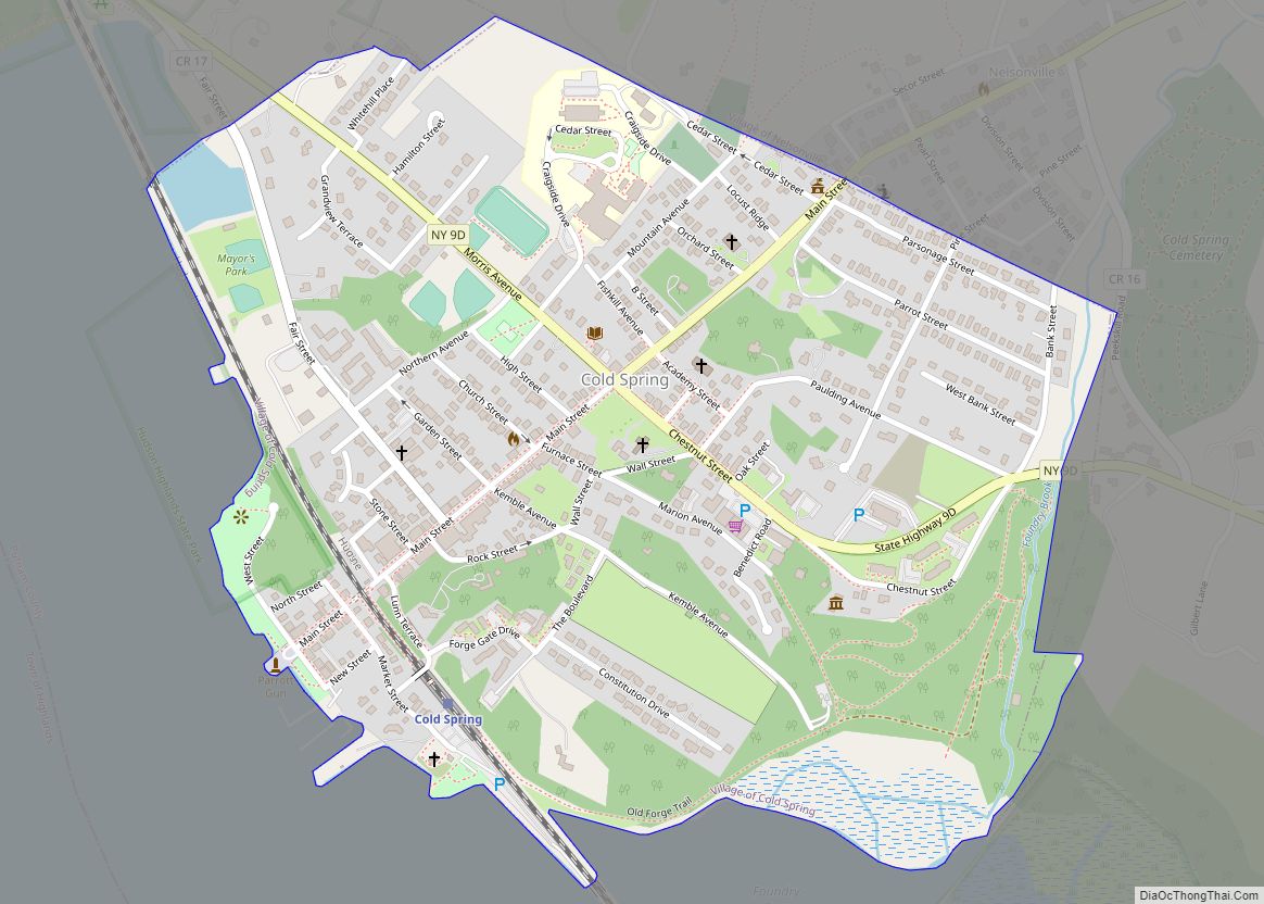
Putnam travelers mostly used boats and ships along the Hudson River. Boats transporting goods traveled up the Hudson to ports, mainly at Peekskill, New York. They were transported by road into Putnam County, or goods were unloaded in Putnam County at Cold Spring, New York. Such transport suffered in winter, when the river froze. At that time, little food or goods could be shipped to the county.
The Philipstown Turnpike was created in 1815 as a toll road from Cold Spring to Connecticut. The wagons that traveled the road would transport produce from eastern Putnam County and iron ore from the mines. The route of the turnpike can roughly be traced today: Rt 301 from Cold Spring to Farmers Mills Road, to White Pond Road to Pecksville, then Holmes Rd to Patterson, then Quaker Hill Rd to Connecticut. Transportation improved with the advent of the railroad, namely the Harlem Line, which was built in the 1840s, connecting Putnam by rail to New York City. Originally there were four stations on the Harlem line in Putnam County: Brewster, Dykemans, Towners, and Patterson. Today only the Brewster and Patterson stops remain; a new one called Southeast was added in modern times.
Putnam County played an important role in the Civil War. One third of the county’s men between the ages of 15 and 55 served in the military during the war years. During the post-Civil War years, industry and agriculture suffered losses as the economy contracted. Iron, which was produced in the Highland Mountains, could be found elsewhere. Agriculture was also affected greatly. The increasing need for drinking water in New York City led the city to search for sources in the Hudson Valley. In Putnam County, much of the farmland was flooded to create reservoirs as part of New York City’s Croton Watershed. The abandoning of farms, the creation of reservoirs, and the preservation of the remaining open land resulted in scenic lands that drew large amounts of tourism from New York City.
By the 20th century, improved roads brought vacationers from New York City. The Taconic State Parkway was constructed during the Great Depression as one of numerous infrastructure projects in the state and country. This brought more vacationers from the city, who were attracted to the scenic lands and the inexpensive hotels, inns, and summer houses. Putnam County’s population doubled during the summer months.
After World War II, Putnam County became an exurb of New York City. Rapid residential development occurred and the county became a bedroom community. However, the prevalent rocky uplands and protection of Putnam county’s reservoirs inherently limited development, as much of the land in the county is close to wetlands or reservoirs.
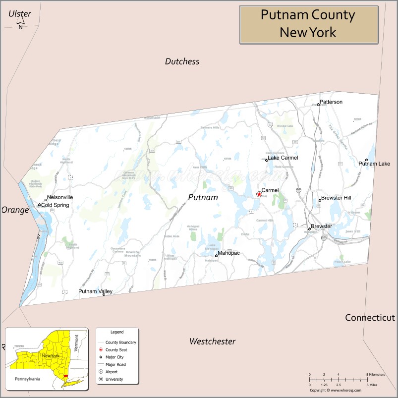
Putnam County Road Map
Geography
According to the U.S. Census Bureau, the county has a total area of 246 square miles (640 km), of which 230 square miles (600 km) is land and 16 square miles (41 km) (6.5%) is water.
Putnam County is situated in the lower Hudson Valley in the southeastern part of New York, between the Hudson River on its west and the New York–Connecticut border on its east. Putnam is southeast of Newburgh, and it is north of White Plains. Depending on precise location within the county, road travel distance to New York City ranges between 45 miles (72 km) and 65 miles (105 km).
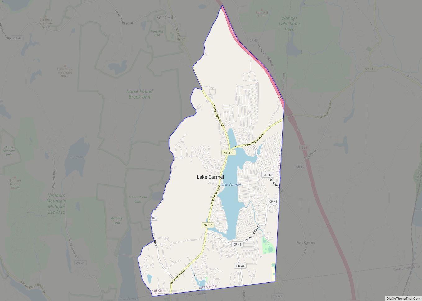
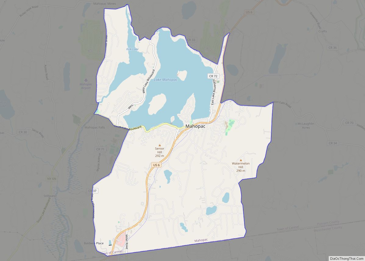
The terrain of the county is generally hilly. The region of the county nearest the Hudson River is especially so, and is part of the Hudson Highlands. The highest point in Putnam County is Scofield Ridge, with four summits at approximately 1,540 feet (469 m) above sea level. The lowest point is sea level along the Hudson. The Hudson River, named for Henry Hudson, has provided transportation of goods from New York City, north to the Hudson Valley, throughout history. Between the hills and glacial moraine, Putnam County’s valleys contain numerous wetlands (including part of the Great Swamp), creeks, ponds, lakes (including the 583 acre Lake Mahopac, and reservoirs.
Reservoirs
Putnam County is known for its many pristine reservoirs, part of the New York City water supply system’s Croton Watershed. These include Bog Brook in Southeast; Croton Falls Reservoir in Carmel and Southeast; Diverting Reservoir in Southeast; East Branch in Brewster; Middle Branch Reservoir in Southeast; West Branch in Kent and Carmel, and Boyds Corner Reservoir in Kent. There are also three controlled lakes in the system in the town of Carmel, Kirk, Gilead, and Gleneida.
Adjacent counties
- Dutchess County (north)
- Fairfield County, Connecticut (east)
- Westchester County (south)
- Rockland County (southwest)
- Orange County (west)
Climate
The climate of Putnam County is humid continental, as is most of New York. In the winter, bouts of cold, dry air arrive from Canada, and interior sections of North America. In the summer, the Gulf Stream brings hot, moist, humid air to the county. Extratropical storms often affect the county; in the winter, Nor’easters bring heavy snow and rain, and sometimes high wind. In the summer and fall, back door cold fronts move in from the north and bring thunderstorms, sometimes severe. Putnam County receives on average 36 inches of snowfall a year.
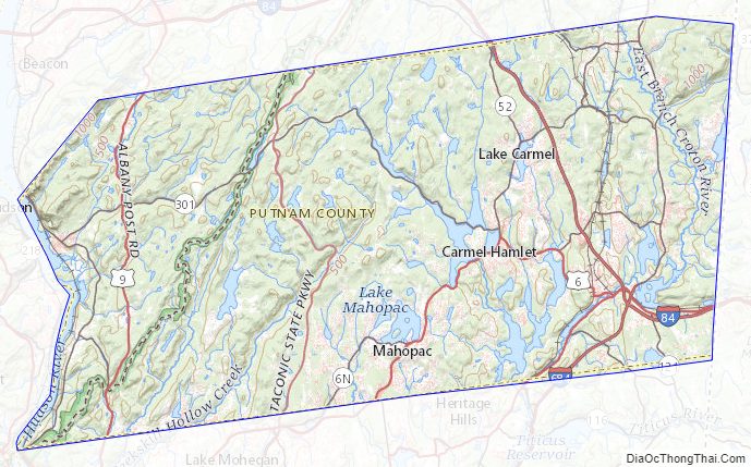
Putnam County Topographic Map
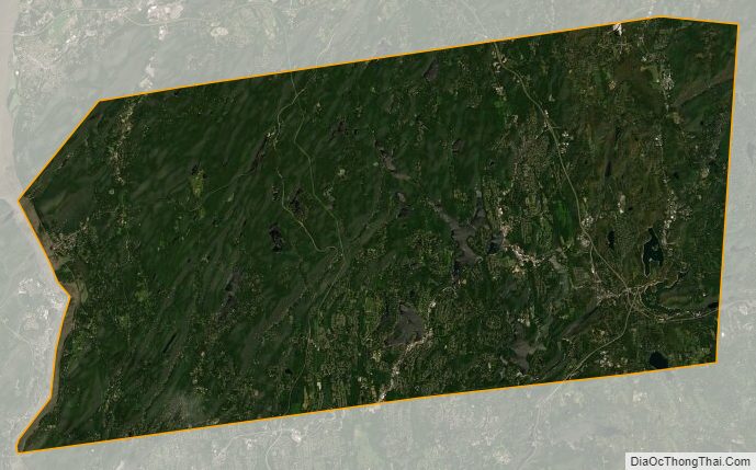
Putnam County Satellite Map
Putnam County Outline Map