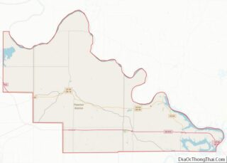
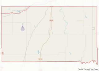
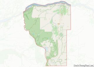
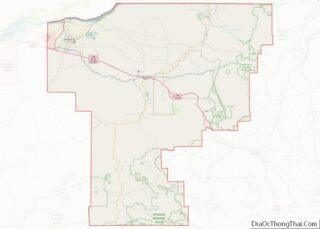
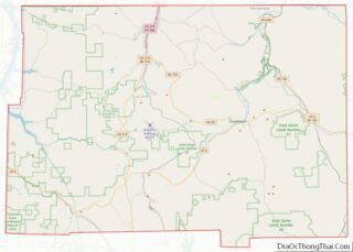
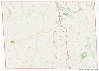
Map of Beaverhead County, Montana
Beaverhead County is the largest county by area in the U.S. state of Montana. As of the 2020 census, the population was 9,371. Its county seat is Dillon. The county was founded in 1865. Much of the perimeter of the county is the Continental Divide, including its entire border with the state of Idaho. The ... Read more
Map of Beaverhead County, Montana
Map of Garfield County, Montana
Garfield County is a county located in the U.S. state of Montana. As of the 2020 census, the population was 1,173. Its county seat is Jordan. Garfield County is noteworthy as the site of the discovery and excavation of four of the world’s dozen or so major specimens (as of 1994) of Tyrannosaurus rex. A ... Read more
Map of Garfield County, Montana
Map of Musselshell County, Montana
Musselshell County is a county in south-central Montana. As of the 2020 census, the population was 4,730. Its county seat is Roundup. Musselshell County overview: Name: Musselshell County FIPS code: 30-065 State: Montana Founded: February 2, 1911 Seat: Roundup Largest city: Roundup Total Area: 1,871 sq mi (4,850 km²) Land Area: 1,868 sq mi (4,840 km²) Total Population: 4,730 Population Density: ... Read more
Map of Musselshell County, Montana
Map of Sweet Grass County, Montana
Sweet Grass County is a county located in the U.S. state of Montana. As of the 2020 census, the population was 3,678. Its county seat is Big Timber. The county was founded in 1895. Sweet Grass County overview: Name: Sweet Grass County FIPS code: 30-097 State: Montana Founded: 1895 Named for: Sweet grass Seat: Big ... Read more
Map of Sweet Grass County, Montana
Map of Brown County, Nebraska
Brown County is a county in the U.S. state of Nebraska. As of the 2010 United States Census, the population was 3,145. Its county seat is Ainsworth. The county was established in 1883 and named for two members of the legislature who reported the bill for the county’s organization. In the Nebraska license plate system, ... Read more
Map of Brown County, Nebraska
Map of Deuel County, Nebraska
Deuel County is a county located in the U.S. state of Nebraska. As of the 2010 United States Census, the population was 1,941. Its county seat is Chappell. The county was formed in 1889 and named for Harry Porter Deuel, superintendent of the Union Pacific Railroad. In the Nebraska license plate system, Deuel County is ... Read more
Map of Deuel County, Nebraska
Map of Hamilton County, Nebraska
Hamilton County is a county in the U.S. state Nebraska. As of the 2020 United States Census, the population was 9,429. Its county seat is Aurora. The county was named for Alexander Hamilton, the first Secretary of the Treasury in the new United States government. Hamilton County is included in the Grand Island, NE Metropolitan ... Read more
Map of Hamilton County, Nebraska
Map of Logan County, Nebraska
Logan County is a county in the U.S. state of Nebraska. As of the 2020 census, the population was 716. Its county seat is Stapleton. Logan County is part of the North Platte, NE Micropolitan Statistical Area. In the Nebraska license plate system, Logan County is represented by the prefix 87 (it had the eighty-seventh-largest ... Read more
Map of Logan County, Nebraska
Map of Red Willow County, Nebraska
Red Willow County is a county located in the U.S. state of Nebraska. As of the 2020 United States Census, the population was 10,702. Its county seat is McCook. In the Nebraska license plate system, Red Willow County is represented by the prefix 48 (it had the forty-eighth-largest number of vehicles registered in the county ... Read more
Map of Red Willow County, Nebraska
Map of Washington County, Nebraska
Washington County is a county in the U.S. state of Nebraska. As of the 2010 United States Census, the population was 20,234. Its county seat is Blair. Washington County is part of the Omaha–Council Bluffs, NE-IA Metropolitan Statistical Area. In the Nebraska license plate system, Washington County is represented by the prefix 29 (it had ... Read more
Map of Washington County, Nebraska
Map of Mineral County, Nevada
Mineral County overview: Name: Mineral County FIPS code: 32-021 State: Nevada Founded: 1911 Named for: Mineral Seat: Hawthorne Total Area: 3,813 sq mi (9,880 km²) Land Area: 3,753 sq mi (9,720 km²) Total Population: 4,554 Population Density: 1.2/sq mi (0.46/km²) Time zone: UTC−8 (Pacific) Summer Time Zone (DST): UTC−7 (PDT) Website: mineralcountynv.us Mineral County location map. Where is Mineral County? History Mineral ... Read more
Map of Mineral County, Nevada
Map of Atlantic County, New Jersey
Atlantic County overview: Name: Atlantic County FIPS code: 34-001 State: New Jersey Founded: 1837 Named for: Atlantic Ocean Seat: Mays Landing Total Area: 671.83 sq mi (1,740.0 km²) Land Area: 555.70 sq mi (1,439.3 km²) Total Population: 274,534 Population Density: 494.2/sq mi (190.8/km²) Website: www.atlantic-county.org Atlantic County location map. Where is Atlantic County? History Etymology The county was named after the Atlantic ... Read more
Map of Atlantic County, New Jersey