Pettis County is a county located in west central U.S. state of Missouri. As of the 2010 census, the population was 42,201. Its county seat is Sedalia. The county was organized January 24, 1833, and named after former U.S. Representative Spencer Darwin Pettis.
Pettis County comprises the Sedalia, MO Micropolitan Statistical Area.
The county is home to the site of the Missouri State Fair in Sedalia.
Name: | Pettis County |
---|---|
FIPS code: | 29-159 |
State: | Missouri |
Founded: | January 24, 1833 |
Named for: | Spencer Darwin Pettis |
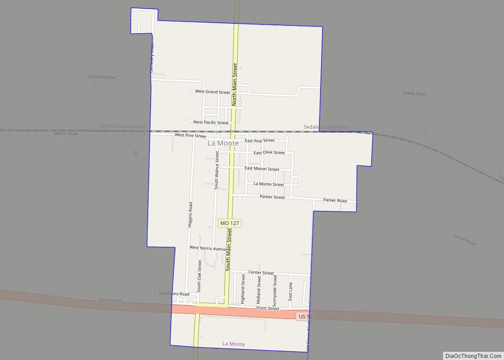
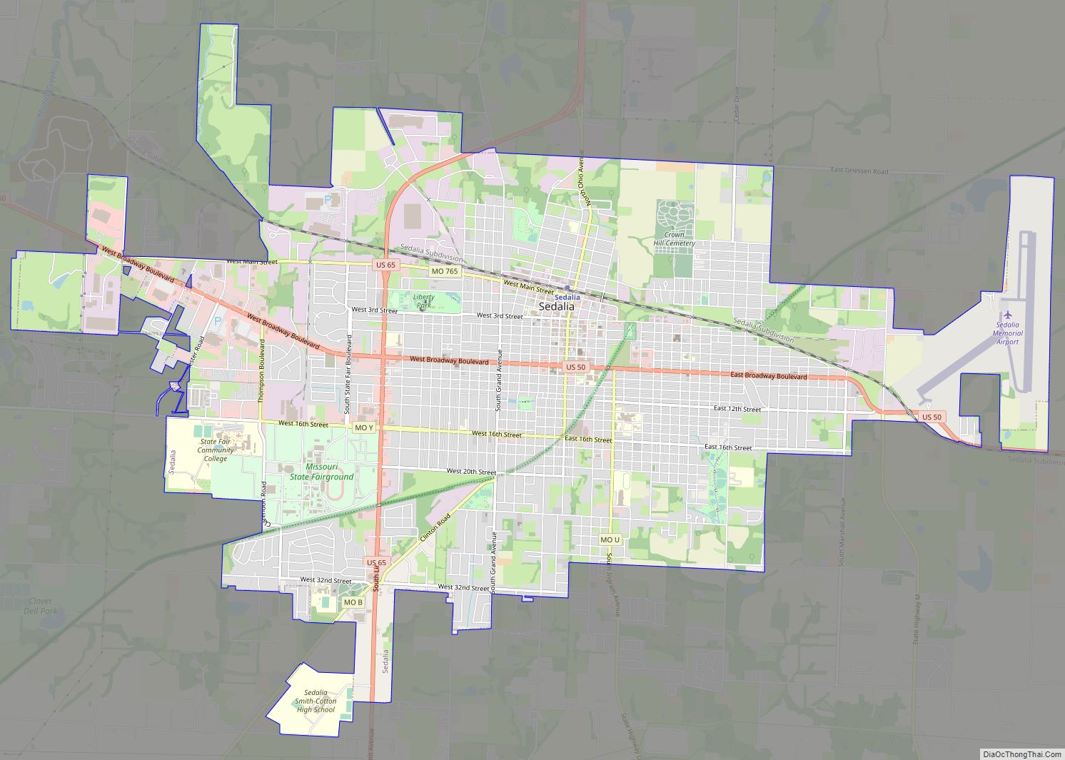
Seat: | Sedalia |
Largest city: | Sedalia |
Total Area: | 686 sq mi (1,780 km²) |
Land Area: | 682 sq mi (1,770 km²) |
Total Population: | 42,201 |
Population Density: | 62/sq mi (24/km²) |
Time zone: | UTC−6 (Central) |
Summer Time Zone (DST): | UTC−5 (CDT) |
Website: | www.pettiscomo.com |
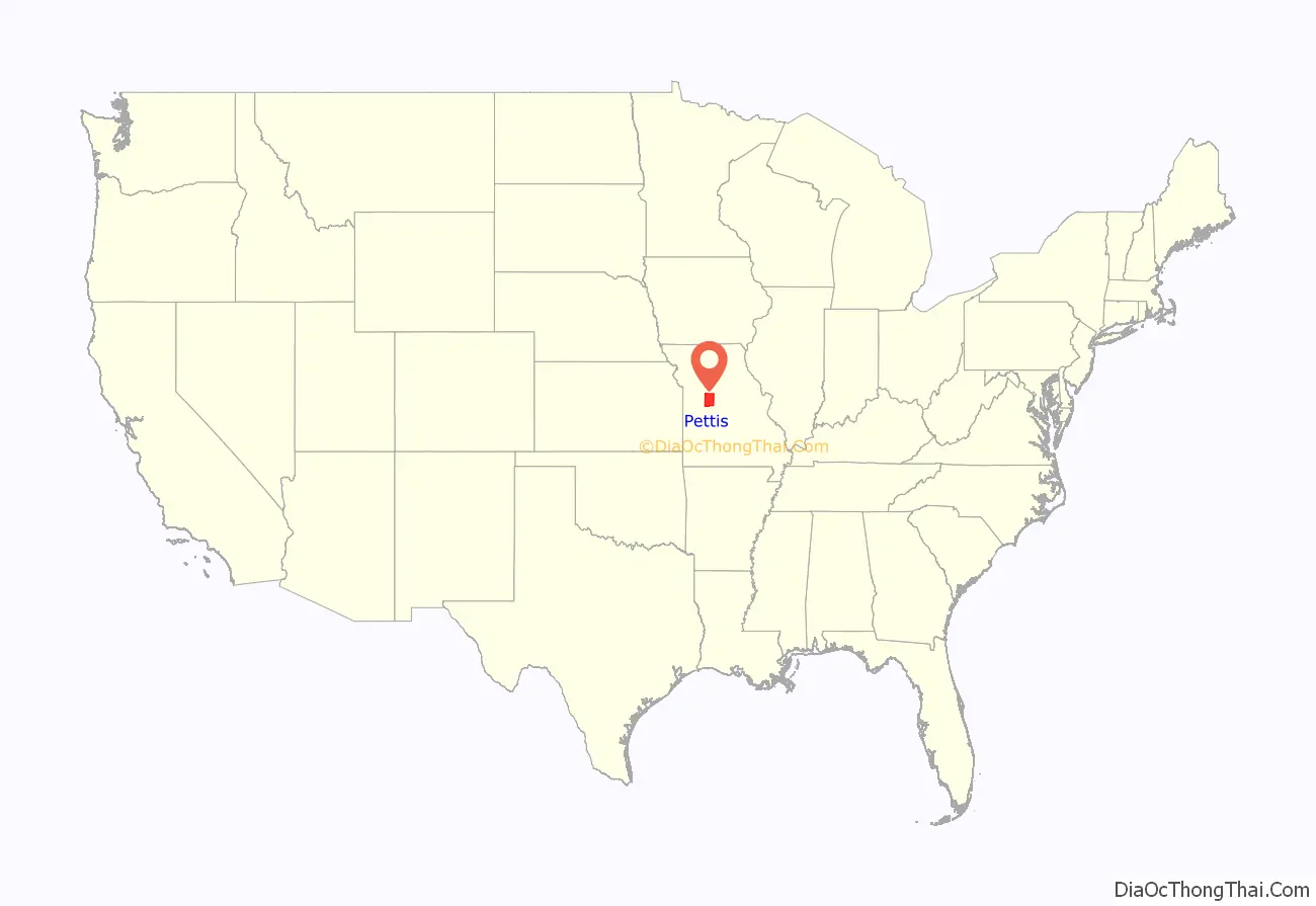
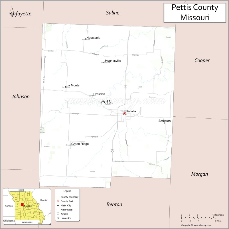
Pettis County location map. Where is Pettis County?
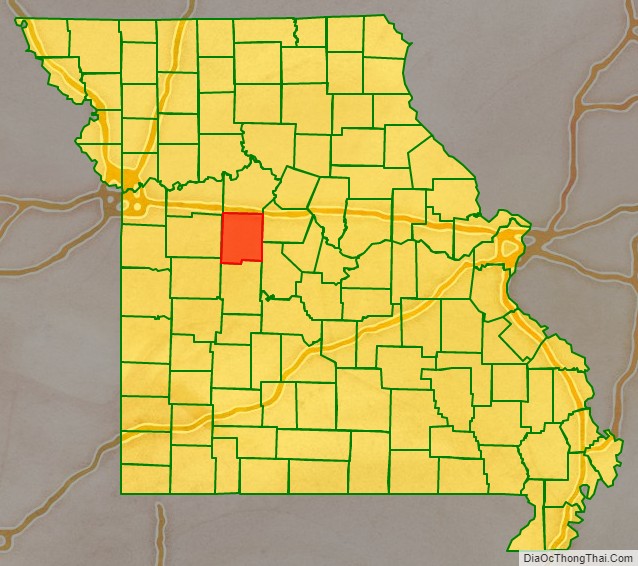
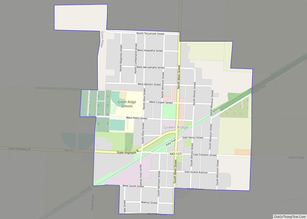
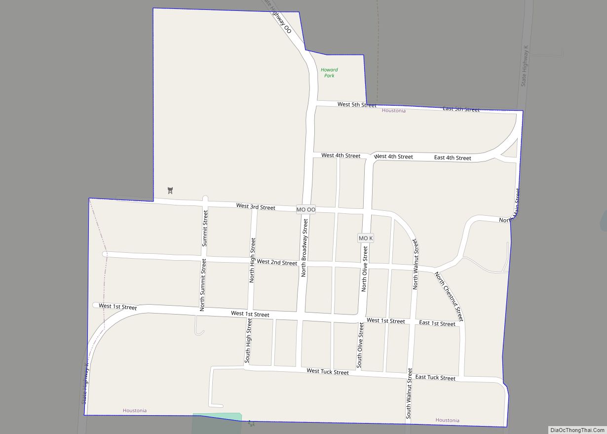
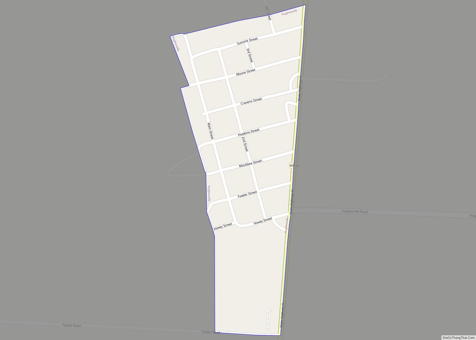
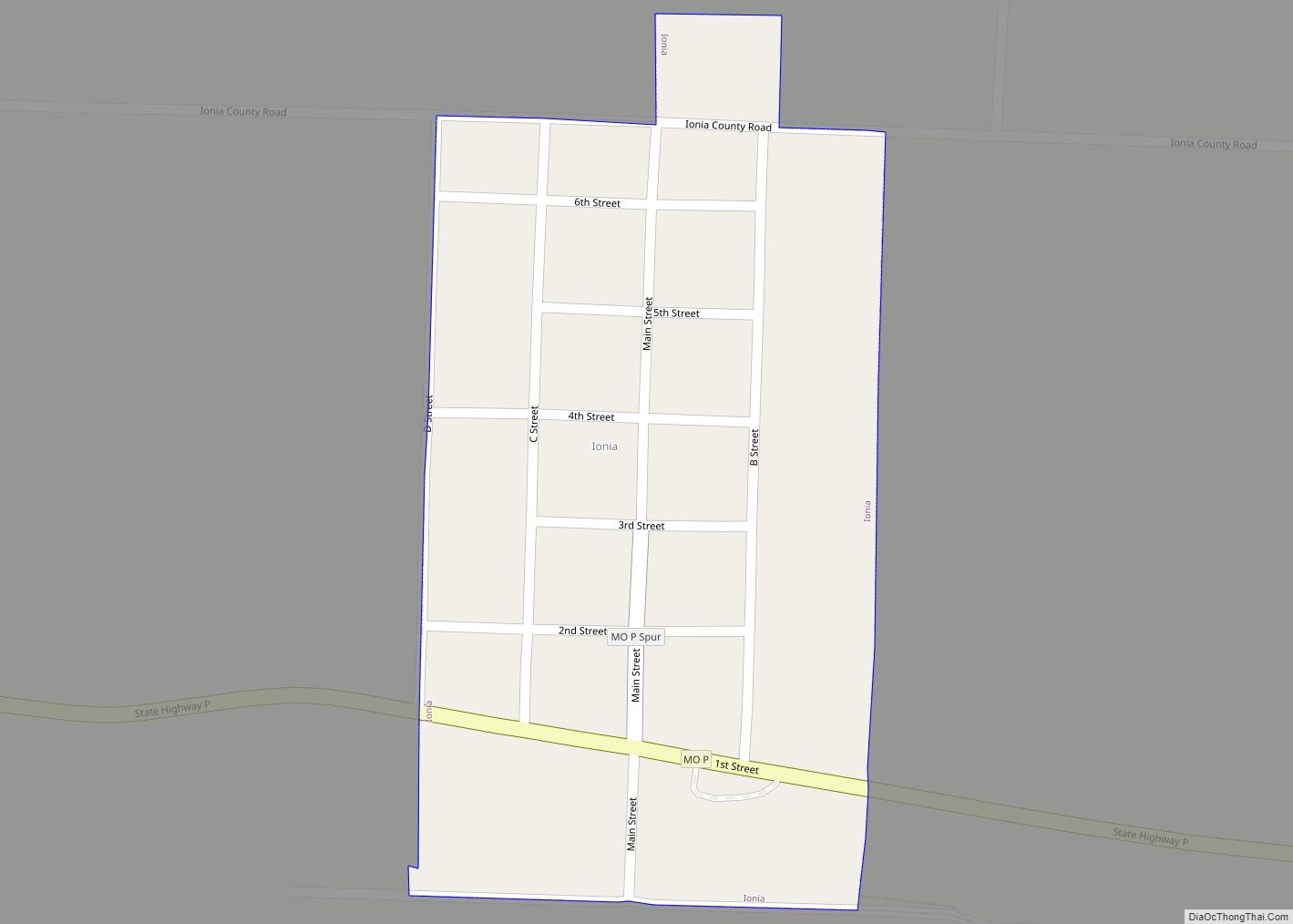
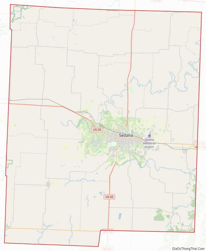
Pettis County Road Map
Geography
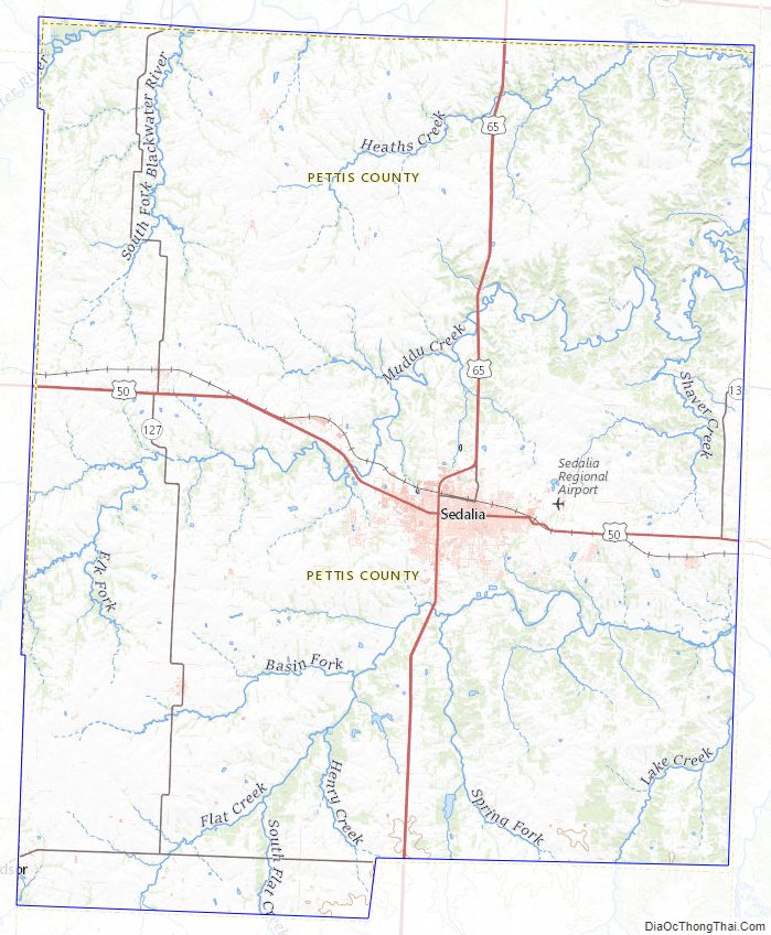
According to the U.S. Census Bureau, the county has a total area of 686 square miles (1,780 km), of which 682 square miles (1,770 km) is land and 4.0 square miles (10 km) (0.6%) is water. It is drained by Lamine River and branches.
Adjacent counties
- Saline County (north)
- Cooper County (east)
- Morgan County (southeast)
- Benton County (south)
- Henry County (southwest)
- Johnson County (west)
- Lafayette County (northwest)
Major highways
- U.S. Route 50
- U.S. Route 65
- Route 52
- Route 127
- Route 135
Pettis County Topographic Map
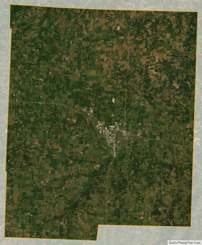
Pettis County Satellite Map
Pettis County Outline Map
See also
Map of Missouri State and its subdivision:- Adair
- Andrew
- Atchison
- Audrain
- Barry
- Barton
- Bates
- Benton
- Bollinger
- Boone
- Buchanan
- Butler
- Caldwell
- Callaway
- Camden
- Cape Girardeau
- Carroll
- Carter
- Cass
- Cedar
- Chariton
- Christian
- Clark
- Clay
- Clinton
- Cole
- Cooper
- Crawford
- Dade
- Dallas
- Daviess
- De Kalb
- Dent
- Douglas
- Dunklin
- Franklin
- Gasconade
- Gentry
- Greene
- Grundy
- Harrison
- Henry
- Hickory
- Holt
- Howard
- Howell
- Iron
- Jackson
- Jasper
- Jefferson
- Johnson
- Knox
- Laclede
- Lafayette
- Lawrence
- Lewis
- Lincoln
- Linn
- Livingston
- Macon
- Madison
- Maries
- Marion
- McDonald
- Mercer
- Miller
- Mississippi
- Moniteau
- Monroe
- Montgomery
- Morgan
- New Madrid
- Newton
- Nodaway
- Oregon
- Osage
- Ozark
- Pemiscot
- Perry
- Pettis
- Phelps
- Pike
- Platte
- Polk
- Pulaski
- Putnam
- Ralls
- Randolph
- Ray
- Reynolds
- Ripley
- Saint Charles
- Saint Clair
- Saint Francois
- Saint Louis
- Sainte Genevieve
- Saline
- Schuyler
- Scotland
- Scott
- Shannon
- Shelby
- Stoddard
- Stone
- Sullivan
- Taney
- Texas
- Vernon
- Warren
- Washington
- Wayne
- Webster
- Worth
- Wright
- Alabama
- Alaska
- Arizona
- Arkansas
- California
- Colorado
- Connecticut
- Delaware
- District of Columbia
- Florida
- Georgia
- Hawaii
- Idaho
- Illinois
- Indiana
- Iowa
- Kansas
- Kentucky
- Louisiana
- Maine
- Maryland
- Massachusetts
- Michigan
- Minnesota
- Mississippi
- Missouri
- Montana
- Nebraska
- Nevada
- New Hampshire
- New Jersey
- New Mexico
- New York
- North Carolina
- North Dakota
- Ohio
- Oklahoma
- Oregon
- Pennsylvania
- Rhode Island
- South Carolina
- South Dakota
- Tennessee
- Texas
- Utah
- Vermont
- Virginia
- Washington
- West Virginia
- Wisconsin
- Wyoming