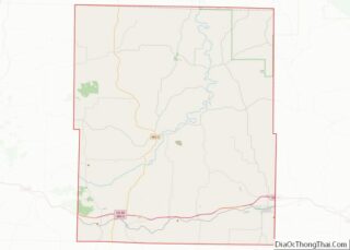
Map of Humboldt County

Map of Humboldt County, Iowa

Humboldt County is a county in the U.S. state of Iowa. As of the 2020 census, the population was 9,597. The county seat is Dakota City. The county was created in 1857 and named in honor of Alexander von Humboldt. Humboldt County overview: Name: Humboldt County FIPS code: 19-091 State: Iowa Founded: January 28, 1857 … Read more

Map of Mahaska County

Map of Mahaska County, Iowa

Mahaska County is a county located in the U.S. state of Iowa. As of the 2020 census, the population was 22,190. The county seat is Oskaloosa. Mahaska County comprises the Oskaloosa, IA Micropolitan Statistical Area. Mahaska County overview: Name: Mahaska County FIPS code: 19-123 State: Iowa Founded: February 17, 1843 Named for: Chief Mahaska Seat: … Read more

Map of Pottawattamie County

Map of Pottawattamie County, Iowa

Pottawattamie County (/ˌpɑːtəˈwɑːtəmiː/) is a county located in the U.S. state of Iowa. At the 2020 census, the population was 93,667, making it the tenth-most populous county in Iowa. The county takes its name from the Potawatomi Native American tribe. The county seat is Council Bluffs. Pottawattamie County is included in the Omaha–Council Bluffs, NE–IA … Read more

Map of Webster County

Map of Webster County, Iowa

Webster County is a county in the U.S. state of Iowa. As of the 2020 census, the population was 36,999. The county seat is Fort Dodge. The county was established in January 1851, one of 43 counties established by a legislative package. This county was named after Daniel Webster, an American statesman noted for his … Read more

Map of Cherokee County

Map of Cherokee County, Kansas

Cherokee County (county code CK) is a U.S. county located in Southeast Kansas. As of the 2020 census, the county population was 19,362. Its county seat is Columbus, and its most populous city is Baxter Springs. The latter became the first “cow town” in Kansas during the 1870s and the period of cattle drives. Cherokee … Read more

Map of Ellsworth County

Map of Ellsworth County, Kansas

Ellsworth County (county code EW) is a county located in the U.S. state of Kansas. As of the 2020 census, the county population was 6,376. Its county seat and most populous city is Ellsworth. Ellsworth County overview: Name: Ellsworth County FIPS code: 20-053 State: Kansas Founded: February 26, 1867 Named for: Fort Ellsworth Seat: Ellsworth … Read more

Map of Jackson County

Map of Jackson County, Kansas

Jackson County (county code JA) is a county in the U.S. state of Kansas. As of the 2020 census, the county population was 13,232. Its county seat and most populous city is Holton. The county, first named Calhoun County for pro-slavery South Carolina Senator John C. Calhoun, was renamed in 1859 for President Andrew Jackson. … Read more

Map of McPherson County

Map of McPherson County, Kansas

McPherson County (standard abbreviation: MP) is a county located in the U.S. state of Kansas. As of the 2020 census, the county population was 30,223. The largest city and county seat is McPherson. The county is named for Civil War General James B. McPherson. McPherson County overview: Name: McPherson County FIPS code: 20-113 State: Kansas … Read more

Map of Pottawatomie County

Map of Pottawatomie County, Kansas

Pottawatomie County (standard abbreviation: PT) is a county located in the U.S. state of Kansas. As of the 2020 census, the county population was 25,348. The county seat is Westmoreland. The county takes its name from the Potawatomi tribe of Native Americans. Pottawatomie County overview: Name: Pottawatomie County FIPS code: 20-149 State: Kansas Founded: February … Read more

Map of Sherman County

Map of Sherman County, Kansas

Sherman County (standard abbreviation: SH) is a county located in the U.S. state of Kansas. As of the 2020 census, the county population was 5,927. Its county seat is Goodland. Sherman County was created by the Legislature of 1873, and named after General William Tecumseh Sherman. Sherman County overview: Name: Sherman County FIPS code: 20-181 … Read more

Map of Allen County

Map of Allen County, Kentucky

Allen County is a county located in the U.S. state of Kentucky. As of the 2020 census, the population was 20,588. Its county seat is Scottsville. The county is named for Colonel John Allen, a state senator and soldier who was killed leading the 1st Regiment of Kentucky Rifleman at the Battle of Frenchtown, Michigan … Read more

Map of Calloway County

Map of Calloway County, Kentucky

Calloway County is a county located in the southwest part of the U.S. Commonwealth of Kentucky. As of the 2020 census, the population was 37,103. Its county seat is Murray. The county was founded in November 1822 and named for Colonel Richard Callaway, one of the founders of Boonesborough. Calloway County comprises the Murray, KY … Read more