Boone County is a county in the U.S. state of Indiana. As of 2020, the population was 70,812. The county seat (and the county’s only incorporated city) is Lebanon.
| Name: | Boone County |
|---|---|
| FIPS code: | 18-011 |
| State: | Indiana |
| Founded: | 1 April 1830 (created) 1831 (organized) |
| Named for: | Daniel Boone |
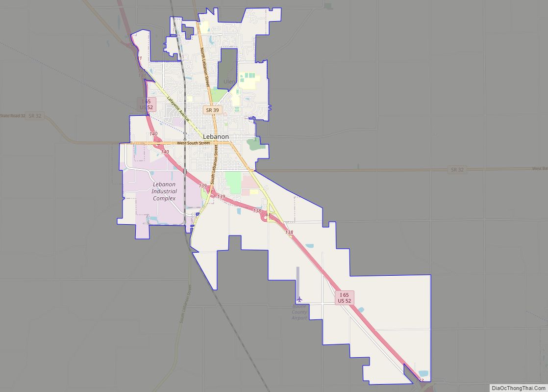
| Seat: | Lebanon |
| Largest city: | Zionsville |
| Total Area: | 423.25 sq mi (1,096.2 km²) |
| Land Area: | 422.91 sq mi (1,095.3 km²) |
| Population Density: | 158.4/sq mi (61.2/km²) |
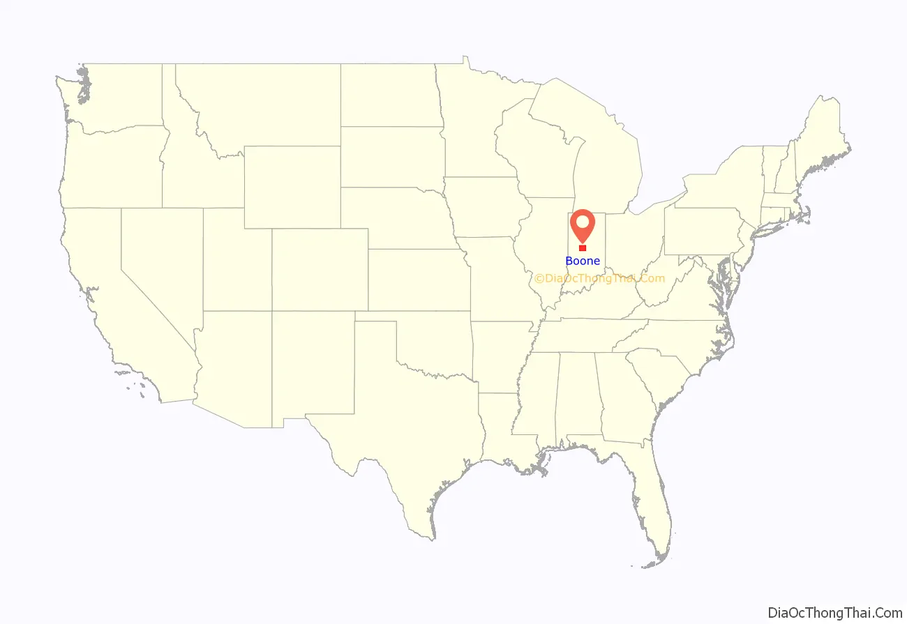
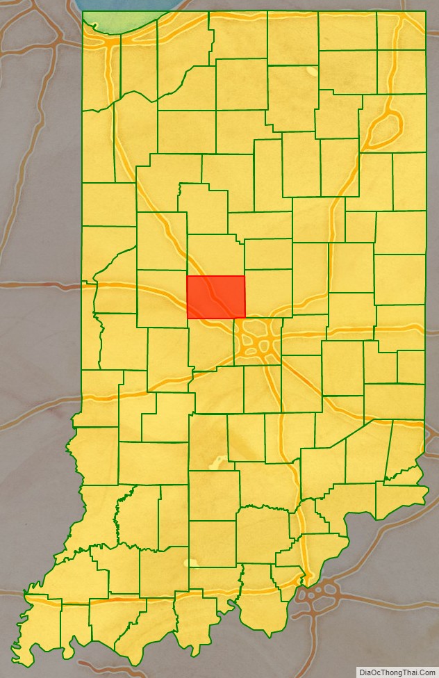
Boone County location map. Where is Boone County?
History
In 1787, the fledgling United States defined the Northwest Territory, which included the area of present-day Indiana. In 1800, Congress separated Ohio from the Northwest Territory, designating the rest of the land as the Indiana Territory. President Thomas Jefferson chose William Henry Harrison as the territory’s first governor, and Vincennes was established as the territorial capital. After the Michigan Territory was separated and the Illinois Territory was formed, Indiana was reduced to its current size and geography. By December 1816 the Indiana Territory was admitted to the Union as a state.
Starting in 1794, Native American titles to Indiana lands were extinguished by usurpation, purchase, or war and treaty. The United States acquired land from the Native Americans in the 1809 treaty of Fort Wayne, and by the treaty of St. Mary’s in 1818 considerably more territory became property of the government. This included the future Boone County, designating areas covered by the Delaware New Purchase.
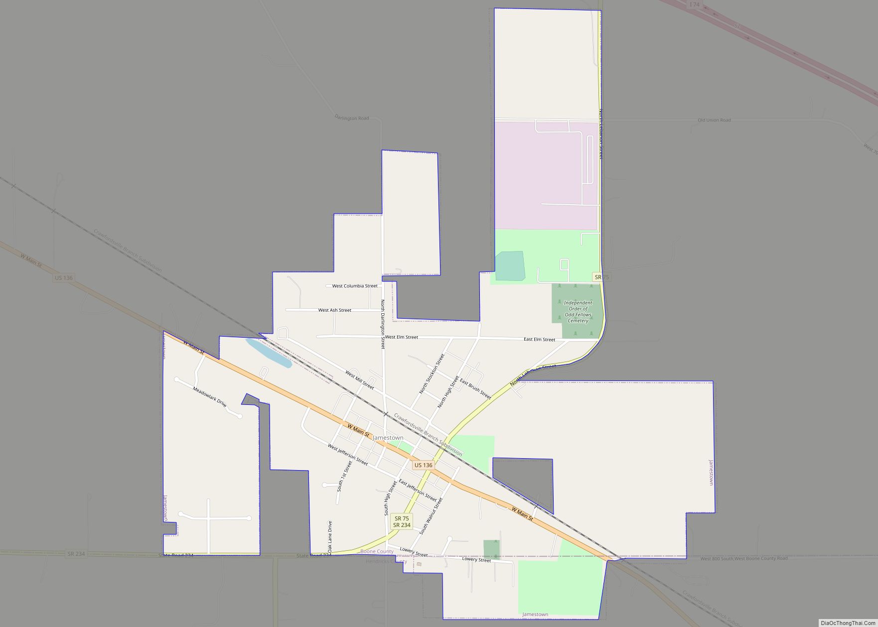
Boone County was created by the state legislature on 1 April 1830, with Jamestown (which had been first settled that year) named as the initial county seat. The county was named for frontiersman Daniel Boone. The interim county commissioners met on 1 May of the following year to identify a permanent seat of government, which by law had to be within 2 miles (3.2 km) of the county’s center; the [future] city of Lebanon was selected to serve this purpose.
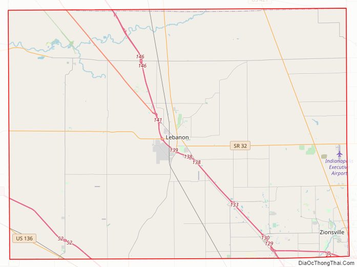
Boone County Road Map
Geography
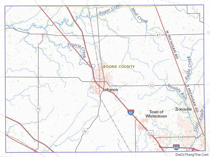
Boone County lies near the center of the state. It is 24 miles (39 km) from east to west and 17.5 miles (28.2 km) from north to south. It contains about 418.5 square miles (108,500 hectares), two-thirds of which is in cultivation. Its central position, excellent soil, and available water power have been in its favor. The highest point of the county (984 feet (300 meters) ASL) is a small hill two miles/3.2 km northeast of Lebanon. The upper part of the county is drained by Sugar Creek, flowing westward into Montgomery County; the southwest part of the county is drained by Big Raccoon Creek, also flowing west-southwestward into Montgomery. The southeast part of the county is drained by Eagle Creek and its tributaries, flowing southward into Marion County.
According to the 2010 census, the county has a total area of 423.25 square miles (1,096.2 km), of which 422.91 square miles (1,095.3 km) (or 99.92%) is land and 0.34 square miles (0.88 km) (or 0.08%) is water.
Adjacent counties
- Clinton County − north
- Hamilton County − east
- Marion County − southeast
- Hendricks County − south
- Montgomery County − west
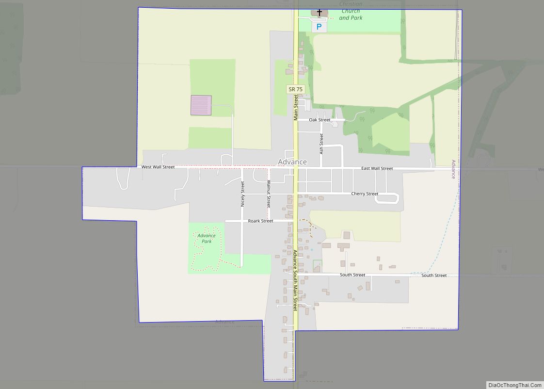
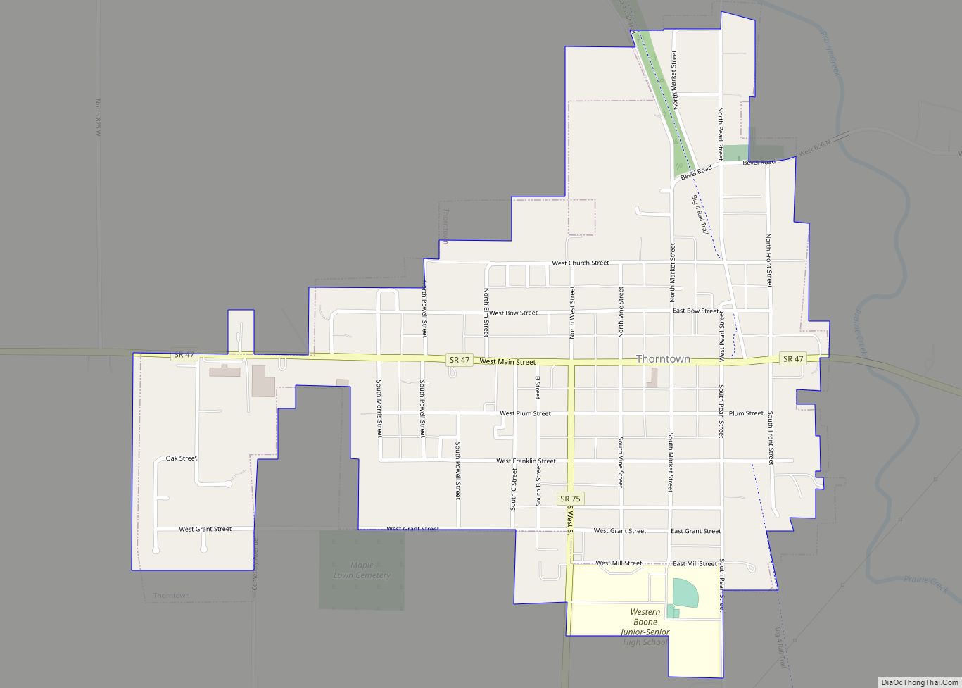
Cities
- Lebanon – county seat
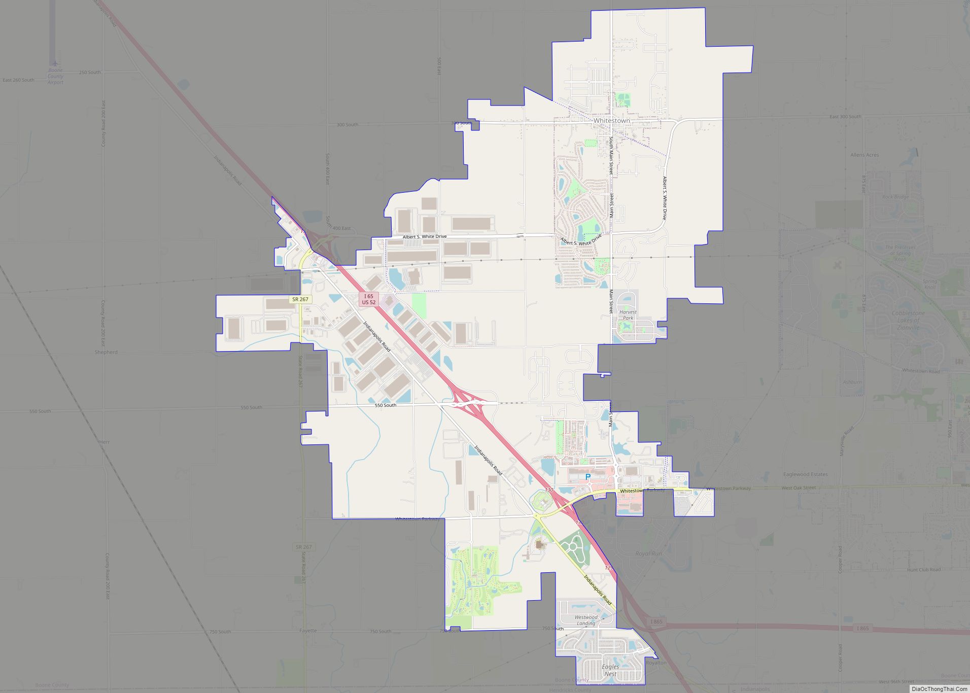
Towns
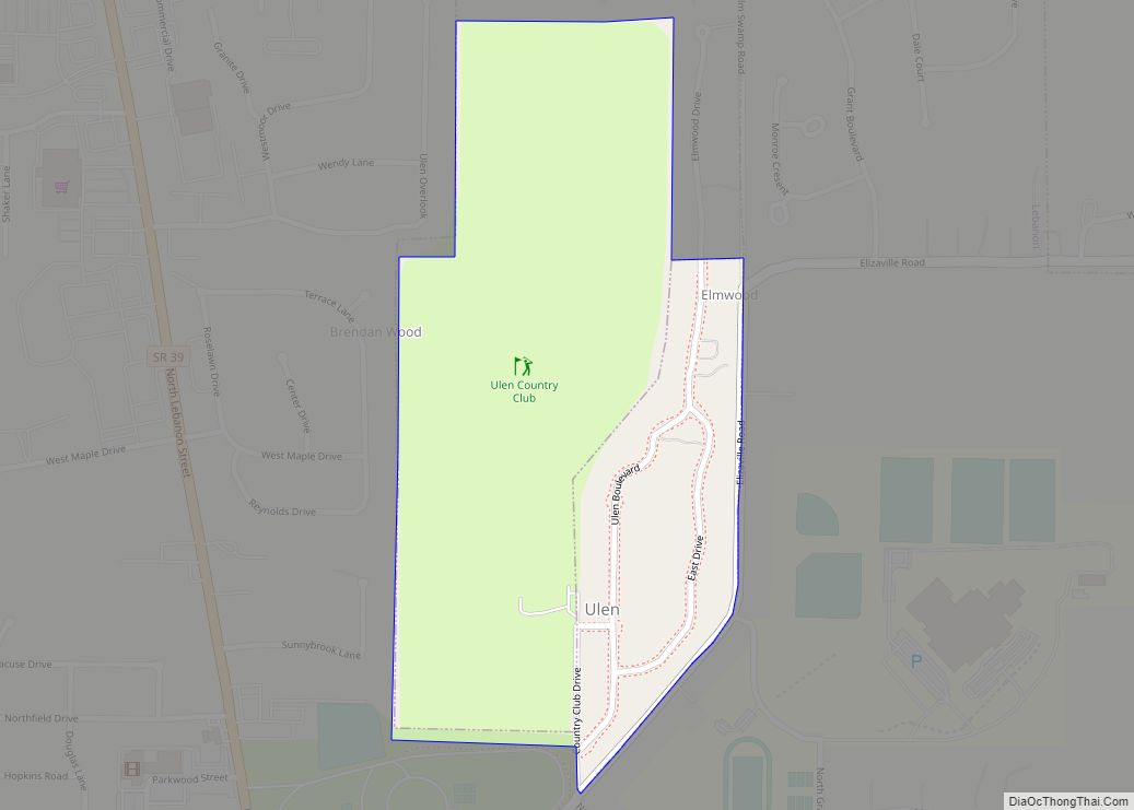
Unincorporated communities
- Big Springs
- Brendan Wood
- Dale
- Dover
- Eagle Village
- Eaglewood Estates
- Elizaville
- Fayette
- Fox Hollow
- Gadsden
- Hazel College
- Hazelrigg
- Herr
- Max
- Mechanicsburg
- Milledgeville
- New Brunswick
- Northfield
- Northfield Village
- Pike
- Rosston
- Royalton
- Russell Lake
- Shannondale (partial)
- Shepherd
- Stringtown
- Terhune
- The Woodlands
- Ward
- Waugh
Townships
Major highways
- Interstate 65
- Interstate 74
- Interstate 465
- Interstate 865
- U.S. Route 52
- U.S. Route 136
- U.S. Route 421
- Indiana State Road 32
- Indiana State Road 38
- Indiana State Road 39
- Indiana State Road 47
- Indiana State Road 75
- Indiana State Road 234
- Indiana State Road 267
Airport
- KTYQ – Indianapolis Executive Airport
Railroads
- CSX Transportation
Boone County Topographic Map
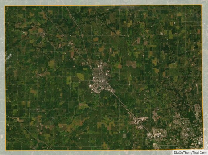
Boone County Satellite Map
Boone County Outline Map