Floyd County is a county located in the U.S. state of Indiana. Its county seat is New Albany. Floyd County has the second-smallest land area in the entire state. It was formed in the year 1819 from neighboring Clark, and Harrison counties.
Floyd County is part of the Louisville/Jefferson County, KY–IN Metropolitan Statistical Area.
| Name: | Floyd County |
|---|---|
| FIPS code: | 18-043 |
| State: | Indiana |
| Founded: | 1819 |
| Named for: | Brigadier General John Floyd |
| Seat: | New Albany |
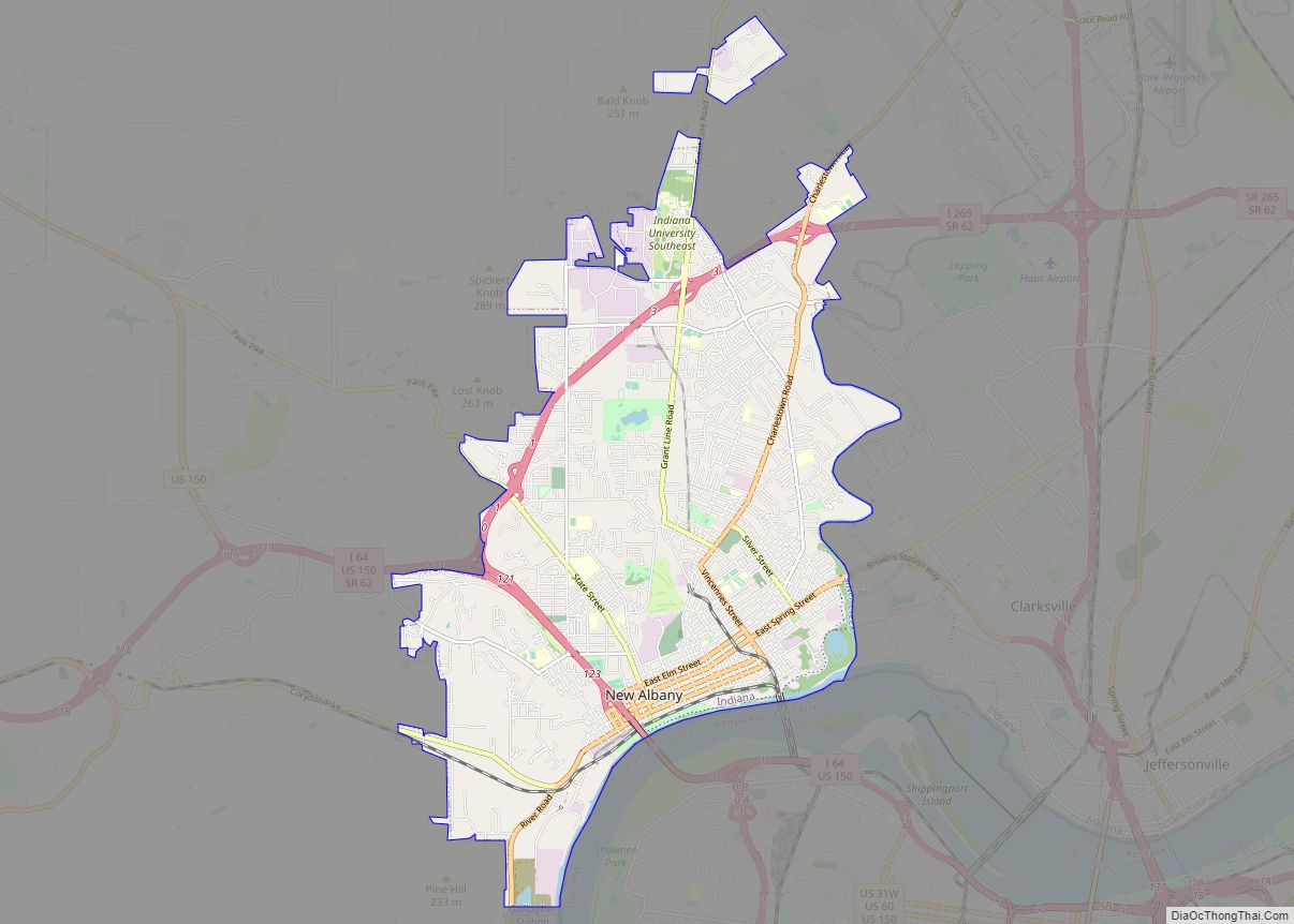
| Largest city: | New Albany |
| Total Area: | 148.96 sq mi (385.8 km²) |
| Land Area: | 147.94 sq mi (383.2 km²) |
| Total Population: | 80,484 |
| Population Density: | 504/sq mi (194.57/km²) |
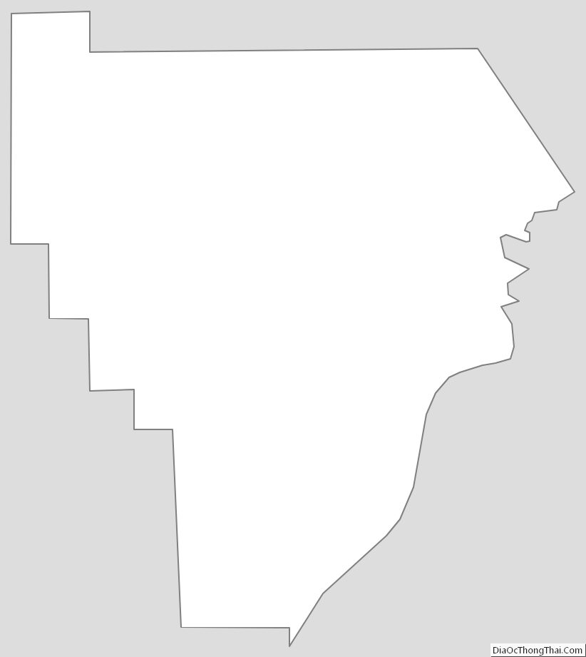
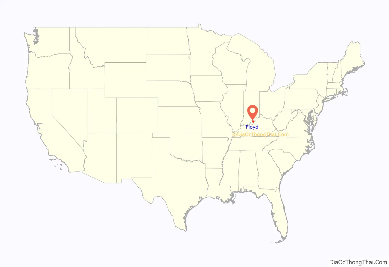
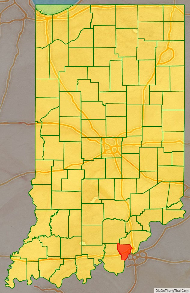
Floyd County location map. Where is Floyd County?
History
Floyd County, originally the Shawnee Indians hunting ground, was conquered for the United States by George Rogers Clark during the American Revolutionary War from the British. He was awarded large tracts of land in Indiana, including almost all of present-day Floyd County. Clark sold land to the settlers who began arriving as soon as peace returned.
In 1818, New Albany was large enough to become a county seat and form a new county. New Albany leaders sent Nathaniel Scribner and John K. Graham to the capital at Corydon to petition the General Assembly. Legislation was passed on January 2, 1819, by the General Assembly, and the county was established on February 1. The origin of the county’s name is debated. According to the State Library, it was named for John Floyd, a leading Jefferson County, Kentucky pioneer and uncle of Davis Floyd. John Floyd was killed in 1783 when his party was attacked by Indians in Bullitt County, Kentucky. However, some maintain the county was actually named for Davis Floyd, who was convicted of aiding Aaron Burr in the treason of 1809. Davis Floyd had also been a leading local political figure and was the county’s first circuit court judge.
In 1814, New Albany was platted and was established as the county seat on March 4, 1819. There was an attempt in 1823 to move the county seat, but the motion failed. New Albany would be the largest city in the state for much of the early 19th century, eventually being overtaken by Indianapolis during the Civil War.
Between 1800 and 1860, Floyd County experienced a huge boom in population (doubling many times over). A survey in the 1850s found that over half of Indiana’s population that made more than $100,000 per year lived in Floyd County, establishing it as having the richest population in the state.
The Duncan Tunnel, the longest tunnel in Indiana, was built in Floyd County in 1881 between New Albany and Edwardsville. Because no route over the Floyds Knobs was suitable for a railroad line, civil engineers decided to tunnel through them. The project was originally started by the Air Line but was completed by Southern Railway. It took five years to bore at a cost of $1 million. The Tunnel is 4,311 feet (1,314 m) long.
Floyd County, during the 19th century, attracted immigrants of Irish, German, French and African American origins. The French settlers located mostly in Floyds Knobs, Indiana. The Irish began arriving in 1817 and settled in large numbers between 1830 and 1850. German immigrants settled mostly in New Albany. By 1850, about one in six county residents had been born in other countries. Mount Saint Francis, a multi-purpose complex owned and administered by the Conventual Franciscan Friars of the Province of Our Lady of Consolation, is located in Floyds Knobs along Highway 150. The property includes 400 acres of woods and Mount Saint Francis Lake, both which are open to the public. Numerous hiking trails meander through the woods and fields containing native prairie grasses. No hunting is allowed on the property.
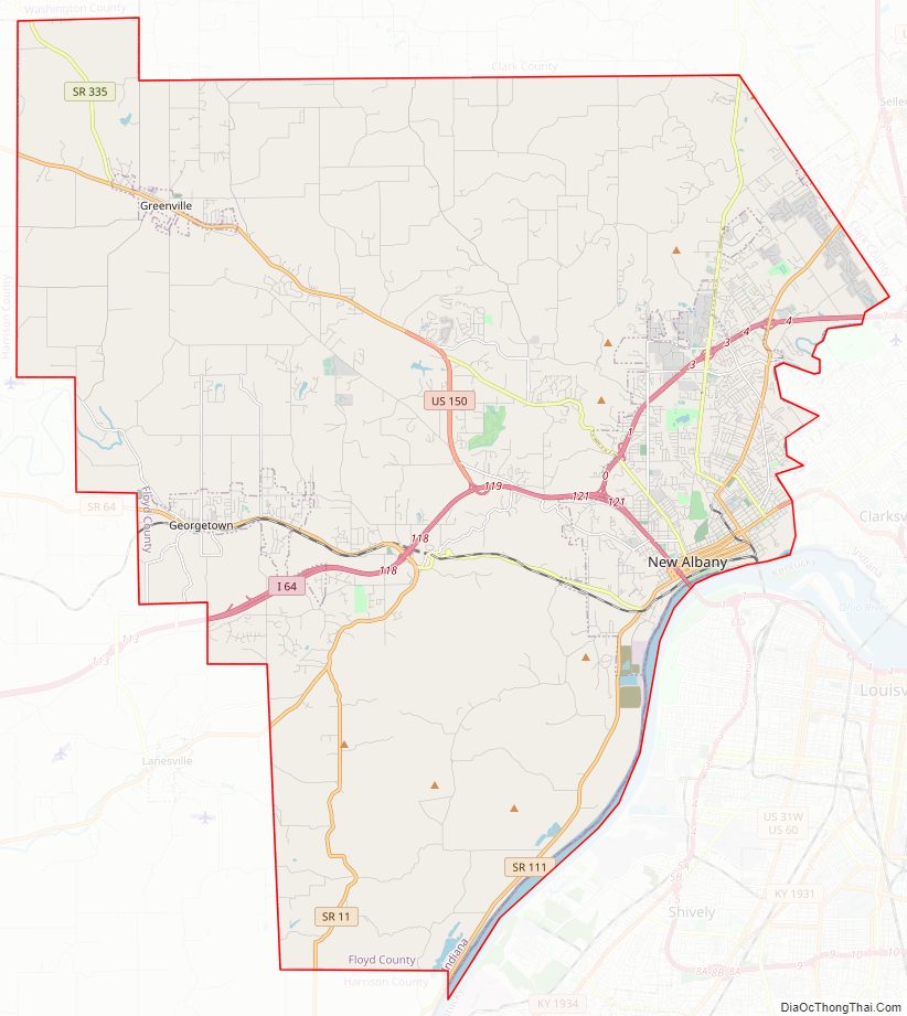
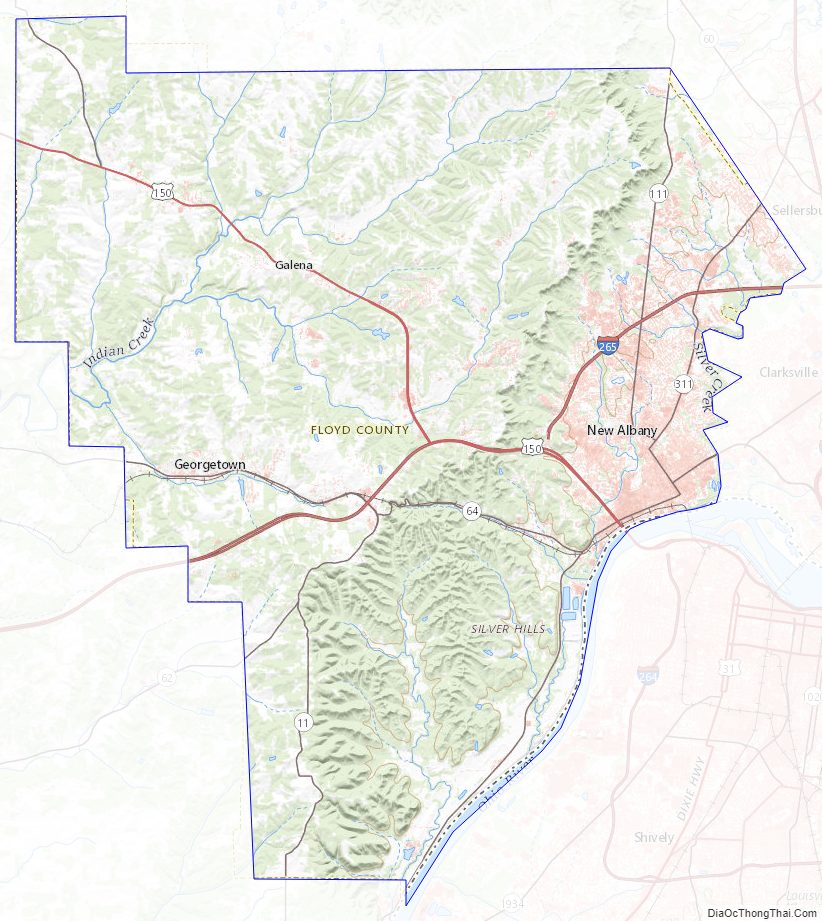
Floyd County Road Map
Geography
According to the 2010 census, the county has a total area of 148.96 square miles (385.8 km), of which 147.94 square miles (383.2 km) (or 99.32%) is land and 1.02 square miles (2.6 km) (or 0.68%) is water. It is the second smallest county in area, behind only Ohio County, although significantly more populated.
City
Towns
Census-designated place
Townships
Floyd County is divided into five townships:
- Franklin
- Georgetown
- Greenville
- Lafayette
- New Albany
Geographical features
The Knobs Unit, which includes Floyd County, contains some of the hilliest country in Indiana. As a result, the area supports trees that prefer very dry sites and ridgetops, as well as those that prefer very wet sites, ravines, or “bottomland.” Tree types unique to the unit include blackjack oak and swamp tupelo. Part of the unit stands on sandstone bedrock; other areas developed over limestone. This difference accommodates a variety of trees and their associated flowering plants and shrubs. Trees found in Floyd County include the Sycamore, Flowering Dogwood, Virginia Pine, Easter Redcedar, American Beech, Sugar Maple, American Elm and Chestnut Oak. The lowest point in the county is the shore of the Ohio River near New Albany at an elevation of 380 ft (120 m).
Major highways
- Interstate 64
- Interstate 265
- U.S. Route 150
- Indiana State Road 11
- Indiana State Road 62
- Indiana State Road 64
- Indiana State Road 111
- Indiana State Road 335
Adjacent counties
- Clark County (northeast)
- Jefferson County, Kentucky (south, across the Ohio River)
- Harrison County (west)
- Washington County (northwest)
Floyd County Topographic Map
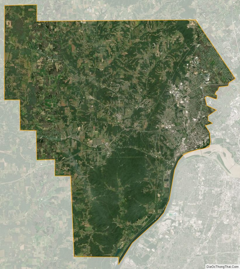
Floyd County Satellite Map
Floyd County Outline Map