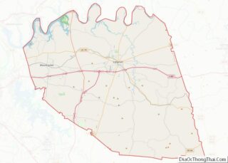
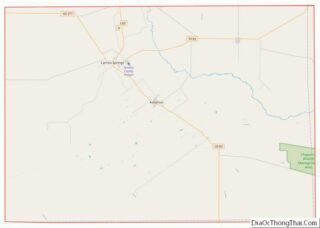
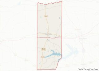
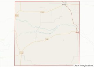
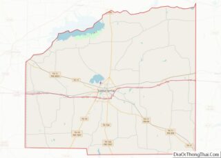
Map of Uinta County, Wyoming
Uinta County (/juːˈɪntə/ yoo-IN-tə) is a county in the U.S. state of Wyoming. As of the 2020 United States Census, the population was 20,450. Its county seat is Evanston. Its south and west boundary lines abut the Utah state line. Uinta County comprises the Evanston, WY Micropolitan Statistical Area. Uinta County overview: Name: Uinta County ... Read more
Map of Uinta County, Wyoming
Map of Cherokee County, Alabama
Cherokee County, Alabama is a county located in the northeastern part of the U.S. state of Alabama. As of the 2020 census, the population was 24,971. Its county seat is Centre. The county is named for the Cherokee tribe. Cherokee County overview: Name: Cherokee County FIPS code: 01-019 State: Alabama Founded: January 9, 1836 Named ... Read more
Map of Cherokee County, Alabama
Map of Elmore County, Alabama
Elmore County is a county located in the east central portion of the U.S. state of Alabama. As of the 2020 census, the population was 87,977. Its county seat is Wetumpka. Its name is in honor of General John A. Elmore. Elmore County is part of the Montgomery, AL Metropolitan Statistical Area. Elmore County overview: ... Read more
Map of Elmore County, Alabama
Map of Limestone County, Alabama
Limestone County is a county of the U.S. state of Alabama. As of the 2020 census, the county’s population was 103,570. Its county seat is Athens. The county is named after Limestone Creek. Limestone County is included in the Huntsville, AL Metropolitan Statistical Area. Limestone County overview: Name: Limestone County FIPS code: 01-083 State: Alabama ... Read more
Map of Limestone County, Alabama
Map of St. Clair County, Alabama
St. Clair County is a county located in the central portion of the U.S. state of Alabama. As of the 2020 census, the population was 91,103. It has two county seats: Ashville and Pell City. It is one of two counties in Alabama, and one of 33 in the United States, with more than one ... Read more
Map of St. Clair County, Alabama
Map of Dillingham Census Area, Alaska
Dillingham Census Area is a census area located in the state of Alaska, United States. At the 2020 census, the population was 4,857, slightly up from 4,847 in 2010. It is part of the unorganized borough and therefore has no borough seat. Its largest community by far is the city of Dillingham, on a small ... Read more
Map of Dillingham Census Area, Alaska
Map of Valdez-Cordova Census Area, Alaska
Valdez–Cordova Census Area was a census area located in the state of Alaska, United States. As of the 2010 census, the population was 9,636. It was part of the Unorganized Borough and therefore has no borough seat. On January 2, 2019, it was abolished and replaced by the Chugach Census Area and the Copper River ... Read more
Map of Valdez-Cordova Census Area, Alaska
Map of Santa Cruz County, Arizona
Santa Cruz is a county in southern Arizona, United States. As of the 2020 census, the population is 47,669. The county seat is Nogales. The county was established in 1899. It borders Pima County to the north and west, Cochise County to the east, and the Mexican state of Sonora to the south. Santa Cruz ... Read more
Map of Santa Cruz County, Arizona
Map of Columbia County, Arkansas
Columbia County is a county located in the U.S. state of Arkansas. As of the 2020 census, the population was 22,801. The county seat is Magnolia. The county was formed on December 17, 1852, and was named for Christopher Columbus. The Magnolia, AR Micropolitan Statistical Area includes all of Columbia County. Columbia County overview: Name: ... Read more
Map of Columbia County, Arkansas
Map of Hot Spring County, Arkansas
Hot Spring County is located in the U.S. state of Arkansas. As of the 2020 census, the population was 33,040. The county seat is Malvern. Hot Spring County was formed on November 2, 1829, from a portion of Clark County. It was named for the hot springs at Hot Springs, Arkansas, which were within its ... Read more
Map of Hot Spring County, Arkansas
Map of Miller County, Arkansas
Miller County is a county located in the southwestern corner of the U.S. state of Arkansas. As of the 2020 census, the population was 42,600. The county seat is Texarkana. Miller County is part of the Texarkana, TX-AR, Metropolitan Statistical Area. When first formed, Miller County was Arkansas’s sixth county, established on April 1, 1820, ... Read more
Map of Miller County, Arkansas
Map of St. Francis County, Arkansas
St. Francis County is a county in the U.S. state of Arkansas. As of the 2020 census, the population was 23,090. The county seat is Forrest City. St. Francis County comprises the Forrest City, Arkansas Micropolitan Statistical Area, which is also included in the Memphis-Forrest City, TN–MS-AR Combined Statistical Area. St. Francis County overview: Name: ... Read more
Map of St. Francis County, Arkansas