Cumberland County is a county in the Commonwealth of Pennsylvania. As of the 2020 census, the population was 259,469. Its county seat is Carlisle.
Cumberland County is included in the Harrisburg–Carlisle metropolitan statistical area.
| Name: | Cumberland County |
|---|---|
| FIPS code: | 42-041 |
| State: | Pennsylvania |
| Founded: | January 27, 1750 |
| Named for: | Cumberland |
| Seat: | Carlisle |
| Total Area: | 550 sq mi (1,400 km²) |
| Land Area: | 545 sq mi (1,410 km²) |
| Total Population: | 259,469 |
| Population Density: | 470/sq mi (180/km²) |
| Time zone: | UTC−5 (Eastern) |
| Summer Time Zone (DST): | UTC−4 (EDT) |
| Website: | www.cumberlandcountypa.gov |
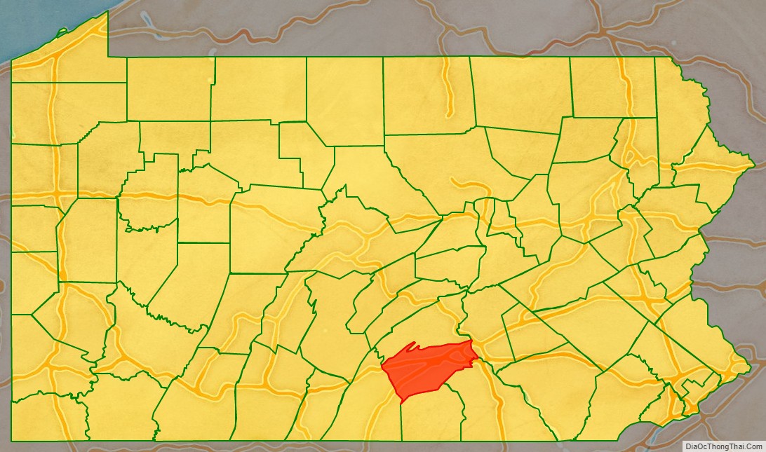
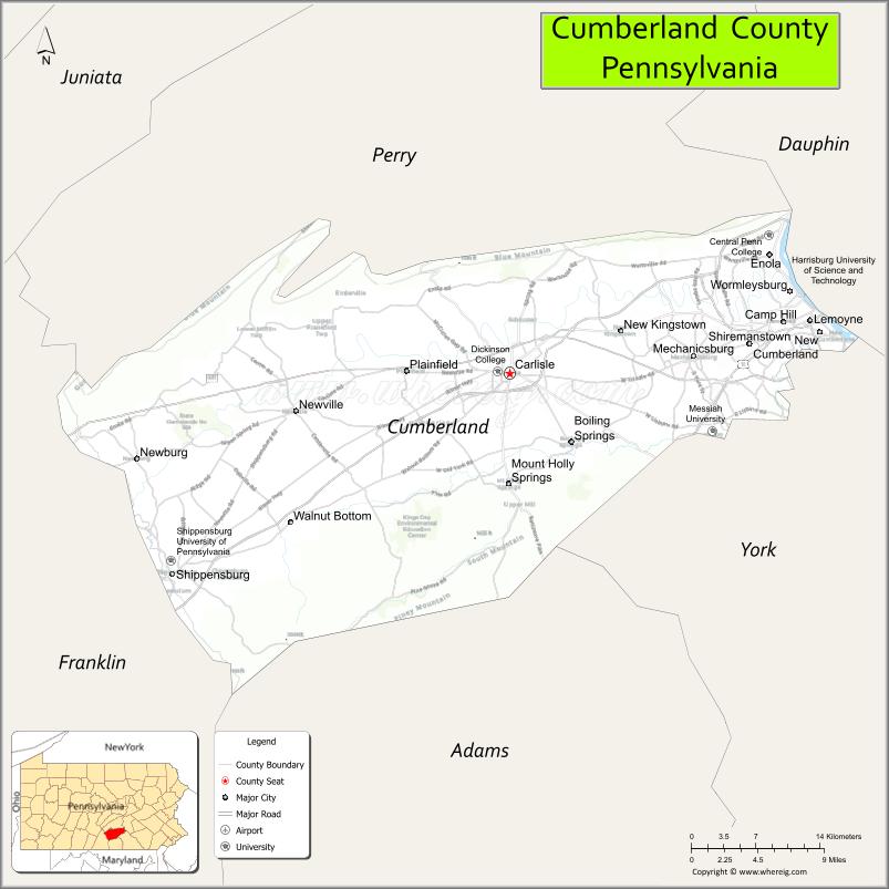
Cumberland County location map. Where is Cumberland County?

History
Cumberland County was first settled by a majority of Scots-Irish immigrants who arrived in this area about 1730. English and German settlers constituted about ten percent of the early population. The settlers originally mostly devoted the area to farming and later developed other trades. These settlers built the Middle Spring Presbyterian Church, among the oldest houses of worship in central Pennsylvania, in 1738 near present-day Shippensburg, Pennsylvania.
The General Assembly (legislature) of the Pennsylvania colony on January 27, 1750, created Cumberland County from Lancaster County, Pennsylvania, naming it for Cumberland, England. Its county seat is Carlisle. The county also lies within the Cumberland Valley adjoining the Susquehanna River at its eastern border, stretching approximately 42 miles from the borough of Shippensburg on the west to the Susquehanna River in east Cumberland County.
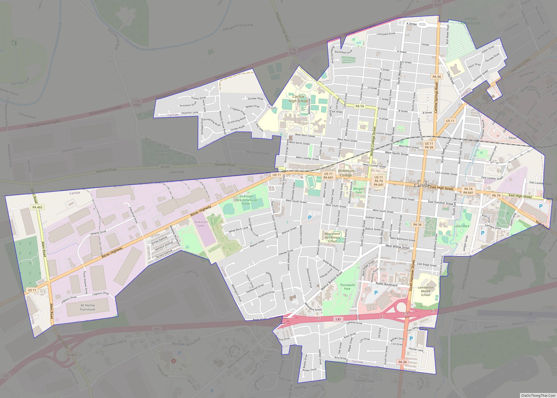
The oldest towns in the county are Shippensburg and Carlisle, each with its unique history. Shippensburg is home to Shippensburg University of Pennsylvania, one of 14 universities of the Pennsylvania State System of Higher Education. Carlisle is also home to Dickinson College, established in 1773, and the Penn State Dickinson School of Law.
The United States Army War College is a United States Army school located in Carlisle, Pennsylvania, on the 500 acre (2 km) campus of the historic Carlisle Barracks, a military post dating back to the 1770s. It caters to high-level military personnel and civilians and prepares them for strategic leadership responsibilities. It is the U. S. Army’s most senior military educational institution.
During the Gettysburg campaign of the American Civil War in the summer of 1863, Confederate troops marched through the Cumberland Valley, briefly occupying much of Cumberland County.
In the 20th century, the suburbs of Harrisburg, the state capital, expanded extensively into eastern Cumberland County. Carlisle also developed suburbs in adjoining townships.
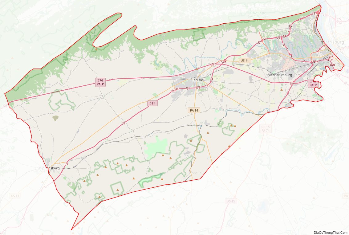
Cumberland County Road Map
Geography
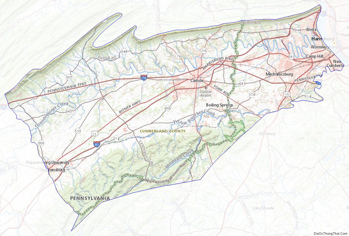
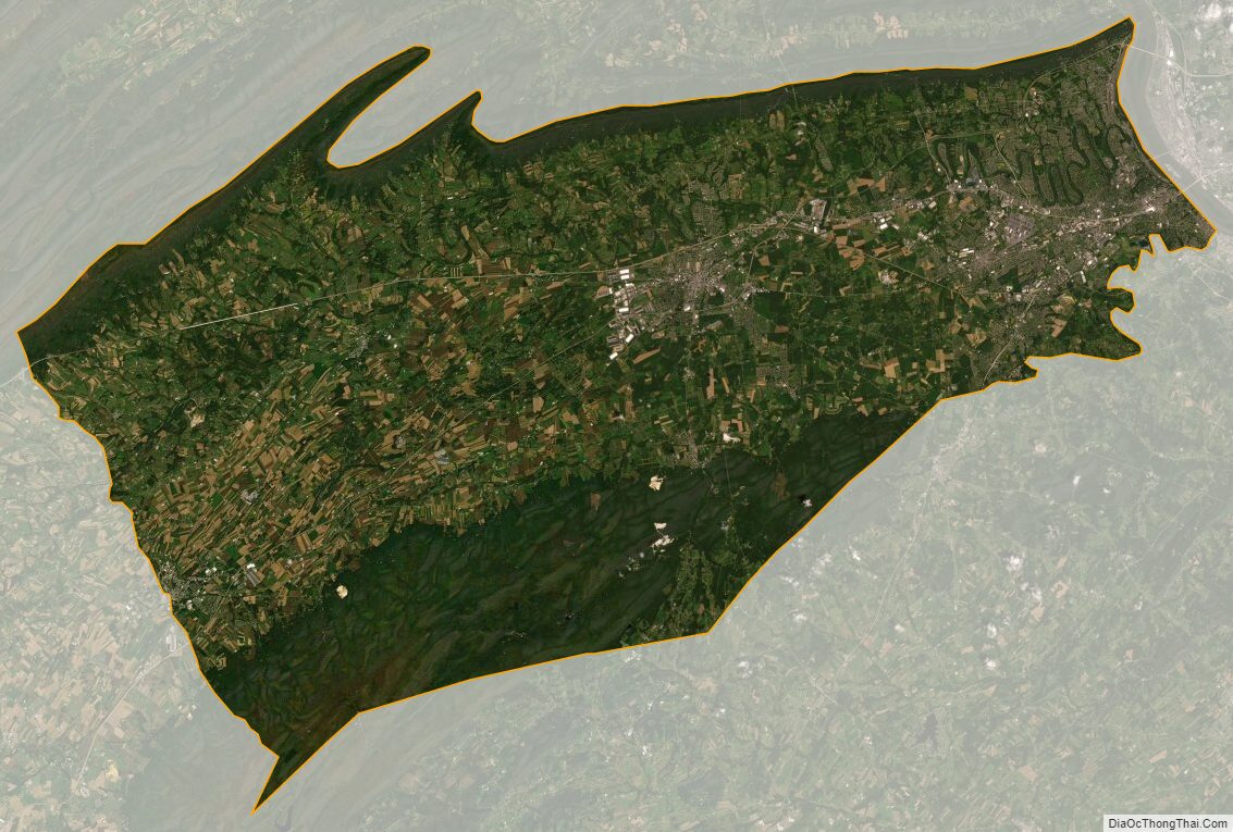
According to the U.S. Census Bureau, the county has a total area of 550 square miles (1,400 km), of which 545 square miles (1,410 km) is land and 4.8 square miles (12 km) (0.9%) is water. The area code is 717 with an overlay of 223. Blue Mountain forms Cumberland’s northern natural boundary and Yellow Breeches Creek forms part of its SE natural boundary. The Susquehanna River drains the county and forms its eastern natural boundary. A large portion of Cumberland is drained by the Conodoguinet Creek, which winds its way west-to-east across the county into the Susquehanna.
Climate
Almost all of Cumberland has a hot-summer humid continental climate (Dfa) and its hardiness zone is 6b, except in much of the eastern portion, where it is 7a. Average monthly temperatures in Lemoyne range from 29.9° F in January to 74.9° F in July, in Carlisle they range from 29.8° F in January to 75.2° F in July, and in Shippensburg they range from 29.6° F in January to 74.6° F in July. [1] The latest temperature averages show some low-lying eastern areas of the county to have a humid subtropical climate (Cfa.)
Adjacent counties
- Perry County (north)
- Dauphin County (east)
- York County (southeast)
- Adams County (south)
- Franklin County (southwest)
Major highways
- I-76 / Penna Turnpike
- I-81
- I-83
- US 11
- US 15
- PA 34
- PA 74
- PA 94
- PA 114
- PA 174
- PA 233
- PA 465
- PA 533
- PA 581
- PA 641
- PA 696
- PA 944
- PA 997
State protected areas
- Colonel Denning State Park
- Kings Gap Environmental Education and Training Center
- Pine Grove Furnace State Park
Cumberland County Topographic Map
Cumberland County Satellite Map
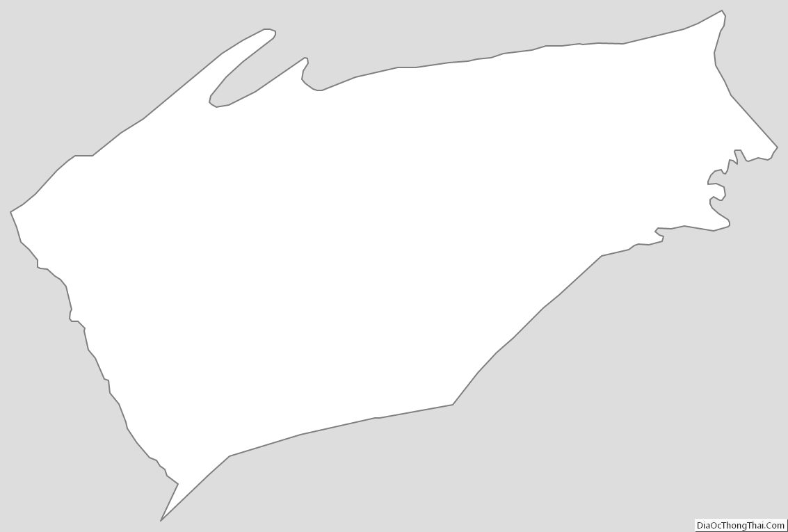
Cumberland County Outline Map