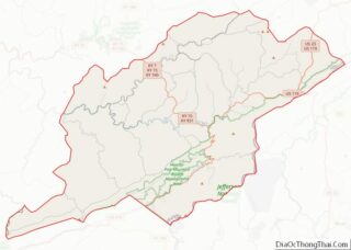
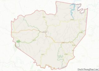
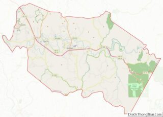
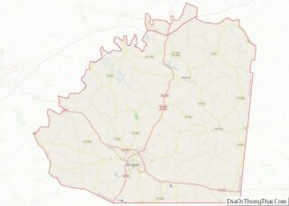
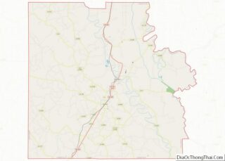
Map of Preston County

Map of Preston County, West Virginia

Preston County is a county located in the U.S. state of West Virginia. As of the 2020 Census, the population was 34,216. Its county seat is Kingwood. The county was formed from Monongalia County in 1818 and named for Virginia Governor James Patton Preston. Preston County is part of the Morgantown, WV Metropolitan Statistical Area, … Read more

Map of Wyoming County

Map of Wyoming County, West Virginia

Wyoming County is a county in the U.S. state of West Virginia. As of the 2020 census, the population was 21,382. Its county seat is Pineville. The county was created in 1850 from Logan County and named for the Lenape word meaning “large plains”. Wyoming County overview: Name: Wyoming County FIPS code: 54-109 State: West … Read more

Map of Douglas County

Map of Douglas County, Wisconsin

Douglas County is a county located at the northwest corner of the U.S. state of Wisconsin. As of the 2020 census, the population was 44,295 Its county seat is Superior. Douglas County is included in the Duluth, MN-WI Metropolitan Statistical Area. Douglas County overview: Name: Douglas County FIPS code: 55-031 State: Wisconsin Founded: February 8, … Read more

Map of La Crosse County

Map of La Crosse County, Wisconsin

La Crosse County is a county located in the U.S. state of Wisconsin. At the 2020 census, the population was 120,784. Its county seat is La Crosse. La Crosse County is included in the La Crosse-Onalaska, WI-MN Metropolitan Statistical Area with a population of 139,627 and is the most populous county on Wisconsin’s western border. … Read more

Map of Ozaukee County

Map of Ozaukee County, Wisconsin

Ozaukee County is a county in the U.S. state of Wisconsin. As of the 2020 census, the population was 91,503. Its county seat is Port Washington, making it one of three Wisconsin counties on Lake Michigan not to have a county seat with the same name. Ozaukee County is included in the Milwaukee–Waukesha–West Allis, WI … Read more

Map of Trempealeau County

Map of Trempealeau County, Wisconsin

Trempealeau County (/ˈtrɛm.pə.loʊ/, TREM-pə-loh) is a county in the U.S. state of Wisconsin. As of the 2020 census, the population was 30,760. Its county seat is Whitehall. Many people of Polish, Norwegian and German descent live in this area. Trempealeau County overview: Name: Trempealeau County FIPS code: 55-121 State: Wisconsin Founded: 1855 Named for: Trempealeau … Read more

Map of Crook County

Map of Crook County, Wyoming

Crook County overview: Name: Crook County FIPS code: 56-011 State: Wyoming Founded: December 8, 1875 (authorized)1888 (organized) Named for: George Crook Seat: Sundance Largest town: Sundance Total Area: 2,865 sq mi (7,420 km²) Land Area: 2,854 sq mi (7,390 km²) Total Population: 7,181 Population Density: 2.5/sq mi (0.97/km²) Crook County location map. Where is Crook County? History Crook County was created by … Read more

Map of Washakie County

Map of Washakie County, Wyoming

Washakie County is a county in the U.S. state of Wyoming. As of the 2020 United States Census, the population was 7,685. Its county seat is Worland. Washakie County overview: Name: Washakie County FIPS code: 56-043 State: Wyoming Founded: February 21, 1911 (authorized)1913 (organized) Named for: Chief Washakie Seat: Worland Largest city: Worland Total Area: … Read more

Map of Chilton County

Map of Chilton County, Alabama

Chilton County is a county located in the central portion of the U.S. state of Alabama. As of the 2020 census, the population was 45,014. The county seat is Clanton. Its name is in honor of William Parish Chilton, Sr. (1810–1871), a lawyer who became Chief Justice of the Alabama Supreme Court and later represented … Read more

Map of Escambia County

Map of Escambia County, Alabama

Escambia County is a county located in the south central portion of the U.S. state of Alabama. As of the 2020 census, the population was 36,757. Its county seat is Brewton. Escambia County is coextensive with the Atmore, AL Micropolitan Statistical Area; which is itself a constituent part of the larger Pensacola-Ferry Pass, FL-AL Combined … Read more

Map of Lowndes County

Map of Lowndes County, Alabama

Lowndes County is in the central part of the U.S. state of Alabama. As of the 2020 census, the county’s population was 10,311. Its county seat is Hayneville. The county is named in honor of William Lowndes, a member of the United States Congress from South Carolina. Lowndes County is part of the Montgomery, Alabama … Read more

Map of Shelby County

Map of Shelby County, Alabama

Shelby County is located in the central portion of the U.S. state of Alabama. As of the 2020 census the population was 223,024. The county seat is Columbiana. Its largest city is Alabaster. The county is named in honor of Isaac Shelby, Governor of Kentucky from 1792 to 1796 and again from 1812 to 1816. … Read more