Clarendon County is a county located below the fall line in the Coastal Plain region of U.S. state of South Carolina. As of 2020 census, its population was 31,144. Its county seat is Manning.
This area was developed for lumber and mills, including textile mills. Clarendon County boasts one of the largest man-made lakes in the United States, Lake Marion, completed in 1941 as a New Deal project. It was planned as part of a national rural electrification initiative. Since the late 20th century, the dam’s generation of hydroelectric power has also stimulated economic development and industry in the region.
The South Carolina state legislature established racial segregation of public facilities by state law in the late 19th century. During the Civil Rights Movement, Clarendon County was the site of the Briggs v. Elliott trial challenging segregation of public schools. This case was one of five combined with what came to be known as Brown v. Board of Education, under which the United States Supreme Court ruled in 1954 that racial segregation of public schools was unconstitutional.
| Name: | Clarendon County |
|---|---|
| FIPS code: | 45-027 |
| State: | South Carolina |
| Founded: | 1785 |
| Named for: | Edward Hyde, 1st Earl of Clarendon |
| Seat: | Manning |
| Largest city: | Manning |
| Total Area: | 696 sq mi (1,800 km²) |
| Land Area: | 607 sq mi (1,570 km²) |
| Total Population: | 31,024 |
| Population Density: | 51.1/sq mi (19.7/km²) |
| Time zone: | UTC−5 (Eastern) |
| Summer Time Zone (DST): | UTC−4 (EDT) |
| Website: | www.clarendoncountygov.org |
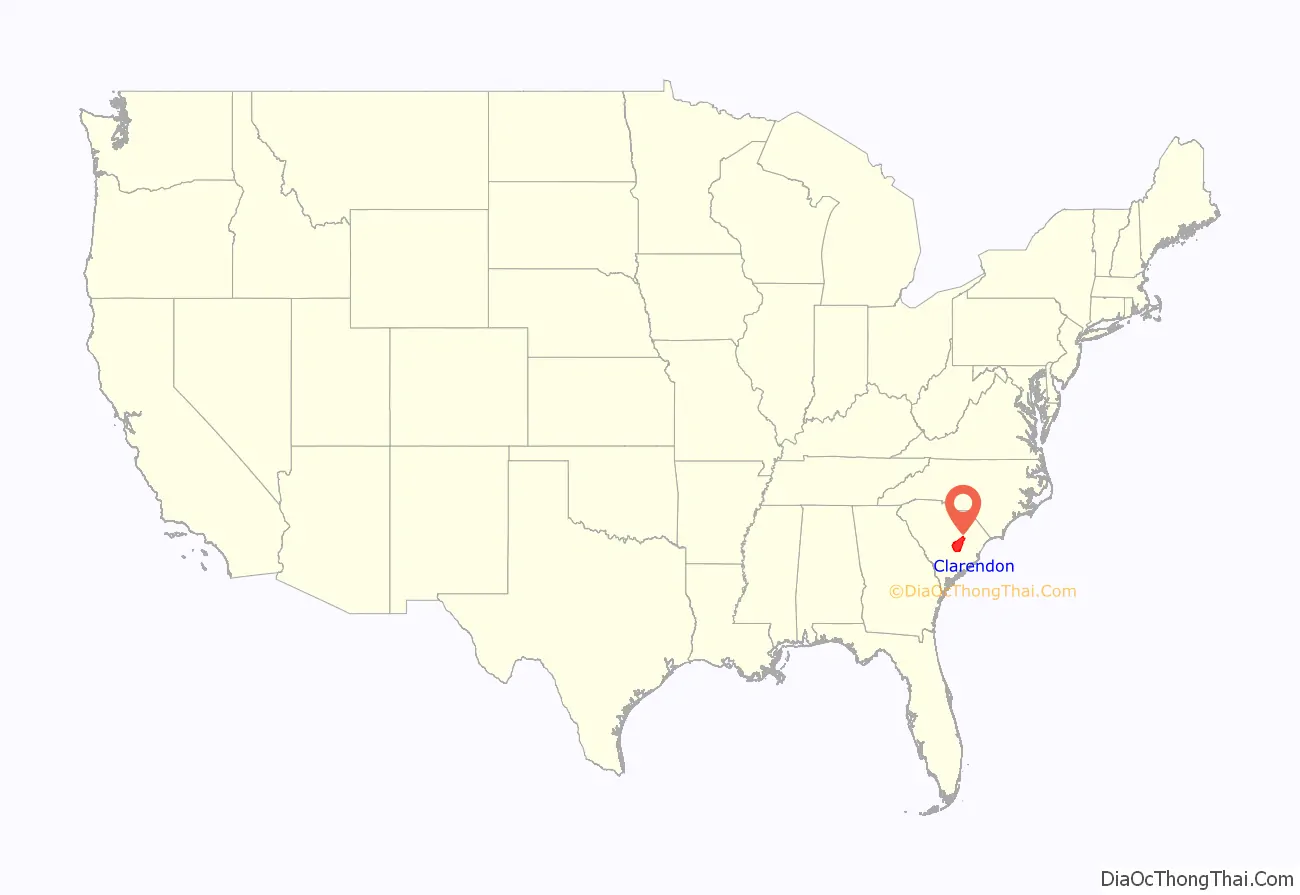
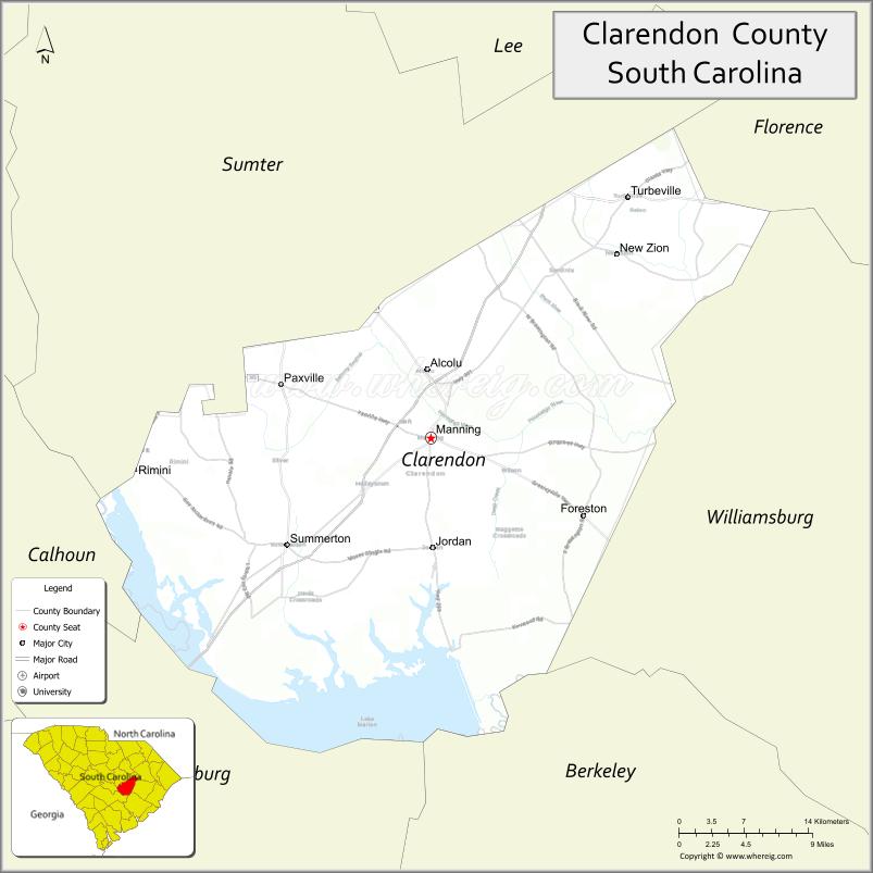
Clarendon County location map. Where is Clarendon County?
History
Clarendon County was officially established in 1785, shortly after the American Revolutionary War, when the legislature divided Camden District into seven counties. One was Clarendon County. It was named after Edward Hyde, who was a Lord Proprietor and earl of Clarendon.
During the American Revolutionary War, the Battle of Half Way Swamp was fought in December 1780. That was one of the many Revolutionary battles that took place in the area of Clarendon County. Others in this area were the following battles: Richbourg’s Mill, Nelson’s Ferry, Fort Watson/Santee Indian Mound, and Tearcoat. The Swamp Fox Murals Trail has been established as an historical landmark depicting the American Revolution and General Francis Marion, the “Swamp Fox”.
The first European settlers in Clarendon County were ethnic French Huguenots, who traveled by boat up the Santee River. Their ancestors had earlier settled in Charleston after leaving France in the late 17th century to escape religious persecution. Transportation of goods by land was difficult, so canals were constructed to carry boat traffic around rapids in the river. The first notable canal was the Santee Canal, which was constructed in 1793. But due to the development of the railroads in the mid-1800s and construction linking major markets, the canal was superseded and ended operations some years later.
In 1798, the state legislature combined three counties – Clarendon, Claremont, and Salem – to form Sumter District for ease of administration. On December 19, 1855, a legislative act was passed establishing the Clarendon District, with the same boundaries as defined for the county in 1785. When implemented in 1787, an additional section from Sumter District was annexed – the northeast extension of Clarendon District. (The northernmost township was released to Florence County about 1888.)
During the antebellum period, the county was developed as large plantations to cultivate commodity crops, particularly short-staple cotton, by the labor of enslaved African Americans. Cultivation of this crop was made profitable by development of the cotton gin by Eli Whitney, which made processing more labor-efficient. By the time of the Civil War, the population of the county was majority black.
In 1855, Captain Joseph C. Burgess was selected to determine the geographical center of the county, the preferred location for the county seat, so that a courthouse village could be built. The commissioners decided on the site where the present courthouse was erected. Manning was developed as the county seat. Captain Burgess deeded six acres to the state, providing sites for the courthouse and jail, in addition to streets 75-feet-wide on four sides.
In 1865, toward the end of the American Civil War, a body of General Sherman’s Union troops under command of General Potter raided Clarendon county. They destroyed a large portion of Manning, including the court house. The raid took place a few days before Gen. Robert E. Lee´s surrender at Appomattox. The county recovered slowly from the Civil War due to its reliance on agriculture, which suffered a long depression.
The State Constitution of 1868 renamed the districts as counties. Agriculture continued as the mainstay of the economy through much of the 19th century, and planters had to adjust to a free labor economy. They gradually relied on a system of mostly African-American tenant farmers and sharecroppers. Lumber and related mills and industries became increasingly important, with towns developed along railroad lines in the area.
Following Reconstruction, white Democrats regained control of the state legislature, passing laws for segregation of public facilities, Jim Crow and a new constitution of 1895 that effectively disfranchised most blacks in the state. This exclusion from the political system was not ended until after decades of activism by African Americans, who gained passage of federal civil rights legislation in the mid-1960s to enforce their constitutional rights.
In November 1941, Lake Marion was created as a reservoir by construction of the Santee Dam by the United States Corps of Engineers. The dam was built across the Santee River to generate hydroelectric power for rural electrification, one of the major infrastructure projects initiated under President Franklin D. Roosevelt’s New Deal federal investments during the Great Depression. Lake Marion and the Santee Dam were part of the Santee-Cooper Hydroelectric and Navigation Project.
Two notable court cases in Clarendon County in the mid-20th century were part of challenges by the Civil Rights Movement to racial segregation of public facilities; these cases related to segregated public schools. This was concluded in law by the United States Supreme Court ruling in Brown v. Board of Education (1954), which declared that separate but equal schools were unconstitutional. The court learned that the separate school were historically underfunded in most Southern states and seldom equal. These cases were Levi Pearson v. Clarendon County Board of Education (1947), and Briggs v. Elliott (1952).
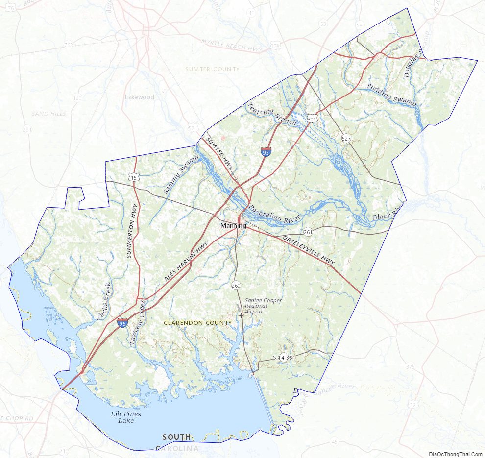
Clarendon County Road Map
Geography
According to the U.S. Census Bureau, the county has a total area of 696 square miles (1,800 km), of which 607 square miles (1,570 km) is land and 89 square miles (230 km) (13%) is water.
Clarendon Country is located in the east-central portion of South Carolina, inland of the Lowcountry and bordering the southern edge of the Pee Dee. The county covers 606.94 square miles; Lake Marion, located in the southern portion of the county, covers an additional 95 square miles of the county (See Map 2). Most of the land is predominantly sand and loamy soils. Clarendon County has a moderate climate with very warm summers and mild winters. The average precipitation is 55 inches per year. The growing season is 225 days, so farmers have a long season to grow crops. Some of the major crops grown in Clarendon County are cotton, tobacco, corn and soybean.
According to Core Based Statistical Classifications, Clarendon County is classified as a non-core area, and is neither a metropolitan or micropolitan statistical area. As seen in Table 1, there are only 57.60 people per square mile in Clarendon County, significantly less than average in South Carolina, areas of which have been urbanized.
Clarendon County is characterized by a Humid subtropical climate with hot, humid summers and cool, dry winters. The county also holds the state’s records for both maximum 24-hour snowfall and largest hailstone.
National protected areas
- Bluff Unit National Wildlife Refuge
- Pine Island Unit National Wildlife Refuge
- Santee National Wildlife Refuge
State and local protected areas/sites
- Davis House
- Santee Indian Mound and Fort Watson
- Taw Caw Creek Park
- Woods Bay State Park (part)
Major water bodies
- Black River
- Congaree River
- Cooper River
- Lake Marion
- Ox Swamp
- Pocotaligo River
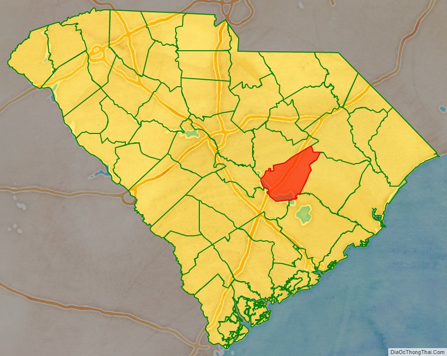
Adjacent counties
- Sumter County – north
- Florence County – northeast
- Williamsburg County – east
- Berkeley County – southeast
- Orangeburg County – southwest
- Calhoun County – west
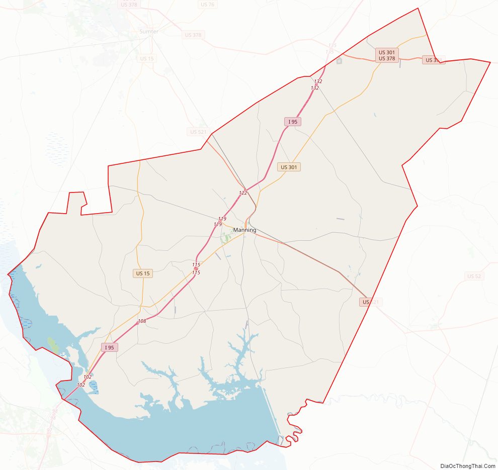
Major highways
- I-95
- US 15
- US 15 Conn.
- US 52
- US 521
- US 301
- US 301 Conn. (Alcolu 1)
- US 301 Conn. (Alcolu 2)
- US 378
- SC 35
- SC 56
- SC 260
- SC 261
- SC 527
Clarendon County Topographic Map
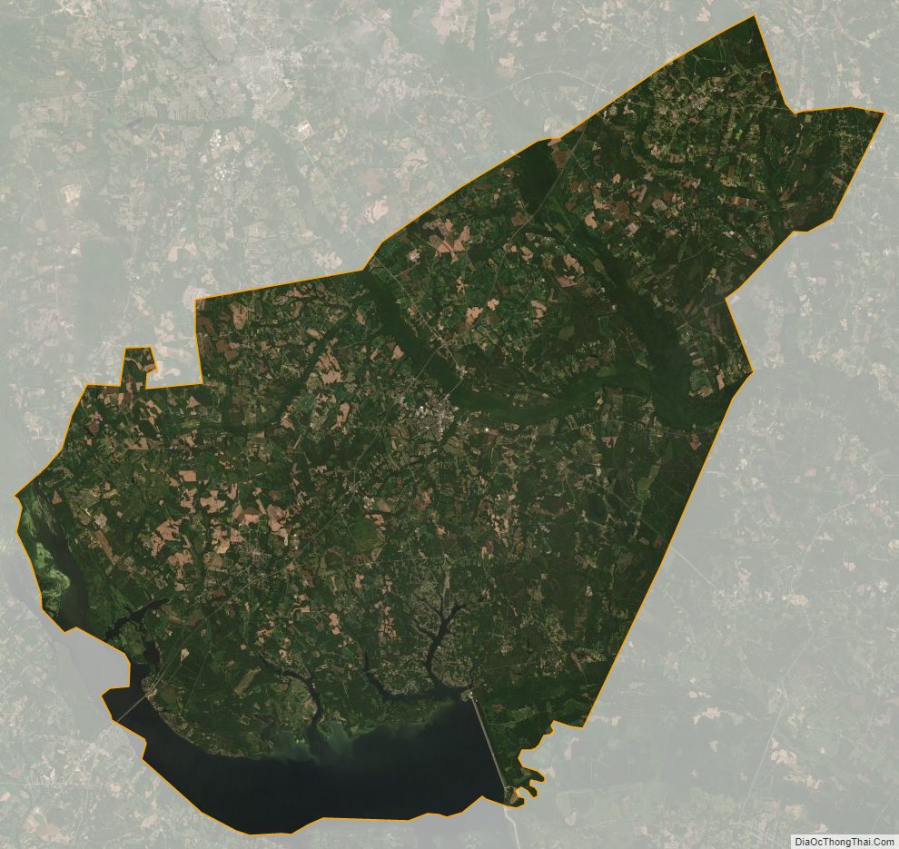
Clarendon County Satellite Map
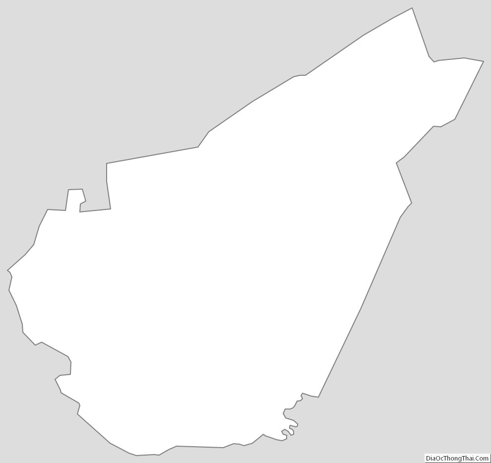
Clarendon County Outline Map