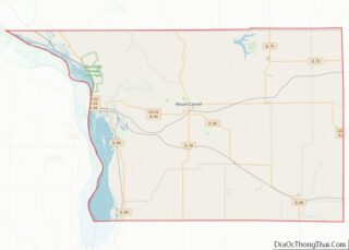
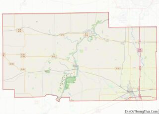
Map of Green County

Map of Green County, Wisconsin

Green County is a county located in the U.S. state of Wisconsin. As of the 2020 census, the population was 37,093. Its county seat is Monroe. Green County is included in the Madison, WI Metropolitan Statistical Area. Green County overview: Name: Green County FIPS code: 55-045 State: Wisconsin Founded: 1837 Named for: Nathanael Greene Seat: … Read more

Map of Marathon County

Map of Marathon County, Wisconsin

Marathon County overview: Name: Marathon County FIPS code: 55-073 State: Wisconsin Founded: 1850 Named for: Marathon, Greece Seat: Wausau Largest city: Wausau Total Area: 1,576 sq mi (4,080 km²) Land Area: 1,545 sq mi (4,000 km²) Total Population: 138,013 Population Density: 89.3/sq mi (34.5/km²) Marathon County location map. Where is Marathon County? Marathon County Road Map Geography According to the U.S. Census … Read more

Map of Richland County

Map of Richland County, Wisconsin

Richland County is a county in the U.S. state of Wisconsin. As of the 2020 census, the population was 17,304. Its county seat is Richland Center. The county was created from the Wisconsin Territory in 1842 and organized in 1850. It is named for the high quality of its soil. Richland County overview: Name: Richland … Read more

Map of Waupaca County

Map of Waupaca County, Wisconsin

Waupaca County is a county in the U.S. state of Wisconsin. As of the 2020 census, the population was 51,812. The county seat is Waupaca. The county was created in 1851 and organized in 1853. It is named after the Waupaca River, a Menominee language name meaning ‘white sand bottom’, ‘pale water’, or ‘tomorrow river’. … Read more

Map of Natrona County

Map of Natrona County, Wyoming

Natrona County is a county in the U.S. state of Wyoming. As of the 2020 United States Census, the population was 79,955, making it the second-most populous county in Wyoming. Its county seat is Casper. Natrona County comprises the Casper, WY Metropolitan Statistical Area. In 2010, the center of population of Wyoming was in Natrona … Read more

Map of Baldwin County

Map of Baldwin County, Alabama

Baldwin County is a county located in the southwestern part of the U.S. state of Alabama, on the Gulf coast. It is one of only two counties in Alabama that border the Gulf of Mexico, along with Mobile County. As of the 2020 census, the population was 231,767. The county seat is Bay Minette. The … Read more

Map of Conecuh County

Map of Conecuh County, Alabama

Conecuh County (/kəˈnɛkə/) is a county located in the south central portion of the U.S. state of Alabama. As of the 2020 census the population was 11,597. Its county seat is Evergreen. Its name is believed to be derived from a Creek Indian term meaning “land of cane.” Conecuh County overview: Name: Conecuh County FIPS … Read more

Map of Henry County

Map of Henry County, Alabama

Henry County is a county in the southeastern part of the U.S. state of Alabama. As of the 2020 census, its population was 17,146. Its county seat is Abbeville. The county was named for Patrick Henry (1736–1799), famous orator and Governor of Virginia. Henry County is part of the Dothan, AL Metropolitan Statistical Area. Henry … Read more

Map of Monroe County

Map of Monroe County, Alabama

Monroe County is a county located in the southwestern part of the U.S. state of Alabama. As of the 2020 census, the population was 19,772. Its county seat is Monroeville. Its name is in honor of James Monroe, fifth President of the United States. It is a dry county, in which the sale of alcoholic … Read more

Map of Wilcox County

Map of Wilcox County, Alabama

Wilcox County is a county of the U.S. state of Alabama. As of the 2020 census, the population was 10,600. Its county seat is Camden. Wilcox County overview: Name: Wilcox County FIPS code: 01-131 State: Alabama Founded: December 13, 1819 Named for: Joseph M. Wilcox Seat: Camden Largest city: Camden Total Area: 907 sq mi (2,350 km²) Land … Read more

Map of Matanuska-Susitna Borough

Map of Matanuska-Susitna Borough, Alaska

Matanuska-Susitna Borough (often referred to as the Mat-Su Borough) is a borough located in the U.S. state of Alaska. Its borough seat is Palmer, and the largest community is the census-designated place of Knik-Fairview. As of the 2020 census, the borough’s population was 107,801, The borough is part of the Anchorage Metropolitan Statistical Area, along … Read more

Map of Graham County

Map of Graham County, Arizona

Graham County overview: Name: Graham County FIPS code: 04-009 State: Arizona Founded: March 10, 1881 Named for: Mount Graham Seat: Safford Largest city: Safford Total Area: 4,641 sq mi (12,020 km²) Land Area: 4,623 sq mi (11,970 km²) Total Population: 38,533 Population Density: 8.3/sq mi (3.2/km²) Time zone: UTC−7 (Mountain) Website: www.graham.az.gov Graham County location map. Where is Graham County? History Joseph … Read more