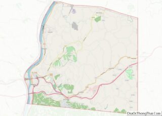
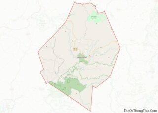
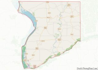
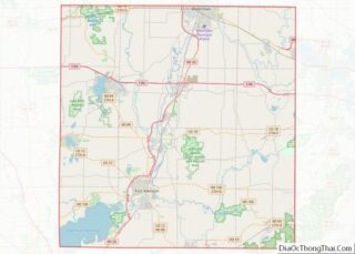
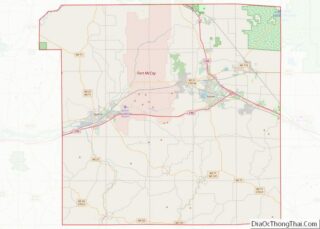
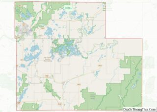
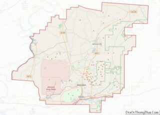
Map of Jefferson County

Map of Jefferson County, Mississippi

Jefferson County is a county located in the U.S. state of Mississippi; its western border is formed by the Mississippi River. As of the 2020 census, the population was 7,260, making it the fourth-least populous county in Mississippi. Its county seat is Fayette. The county is named for U.S. President Thomas Jefferson. Originally developed as … Read more

Map of Monroe County

Map of Monroe County, Mississippi

Monroe County is a county on the northeast border of the U.S. state of Mississippi next to Alabama. As of the 2020 census, the population was 34,180. Its county seat is Aberdeen. Monroe County overview: Name: Monroe County FIPS code: 28-095 State: Mississippi Founded: 1821 Named for: James Monroe Seat: Aberdeen Largest city: Amory Total … Read more

Map of Simpson County

Map of Simpson County, Mississippi

Simpson County is a county located in the U.S. state of Mississippi. Its western border is formed by the Pearl River, an important transportation route in the 19th century. As of the 2020 census, the population was 25,949. The county seat is Mendenhall. The county is named for Josiah Simpson (1787-1817), a territorial judge who … Read more

Map of Winston County

Map of Winston County, Mississippi

Winston County is a county located in the U.S. state of Mississippi. In the 2020 census, the population was 17,714. Its county seat is Louisville. The county is named for Louis Winston (1784–1824), a colonel in the militia, a prominent lawyer, and a judge of the Mississippi Supreme Court. The county is the site of … Read more

Map of Callaway County

Map of Callaway County, Missouri

Callaway County is a county located in the U.S. state of Missouri. As of the 2020 United States Census, the county’s population was 44,283. Its county seat is Fulton. With a border formed by the Missouri River, the county was organized November 25, 1820, and named for Captain James Callaway, grandson of Daniel Boone. The … Read more

Map of Dallas County

Map of Dallas County, Missouri

Dallas County is a county located in the U.S. state of Missouri. As of the 2010 census, the population was 16,777. Its county seat is Buffalo. The county was organized in 1842 as Niangua County and then renamed in 1844 for George M. Dallas, who served as Vice President under James K. Polk. Dallas County … Read more

Map of Howell County

Map of Howell County, Missouri

Howell County is in southern Missouri. As of the 2020 census, the population was 39,750. The largest city and county seat is West Plains. The county was officially organized on March 2, 1851, and is named after Josiah Howell, a pioneer settler in the Howell Valley. Howell County comprises the West Plains, MO, Micropolitan Statistical … Read more

Map of Maries County

Map of Maries County, Missouri

Maries County is a county located in the U.S. state of Missouri. As of the 2020 census, its population was 8,432. Its county seat is Vienna. The county was organized March 2, 1855 and named for the Maries River and Little Maries River. The word “Maries” is derived from the French word marais, which means … Read more

Map of Pemiscot County

Map of Pemiscot County, Missouri

Pemiscot County is a county located in the southeastern corner in the Bootheel in the U.S. state of Missouri, with the Mississippi River forming its eastern border. As of the 2020 census, the population was 15,661. The largest city and county seat is Caruthersville. The county was officially organized on February 19, 1851. It is … Read more

Map of Saint Francois County

Map of St. Francois County, Missouri

St. Francois County (/ˈfrænsɪs/) is a county located in the Lead Belt region in the U.S. state of Missouri. As of the 2020 census, the population was 66,922. The largest city and county seat is Farmington. The county was officially organized on December 19, 1821. It was named after the St. Francis River. The origin … Read more

Map of Washington County

Map of Washington County, Missouri

Washington County is located in the southeastern part of the U.S. state of Missouri. As of the 2020 United States census, the population was 23,514. The county seat and largest city is Potosi. The county was officially organized on August 21, 1813, and was named in honor of George Washington, the first President of the … Read more

Map of Deer Lodge County

Map of Deer Lodge County, Montana

Deer Lodge County is a county in the U.S. state of Montana. As of the 2020 census, the population was 9,421. It forms a consolidated city-county government with its county seat of Anaconda. The county was established in 1865. Deer Lodge County overview: Name: Deer Lodge County FIPS code: 30-023 State: Montana Founded: 1865 Seat: … Read more