Monroe County is a county in the U.S. state of Wisconsin. As of the 2020 census, the population was 46,274. Its county seat is Sparta.
| Name: | Monroe County |
|---|---|
| FIPS code: | 55-081 |
| State: | Wisconsin |
| Founded: | 1854 DT Moseley was the first white child born to settlers in Monroe County. |
| Named for: | James Monroe |
| Seat: | Sparta |
| Largest city: | Sparta |
| Total Area: | 908 sq mi (2,350 km²) |
| Land Area: | 901 sq mi (2,330 km²) |
| Total Population: | 46,274 |
| Population Density: | 51.4/sq mi (19.8/km²) |
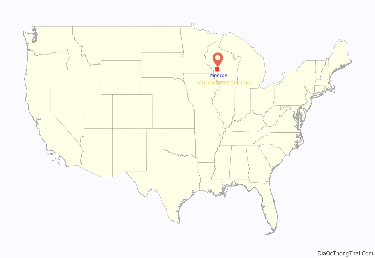
Monroe County location map. Where is Monroe County?
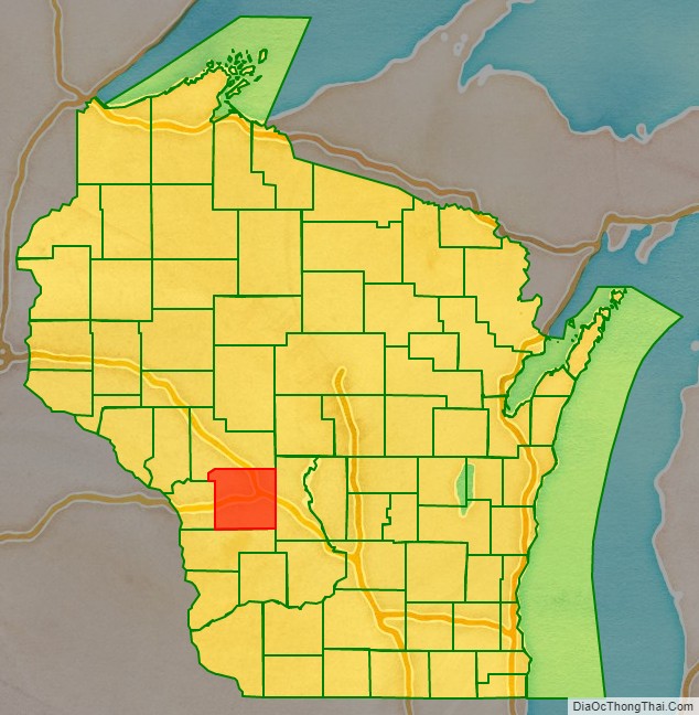
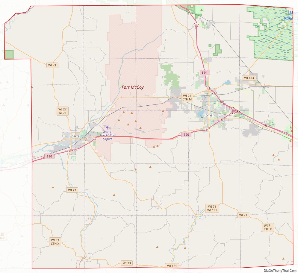
Monroe County Road Map
Geography
According to the U.S. Census Bureau, the county has a total area of 908 square miles (2,350 km), of which 901 square miles (2,330 km) is land and 7.4 square miles (19 km) (0.8%) is water.
United States Army posts
- Fort McCoy, Wisconsin
Adjacent counties
- Jackson County – north
- Juneau County – east
- Vernon County – south
- La Crosse County – west
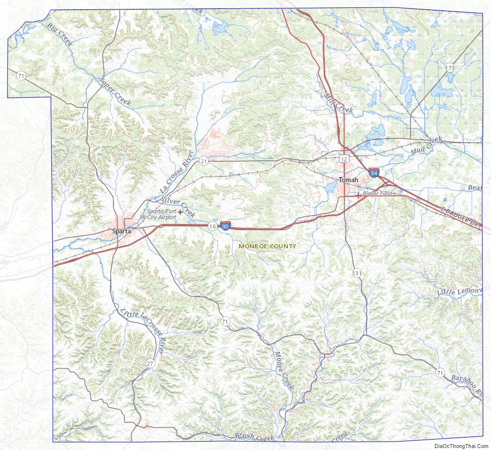
Monroe County Topographic Map
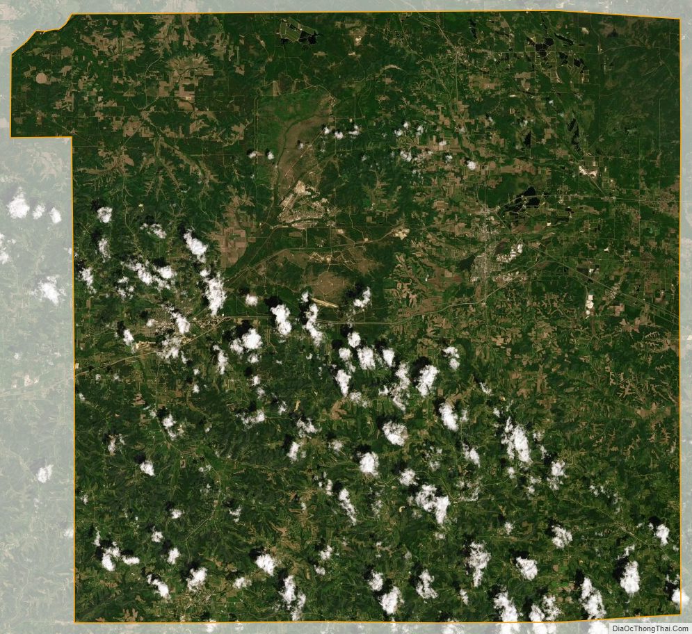
Monroe County Satellite Map
Monroe County Outline Map