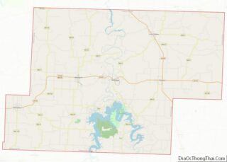
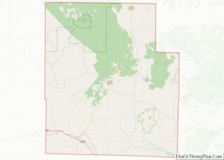
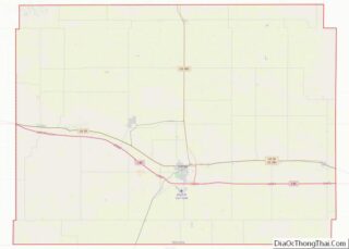
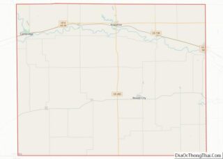
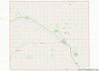
Louisa County (/luˈaɪzə/ loo-EYE-zə) is a county located in the U.S. state of Iowa. As of the 2020 census, the population was 10,837. The county seat is Wapello. Louisa County is part of the Muscatine Micropolitan Statistical Area. Louisa County overview: Name: Louisa County FIPS code: 19-115 State: Iowa Founded: 1836 Seat: Wapello Largest city: ... Read more
Map of US Counties
Palo Alto County is a county located in the U.S. state of Iowa. As of the 2020 census, the population was 8,996. The county seat is Emmetsburg. It is named after the Battle of Palo Alto, the first major battle of the Mexican–American War. Palo Alto County overview: Name: Palo Alto County FIPS code: 19-147 ... Read more
Wapello County overview: Name: Wapello County FIPS code: 19-179 State: Iowa Founded: 1843 Named for: Wapello Seat: Ottumwa Largest city: Ottumwa Total Area: 436 sq mi (1,130 km²) Land Area: 432 sq mi (1,120 km²) Total Population: 35,437 Population Density: 81/sq mi (31/km²) Time zone: UTC−6 (Central) Summer Time Zone (DST): UTC−5 (CDT) Website: www.wapellocounty.org Wapello County location map. Where is Wapello ... Read more
Brown County (county code BR) is a county located in the northeast portion of the U.S. state of Kansas. As of the 2020 census, the county population was 9,508. Its county seat and most populous city is Hiawatha. Brown County is the location of the Kickapoo Indian Reservation of Kansas, the majority of the Sac ... Read more
Douglas County (county code DG) is located in the U.S. state of Kansas. As of the 2020 census, the county population was 118,785, making it the fifth-most populous county in Kansas. Its county seat and most populous city is Lawrence. Douglas County overview: Name: Douglas County FIPS code: 20-045 State: Kansas Founded: August 25, 1855 ... Read more
Harper County (county code HP) is a county located in the U.S. state of Kansas. As of the 2020 census, the county population was 5,485. Its county seat and most populous city is Anthony. The county was named for Sergeant Marion Harper of the 2nd Kansas Cavalry, who died of wounds suffered near Waldron, Arkansas, ... Read more
Logan County overview: Name: Logan County FIPS code: 20-109 State: Kansas Founded: February 24, 1887 Named for: John A. Logan Seat: Oakley Largest city: Oakley Total Area: 1,073 sq mi (2,780 km²) Land Area: 1,073 sq mi (2,780 km²) Total Population: 2,762 Population Density: 2.6/sq mi (1.0/km²) Time zone: UTC−6 (Central) Summer Time Zone (DST): UTC−5 (CDT) Website: discoveroakley.com Logan County location ... Read more
Osborne County (standard abbreviation: OB) is a county located in the U.S. state of Kansas. As of the 2020 census, the county population was 3,500. The largest city and county seat is Osborne. Osborne County overview: Name: Osborne County FIPS code: 20-141 State: Kansas Founded: February 26, 1867 Named for: Vincent B. Osborne Seat: Osborne ... Read more
Sedgwick County (county code: SG) is located in the U.S. state of Kansas. As of the 2020 census, the population was 523,824, making it the second-most populous county in Kansas. Its county seat is Wichita, the most populous city in the state. Sedgwick County overview: Name: Sedgwick County FIPS code: 20-173 State: Kansas Founded: February ... Read more
Wilson County (standard abbreviation: WL) is a county located in Southeast Kansas. As of the 2020 census, the county population was 8,624. Its county seat is Fredonia. Wilson County overview: Name: Wilson County FIPS code: 20-205 State: Kansas Founded: 1855 Named for: Hiero T. Wilson Seat: Fredonia Largest city: Neodesha Total Area: 575 sq mi (1,490 km²) Land ... Read more
Breckinridge County is a county located in the Commonwealth of Kentucky. As of the 2020 census, the population was 20,432. Its county seat is Hardinsburg, Kentucky. The county was named for John Breckinridge (1760–1806), a Kentucky Attorney General, state legislator, United States Senator, and United States Attorney General. It was the 38th Kentucky county in ... Read more
Daviess County (/ˈdeɪvɪs/ “Davis”), is a county in Kentucky. As of the 2020 census, the population was 103,312. Its county seat is Owensboro. The county was formed from part of Ohio County on January 14, 1815. Daviess County is included in the Owensboro, KY Metropolitan Statistical Area. Daviess County also shares its namesake with another ... Read more