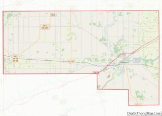
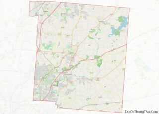
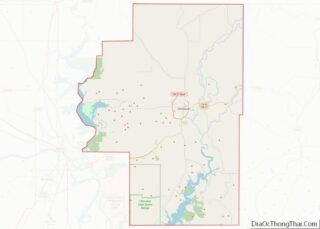
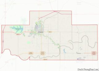
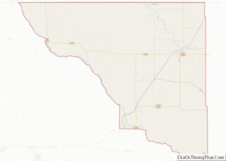
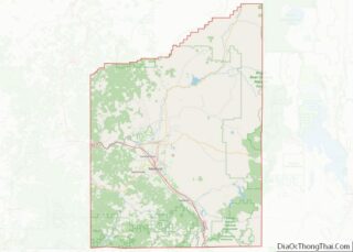
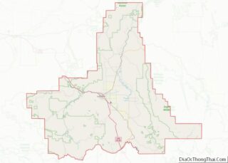
Map of Bowman County, North Dakota
Bowman County is a county in the U.S. state of North Dakota. As of the 2020 census, the population was 2,993. Its county seat is Bowman. Bowman County overview: Name: Bowman County FIPS code: 38-011 State: North Dakota Founded: 1883 Named for: Edward M. Bowman Seat: Bowman Largest city: Bowman Total Area: 1,167 sq mi (3,020 km²) Land ... Read more
Map of Bowman County, North Dakota
Map of Kidder County, North Dakota
Kidder County is a county located in the U.S. state of North Dakota. As of the 2020 census, the population was 2,394. Its county seat is Steele. Kidder County overview: Name: Kidder County FIPS code: 38-043 State: North Dakota Founded: 1873 Named for: Jefferson Kidder Seat: Steele Largest city: Steele Total Area: 1,433 sq mi (3,710 km²) Land ... Read more
Map of Kidder County, North Dakota
Map of Renville County, North Dakota
Renville County is a county in the U.S. state of North Dakota. As of the 2020 census, the population was 2,282. Its county seat is Mohall. Renville County is part of the Minot, ND Micropolitan Statistical Area. It is located south of the Canada–United States border with Saskatchewan. Renville County overview: Name: Renville County FIPS ... Read more
Map of Renville County, North Dakota
Map of Adams County, Ohio
Adams County is a county in the U.S. state of Ohio. As of the 2020 census, the population was 27,477. Its county seat and largest village is West Union. The county is named after John Adams, the second President of the United States. Adams County overview: Name: Adams County FIPS code: 39-001 State: Ohio Founded: ... Read more
Map of Adams County, Ohio
Map of Crawford County, Ohio
Crawford County is a county located in the north central portion of the U.S. state of Ohio. As of the 2020 census, the population was 42,025. Its county seat and largest city is Bucyrus. The county was created in 1820 and later organized in 1836. It was named for Colonel William Crawford, a soldier during ... Read more
Map of Crawford County, Ohio
Map of Hardin County, Ohio
Hardin County is a county located in the west central portion of the U.S. state of Ohio. As of the 2020 census, the population was 30,696. Its county seat and largest city is Kenton. The county was created in 1820 and later organized in 1833. It is named for John Hardin, an officer in the ... Read more
Map of Hardin County, Ohio
Map of Lucas County, Ohio
Lucas County is a county located in the northwestern part of the U.S. state of Ohio. It is bordered to the east by Lake Erie, and to the southeast by the Maumee River, which runs to the lake. As of the 2020 census, the population was 431,279. Its county seat and largest city is Toledo, ... Read more
Map of Lucas County, Ohio
Map of Pickaway County, Ohio
Pickaway County is a county in the U.S. state of Ohio. As of the 2020 census, the population was 58,539. Its county seat is Circleville. Its name derives from the Pekowi band of Shawnee Indians, who inhabited the area. (See List of Ohio county name etymologies.) Pickaway County is part of the Columbus, OH Metropolitan ... Read more
Map of Pickaway County, Ohio
Map of Van Wert County, Ohio
Van Wert County is a county located in the U.S. state of Ohio. As of the 2020 census, the population was 28,931. Its county seat is Van Wert. The county was created in February 12, 1820 and later organized on March 18, 1837. It is named for Isaac Van Wart, one of the captors of ... Read more
Map of Van Wert County, Ohio
Map of Canadian County, Oklahoma
Canadian County is a county located in the U.S. state of Oklahoma. As of the 2020 census, the population was 154,405, making it the fifth most populous county in Oklahoma. Its county seat is El Reno. The county is named for the Canadian River, which forms part of its southern border. The river may have ... Read more
Map of Canadian County, Oklahoma
Map of Garvin County, Oklahoma
Garvin County is a county in south-central Oklahoma, United States. As of the 2010 census, the population was 27,576. Its county seat is Pauls Valley. In 1906, delegates to Constitution Convention formed Garvin County from part of the Chickasaw Nation, Indian Territory. The county was named for Samuel J. Garvin, a local Chickasaw rancher, merchant ... Read more
Map of Garvin County, Oklahoma
Map of Lincoln County, Oklahoma
Lincoln County is a county in eastern Central Oklahoma. As of the 2010 census, the population was 34,273. Its county seat is Chandler. Lincoln County is part of the Oklahoma City, OK Metropolitan Statistical Area. In 2010, the center of population of Oklahoma was in Lincoln County, near the town of Sparks. Lincoln County overview: ... Read more
Map of Lincoln County, Oklahoma