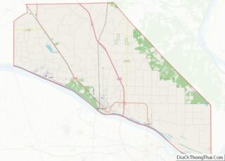
Map of Beltrami County, Minnesota
Beltrami County (/bɛlˈtræmiː/ bel-TRAM-ee) is a county in the northern part of the U.S. state of Minnesota. As of the 2020 census, the population was 46,228. Its county seat is Bemidji. The county’s name comes from Italian adventurer Giacomo Beltrami from Bergamo, who explored the area in 1825. The county was created in 1866 and ... Read more
Map of Beltrami County, Minnesota
Map of Dodge County, Minnesota
Dodge County is a county in the U.S. state of Minnesota. The population was 20,867 as of the 2020 census. Its county seat is Mantorville. Dodge County is part of the Rochester, MN Metropolitan Statistical Area. Dodge County overview: Name: Dodge County FIPS code: 27-039 State: Minnesota Founded: February 20, 1855 Named for: Henry Dodge ... Read more
Map of Dodge County, Minnesota
Map of Koochiching County, Minnesota
Koochiching County (/ˈkuːtʃɪtʃɪŋ/ KOO-chitch-ing) is a county in the U.S. state of Minnesota. As of the 2020 census, the population was 12,062. Its county seat is International Falls. A portion of the Bois Forte Indian Reservation is in the county. A small part of Voyageurs National Park extends into its boundary, with Lake of the ... Read more
Map of Koochiching County, Minnesota
Map of Murray County, Minnesota
Murray County is a county in the U.S. state of Minnesota. The population was 8,179 at the 2020 census. Its county seat is Slayton. Murray County overview: Name: Murray County FIPS code: 27-101 State: Minnesota Founded: 1857 Named for: William Pitt Murray Seat: Slayton Largest city: Slayton Total Area: 720 sq mi (1,900 km²) Land Area: 705 sq mi (1,830 km²) ... Read more
Map of Murray County, Minnesota
Map of Rock County, Minnesota
Rock County is a county at the southwestern corner of the U.S. state of Minnesota. As of the 2020 census, the population was 9,704. Its county seat is Luverne. Rock County overview: Name: Rock County FIPS code: 27-133 State: Minnesota Founded: 1857 Named for: Rock outcrop on Rock River Seat: Luverne Largest city: Luverne Total ... Read more
Map of Rock County, Minnesota
Map of Watonwan County, Minnesota
Watonwan County is a county in the U.S. state of Minnesota. As of the 2020 census, the population was 11,253. Its county seat is St. James. Watonwan County overview: Name: Watonwan County FIPS code: 27-165 State: Minnesota Founded: February 25, 1860 Named for: Watonwan River Seat: St. James Largest city: St. James Total Area: 440 sq mi ... Read more
Map of Watonwan County, Minnesota
Map of Clarke County, Mississippi
Clarke County is a county located in the U.S. state of Mississippi. As of the 2020 census, the population was 15,615. Its county seat is Quitman. Clarke County is named for Joshua G. Clarke, the first Mississippi state chancellor and judge. The county is part of the Meridian, MS Micropolitan Statistical Area. Clarke County overview: ... Read more
Map of Clarke County, Mississippi
Map of Issaquena County, Mississippi
Issaquena County is a county located in the U.S. state of Mississippi. As of the 2020 Census, its population was 1,338, making it the least populous county in the United States east of the Mississippi River. Its county seat is Mayersville. With a per-capita income of $18,598, Issaquena County is, by that measure, one of ... Read more
Map of Issaquena County, Mississippi
Map of Lowndes County, Mississippi
Lowndes County is a county on the eastern border of the U.S. state of Mississippi. As of the 2020 United States Census, the population was 58,879. Its county seat is Columbus. The county is named for U.S. Congressman and slave owner William Jones Lowndes. Lowndes County comprises the Columbus, MS Micropolitan Statistical Area. Since the ... Read more
Map of Lowndes County, Mississippi
Map of Quitman County, Mississippi
Quitman County is a county located in the U.S. state of Mississippi. As of the 2020 census, the population was 6,176, making it the third-least populous county in Mississippi. Its county seat is Marks. The county is named after John A. Quitman, Governor of Mississippi from 1835 to 1836 and from 1850 to 1851. Quitman ... Read more
Map of Quitman County, Mississippi
Map of Washington County, Mississippi
Washington County is a county located in the U.S. state of Mississippi. As of the 2020 census, the population was 44,922. Its county seat is Greenville. The county is named in honor of the first president of the United States, George Washington. It is located to the Arkansas border. The Greenville, MS Micropolitan Statistical Area ... Read more
Map of Washington County, Mississippi
Map of Boone County, Missouri
Boone County is located in the U.S. state of Missouri. Centrally located in Mid-Missouri, its county seat is Columbia, Missouri’s fourth-largest city and location of the University of Missouri. As of the 2020 census, the population was 183,610, making it the state’s eighth-most populous county. The county was organized November 16, 1820 and named for ... Read more
Map of Boone County, Missouri