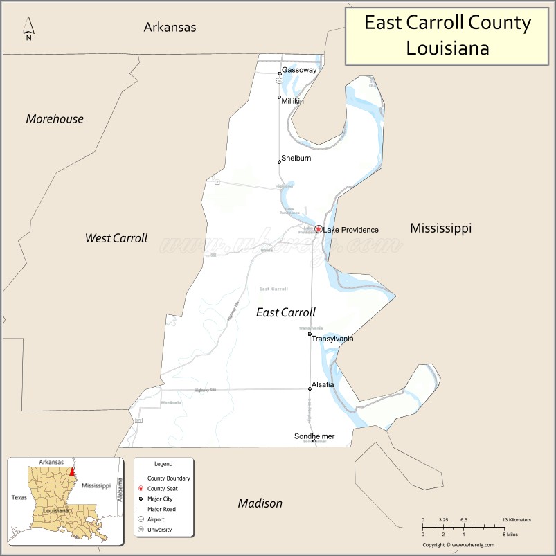
East Carroll Parish (French: Paroisse de Carroll Est) is a parish located in the Mississippi Delta in northeastern Louisiana. As of 2020, its population was 7,459. The parish seat is Lake Providence. An area of cotton plantations in the antebellum era, the parish in the early 21st century has about 74% of its land devoted to agriculture.
| Name: | East Carroll Parish |
|---|---|
| FIPS code: | 22-035 |
| State: | Louisiana |
| Founded: | March 26, 1877 |
| Named for: | Charles Carroll of Carrollton |
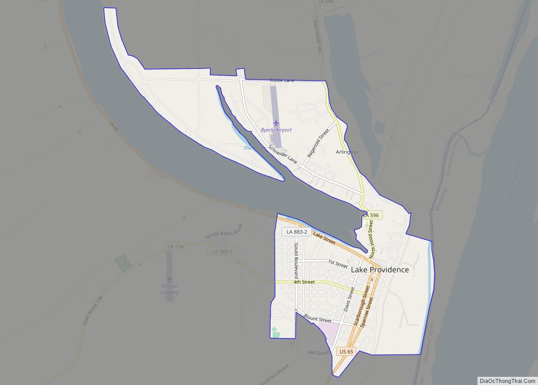
| Seat: | Lake Providence |
| Largest town: | Lake Providence |
| Total Area: | 442 sq mi (1,140 km²) |
| Land Area: | 421 sq mi (1,090 km²) |
| Total Population: | 7,459 |
| Population Density: | 17/sq mi (6.5/km²) |
| Time zone: | UTC−6 (Central) |
| Summer Time Zone (DST): | UTC−5 (CDT) |
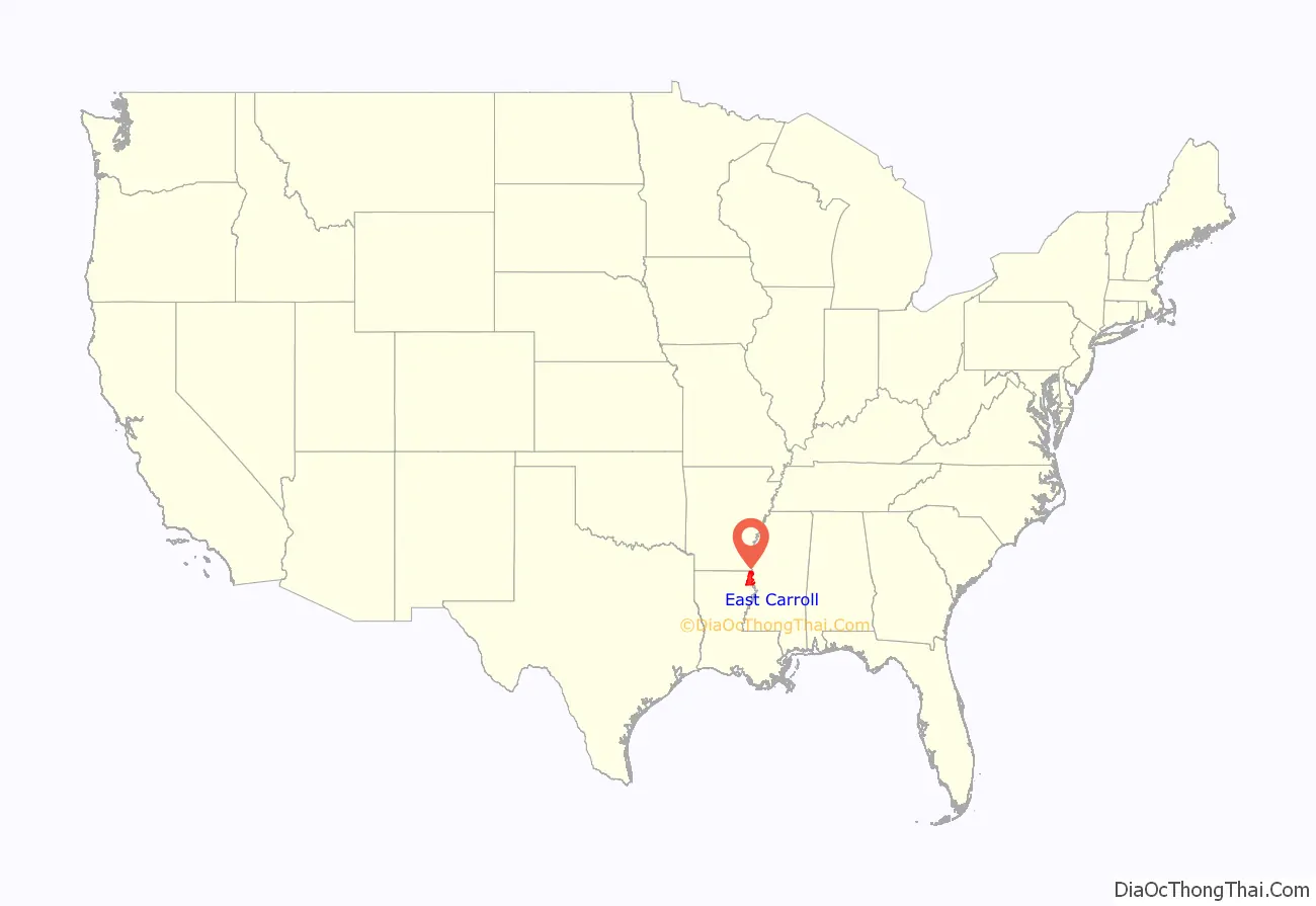
East Carroll Parish location map. Where is East Carroll Parish?
History
This area is part of the delta along the western edge of the Mississippi River, long subject to the seasonal flooding that gave the area fertile soils. It was occupied by indigenous peoples for thousands of years. European explorers encountered the historic tribes of the Caddo and Choctaw in this area, as well as the Natchez on the east side of the Mississippi River.
In the 1830s, the United States forced out most of the people of the Five Civilized Tribes from the Southeast to west of the Mississippi River in Indian Territory to make way for development by European Americans. Areas along the river were cleared and developed for cultivation of cotton, the major commodity crop in the Deep South before the Civil War. The cotton was cultivated and processed on plantations by large groups of enslaved African-American laborers.
Prior to 1814, all of the territory covered by the current East Carroll Parish was part of the now defunct Warren Parish. The original Carroll Parish, before it was divided into “East” and “West” segments after Reconstruction, was named for Charles Carroll of Carrollton, Maryland, the only Roman Catholic signer of the Declaration of Independence. This and other nearby parishes along the Mississippi River were called the Natchez District, referring to the major port on the Mississippi side of the river. Both areas were developed for cotton plantations.
Given the dependence of plantation agriculture on enslaved workers, the population of this area was majority African American well before the American Civil War. Carroll Parish had 11,000 slaves in 1860, more than three times the white population of the total parish. Most were located on the plantations in the floodplain along the Mississippi River. During the war, many slaves joined Union lines and served in the United States Colored Troops; Louisiana had more former slaves enlisted in the USCT than six other southern states combined.
Carroll Parish covered a large area and the parish was split by the state legislature in 1877, following the Reconstruction era. West Carroll Parish, with territory west of the Bayou Macon, was majority-white and voted Democratic.
After the war, this area continued to be dominated by agriculture and was largely rural. Numerous black Union veterans settled in East Carroll Parish and some owned their own land, especially in an area called Soldiers’ Rest, site of a former Union camp. They developed an independent community. With blacks outnumbering whites in Carroll Parish by a seven-to-one margin, and with combat experience, they resisted efforts in the 1870s to suppress their population. Voters in the larger Carroll Parrish elected blacks to the positions of sheriff, state representative, clerk of the court, and several justices of the peace, and hired black constables, giving blacks a voice at the local level.
But white conservative Democrats formed groups noted as Bulldozers, conducting violence against black voters, teachers, and supporters to suppress their activities. White conservatives succeeded in regaining control of the state legislature by the end of Reconstruction. By creating West Carroll Parish in 1877, they had an additional jurisdiction dominated by white Democrats.
Two decades later, at the end of the 19th century, the state legislature passed a new constitution in 1898 that raised barriers to voter registration, with rules applied against African Americans. They were effectively disenfranchised well into the 1960s. The legislature passed segregation and Jim Crow laws of increasing severity into the early 20th century.
In 1907 U.S. President Theodore Roosevelt came to East Carroll Parish near Lake Providence for a black bear hunt. When a particular bear managed to elude the hunters, the president’s camp was moved to Bear Lake in Madison Parish near Tallulah. The 21-year-old Arthur Spencer of Richland Parish took a photograph of Roosevelt with the heavily armed hunting party. Among the hunters was John M. Parker, future governor of Louisiana and the vice-presidential choice of the Bull Moose Party ticket in the 1912 presidential election.
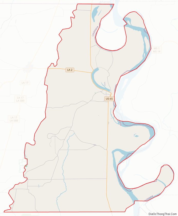
East Carroll Parish Road Map
Geography
According to the U.S. Census Bureau, the parish has a total area of 442 square miles (1,140 km), of which 421 square miles (1,090 km) is land and 22 square miles (57 km) (4.9%) is water.
Major highways
- U.S. Highway 65
- Louisiana Highway 2
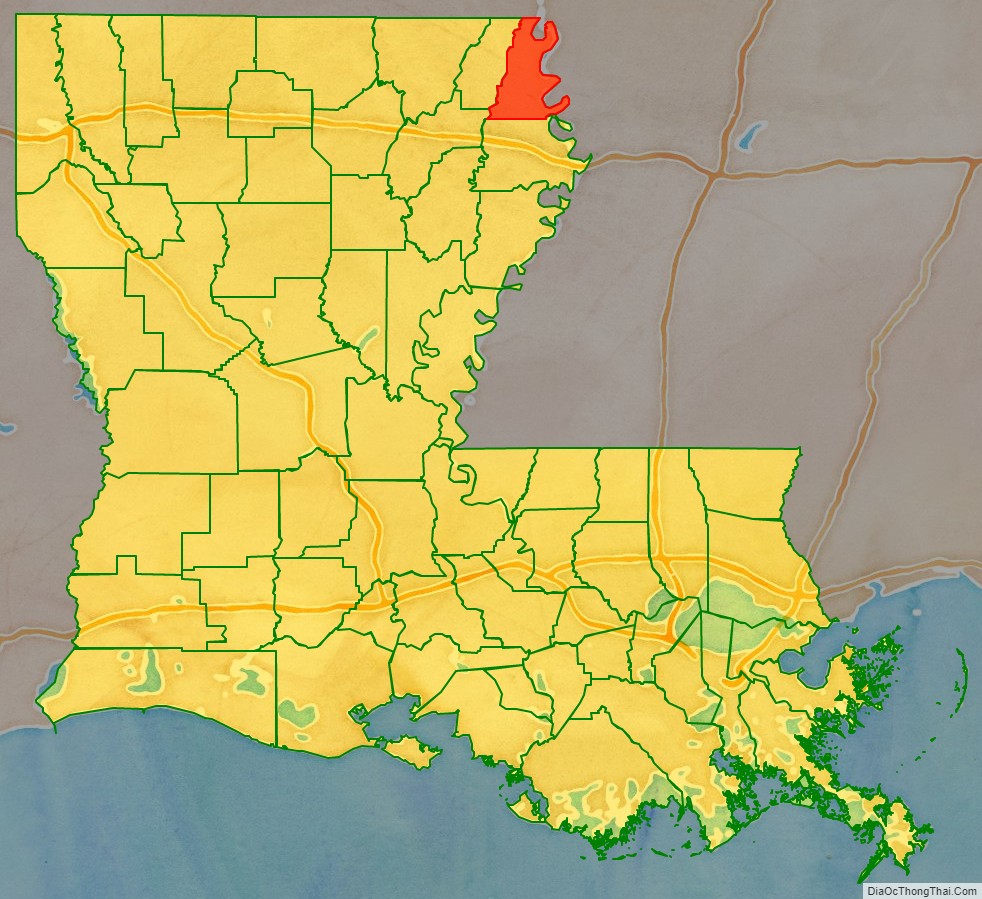
Adjacent counties and parishes
- Chicot County, Arkansas (north)
- Issaquena County, Mississippi (east)
- Warren County, Mississippi (southeast)
- Madison Parish (south)
- Richland Parish (southwest)
- West Carroll Parish (west)
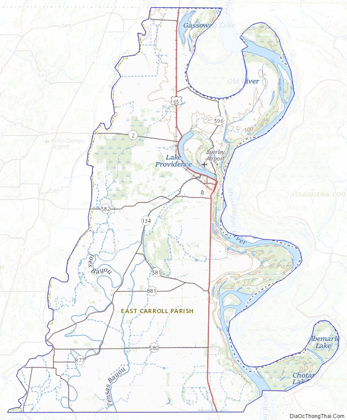
East Carroll Parish Topographic Map
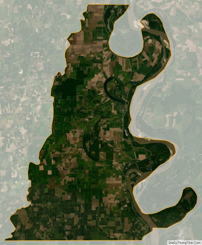
East Carroll Parish Satellite Map
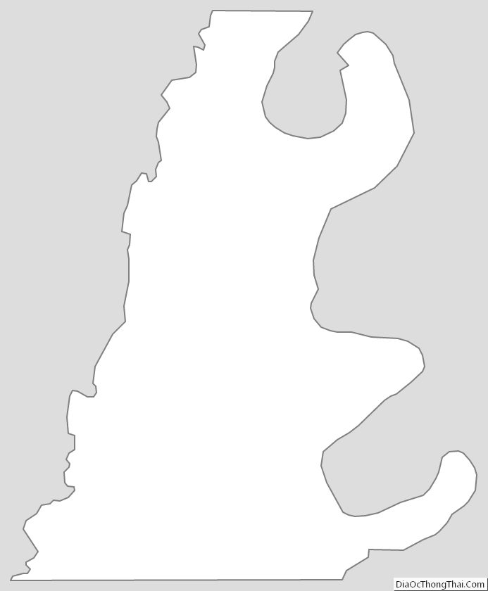
East Carroll Parish Outline Map