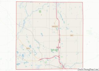
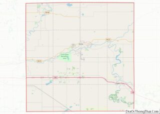
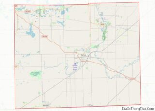
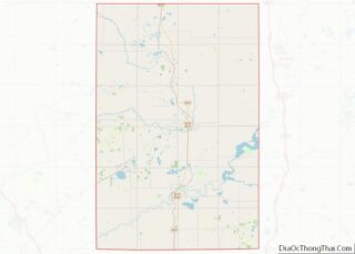
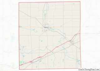
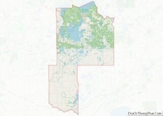
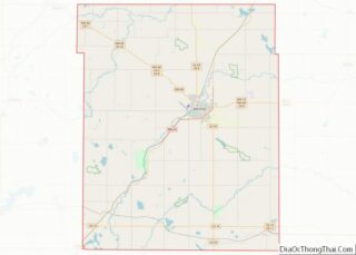
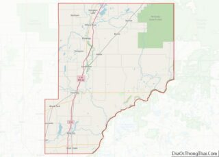
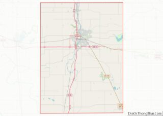
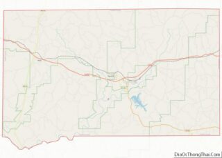
Map of Tama County, Iowa
Tama County overview: Name: Tama County FIPS code: 19-171 State: Iowa Founded: 1843 Named for: Taimah Seat: Toledo Largest city: Tama Total Area: 722 sq mi (1,870 km²) Land Area: 721 sq mi (1,870 km²) Total Population: 17,135 Population Density: 24/sq mi (9.2/km²) Time zone: UTC−6 (Central) Summer Time Zone (DST): UTC−5 (CDT) Website: www.tamacounty.iowa.gov Tama County location map. Where is Tama ... Read more
Map of Tama County, Iowa
Map of Atchison County, Kansas
Atchison County (county code AT) is a county located in northeastern Kansas, in the Central United States. As of the 2020 census, the county population was 16,348. Its county seat and most populous city is Atchison. The county is named in honor of David Rice Atchison, a United States Senator from Missouri. Atchison County overview: ... Read more
Map of Atchison County, Kansas
Map of Crawford County, Kansas
Crawford County (county code CR) is a county located in Southeast Kansas. As of the 2020 census, the county population was 38,972. Its county seat is Girard, and its most populous city is Pittsburg. The county was named in honor of Samuel J. Crawford, Governor of Kansas. Located in the Osage Cuestas and Cherokee Lowlands, ... Read more
Map of Crawford County, Kansas
Map of Gray County, Kansas
Gray County (county code GY) is a county located in the U.S. state of Kansas. As of the 2020 census, the county population was 5,653. Its county seat and most populous city is Cimarron. Gray County overview: Name: Gray County FIPS code: 20-069 State: Kansas Founded: March 13, 1881 Named for: Alfred Gray Seat: Cimarron ... Read more
Map of Gray County, Kansas
Map of Lane County, Kansas
Lane County (standard abbreviation: LE) is a county located in the U.S. state of Kansas. As of the 2020 census, the county population was 1,574, making it the third-least populous county in Kansas. The county seat is Dighton, the only city in the county. The county was named after James H. Lane who was a ... Read more
Map of Lane County, Kansas
Map of Neosho County, Kansas
Neosho County (standard abbreviation: NO) is a county located in Southeast Kansas. As of the 2020 census, the county population was 15,904. The county seat is Erie. Neosho County overview: Name: Neosho County FIPS code: 20-133 State: Kansas Founded: June 3, 1861 Named for: Neosho River Seat: Erie Largest city: Chanute Total Area: 578 sq mi (1,500 km²) ... Read more
Map of Neosho County, Kansas
Map of Rush County, Kansas
Rush County (standard abbreviation: RH) is a county located in the U.S. state of Kansas. As of the 2020 census, the county population was 2,956. The largest city and county seat is La Crosse. Rush County overview: Name: Rush County FIPS code: 20-165 State: Kansas Founded: February 26, 1867 Named for: Alexander Rush Seat: La ... Read more
Map of Rush County, Kansas
Map of Wabaunsee County, Kansas
Wabaunsee County (standard abbreviation: WB) is a county located in the U.S. state of Kansas. As of the 2020 census, the county population was 6,877. Its county seat is Alma. The county was created by the territorial legislature of Kansas Territory on March 25, 1859, and was named for a chief of the Potawatomi Indians. ... Read more
Map of Wabaunsee County, Kansas
Map of Boyd County, Kentucky
Boyd County is a county located in the U.S. state of Kentucky. As of the 2020 census, its population was 48,261. The county seat is Catlettsburg, and its largest city is Ashland. The county was formed in 1860. Its 160 square miles (410 km) are found at the northeastern edge of the state near the Ohio ... Read more
Map of Boyd County, Kentucky
Map of Clay County, Kentucky
Clay County is a county located in the U.S. state of Kentucky. As of the 2020 census, the county population was 20,345. Its county seat is Manchester. The county was formed in 1807 and named in honor of Green Clay (1757–1826). Clay was a member of the Virginia and Kentucky State legislatures, first cousin once ... Read more
Map of Clay County, Kentucky
Map of Graves County, Kentucky
Graves County is a county located on the southwest border of the U.S. Commonwealth of Kentucky. As of the 2020 census, the population was 36,649. Its county seat is Mayfield. The county was formed in 1824 and was named for Major Benjamin Franklin Graves, a politician and fallen soldier in the War of 1812. Graves ... Read more
Map of Graves County, Kentucky
Map of Johnson County, Kentucky
Johnson County is a county located in the U.S. state of Kentucky. As of the 2020 census, the population was 22,680. Its county seat is Paintsville. The county was formed in 1843 and named for Richard Mentor Johnson, War of 1812 general, United States Representative, Senator, and Vice President of the United States. Johnson County ... Read more
Map of Johnson County, Kentucky